Category:Duivelsberg
Jump to navigation
Jump to search
| Object location | | View all coordinates using: OpenStreetMap |
|---|
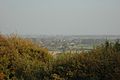
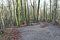
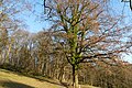
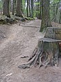
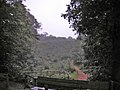
Nederlands: Afbeeldingen van de Duivelsberg een heuvel en natuurgebied van Staatsbosbeheer nabij Beek en Berg en Dal, behorende tot de gemeente Berg en Dal, in de provincie Gelderland in Nederland. Nabij de motte Mergelpe. Een motte is een kunstmatige kasteelheuvel, met grachten en een omwalling, ter verdediging tegen vijandelijke aanvallen.
mountain in the Netherlands  | |||||
| Upload media | |||||
| Instance of | |||||
|---|---|---|---|---|---|
| Location | Berg en Dal, Gelderland, Netherlands | ||||
| Elevation above sea level |
| ||||
 | |||||
Subcategories
This category has the following 3 subcategories, out of 3 total.
Media in category "Duivelsberg"
The following 50 files are in this category, out of 50 total.
-
 Beek-Ubbergen-Duivelsberg (8).JPG 4,000 × 3,000; 4.98 MB
-
 Beek-Ubbergen-Duivelsberg (9).JPG 4,000 × 3,000; 4.81 MB
-
 Bij Berg en Dal, bomen bij de Duivelsberg IMG 2992 2019-11-30 14.02.jpg 5,472 × 2,360; 11.06 MB
-
 De Duivelsberg - panoramio - Rokus Cornelis (1).jpg 2,406 × 1,600; 639 KB
-
 De Duivelsberg - panoramio - Rokus Cornelis.jpg 1,600 × 2,406; 620 KB
-
 De Duivelsberg - panoramio.jpg 2,406 × 1,600; 858 KB
-
 Duivelsberg - panoramio - Rokus Cornelis (1).jpg 2,406 × 1,600; 776 KB
-
 Duivelsberg - panoramio - Rokus Cornelis.jpg 2,406 × 1,600; 397 KB
-
 Duivelsberg - panoramio.jpg 2,406 × 1,600; 474 KB
-
 Duivelsberg P1420552.jpg 4,000 × 2,672; 5.67 MB
-
 Duivelsberg P1420553.jpg 4,000 × 2,672; 5.77 MB
-
 Duivelsberg P1420554.jpg 4,000 × 2,672; 5.86 MB
-
 Duivelsberg P1420555.jpg 4,000 × 2,672; 5.96 MB
-
 Duivelsberg P1420556.jpg 4,000 × 2,672; 5.62 MB
-
 Duivelsberg P1420563.jpg 4,000 × 2,672; 6.07 MB
-
 Duivelsberg P1420564.jpg 4,000 × 2,672; 6.17 MB
-
 Duivelsberg P1420569.jpg 4,000 × 2,672; 5.81 MB
-
 Duivelsberg P1420570.jpg 4,000 × 2,672; 5.71 MB
-
 Duivelsberg P1420579.jpg 4,000 × 2,672; 5.88 MB
-
 Duivelsberg P1420582.jpg 4,000 × 2,672; 6.04 MB
-
 Duivelsberg P1420583.jpg 4,000 × 2,672; 5.85 MB
-
 Duivelsberg P1420584.jpg 4,000 × 2,672; 6.23 MB
-
 Duivelsberg P1420586.jpg 4,000 × 2,672; 5.85 MB
-
 Duivelsberg P1420595.jpg 4,000 × 2,672; 5.86 MB
-
 Duivelsberg P1420606.jpg 4,000 × 2,672; 4.88 MB
-
 Duivelsberg P1420614.jpg 4,000 × 2,672; 5.78 MB
-
 Duivelsberg P1420621.jpg 2,672 × 4,000; 5.78 MB
-
 Duivelsberg P1420656.jpg 4,000 × 2,672; 5.78 MB
-
 Duivelsberg P1420660.jpg 4,000 × 2,672; 5.6 MB
-
 Duivelsberg P1420663.jpg 4,000 × 2,672; 5.64 MB
-
 Duivelsberg P1420673.jpg 4,000 × 2,672; 4.9 MB
-
 Duivelsberg P1420674.jpg 4,000 × 2,672; 5.05 MB
-
 Duivelsberg P1420676.jpg 4,000 × 2,672; 5.02 MB
-
 Duivelsberg P1420677.jpg 4,000 × 2,672; 5.76 MB
-
 Duivelsberg.jpg 840 × 1,122; 354 KB
-
 DUivelsberg2.jpg 1,072 × 679; 299 KB
-
 Little forest opposite the Duivelsberg restaurant 10.JPG 4,000 × 2,248; 6.35 MB
-
 Little forest opposite the Duivelsberg restaurant 2.JPG 4,000 × 2,248; 5.96 MB
-
 Little forest opposite the Duivelsberg restaurant 3.JPG 4,000 × 2,248; 5.84 MB
-
 Little forest opposite the Duivelsberg restaurant 4.JPG 4,000 × 2,248; 5.44 MB
-
 Little forest opposite the Duivelsberg restaurant 5.JPG 4,000 × 2,248; 5.14 MB
-
 Little forest opposite the Duivelsberg restaurant 6.JPG 4,000 × 2,248; 5.75 MB
-
 Little forest opposite the Duivelsberg restaurant 7.JPG 4,000 × 2,248; 6.17 MB
-
 Little forest opposite the Duivelsberg restaurant 8.JPG 4,000 × 2,248; 6.01 MB
-
 Little forest opposite the Duivelsberg restaurant 9.JPG 4,000 × 2,248; 4.27 MB
-
 Little forest opposite the Duivelsberg restaurant.JPG 4,000 × 2,248; 5.33 MB
-
 Mergelp teufelsberg herbst.JPG 2,288 × 1,712; 1.26 MB
-

-

-
 Winteraspect van de associatie van groot platmos.jpg 4,032 × 3,024; 12.82 MB
.JPG)
.JPG)

.jpg)


.jpg)


