Category:Drechterland
Jump to navigation
Jump to search
municipality in the Netherlands    .png)  | |||||
| Upload media | |||||
| Pronunciation audio | |||||
|---|---|---|---|---|---|
| Instance of |
| ||||
| Location | North Holland, Netherlands | ||||
| Inception |
| ||||
| Population |
| ||||
| Area |
| ||||
| Follows |
| ||||
| official website | |||||
 | |||||
Subcategories
This category has the following 4 subcategories, out of 4 total.
B
G
P
S
Media in category "Drechterland"
The following 54 files are in this category, out of 54 total.
-
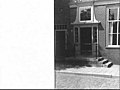
 Achter- en zijgevel - Unknown - 20481164 - RCE.jpg 1,200 × 900; 241 KB
-
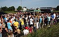
 AerialPhotographofHoornNov2018.jpg 5,472 × 3,080; 3.16 MB
-
 Arbeiderswoning - Unknown - 20524670 - RCE.jpg 1,200 × 900; 112 KB
-
 Arbeiderswoningen - Unknown - 20524669 - RCE.jpg 1,200 × 900; 174 KB
-
 Bevolkingspiramide - Gemeente Drechterland (2007).png 350 × 370; 7 KB
-
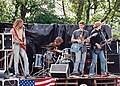 Burgpop 1995.jpg 800 × 574; 193 KB
-
 Burgpop 2011 (1).jpg 1,200 × 750; 103 KB
-
 Burgpop kermisborrel.jpg 1,200 × 748; 231 KB
-
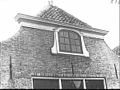
 Darsdeuren met bovenlichten, gietijzeren figuren - Unknown - 20515314 - RCE.jpg 1,200 × 900; 149 KB
-
 De Weed.jpg 1,280 × 720; 276 KB
-
 Detail windveren, houten voorschotten - Unknown - 20511838 - RCE.jpg 1,200 × 900; 177 KB
-

-
 Deur met omlijsting, bewerkt bovenlicht - Unknown - 20485308 - RCE.jpg 1,200 × 900; 129 KB
-
 Deur, bewerkte omlijsting - Unknown - 20515313 - RCE.jpg 1,200 × 900; 131 KB
-
 Deur, omlijsting en tredenstoep - Unknown - 20515329 - RCE.jpg 1,200 × 900; 101 KB
-
 Deur, ontlastingsboog - Unknown - 20515308 - RCE.jpg 1,200 × 900; 124 KB
-
 Deuren, bewerkte panelen - Unknown - 20515312 - RCE.jpg 1,200 × 900; 132 KB
-
 Drechterland vlag.png 326 × 217; 9 KB
-
 Drechterland vlag.svg 652 × 434; 57 KB
-
 Drechterland wapen.png 201 × 289; 6 KB
-
 Drechterland wapen.svg 421 × 657; 200 KB
-
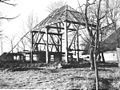 Dubbel vierkant afgebroken boerderij nr. OB 2 - Oost Mijzen - 20479207 - RCE.jpg 1,200 × 900; 268 KB
-

-

-
 Hek als erfafscheiding - Unknown - 20520955 - RCE.jpg 1,200 × 900; 230 KB
-
 Hoekje bij de kerk - Unknown - 20521823 - RCE.jpg 1,200 × 900; 118 KB
-
 Kanaal - Unknown - 20521824 - RCE.jpg 1,200 × 900; 178 KB
-
 Klokgevel met fronton - Unknown - 20512930 - RCE.jpg 1,200 × 900; 134 KB
-
 Koopmanswoning - Unknown - 20524700 - RCE.jpg 1,200 × 900; 128 KB
-
 Koopmanswoningen - Unknown - 20524701 - RCE.jpg 1,200 × 900; 217 KB
-
 Kraaienburg.jpg 1,280 × 720; 443 KB
-
 Kuiperij - Unknown - 20459900 - RCE.jpg 1,200 × 900; 121 KB
-
 Langs de Zuiderzee - Unknown - 20521822 - RCE.jpg 1,200 × 900; 231 KB
-
 Leekerweg1.jpg 800 × 600; 240 KB
-
 Leekerweg2.jpg 800 × 600; 229 KB
-
 Middenstandswoning - Unknown - 20524687 - RCE.jpg 1,200 × 900; 144 KB
-
 Oosterleek funduring.jpg 800 × 600; 210 KB
-
 OverDeDijk.JPG 1,600 × 1,200; 639 KB
-

-

-
 Stoepbank - Unknown - 20520542 - RCE.jpg 1,200 × 900; 128 KB
-
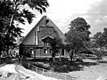
 Stolpboerderij Zuiderdijk nabij De Weed.jpg 4,699 × 3,524; 1.21 MB
-
 Trapgevel anno 1623 - Unknown - 20510012 - RCE.jpg 1,200 × 900; 190 KB
-
 Trapgevel anno 1623 - Unknown - 20510013 - RCE.jpg 1,200 × 900; 112 KB
-
 Trapgevels koopmanshuizen - Unknown - 20493058 - RCE.jpg 1,200 × 900; 176 KB
-
 Venster nabij dak - Unknown - 20520696 - RCE.jpg 1,200 × 900; 191 KB
-
 Vergezicht boerderij nr. BY 8 - De Lageweg - 20480070 - RCE.jpg 1,200 × 900; 169 KB
-
 Voorgevel nr. BY 7 - De Lageweg - 20480071 - RCE.jpg 1,200 × 900; 237 KB
-
 Voorgevel nr. BZ 1 - De Lageweg - 20480072 - RCE.jpg 1,200 × 900; 195 KB
-
 Voorgevel nr. BZ 4 - De Lageweg - 20480075 - RCE.jpg 1,200 × 900; 195 KB
-
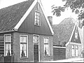 Voorgevels - Unknown - 20524716 - RCE.jpg 1,200 × 900; 206 KB
-
 Weidehek en groot inrijhek - Unknown - 20520954 - RCE.jpg 1,200 × 900; 217 KB
-
 Zittend1.jpg 1,024 × 320; 161 KB
-
 Zittend2.jpg 800 × 600; 185 KB


.png)

.jpg)


