Category:Drayton Beauchamp
Jump to navigation
Jump to search
English: Drayton Beauchamp (pronounced 'Beecham') is a village and is also a civil parish within Aylesbury Vale district in Buckinghamshire, England. It is in the east of the county, near the border with Hertfordshire, about six miles from Aylesbury and two miles from Tring.
village in the United Kingdom  | |||||
| Upload media | |||||
| Instance of | |||||
|---|---|---|---|---|---|
| Location | Buckinghamshire, South East England, England | ||||
 | |||||
Subcategories
This category has only the following subcategory.
Media in category "Drayton Beauchamp"
The following 200 files are in this category, out of 207 total.
(previous page) (next page)-
 A family of swans approach Bridge 5 on the Wendover Arm - geograph.org.uk - 5526754.jpg 2,513 × 1,885; 2.76 MB
-

-
 A narrowboat passes Bates Boatyard on the Aylesbury Arm - geograph.org.uk - 2851755.jpg 2,805 × 2,103; 873 KB
-
 A neglected field between Tring and Drayton Beauchamp - geograph.org.uk - 4626716.jpg 2,238 × 1,492; 2.07 MB
-

-

-
-
 A working Narrowboat at Bates Boatyard - geograph.org.uk - 2851714.jpg 2,852 × 2,139; 1.06 MB
-
 A41 heading towards Aylesbury - geograph.org.uk - 2680097.jpg 640 × 480; 58 KB
-
 A41 in cutting north of the junction - geograph.org.uk - 3010288.jpg 640 × 480; 55 KB
-
 A41 northbound on-slip at Buckland - geograph.org.uk - 4871750.jpg 640 × 480; 44 KB
-
 A41 towards Aylesbury - geograph.org.uk - 2865105.jpg 640 × 423; 65 KB
-
 Approaching Bates Boatyard from Aylesbury in the Autumn - geograph.org.uk - 2851320.jpg 2,617 × 1,962; 1.36 MB
-

-
 At work in Bates Boatyard, Aylesbury Arm - geograph.org.uk - 2851773.jpg 1,254 × 941; 234 KB
-
 Aylesbury Arm - geograph.org.uk - 2167411.jpg 640 × 480; 79 KB
-

-
 Barn in poor condition - geograph.org.uk - 4014024.jpg 640 × 480; 106 KB
-
 Bates Boatyard - geograph.org.uk - 5212204.jpg 5,202 × 3,465; 3.11 MB
-
 Bates Boatyard and narrowboats - geograph.org.uk - 4166734.jpg 2,582 × 1,935; 2.26 MB
-
 Bates Boatyard, Aylesbury Arm, Grand Union Canal - geograph.org.uk - 2851118.jpg 2,448 × 3,264; 2.33 MB
-

-
 Being Friendly to footpath users - geograph.org.uk - 4637069.jpg 3,038 × 2,975; 5 MB
-
 Bird Scarers on the Lines by Wilstone Reservoir - geograph.org.uk - 4637166.jpg 2,250 × 3,000; 2.08 MB
-
 Bluebells by the County Boundary path near Hastoe - geograph.org.uk - 4932062.jpg 2,978 × 2,234; 3.8 MB
-

-
-

-
 Bridge 7, Grand Junction Canal - Aylesbury Arm - geograph.org.uk - 2871430.jpg 4,000 × 3,000; 4.58 MB
-
 Bridge Farm, Drayton Beauchamp - geograph.org.uk - 1287179.jpg 640 × 480; 160 KB
-

-

-
 Buckland, County Boundary footpath - geograph.org.uk - 4162639.jpg 640 × 480; 64 KB
-
 Canal-side bench and trees, Wendover Arm - geograph.org.uk - 4396854.jpg 1,000 × 1,434; 1.59 MB
-

-
 Chilterns beech wood - geograph.org.uk - 2403528.jpg 2,908 × 2,731; 5.7 MB
-
 Church Hill Farm, Drayton Beauchamp - geograph.org.uk - 1287178.jpg 640 × 384; 109 KB
-
 Churchyard Gates, Drayton Beauchamp - geograph.org.uk - 4688644.jpg 4,000 × 2,664; 3.62 MB
-
 Collapsed end of Derelict Farm Barn - geograph.org.uk - 1205139.jpg 640 × 480; 100 KB
-
-
 County Hedge - geograph.org.uk - 4710871.jpg 4,000 × 2,664; 3.19 MB
-
 Cyclist on towpath, Aylesbury Arm, Grand Union Canal - geograph.org.uk - 4166742.jpg 2,270 × 1,704; 2.08 MB
-
 Disused chicken sheds at Beeches Farm - geograph.org.uk - 3183823.jpg 1,333 × 1,000; 1.15 MB
-

-

-

-
 Gable End of Derelict Farm Barn - geograph.org.uk - 1205112.jpg 480 × 640; 63 KB
-
 Drayton Beauchamp , Church of St Mary - geograph.org.uk - 6294015.jpg 1,024 × 671; 552 KB
-
 Drayton Beauchamp - Canal Bridge - 20231125115759.jpg 4,000 × 3,000; 5.49 MB
-
 Drayton Beauchamp - Canal Bridge - 20231125115833.jpg 4,000 × 3,000; 4.82 MB
-
 Drayton Beauchamp - Lock Cottage - 20231125115854.jpg 4,000 × 3,000; 5.83 MB
-

-
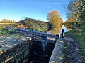
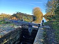
 Drayton Beauchamp - Puttenham Bottom Lock No 11 - 20231125115814.jpg 4,000 × 3,000; 4.9 MB
-
 Drayton Beauchamp - Puttenham Bottom Lock No 11 - 20231125115846.jpg 4,000 × 3,000; 3.8 MB
-
 Drayton Beauchamp - Puttenham Bottom Lock No 11 - 20231125115910.jpg 4,000 × 3,000; 3.51 MB
-
 Drayton Beauchamp - Puttenham Bottom Lock No 11 - 20231125115922.jpg 4,000 × 3,000; 3.63 MB
-
 Drayton Beauchamp - Puttenham Bottom Lock No 11 - 20231125115925.jpg 4,000 × 3,000; 3.84 MB
-
 Drayton Beauchamp - Puttenham Bottom Lock No 11 - 20231125115944.jpg 4,000 × 3,000; 5.27 MB
-
 Drayton Beauchamp - Puttenham Bottom Lock No 11 - 20231125120005.jpg 4,000 × 3,000; 4.25 MB
-
 Drayton Beauchamp Parish Church - geograph.org.uk - 4763367.jpg 3,497 × 2,311; 1.97 MB
-
 Driveway to Drayton Manor - geograph.org.uk - 570638.jpg 640 × 480; 137 KB
-

-

-
 Field beside Lower Icknield Way - geograph.org.uk - 129673.jpg 640 × 480; 138 KB
-
 Field near Pavis Wood - geograph.org.uk - 6199718.jpg 1,024 × 768; 221 KB
-
 Fields and Broadview Farm - geograph.org.uk - 3183833.jpg 1,333 × 1,000; 1.04 MB
-
 Fields near Puttenham - geograph.org.uk - 3559326.jpg 3,264 × 2,448; 2.82 MB
-

-
 Fine tree on field boundary - geograph.org.uk - 4397423.jpg 1,000 × 1,234; 1.11 MB
-
 Footpath across field, Drayton Beauchamp - geograph.org.uk - 4397463.jpg 1,423 × 1,000; 1.35 MB
-
 Footpath across the fields near Hastoe House - geograph.org.uk - 4930740.jpg 2,731 × 2,982; 3.99 MB
-

-
 Footpath to Drayton Beauchamp from Icknield Way - geograph.org.uk - 3183880.jpg 1,000 × 1,333; 1.5 MB
-
 Footpathr to the B489 - geograph.org.uk - 2680084.jpg 640 × 480; 83 KB
-

-
 Fox Lane bridge, A41 - geograph.org.uk - 3010280.jpg 640 × 480; 57 KB
-
 Frosted bracken in Pavis Wood - geograph.org.uk - 2767973.jpg 1,333 × 1,000; 1.73 MB
-
 Frosted leaves, Pavis Wood - geograph.org.uk - 2767982.jpg 1,333 × 1,000; 1.68 MB
-
 Gate on the path to Long Marston - geograph.org.uk - 3154203.jpg 1,600 × 1,067; 603 KB
-
 GOC Tring & Wendover Woods 104 The Rectory, Drayton Beauchamp (34072743703).jpg 3,397 × 2,555; 3.21 MB
-
 GOC Tring & Wendover Woods 106 St Mary's Church, Drayton Beauchamp (34720183462).jpg 3,059 × 4,093; 3.91 MB
-
 GOC Tring & Wendover Woods 110 St Mary's Church, Drayton Beauchamp (34720185832).jpg 4,608 × 3,456; 5.22 MB
-
 GOC Tring & Wendover Woods 111 St Mary's Church, Drayton Beauchamp (34720187122).jpg 4,608 × 3,456; 5.41 MB
-
 GOC Tring & Wendover Woods 113 St Mary's Church, Drayton Beauchamp (34519426890).jpg 4,608 × 3,456; 5.11 MB
-
 GOC Tring & Wendover Woods 114 St Mary's Church, Drayton Beauchamp (34519428290).jpg 3,904 × 2,934; 3.88 MB
-
 GOC Tring & Wendover Woods 115 St Mary's Church, Drayton Beauchamp (34519430350).jpg 4,100 × 3,083; 3.95 MB
-

-
 GOC Tring & Wendover Woods 119 Wendover Arm Canal, Drayton Beauchamp (34519433820).jpg 4,608 × 3,456; 4.7 MB
-
 GOC Tring & Wendover Woods 120 Wendover Arm Canal, Drayton Beauchamp (34107533774).jpg 4,608 × 3,456; 4.88 MB
-
 GOC Tring & Wendover Woods 126 View over Broadview Farm, Drayton Beauchamp (34818555131).jpg 4,608 × 2,880; 4.63 MB
-

-
 Grand Union Canal - geograph.org.uk - 2166983.jpg 640 × 480; 99 KB
-
 Grand Union Canal Wendover Arm - geograph.org.uk - 2388069.jpg 4,000 × 3,000; 4.07 MB
-

-

-

-

-
 Guardians of the Footpath at Wilstone Reservoir - geograph.org.uk - 4637051.jpg 3,122 × 2,341; 3.26 MB
-
 GUC Walk LDP near Drayton Beauchamp - geograph.org.uk - 4397438.jpg 1,084 × 1,000; 1.09 MB
-
 Harvested logs waiting for collection in Pavis Wood - geograph.org.uk - 1240783.jpg 2,592 × 1,944; 3.32 MB
-
 Hertfordshire boundary sign - geograph.org.uk - 5212201.jpg 4,013 × 2,751; 2.87 MB
-
-

-
 Leafy Lane past Pavis Wood - geograph.org.uk - 2766266.jpg 1,000 × 1,333; 2.11 MB
-
 Lock 10, Aylesbury Arm - geograph.org.uk - 4013998.jpg 640 × 480; 150 KB
-

-

-

-
 Lock No 11 on Aylesbury Arm of the Grand Union Canal - geograph.org.uk - 2388222.jpg 4,000 × 3,000; 4.35 MB
-

-
 Looking towards Beeches Farm, Drayton Beauchamp - geograph.org.uk - 4626809.jpg 3,648 × 2,736; 6.64 MB
-
 Lower Farm, Drayton Beauchamp - geograph.org.uk - 26778.jpg 640 × 479; 55 KB
-
 Lower Icknield Way crossing into Bucks - geograph.org.uk - 5646232.jpg 2,242 × 1,642; 1.78 MB
-

-
 Name panel of narrowboat "Dart" at Bates Boatyard - geograph.org.uk - 4166695.jpg 3,648 × 2,736; 3.13 MB
-

-
 Narrow Boats at Bates Boat Yard - geograph.org.uk - 2388207.jpg 4,000 × 3,000; 2.41 MB
-

-
 Narrowboat "Severn No 86" at Bates Boatyard - geograph.org.uk - 4166643.jpg 3,648 × 2,736; 4.28 MB
-
 Narrowboats at Bates Boatyard (2) - geograph.org.uk - 4166628.jpg 3,648 × 2,736; 3.77 MB
-
 Narrowboats at the boatyard, from under Bridge 7 - geograph.org.uk - 2851257.jpg 2,514 × 1,885; 854 KB
-
 Old Barn at Upper Farm Drayton Beauchamp - geograph.org.uk - 2388143.jpg 4,000 × 3,000; 3.81 MB
-
 On the County Boundary Footpath near Hastoe - geograph.org.uk - 4932057.jpg 2,983 × 2,961; 5.58 MB
-

-
 Painesend, near Tring - geograph.org.uk - 90130.jpg 480 × 640; 107 KB
-
 Painsend Farm - geograph.org.uk - 89850.jpg 640 × 480; 124 KB
-
 Path toward Long Marston - geograph.org.uk - 3154199.jpg 1,600 × 1,066; 691 KB
-
 Pavis Wood looking northwestwards - geograph.org.uk - 2767964.jpg 1,333 × 1,000; 2.13 MB
-
 Pavis Wood signboard - geograph.org.uk - 2767245.jpg 1,333 × 1,000; 2.17 MB
-
 Professional's Corner - geograph.org.uk - 4688627.jpg 3,463 × 2,491; 2.91 MB
-
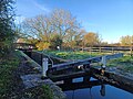
 Puttenham Bottom Lock - geograph.org.uk - 136003.jpg 640 × 480; 98 KB
-
 Puttenham Bottom Lock - geograph.org.uk - 2167404.jpg 640 × 480; 104 KB
-
 Puttenham Bottom Lock - geograph.org.uk - 4013983.jpg 640 × 480; 143 KB
-
 Puttenham Bridge No 7 - geograph.org.uk - 4890331.jpg 800 × 600; 168 KB
-

-
 Puttenham Top Lock - geograph.org.uk - 6008859.jpg 4,608 × 3,456; 4.89 MB
-
 Ridgeway through the trees of Pavis Wood - geograph.org.uk - 2768018.jpg 1,000 × 1,333; 2.09 MB
-

-
 Road over canal bridge 7 - geograph.org.uk - 5212193.jpg 4,251 × 2,784; 4.23 MB
-
 Roof Timbers in Derelict Farm Barn - geograph.org.uk - 1205147.jpg 640 × 480; 91 KB
-
 Roots and Branches, Pavis Wood - geograph.org.uk - 2767953.jpg 1,000 × 1,333; 1.98 MB
-

-

-
 Sheds old and new at Beeches Farm - geograph.org.uk - 579922.jpg 640 × 480; 82 KB
-
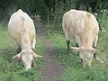
 Sheep (33685340724).jpg 3,394 × 2,554; 2.95 MB
-
 Sheep grazing in field in Drayton Beauchamp - geograph.org.uk - 2388153.jpg 4,000 × 3,000; 3.25 MB
-
 Shire Lane - geograph.org.uk - 3135297.jpg 4,000 × 3,000; 2.39 MB
-
 Shire Lane - geograph.org.uk - 6199735.jpg 1,024 × 768; 236 KB
-
 St Mary the Virgin, Drayton Beauchamp - East end - geograph.org.uk - 2610755.jpg 1,000 × 643; 147 KB
-
 St Mary the Virgin, Drayton Beauchamp - Font - geograph.org.uk - 2610808.jpg 494 × 1,000; 128 KB
-
 St Mary the Virgin, Drayton Beauchamp - geograph.org.uk - 2388110.jpg 4,000 × 3,000; 3.4 MB
-
 St Mary the Virgin, Drayton Beauchamp - geograph.org.uk - 2610752.jpg 1,000 × 667; 163 KB
-
 St Mary the Virgin, Drayton Beauchamp - geograph.org.uk - 2610753.jpg 1,000 × 550; 128 KB
-
 St Mary the Virgin, Drayton Beauchamp - Monument - geograph.org.uk - 2610759.jpg 618 × 1,000; 145 KB
-
 St Mary the Virgin, Drayton Beauchamp - Monument - geograph.org.uk - 2610805.jpg 619 × 1,000; 166 KB
-
 St Mary the Virgin, Drayton Beauchamp - Monument - geograph.org.uk - 2610820.jpg 664 × 1,000; 152 KB
-

-
 St Mary the Virgin, Drayton Beauchamp - Pulpit - geograph.org.uk - 2610804.jpg 1,000 × 671; 182 KB
-

-

-

-

-
 St Mary the Virgin, Drayton Beauchamp - West end - geograph.org.uk - 2610756.jpg 1,000 × 645; 158 KB
-
 St Mary's southern façade - Drayton Beauchamp - geograph.org.uk - 4397483.jpg 1,333 × 1,000; 1.19 MB
-
 Staggered crossroads on B489 - geograph.org.uk - 4014011.jpg 640 × 480; 94 KB
-
 Star class narrowboat "Arcturus" at Bates Boatyard - geograph.org.uk - 4166718.jpg 3,648 × 2,736; 3.27 MB
-
 Steps taking footpath up canal embankment - geograph.org.uk - 2388097.jpg 4,000 × 3,000; 4.28 MB
-
 Struggling towards the Clouds - geograph.org.uk - 1241660.jpg 640 × 462; 122 KB
-
 The Aylesbury Ring passes Bates Boatyard - geograph.org.uk - 2851269.jpg 2,719 × 2,039; 899 KB
-
 The footpath from Drayton Beauchamp reaches Icknield Way - geograph.org.uk - 4102499.jpg 3,234 × 2,425; 2.14 MB
-
 The new Painsend Farm - geograph.org.uk - 2958992.jpg 1,333 × 1,000; 1.53 MB
-
 The Old Rectory, Drayton Beauchamp - geograph.org.uk - 2388126.jpg 4,000 × 3,000; 3.79 MB
-
 The Old Rectory, Drayton Beauchamp - geograph.org.uk - 87567.jpg 640 × 399; 50 KB
-
 The Ridgeway through Northill Wood - geograph.org.uk - 3183901.jpg 1,333 × 1,000; 1.35 MB
-
 The Ridgeway through Pavis Wood - geograph.org.uk - 2767990.jpg 1,000 × 1,225; 2 MB
-
 The Towpath on the Aylesbury Arm opposite Bates Boatyard - geograph.org.uk - 2851684.jpg 3,230 × 2,153; 1.56 MB
-
 The Track through Pavis Wood - geograph.org.uk - 1240782.jpg 2,592 × 1,944; 3.56 MB
-

-

-

-
 The Wendover Arm Trust Stalls at Drayton Beauchamp Church - geograph.org.uk - 5526736.jpg 3,253 × 2,169; 2.44 MB
-
 Track - geograph.org.uk - 2610821.jpg 1,000 × 650; 200 KB
-
 Tractor Turnaround - geograph.org.uk - 4715606.jpg 4,000 × 2,664; 4.02 MB
-
 Tree that refused to die^ - geograph.org.uk - 3548310.jpg 1,000 × 1,333; 1.3 MB
-
 Trees and leaves in Pavis Wood - geograph.org.uk - 2768014.jpg 1,333 × 1,000; 2.17 MB
-
 Trees by former fish ponds, Drayton Beauchamp - geograph.org.uk - 4397451.jpg 1,333 × 1,000; 1.48 MB
-
 Two trees beside a field drain - geograph.org.uk - 4397085.jpg 1,552 × 1,000; 1.33 MB
-
 Upper Farm and old barn, Drayton Beauchamp - geograph.org.uk - 4397459.jpg 1,598 × 1,000; 1.38 MB
-
 Wendover Arm - Bridge 5 - Drayton Beauchamp - geograph.org.uk - 4396868.jpg 1,333 × 1,000; 1.51 MB
-
 Wendover Arm - East of Drayton Beauchamp - geograph.org.uk - 4396877.jpg 1,021 × 1,000; 874 KB
-
 Wendover Arm - end of part one - geograph.org.uk - 3547054.jpg 2,048 × 1,536; 596 KB
-
 Wendover Arm - geograph.org.uk - 3547066.jpg 2,048 × 1,536; 543 KB
-

-
 Why are you taking our picture^ - geograph.org.uk - 1538518.jpg 640 × 480; 138 KB
-
 Wilstone Reservoir - Trees and sunlight - geograph.org.uk - 4397068.jpg 2,294 × 1,000; 1.67 MB
-

-
 Bollard on the boundary - geograph.org.uk - 603890.jpg 640 × 470; 103 KB
-
 Drayton Beauchamp Bridge - geograph.org.uk - 603949.jpg 640 × 477; 77 KB
-
-
 Restoration work on the Wendover Arm - geograph.org.uk - 603895.jpg 640 × 464; 95 KB


.jpg)
.jpg)
.jpg)
.jpg)
.jpg)
.jpg)
.jpg)
.jpg)
.jpg)
.jpg)
.jpg)
_in_Drayton_Beauchamp_-_geograph.org.uk_-_515180.jpg)


_-_geograph.org.uk_-_4166628.jpg)


.jpg)


_in_Drayton_Beauchamp_-_geograph.org.uk_-_515189.jpg)
