Category:Downtown Columbus, Ohio
Jump to navigation
Jump to search
State capitals of the United States: Albany [NY] · Annapolis [MD] · Atlanta [GA] · Augusta [ME] · Austin [TX] · Baton Rouge [LA] · Bismarck [ND] · Boise [ID] · Boston [MA] · Charleston [WV] · Cheyenne [WY] · Columbia [SC] · Columbus [OH] · Denver [CO] · Des Moines [IA] · Dover [DE] · Harrisburg [PA] · Hartford [CT] · Indianapolis [IN] · Jackson [MS] · Jefferson City [MO] · Juneau [AK] · Lansing [MI] · Lincoln [NE] · Little Rock [AR] · Madison [WI] · Montgomery [AL] · Montpelier [VT] · Nashville [TN] · Oklahoma City [OK] · Pierre [SD] · Providence [RI] · Raleigh [NC] · Richmond [VA] · Sacramento [CA] · Saint Paul [MN] · Salem [OR] · Salt Lake City [UT] · Santa Fe [NM] · Springfield [IL] · Tallahassee [FL] · Topeka [KS] · Trenton [NJ] · Federal district: Washington, D.C. [DC] · Insular area of the United States
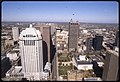
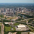
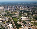
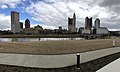
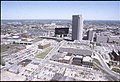
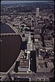
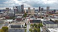
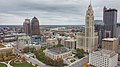
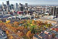
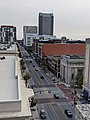
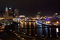
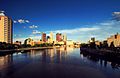
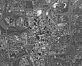
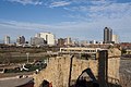
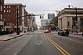
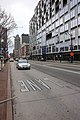
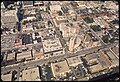
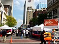
English: Downtown Columbus is the Central Business District of Columbus, Ohio. The area centers around the intersection of Broad and High streets and is the home of most of the largest buildings in Columbus. It is bordered by I-670 on the north, St. Clair Avenue, N. Garfield Avenue, and Parsons Avenue on the east, Livingston Avenue and I-70 on the south, and the Scioto River on the west. Nearby is the State Capitol, the Ohio Theatre, Palace Theatre, Southern Theatre, and COSI. In the Northwest area is the Arena District, a mixed use development centered around the Nationwide Arena. The Discovery District is virtually everything east of Fifth and Sixth streets to the highways, including the historic Downtown residential neighborhood in the southeast corner, centered on Town Street and Franklin Avenue. Just to the west of downtown is Franklinton, also sometimes known as The Bottoms; to the east the Olde Towne East; to the north, The Short North and Victorian Village; and to the south German Village and the Brewery District.
central business district of Columbus, Ohio | |||||
| Upload media | |||||
| Instance of | |||||
|---|---|---|---|---|---|
| Location | Columbus, Franklin County, Ohio | ||||
| official website | |||||
 | |||||
Subcategories
This category has the following 10 subcategories, out of 10 total.
Media in category "Downtown Columbus, Ohio"
The following 200 files are in this category, out of 215 total.
(previous page) (next page)-
 Abbott Labs and downtown.jpg 4,000 × 2,250; 3 MB
-
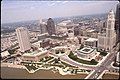
 Aerial view of Capitol Square in downtown Columbus.jpg 3,242 × 2,210; 860 KB
-
 Aerial view of Columbus 01.jpg 5,436 × 4,258; 5.81 MB
-
 Aerial view of Columbus 01a.jpg 4,563 × 2,653; 3.13 MB
-
 Aerial view of Columbus 02.jpg 5,446 × 4,481; 6.05 MB
-
 Aerial view of Columbus, Ohio, September 2015.JPG 3,978 × 2,988; 3.95 MB
-
 Aerial view of Columbus.jpg 5,416 × 4,481; 6.64 MB
-
 Aerial view of downtown Columbus 01.jpg 3,239 × 2,208; 1.17 MB
-
 Aerial view of downtown Columbus 02.jpg 4,407 × 4,368; 2.31 MB
-
 Aerial view of downtown Columbus.jpg 4,552 × 4,808; 2.93 MB
-
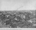
 Aerial view of the F. & R. Lazarus Company building complex photograph.jpg 2,570 × 4,042; 1.89 MB
-
 Bike Shelter Near Riffe Center FE.jpg 5,760 × 3,840; 7.95 MB
-
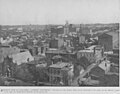
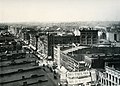
 Bird's-eye View of Downtown Columbus, Ohio.jpg 3,207 × 2,140; 1.97 MB
-
 Brewed in Columbus.jpg 5,303 × 3,535; 1.28 MB
-
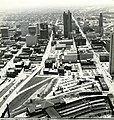
 Capitol South district in Columbus, Ohio 01.jpg 3,192 × 2,172; 1.37 MB
-
 Capitol South district in Columbus, Ohio 03.jpg 3,177 × 2,154; 1,001 KB
-
 Central Downtown Columbus aerial view looking north.jpg 3,268 × 2,229; 1.39 MB
-
 Centrum, Columbus.jpg 2,231 × 3,271; 959 KB
-
 Columbus aerial 04.jpg 1,457 × 1,488; 1.9 MB
-
 Columbus aerial 05.jpg 2,012 × 1,586; 2.76 MB
-
 Columbus aerial 06.jpg 2,084 × 1,147; 2.09 MB
-
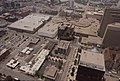
 Columbus City Center.jpg 2,917 × 1,268; 547 KB
-
 Columbus City View.jpg 6,562 × 3,918; 6.39 MB
-
 Columbus Downtown - panoramio.jpg 4,928 × 3,264; 3.92 MB
-
 Columbus downtown 01.jpg 5,839 × 3,895; 14.11 MB
-
 Columbus Downtown skyline - panoramio.jpg 4,928 × 3,264; 4.05 MB
-
 Columbus Downtown Skyline1.jpg 2,592 × 444; 194 KB
-
 Columbus downtown.jpg 2,906 × 2,176; 2.99 MB
-
 Columbus Eateries 24.jpg 3,264 × 1,836; 1.44 MB
-
 Columbus Eateries 25.jpg 3,264 × 2,448; 1.91 MB
-
 Columbus Garden View.jpg 4,032 × 3,024; 3.53 MB
-
 Columbus Ohio Skyline.jpg 166 × 162; 14 KB
-
 Columbus past the CSX Upper Scioto River Bridge 1.jpg 4,158 × 2,749; 4.18 MB
-
 Columbus view 1978.jpg 3,216 × 2,141; 1.36 MB
-
 Columbus, OH - COTA bus stop.jpg 4,032 × 3,024; 7.48 MB
-
 Columbus, OH - COTA vehicle.jpg 1,809 × 1,160; 1.42 MB
-
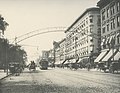
 Columbus, Ohio - Highsmith 38.jpg 3,114 × 3,977; 2.7 MB
-
 Columbus, Ohio 01.tif 9,990 × 8,029; 153.01 MB
-
 Columbus, Ohio 18.jpg 4,576 × 3,056; 12.05 MB
-
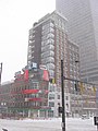
 Columbus, Ohio 2008 snowstorm 01.jpg 800 × 600; 80 KB
-
 Columbus, Ohio 2008 snowstorm 04.jpg 800 × 600; 65 KB
-
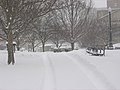
 Columbus, Ohio 2008 snowstorm 05.jpg 600 × 800; 29 KB
-
 Columbus, Ohio 2008 snowstorm 06.jpg 800 × 600; 42 KB
-
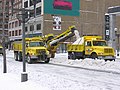
 Columbus, Ohio 2008 snowstorm 10.jpg 800 × 600; 55 KB
-
 Columbus, Ohio 2008 snowstorm 11.jpg 800 × 600; 85 KB
-
 Columbus, Ohio 2008 snowstorm 13.jpg 600 × 800; 49 KB
-
 Columbus, Ohio 2008 snowstorm 14.jpg 800 × 600; 51 KB
-
 Columbus, Ohio 2008 snowstorm 15.jpg 600 × 800; 89 KB
-
 Columbus, Ohio 2008 snowstorm 19.jpg 800 × 600; 85 KB
-
 Columbus, Ohio 2008 snowstorm 21.jpg 800 × 600; 89 KB
-
 Columbus, Ohio 2008 snowstorm 22.jpg 800 × 600; 85 KB
-
 Columbus, Ohio 2008 snowstorm 23.jpg 800 × 600; 117 KB
-
 Columbus, Ohio 2008 snowstorm 24.jpg 800 × 600; 63 KB
-
 Columbus, Ohio 2008 snowstorm 25.jpg 800 × 600; 105 KB
-
 Columbus, Ohio 2008 snowstorm 26.jpg 800 × 600; 111 KB
-
 Columbus, Ohio 2008 snowstorm 28.jpg 800 × 600; 107 KB
-
 Columbus, Ohio 229.jpg 4,320 × 3,240; 4.52 MB
-
 Columbus, Ohio 230.jpg 3,240 × 4,320; 4.37 MB
-
 Columbus, Ohio 245.jpg 4,320 × 3,240; 5.28 MB
-
 Columbus, Ohio 246.jpg 4,320 × 3,240; 5.46 MB
-
 Columbus, Ohio 247.jpg 3,240 × 4,320; 5.5 MB
-
 Columbus, Ohio 248.jpg 4,320 × 3,240; 5.59 MB
-
 Columbus, Ohio 249.jpg 4,320 × 3,240; 5.75 MB
-
 Columbus, Ohio 250.jpg 4,320 × 3,240; 5.59 MB
-
 Columbus, Ohio 251.jpg 3,240 × 4,320; 5.66 MB
-
 Columbus, Ohio 252.jpg 4,320 × 3,240; 5.53 MB
-
 Columbus, Ohio 253.jpg 3,240 × 4,320; 5.4 MB
-
 Columbus, Ohio 254.jpg 4,320 × 3,240; 5.52 MB
-
 Columbus, Ohio 255.jpg 4,320 × 3,240; 5.28 MB
-
 Columbus, Ohio 256.jpg 4,320 × 3,240; 5.57 MB
-
 Columbus, Ohio 257.jpg 4,320 × 3,240; 5.46 MB
-
 Columbus, Ohio 258.jpg 4,320 × 3,240; 5.51 MB
-
 Columbus, Ohio 259.jpg 4,320 × 3,240; 5.46 MB
-
 Columbus, Ohio 260.jpg 4,320 × 3,240; 5.52 MB
-
 Columbus, Ohio 261.jpg 4,320 × 3,240; 5.55 MB
-
 Columbus, Ohio 264.jpg 4,320 × 3,240; 5.39 MB
-
 Columbus, Ohio 265.jpg 4,320 × 3,240; 5.44 MB
-
 Columbus, Ohio 266.jpg 4,320 × 3,240; 5.39 MB
-
 Columbus, Ohio 269.jpg 4,320 × 3,240; 5.56 MB
-
 Columbus, Ohio 274.jpg 4,320 × 3,240; 5.67 MB
-
 Columbus, Ohio 276.jpg 4,320 × 3,240; 5.49 MB
-
 Columbus, Ohio 277.jpg 4,320 × 3,240; 5.52 MB
-
 Columbus, Ohio 281.jpg 4,320 × 3,240; 5.78 MB
-
 Columbus, Ohio 282.jpg 3,240 × 4,320; 5.59 MB
-
 Columbus, Ohio 284.jpg 3,240 × 4,320; 5.47 MB
-
 Columbus, Ohio 285.jpg 4,320 × 3,240; 5.31 MB
-
 Columbus, Ohio 396.jpg 4,320 × 3,240; 5.52 MB
-
 Columbus, Ohio 40.jpg 2,272 × 1,704; 754 KB
-
 Columbus, Ohio c. 1897 08.jpg 5,544 × 3,975; 2.02 MB
-
 Columbus, Ohio c. 1897 10.jpg 5,602 × 4,349; 3.56 MB
-
 Columbus, Ohio c. 1897 12.jpg 5,588 × 4,198; 2.02 MB
-
 Columbus, Ohio CML 13.jpg 3,256 × 2,164; 971 KB
-
 Columbus, Ohio CML 14.jpg 3,245 × 2,208; 1,023 KB
-
 Columbus, Ohio CML 15.jpg 2,195 × 3,271; 749 KB
-
 Columbus, Ohio JJ 13.jpg 3,499 × 1,965; 2.57 MB
-
 Columbus, Ohio JJ 21.jpg 4,000 × 2,250; 3.55 MB
-
 Columbus, Ohio JJ 50.jpg 4,000 × 2,250; 3.37 MB
-
 Columbus, Ohio JJ 53-crop.jpg 1,795 × 2,250; 1.48 MB
-
 Columbus, Ohio JJ 53.jpg 4,000 × 2,250; 3.35 MB
-
 Columbus, Ohio JJ 60-crop.jpg 3,200 × 2,173; 2.89 MB
-
 Columbus, Ohio JJ 60.jpg 4,000 × 2,250; 3.66 MB
-
 Columbus, Ohio JJ 63.jpg 4,000 × 2,250; 3.71 MB
-
 Columbus, Ohio JJ 71.jpg 4,000 × 2,250; 3.59 MB
-
 Columbus, Ohio LOC 12.tif 5,076 × 4,061; 19.69 MB
-
 Columbus, Ohio LOC 25.tif 5,000 × 4,006; 19.13 MB
-
 Columbus, Ohio LOC 26a.tif 10,016 × 8,037; 153.56 MB
-
 Columbus, Ohio LOC 26b.jpg 9,408 × 7,318; 24.58 MB
-
 Columbus, Ohio LOC 27.tif 4,987 × 3,985; 18.98 MB
-
 Columbus, Ohio Ɱ 115.jpg 3,024 × 4,032; 2.19 MB
-
 Columbus, Ohio Ɱ 116.jpg 3,024 × 4,032; 3.11 MB
-
 Columbus-ohio-downtown-night.jpg 2,500 × 1,667; 956 KB
-
 Columbus-ohio-skyline-panorama.jpg 3,264 × 1,269; 2.02 MB
-
 Columbus-ohio-skyline.jpg 2,500 × 1,820; 2.12 MB
-
 ColumbusNightSkyline2.jpg 2,304 × 1,536; 607 KB
-
 ColumbusOHSkyline3.jpg 1,500 × 976; 157 KB
-
 Corner of East Town Street and Pearl.jpg 3,217 × 1,880; 768 KB
-
 COTA Spring Street Terminal.jpg 2,980 × 2,011; 3.59 MB
-
 Downtown Columbus - 9922559554.jpg 2,354 × 2,354; 1.92 MB
-
 Downtown Columbus - A look across the river.jpg 800 × 600; 288 KB
-
 Downtown Columbus - A look back downstream.jpg 800 × 600; 142 KB
-
 Downtown Columbus - A look back upstream.jpg 800 × 600; 129 KB
-
 Downtown Columbus - A resting spot.jpg 800 × 600; 235 KB
-
 Downtown Columbus - Across to the Confluence.jpg 800 × 600; 223 KB
-
 Downtown Columbus - Along Route 315.jpg 800 × 600; 204 KB
-
 Downtown Columbus - Another path north.jpg 800 × 600; 144 KB
-
 Downtown Columbus - Bicentennial Park.jpg 800 × 600; 148 KB
-
 Downtown Columbus - Bike bridge.jpg 800 × 600; 201 KB
-
 Downtown Columbus - Bridge approach 01.jpg 600 × 800; 174 KB
-
 Downtown Columbus - Bridge view.jpg 800 × 600; 89 KB
-
 Downtown Columbus - Bridge.jpg 600 × 800; 170 KB
-
 Downtown Columbus - Broad Street Bridge - 1381901532.jpg 800 × 600; 104 KB
-
 Downtown Columbus - Canadian Geese.jpg 800 × 600; 152 KB
-
 Downtown Columbus - Confluence and downstream.jpg 800 × 600; 103 KB
-
 Downtown Columbus - Continuing 01.jpg 800 × 600; 184 KB
-
 Downtown Columbus - Continuing downstream - 1380974095.jpg 600 × 800; 159 KB
-
 Downtown Columbus - Continuing downstream.jpg 800 × 600; 176 KB
-
 Downtown Columbus - Continuing upstream - 1381886246.jpg 800 × 600; 117 KB
-
 Downtown Columbus - Continuing... 01.jpg 800 × 600; 181 KB
-
 Downtown Columbus - Continuing.jpg 600 × 800; 210 KB
-
 Downtown Columbus - Cormorant.jpg 800 × 600; 152 KB
-
 Downtown Columbus - Downstream back to downtown.jpg 800 × 600; 188 KB
-
 Downtown Columbus - Downstream under the 315.jpg 800 × 600; 125 KB
-
 Downtown Columbus - Follow the arrows.jpg 600 × 800; 175 KB
-
 Downtown Columbus - Getting closer.jpg 800 × 600; 189 KB
-
 Downtown Columbus - Great Blue Heron.jpg 800 × 600; 208 KB
-
 Downtown Columbus - Great Egret.jpg 800 × 600; 296 KB
-
 Downtown Columbus - Heading upstream.jpg 800 × 600; 215 KB
-
 Downtown Columbus - In front of COSI.jpg 800 × 600; 139 KB
-
 Downtown Columbus - Main St Bridge construction.jpg 600 × 800; 153 KB
-
 Downtown Columbus - Near the Boke Bridge.jpg 800 × 600; 236 KB
-
 Downtown Columbus - Nearing COSI.jpg 800 × 600; 131 KB
-
 Downtown Columbus - Olentangy River upstream.jpg 800 × 600; 162 KB
-
 Downtown Columbus - Part of the Franklinton Floodwall.jpg 600 × 800; 159 KB
-
 Downtown Columbus - Past the bridge.jpg 600 × 800; 201 KB
-
 Downtown Columbus - Railbridge bridge -4.jpg 800 × 600; 174 KB
-
 Downtown Columbus - Railroad bridge - 1380998447.jpg 800 × 600; 221 KB
-
 Downtown Columbus - Railroad bridge - 1381874024.jpg 600 × 800; 168 KB
-
 Downtown Columbus - Railroad bridge - 2.jpg 800 × 600; 159 KB
-
 Downtown Columbus - Railroad bridge -3.jpg 800 × 600; 179 KB
-
 Downtown Columbus - Railroad bridge.jpg 800 × 600; 153 KB
-
 Downtown Columbus - Red berries and the park.jpg 800 × 600; 195 KB
-
 Downtown Columbus - Starting downstream.jpg 800 × 600; 172 KB
-
 Downtown Columbus - Streetlight.jpg 800 × 600; 82 KB
-
 Downtown Columbus - Turning right.jpg 800 × 600; 258 KB
-
 Downtown Columbus - Two Great Blue Herons.jpg 800 × 600; 159 KB
-
 Downtown Columbus - Under railroad bridge -4.jpg 800 × 600; 212 KB
-
 Downtown Columbus - Under the bridge - 1381901800.jpg 800 × 600; 118 KB
-
 Downtown Columbus - Under the bridge.jpg 800 × 600; 204 KB
-
 Downtown Columbus - view.jpg 800 × 600; 255 KB
-
 Downtown Columbus 01.jpg 1,500 × 1,094; 348 KB
-
 Downtown Columbus 02.jpg 1,400 × 863; 330 KB
-
 Downtown Columbus aerial 01.jpg 3,285 × 2,236; 838 KB
-
 Downtown Columbus aerial 02.jpg 2,220 × 3,286; 908 KB
-
 Downtown Columbus aerial 03.jpg 2,214 × 3,274; 1.33 MB
-
 Downtown Columbus aerial 04.jpg 3,240 × 2,188; 1.09 MB
-
 Downtown Columbus aerial 05.jpg 2,048 × 1,385; 482 KB
-
 Downtown Columbus aerial view looking west.jpg 3,238 × 2,201; 884 KB
-
 Downtown Columbus Aerial.jpg 1,000 × 800; 187 KB
-
 Downtown Columbus aerial.jpg 4,000 × 2,250; 2.9 MB
-
 Downtown Columbus along East Rich Street.jpg 4,032 × 3,024; 2.57 MB
-
 Downtown Columbus as seen from Scioto Audubon Metro Park 1.jpg 4,182 × 2,791; 5.7 MB
-
 Downtown Columbus from Scioto Greenway 1.jpg 4,142 × 2,775; 7.25 MB
-
 Downtown Columbus Looking South on North High Street.jpg 5,732 × 4,624; 3.06 MB
-
 Downtown Columbus Ohio - 30889400533.jpg 3,648 × 5,472; 1.15 MB
-
 Downtown Columbus Ohio - 31328167370.jpg 3,409 × 5,113; 1,016 KB
-
 Downtown Columbus Ohio - 31574602711.jpg 5,289 × 3,526; 1.41 MB
-
 Downtown Columbus Ohio - 31583925121.jpg 5,384 × 3,589; 1.31 MB
-
 Downtown Columbus Ohio - 31706992525.jpg 3,598 × 5,397; 1.6 MB
-
 Downtown Columbus, Ohio 02.jpg 3,270 × 2,229; 1.62 MB
-
 Downtown columbus.jpg 2,624 × 1,142; 875 KB
-
-
 East Rich Street Columbus Ohio.jpg 4,032 × 3,024; 2.54 MB
-
 Engine House No. 16 (Columbus, Ohio).jpg 2,735 × 2,048; 2.56 MB
-
 GaySt.jpg 2,048 × 1,536; 595 KB
-
 Genoa Park, Columbus 01.jpg 2,202 × 2,388; 2.34 MB
-
 Hartman Building alone.jpg 927 × 679; 154 KB
-
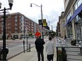
 High St toward downtown.jpg 4,000 × 2,250; 1.53 MB
-
 High Street Looking South (15661909943).jpg 3,203 × 1,943; 2.14 MB
-
 High Street North from Gay Street (16280983522).jpg 3,287 × 2,063; 1.89 MB
-
 Home. (Unsplash).jpg 4,000 × 3,000; 11.04 MB


.jpg)


.jpg)
.jpg)
.jpg)