Category:Downton, Herefordshire
Jump to navigation
Jump to search
civil parish in Herefordshire, UK | |||||
| Upload media | |||||
| Instance of | |||||
|---|---|---|---|---|---|
| Location | Herefordshire, West Midlands, England | ||||
 | |||||
Cymraeg: Pentref yn Swydd Henffordd, Gorllewin Canolbarth Lloegr, Lloegr ydy Downton, Herefordshire.
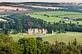
English: Downton is a civil parish in Herefordshire, located in the north of the county and containing the village of Downton-on-the-Rock. It is part of the Leintwardine group of parishes and shares a parish council with Leintwardine and Burrington. In the Domesday Book Downton is referred to as "Duntune", meaning "hill settlement". At Downton Gorge the River Teme cuts through a limestone ridge; above the gorge is Downton Castle, an 18th-century country house with a tower built to resemble a castle.

Subcategories
This category has the following 6 subcategories, out of 6 total.
Media in category "Downton, Herefordshire"
The following 123 files are in this category, out of 123 total.
-

-
 Arable land, Downton - geograph.org.uk - 2532423.jpg 640 × 480; 308 KB
-

-
 Bend in the lane to Leintwardine - geograph.org.uk - 2332580.jpg 640 × 430; 73 KB
-
 Bend in the track at Downton Gorge - geograph.org.uk - 1294150.jpg 640 × 480; 140 KB
-
 Bridge at entrance to Downton Castle (geograph 7043335).jpg 1,600 × 1,069; 606 KB
-
 Burrington Outlet - geograph.org.uk - 797135.jpg 640 × 480; 159 KB
-

-

-

-
 Cophall Cottage - geograph.org.uk - 6367355.jpg 533 × 800; 138 KB
-
 Cottage on the outskirts of Downton - geograph.org.uk - 1309046.jpg 640 × 480; 91 KB
-
-
 Cottages on the Downton Estate - geograph.org.uk - 1306152.jpg 640 × 480; 122 KB
-
 Country road near Burrington (2) - geograph.org.uk - 6046613.jpg 867 × 1,024; 532 KB
-
 Country road near Leintwardine - geograph.org.uk - 6046619.jpg 818 × 1,024; 652 KB
-
 Crag, Downton - geograph.org.uk - 2532476.jpg 480 × 640; 356 KB
-
 Cut off meander, River Teme - geograph.org.uk - 2332111.jpg 640 × 430; 73 KB
-

-
 Downton Castle - geograph.org.uk - 2256378.jpg 640 × 430; 99 KB
-
 Downton Castle - geograph.org.uk - 5891696.jpg 1,024 × 678; 877 KB
-
 Downton Castle - geograph.org.uk - 5891913.jpg 1,024 × 678; 917 KB
-
 Downton Castle from across the river Teme - geograph.org.uk - 797026.jpg 640 × 480; 111 KB
-
 Downton Castle parkland - geograph.org.uk - 1309189.jpg 640 × 480; 95 KB
-
 Downton Gorge National Nature Reserve - geograph.org.uk - 1293761.jpg 640 × 480; 145 KB
-
 Downton on the Rock - geograph.org.uk - 2222075.jpg 640 × 480; 81 KB
-
 Downton on the Rock - geograph.org.uk - 4065382.jpg 800 × 530; 462 KB
-
 Downton parkland - geograph.org.uk - 4062947.jpg 800 × 530; 509 KB
-
 Downton village sign - geograph.org.uk - 1307179.jpg 640 × 480; 84 KB
-
 Downton village sign - geograph.org.uk - 1316266.jpg 640 × 480; 147 KB
-
 Early October misty morning near Nacklestone corner - geograph.org.uk - 4199982.jpg 4,048 × 3,040; 2.56 MB
-

-
 Elan Valley Aqueduct monitoring station - geograph.org.uk - 4411762.jpg 800 × 530; 676 KB
-
 Entrance to Brakes Farm - geograph.org.uk - 1309180.jpg 640 × 480; 94 KB
-
 Entrance to Cophall Farm - geograph.org.uk - 1312764.jpg 640 × 480; 100 KB
-
 Farm buildings at Cop Hall Farm - geograph.org.uk - 6367320.jpg 800 × 533; 139 KB
-
 Farm buildings at The Pools - geograph.org.uk - 6367310.jpg 800 × 533; 111 KB
-
 Farm road, Downton - geograph.org.uk - 2532442.jpg 640 × 480; 343 KB
-
 Farm track beside Gilliers Oaks - geograph.org.uk - 2265344.jpg 640 × 480; 98 KB
-
 Farmland at Tatteridge Hill - geograph.org.uk - 1316357.jpg 640 × 480; 111 KB
-
 Farmland south of Tatteridge Hill - geograph.org.uk - 2330069.jpg 640 × 430; 85 KB
-
 Farmland, Downton - geograph.org.uk - 2532481.jpg 640 × 480; 326 KB
-
 Field near Downton on the Rock - geograph.org.uk - 2222035.jpg 640 × 480; 66 KB
-
 Gated track - geograph.org.uk - 4065394.jpg 800 × 530; 613 KB
-
 Gravel Farm - geograph.org.uk - 1309185.jpg 640 × 480; 119 KB
-
 Heading to Leintwardine - geograph.org.uk - 2332582.jpg 640 × 430; 122 KB
-
-
 Lane at Downton - geograph.org.uk - 1309170.jpg 640 × 480; 125 KB
-
 Lane at Downton - geograph.org.uk - 1315046.jpg 640 × 480; 88 KB
-
 Lane junction - geograph.org.uk - 992121.jpg 640 × 480; 97 KB
-
 Lane junction near Downton - geograph.org.uk - 1309052.jpg 640 × 480; 84 KB
-
 Lane junction near Tatteridge Hill - geograph.org.uk - 1316351.jpg 640 × 480; 94 KB
-

-
 Lane south of Tatteridge Hill - geograph.org.uk - 2332099.jpg 640 × 430; 67 KB
-
 Lane to Downton - geograph.org.uk - 2330066.jpg 640 × 410; 72 KB
-
 Lane to Ford Bridge - geograph.org.uk - 2330074.jpg 640 × 430; 101 KB
-
 Lane to Ford Bridge - geograph.org.uk - 2332113.jpg 640 × 430; 111 KB
-
 Lane to Leintwardine - geograph.org.uk - 2332097.jpg 640 × 430; 72 KB
-
 Lane to Leintwardine - geograph.org.uk - 2332574.jpg 640 × 430; 97 KB
-
 Lodge at Downton - geograph.org.uk - 1309183.jpg 640 × 480; 120 KB
-
 Lower Slopes of Tatteridge Hill - geograph.org.uk - 2332092.jpg 640 × 430; 54 KB
-
 Mysterious building in a gated field - geograph.org.uk - 2737952.jpg 640 × 480; 113 KB
-
 Nacklestone - geograph.org.uk - 5092858.jpg 1,000 × 662; 643 KB
-
 Nacklestone Farm - geograph.org.uk - 2332565.jpg 640 × 430; 69 KB
-
 Nacklestone farm buildings, near Leintwardine - geograph.org.uk - 3888122.jpg 4,048 × 2,030; 2.72 MB
-
 Nacklestone lambs - geograph.org.uk - 1246836.jpg 480 × 640; 83 KB
-
 Nacklestone, near Leintwardine - geograph.org.uk - 3208048.jpg 2,014 × 1,008; 976 KB
-
 Narrow lane to Downton - geograph.org.uk - 2332102.jpg 640 × 430; 84 KB
-
 Old Downton Lodge - geograph.org.uk - 1316264.jpg 640 × 474; 110 KB
-

-

-

-
 Ordnance Survey Cut Mark - geograph.org.uk - 5329315.jpg 640 × 362; 76 KB
-
 Ordnance Survey Cut Mark - geograph.org.uk - 5329321.jpg 640 × 382; 86 KB
-
 Pheasants in the mist and snow of winter 2010. - geograph.org.uk - 2185398.jpg 2,016 × 1,512; 811 KB
-
 Pheasants in the mist. - geograph.org.uk - 2185394.jpg 1,600 × 1,200; 134 KB
-
 Plantation by Nacklestone Farm - geograph.org.uk - 2332576.jpg 640 × 430; 97 KB
-
 Pool near The Pools - geograph.org.uk - 1315055.jpg 640 × 480; 138 KB
-
 Public footpath at Downton - geograph.org.uk - 1309176.jpg 640 × 480; 142 KB
-

-
 Road junction at Nacklestone - geograph.org.uk - 2332559.jpg 640 × 430; 67 KB
-
 Road subsidence and flood damage, Leintwardine - geograph.org.uk - 3888113.jpg 4,048 × 3,040; 2.45 MB
-
 Road, Downton - geograph.org.uk - 2532418.jpg 640 × 480; 323 KB
-
 Roadside pond - geograph.org.uk - 2737942.jpg 640 × 480; 130 KB
-
 Roadsign at Nacklestone - geograph.org.uk - 2332568.jpg 640 × 430; 64 KB
-
 Ruined church at Downton on the Rock - geograph.org.uk - 2222054.jpg 640 × 480; 77 KB
-
 Ruined church at Downton on the Rock - geograph.org.uk - 4171141.jpg 640 × 360; 58 KB
-

-
 Seasonal pond, Downton - geograph.org.uk - 2532439.jpg 640 × 480; 370 KB
-
 Silo, Nacklestone Farm - geograph.org.uk - 2332561.jpg 640 × 430; 69 KB
-
 Skeleton trees above the Teme Gorge - geograph.org.uk - 1293620.jpg 640 × 477; 85 KB
-
 St. Giles Church (Downton on the Rock) - geograph.org.uk - 6332645.jpg 2,048 × 1,152; 1.06 MB
-
 Tatteridge Hill - geograph.org.uk - 2332094.jpg 640 × 430; 55 KB
-
 Tatteridge Hill from the south - geograph.org.uk - 2332114.jpg 640 × 430; 84 KB
-
 Teague's Nursery - geograph.org.uk - 1312756.jpg 640 × 480; 123 KB
-
 Teme Gorge - geograph.org.uk - 4065388.jpg 800 × 530; 531 KB
-
 Teme Valley gateway - geograph.org.uk - 5017476.jpg 4,048 × 1,661; 2.6 MB
-
 Teme Valley morning mists below Nacklestone - geograph.org.uk - 4684640.jpg 4,048 × 2,030; 3.25 MB
-
 Teme Valley morning mists near Nacklestone - geograph.org.uk - 4199989.jpg 4,048 × 2,030; 1.93 MB
-
 Teme Valley morning mists near to Nacklestone - geograph.org.uk - 4684638.jpg 4,048 × 3,040; 2.47 MB
-
 The Brakes - geograph.org.uk - 1309182.jpg 640 × 480; 111 KB
-
 The flanks of Tatteridge Hill - geograph.org.uk - 2332117.jpg 640 × 430; 50 KB
-
 The old motte at Downton on the Rock - geograph.org.uk - 4171148.jpg 640 × 360; 45 KB
-
 The Pools - geograph.org.uk - 1315049.jpg 640 × 480; 87 KB
-
 Towards The Pools - geograph.org.uk - 4064280.jpg 800 × 530; 610 KB
-
 Track across Downton Common - geograph.org.uk - 1309195.jpg 640 × 480; 101 KB
-
 Track near Downton Castle - 2 - geograph.org.uk - 1306145.jpg 640 × 480; 122 KB
-
 Tree near Burrington - geograph.org.uk - 6046614.jpg 801 × 1,024; 662 KB
-
 Un-named lane junction east of Nacklestone - geograph.org.uk - 3743103.jpg 3,547 × 2,491; 1.19 MB
-
 Village noticeboard, Downton - geograph.org.uk - 2532463.jpg 640 × 480; 358 KB
-
 Walker near Nacklestone Farm - geograph.org.uk - 2332571.jpg 640 × 430; 84 KB
-
 Watertrough in parkland - geograph.org.uk - 2737944.jpg 640 × 480; 142 KB
-
 Woodland track, Downton - geograph.org.uk - 2532449.jpg 640 × 480; 334 KB
-
 Cottage by lane on Downton Estates - geograph.org.uk - 590371.jpg 640 × 426; 136 KB
-
 Downton Bridge Aqueduct - geograph.org.uk - 769076.jpg 480 × 640; 111 KB
-
 Downton Estates Grain Stores - geograph.org.uk - 590326.jpg 640 × 426; 130 KB
-
 Elan Valley Aqueduct - geograph.org.uk - 145172 (cropped).jpg 640 × 380; 58 KB
-
 Elan Valley Aqueduct - geograph.org.uk - 145172.jpg 640 × 480; 124 KB
-
 Pool's Top - geograph.org.uk - 590360.jpg 640 × 426; 158 KB
-
 Private Pond - geograph.org.uk - 586757.jpg 640 × 480; 158 KB
-
 Private Road - geograph.org.uk - 586763.jpg 640 × 480; 136 KB
-
 Private Road on the Downton Estate - geograph.org.uk - 586714.jpg 640 × 480; 84 KB
-
 Road to Cophall farm - geograph.org.uk - 586750.jpg 640 × 536; 116 KB


.jpg)


_-_geograph.org.uk_-_6046613.jpg)


_-_geograph.org.uk_-_6332645.jpg)


.jpg)


.jpg)