Category:Downley
Jump to navigation
Jump to search
Main Wikipedia article: Downley.
Français : Downley est un village du Buckinghamshire, Angleterre. Le village, situé sur les chilterns, surplombe la ville de High Wycombe au nord-est de celle-ci. Aujourd'hui Downley fait partie de la banlieue de High Wycombe. La population est de 2 244 habitants.
village in the United Kingdom .jpg) | |||||
| Upload media | |||||
| Instance of | |||||
|---|---|---|---|---|---|
| Location | Buckinghamshire, South East England, England | ||||
| official website | |||||
 | |||||
Media in category "Downley"
The following 87 files are in this category, out of 87 total.
-
 Are we nearly there yet^ - geograph.org.uk - 2558254.jpg 640 × 445; 309 KB
-
 Bridleway, Downley Common - geograph.org.uk - 5583712.jpg 640 × 426; 111 KB
-
 Caution^ Beehives - geograph.org.uk - 527471.jpg 640 × 480; 82 KB
-
 Chiltern Hoarfrost - geograph.org.uk - 1274946.jpg 640 × 480; 70 KB
-
 Clearing in Great Cookshall Wood - geograph.org.uk - 2793312.jpg 640 × 427; 234 KB
-
 Common Side - geograph.org.uk - 5583731.jpg 640 × 426; 93 KB
-
 Common Wood, Hughenden Valley - geograph.org.uk - 2846341.jpg 2,832 × 2,128; 2.89 MB
-
 Cookshall Farm - geograph.org.uk - 2793310.jpg 640 × 427; 224 KB
-
 Cottage on Downley Common - geograph.org.uk - 5583672.jpg 640 × 426; 103 KB
-
 Cricket on Downley Common - geograph.org.uk - 5573159.jpg 640 × 426; 59 KB
-
 Downley - geograph.org.uk - 5583726.jpg 640 × 426; 68 KB
-
 Downley Common - geograph.org.uk - 5573156.jpg 640 × 426; 112 KB
-
 Downley Common - geograph.org.uk - 5573157.jpg 640 × 426; 115 KB
-
 Downley Common - geograph.org.uk - 5573160.jpg 640 × 426; 121 KB
-
 Downley Common - geograph.org.uk - 5583713.jpg 640 × 426; 106 KB
-
 Downley Common - geograph.org.uk - 5583716.jpg 640 × 426; 107 KB
-
 Downley Common - geograph.org.uk - 5583717.jpg 640 × 426; 112 KB
-
 Downley Common - geograph.org.uk - 5583718.jpg 640 × 426; 119 KB
-
 Downley Common - geograph.org.uk - 5583719.jpg 640 × 426; 127 KB
-
 Downley Common - geograph.org.uk - 971587.jpg 640 × 480; 107 KB
-
 Downley Common - geograph.org.uk - 971603.jpg 640 × 480; 71 KB
-
 Downley Common, Bridleway to West Wycombe - geograph.org.uk - 888039.jpg 640 × 480; 148 KB
-
 Downley Methodist church - geograph.org.uk - 2558353.jpg 640 × 429; 226 KB
-
 Farm Buildings - geograph.org.uk - 576062.jpg 640 × 482; 107 KB
-
 Farmland near Hughenden - geograph.org.uk - 3502528.jpg 2,048 × 1,536; 544 KB
-
 Flagmore Wood - geograph.org.uk - 5226927.jpg 1,600 × 1,200; 828 KB
-
 Flint built cottage, Littleworth Rd - geograph.org.uk - 5583745.jpg 640 × 426; 77 KB
-

-
 Flint built cottages, Littleworth Rd - geograph.org.uk - 5583738.jpg 640 × 426; 93 KB
-
 Footpath junction at Flagmore Wood - geograph.org.uk - 2558227.jpg 640 × 454; 275 KB
-
 Footpath, Downley Common - geograph.org.uk - 5573154.jpg 640 × 426; 113 KB
-
 Footpath, Downley Common - geograph.org.uk - 5573155.jpg 640 × 426; 106 KB
-
 Footpath, Downley Common - geograph.org.uk - 5583707.jpg 640 × 426; 127 KB
-
 Footpath, Downley Common - geograph.org.uk - 5583722.jpg 640 × 426; 115 KB
-
 Footpath, Little Tinker's Wood - geograph.org.uk - 5583751.jpg 640 × 426; 136 KB
-
 Footpath, Naphill Common - geograph.org.uk - 5573150.jpg 640 × 426; 126 KB
-
 Footpath, Naphill Common - geograph.org.uk - 5573151.jpg 640 × 426; 132 KB
-
 Footpath, Naphill Common - geograph.org.uk - 5573152.jpg 640 × 426; 123 KB
-
 Gate onto Naphill Common - geograph.org.uk - 2793488.jpg 607 × 640; 289 KB
-
 Grassland, Downley Common - geograph.org.uk - 5583725.jpg 640 × 426; 75 KB
-
 Hanging Wood - geograph.org.uk - 2888575.jpg 2,832 × 2,128; 1.9 MB
-
 House on Downley Common - geograph.org.uk - 5583676.jpg 640 × 426; 95 KB
-
 Houses on Common Side - geograph.org.uk - 5583729.jpg 640 × 426; 103 KB
-
 In Flagmore Wood - geograph.org.uk - 2558232.jpg 640 × 390; 243 KB
-
 In Little Cookshall Wood - geograph.org.uk - 2793307.jpg 640 × 465; 245 KB
-
 Junction in the Woods - geograph.org.uk - 5455543.jpg 640 × 480; 131 KB
-
 Little Cookshall Wood - geograph.org.uk - 2793305.jpg 640 × 427; 260 KB
-
 Little Tinker's Wood - geograph.org.uk - 5583754.jpg 640 × 426; 119 KB
-
 Littleworth Rd - geograph.org.uk - 5583734.jpg 640 × 426; 102 KB
-
 Littleworth Rd - geograph.org.uk - 5583739.jpg 640 × 426; 81 KB
-
 Littleworth Rd - geograph.org.uk - 5583740.jpg 640 × 426; 83 KB
-
 Littleworth Road - geograph.org.uk - 2558358.jpg 640 × 416; 214 KB
-
 Manning's Pond, Downley Common - geograph.org.uk - 5212072.jpg 1,024 × 768; 440 KB
-
 Middlebrook Way - geograph.org.uk - 843289.jpg 640 × 480; 70 KB
-
 Naphill Common - geograph.org.uk - 5573147.jpg 640 × 426; 111 KB
-
 Naphill Common - geograph.org.uk - 5573149.jpg 640 × 426; 115 KB
-
 Narrow Lane - geograph.org.uk - 5583743.jpg 640 × 425; 80 KB
-
 Oak, Downley Common - geograph.org.uk - 5583727.jpg 640 × 426; 98 KB
-
 Paddock near Common Wood - geograph.org.uk - 2558335.jpg 640 × 428; 264 KB
-
 Path in Flagmore Wood - geograph.org.uk - 2525194.jpg 4,000 × 3,000; 4.39 MB
-
 Plomer Green Lane - geograph.org.uk - 5583668.jpg 640 × 426; 92 KB
-
 Plomer Green Lane - geograph.org.uk - 5583669.jpg 640 × 426; 84 KB
-

-
 Public Bridleway on Naphill Common - geograph.org.uk - 2525189.jpg 4,000 × 3,000; 3.21 MB
-

-
 Recent harvest at Manor Farm - geograph.org.uk - 2524560.jpg 4,000 × 3,000; 2.47 MB
-
 Ringside Seats, Downley Common - geograph.org.uk - 5212062.jpg 1,600 × 1,200; 624 KB
-
 Road junction, Downley Common - geograph.org.uk - 5583670.jpg 640 × 426; 76 KB
-
 Road, Downley Common - geograph.org.uk - 5583673.jpg 640 × 426; 111 KB
-
 Runner in Great Cookshall Wood - geograph.org.uk - 2793319.jpg 518 × 640; 278 KB
-
 The end of Huntshill Lane - geograph.org.uk - 5573145.jpg 640 × 426; 107 KB
-
 To the tea room - geograph.org.uk - 2558247.jpg 640 × 459; 273 KB
-
 Track on Downley Common - geograph.org.uk - 5212089.jpg 1,600 × 1,145; 574 KB
-
 West Wycombe 074 Downley Methodist Church (8066923292).jpg 4,288 × 3,216; 4.03 MB
-
 West Wycombe 075 Stone laid by Arthur Fairfax (8066924160).jpg 2,436 × 1,835; 1.77 MB
-
 West Wycombe 076 Cross (8066925280).jpg 4,288 × 3,216; 4.69 MB
-
 Westover Road, Downley - geograph.org.uk - 2230191.jpg 640 × 480; 151 KB
-
 Annual Display, Christmas 2006 - geograph.org.uk - 523025.jpg 640 × 480; 95 KB
-
 Downley, Common Wood - geograph.org.uk - 687894.jpg 640 × 480; 138 KB
-

-
 Farmland, Hughenden - geograph.org.uk - 745865.jpg 640 × 480; 140 KB
-
 Farmland, Hughenden - geograph.org.uk - 745903.jpg 640 × 480; 147 KB
-
 Farmland, Hughenden - geograph.org.uk - 745944.jpg 640 × 480; 152 KB
-
 Hughenden Manor, Hanging Wood - geograph.org.uk - 687934.jpg 640 × 480; 154 KB
-

-
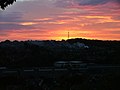 Sunset over Downley - geograph.org.uk - 519429.jpg 640 × 482; 54 KB
-
 Thara Stores - geograph.org.uk - 524472.jpg 640 × 480; 73 KB


.jpg)
.jpg)
.jpg)


