Category:Dorpskerk (Garderen)
Jump to navigation
Jump to search
| Object location | | View all coordinates using: OpenStreetMap |
|---|
 | |||||
| Upload media | |||||
| Instance of |
| ||||
|---|---|---|---|---|---|
| Location | Garderen, Gelderland, Netherlands | ||||
| Street address |
| ||||
| Heritage designation |
| ||||
 | |||||
|
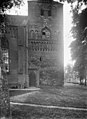
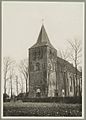
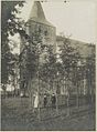
This is a category about rijksmonument number 8620
|
| Address |
|
Media in category "Dorpskerk (Garderen)"
The following 39 files are in this category, out of 39 total.
-
 20130505 05 Garderen.jpg 3,648 × 2,736; 2.15 MB
-
 20151101 16 Garderen.jpg 5,184 × 3,888; 14.34 MB
-
 20160707 Kerk Garderen.jpg 3,456 × 5,184; 3.83 MB
-
 20160816 torenspits kerk Garderen.jpg 3,456 × 5,184; 2.27 MB
-
 Dorpskerk Garderen (30652002350).jpg 2,592 × 3,872; 4.73 MB
-
 Dorpskerk Garderen (30953991885).jpg 2,592 × 3,872; 4.45 MB
-
 Dorpskerk Garderen P1370819.jpg 4,000 × 2,672; 6.11 MB
-
 Dorpskerk Garderen P1370820.jpg 2,672 × 4,000; 5.82 MB
-
 Dorpskerk Garderen P1370821.jpg 4,000 × 2,672; 6.06 MB
-
 Dorpskerk Garderen P1370823.jpg 2,672 × 4,000; 5.94 MB
-
 Dorpskerk Garderen P1370824.jpg 2,672 × 4,000; 6.05 MB
-
 Dorpskerk Garderen P1370825.jpg 2,672 × 4,000; 5.87 MB
-
 Dorpskerk Garderen P1370831.jpg 4,000 × 2,672; 6.15 MB
-
 Garderen kerk (01).jpg 7,360 × 4,912; 8.74 MB
-
 Garderen kerk (02).jpg 4,621 × 6,951; 6.61 MB
-
 Garderen kerk (03).jpg 4,912 × 7,360; 8.38 MB
-
 Garderen kerk (04).jpg 4,912 × 7,360; 5.56 MB
-
 Garderen kerk vanaf molen De Hoop.jpg 2,448 × 3,264; 3.33 MB
-
 Garderen, de Nederlands Hervormde kerk RM8620 IMG 4660 2020-04-16 13.45.jpg 4,855 × 3,237; 13.52 MB
-
 Garderen-mazenhofstraat-184925.jpg 3,264 × 2,448; 3.2 MB
-
 Kerk - Garderen - 20074994 - RCE.jpg 884 × 1,200; 336 KB
-
 Onderste deel toren gezien vanuit het zuidwesten - Garderen - 20324225 - RCE.jpg 1,200 × 911; 249 KB
-
 Overzicht westgevel - Garderen - 20074995 - RCE.jpg 894 × 1,200; 302 KB
-
 Protestant old church at Garderen - panoramio.jpg 2,848 × 4,288; 6.93 MB
-
 Tilia × europaea water sprouts (04).jpg 4,912 × 7,360; 10.61 MB
-
 Toren - Garderen - 20074991 - RCE.jpg 891 × 1,200; 334 KB
-
 Toren - Garderen - 20074996 - RCE.jpg 873 × 1,200; 226 KB
-
 Toren - Garderen - 20074997 - RCE.jpg 798 × 1,200; 241 KB
-
 Toren gezien vanuit het noorden - Garderen - 20326796 - RCE.jpg 806 × 1,200; 302 KB
-
 Toren noord-zijde - Garderen - 20074993 - RCE.jpg 892 × 1,200; 323 KB
-
 Toren vanuit het noorden - Garderen - 20074992 - RCE.jpg 874 × 1,200; 293 KB
-
 Toren vanuit het zuid-westen - Garderen - 20074990 - RCE.jpg 899 × 1,200; 283 KB
-
 Toren west zijde - Garderen - 20074987 - RCE.jpg 896 × 1,200; 240 KB
-
 Toren west zijde - Garderen - 20074988 - RCE.jpg 885 × 1,200; 225 KB
-
 Toren zuid-zijde - Garderen - 20074989 - RCE.jpg 894 × 1,200; 319 KB
-

-
 Zicht vanuit het westen - Garderen - 20324224 - RCE.jpg 869 × 1,200; 193 KB
-
 Zicht vanuit het zuidwesten - Garderen - 20324165 - RCE.jpg 859 × 1,200; 199 KB
-
 Zicht vanuit het zuidwesten - Garderen - 20326687 - RCE.jpg 884 × 1,200; 291 KB


.jpg)
.jpg)


.jpg)
.jpg)
.jpg)
.jpg)


.jpg)


