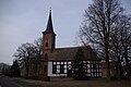
Category:Dorfkirche Großbeuthen
Jump to navigation
Jump to search
| Object location | | View all coordinates using: OpenStreetMap |
|---|
 | |||||
| Upload media | |||||
| Instance of | |||||
|---|---|---|---|---|---|
| Location | Großbeuthen, Trebbin, Teltow-Fläming District, Brandenburg, Germany | ||||
| Heritage designation | |||||
 | |||||
This is the category of the Brandenburger Baudenkmal (cultural heritage monument) with the ID 09105318 (Wikidata)
|
Media in category "Dorfkirche Großbeuthen"
The following 4 files are in this category, out of 4 total.
-
 Dorfkirche Großbeuthen - Germany - panoramio.jpg 1,944 × 2,592; 1.78 MB
-
 Großbeuthen-Kirche.JPG 4,000 × 3,000; 4.27 MB
-
 Kirche Großbeuthen 2.JPG 640 × 480; 120 KB
-
 Kirche Großbeuthen Trebbin.jpg 3,872 × 2,592; 5.16 MB


