Category:Dorfkirche Frankenförde
Jump to navigation
Jump to search
| Object location | | View all coordinates using: OpenStreetMap |
|---|
church building in Nuthe-Urstromtal, Brandenburg state, Germany  | |||||
| Upload media | |||||
| Instance of | |||||
|---|---|---|---|---|---|
| Location | Frankenförde, Nuthe-Urstromtal, Teltow-Fläming District, Brandenburg, Germany | ||||
| Heritage designation | |||||
 | |||||
This is the category of the Brandenburger Baudenkmal (cultural heritage monument) with the ID 09105296 (Wikidata)
|
Media in category "Dorfkirche Frankenförde"
The following 13 files are in this category, out of 13 total.
-
 Dorfkirche Frankenfoerde Blick ins Kirchenschiff.jpg 2,592 × 1,944; 1.38 MB
-
 Dorfkirche Frankenfoerde Kirchenschiff Suedseite Portal.jpg 2,592 × 1,944; 3.45 MB
-
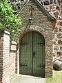
 Dorfkirche Frankenfoerde Kirchenschiff Suedseite Priesterpforte.jpg 2,592 × 1,944; 3.56 MB
-
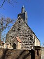
 Dorfkirche Frankenfoerde Ostansicht.jpg 2,592 × 1,944; 2.93 MB
-
 Dorfkirche Frankenfoerde Suedansicht.jpg 2,592 × 1,944; 2.73 MB
-
 Dorfkirche Frankenfoerde Suedostansicht.jpg 2,592 × 1,944; 2.7 MB
-
 Dorfkirche Frankenfoerde Suedwestansicht.jpg 2,592 × 1,944; 2.43 MB
-
 Dorfkirche Frankenfoerde Westansicht.jpg 1,944 × 2,592; 2.1 MB
-
 Dorfkirche Frankenfoerde Westturm.jpg 1,944 × 2,592; 1.91 MB
-
 Dorfkirche Frankenfoerde Westvorhalle.jpg 1,944 × 2,592; 2.42 MB
-
 Dorfkirche Frankenförde - Germany - panoramio.jpg 2,592 × 1,944; 2.45 MB
-
 Dorfkirche Frankenförde - panoramio.jpg 1,944 × 2,592; 2.85 MB
-
 NU-Frankenförde Dorfkirche März 2022.jpg 3,024 × 4,032; 4.32 MB


