Category:Divided highways in the United States
Jump to navigation
Jump to search
Wikimedia category | |||||
| Upload media | |||||
| Instance of | |||||
|---|---|---|---|---|---|
| |||||
Subcategories
This category has the following 12 subcategories, out of 12 total.
Media in category "Divided highways in the United States"
The following 110 files are in this category, out of 110 total.
-
 1228039.jpg 547 × 394; 69 KB
-
 1680 - W Providence Twp - US30 WB.JPG 4,000 × 2,575; 2 MB
-
 1832 - Altoona - 17th St at I99-US220.JPG 4,000 × 3,000; 2.51 MB
-
 1833 - Altoona - 17th St at I99-US220.JPG 4,000 × 3,000; 2.57 MB
-
 2006 09 30 - Georgia - Offset left-turn.JPG 2,592 × 1,503; 482 KB
-
 2006 Feb - Facing eastward, toward Bauer.JPG 2,592 × 1,944; 1.66 MB
-
 422 West Express ends.jpg 2,048 × 1,536; 1.15 MB
-
 89A in Sedona.JPG 1,558 × 872; 231 KB
-
 Al210-ccw-past-us084-east.jpg 2,200 × 662; 189 KB
-
 Alabama 297 South at Paul Bryant Bridge.jpg 600 × 450; 74 KB
-
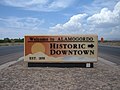 Alamogordo Historic Downtown welcome sign.jpg 2,272 × 1,704; 716 KB
-
 AmericanElectricPowerPlantonUS23.jpg 800 × 533; 120 KB
-
 Briarcliff Wells Gas Station.jpg 4,650 × 3,700; 4.25 MB
-

-

-
 Chestnut Expy Spfd MO.jpg 1,600 × 1,200; 499 KB
-
 Citizens Bank Bemiss Rd.JPG 3,072 × 2,304; 2.93 MB
-
 Cliffs of East Liverpool.jpg 2,576 × 1,920; 1.99 MB
-
 Corridor Q western terminus.jpg 550 × 396; 60 KB
-
 CR 541 northbound approaching CR 638.jpg 2,465 × 1,862; 837 KB
-
 CR 544 wb, Marlton Parkway, May 2022.jpg 3,592 × 2,038; 1.91 MB
-
 Divided section of CR 536 Spur at CR 561, July 2021.jpg 2,901 × 2,198; 1.16 MB
-
 Dollar General Bemiss Rd.JPG 3,072 × 2,304; 2.96 MB
-
 DowntownSprings.jpg 1,000 × 750; 150 KB
-
 Durant hwy 69 75.jpg 3,264 × 2,448; 1.32 MB
-
 GA 376 Hwy 41 Int Lake Park SB.JPG 3,072 × 2,304; 2.89 MB
-
 GA Woodbine US 17 north01.jpg 4,288 × 3,216; 2.44 MB
-
 GA383LeavingFortGordon.JPG 3,093 × 1,961; 2.91 MB
-
 Greeley, CO, September 19, 2013 (12441526333).jpg 800 × 520; 154 KB
-
 Harvey's Grocery Store Bemiss Rd.JPG 3,072 × 2,304; 2.97 MB
-
 Highway 104-N.jpg 1,632 × 1,224; 485 KB
-
 Highway 59 between Marshall and Jefferson.JPG 2,304 × 1,728; 271 KB
-
 Highway151atHighway45.jpg 2,304 × 1,728; 692 KB
-
 Highway15WisconsinEastTerminus.jpg 2,304 × 1,728; 626 KB
-
 I-474 West Sign on SW Adams St (42058196095).jpg 2,400 × 1,600; 1.82 MB
-
 I73nbi74wb.JPG 1,600 × 1,200; 887 KB
-
 Illinois Route 171 at U.S. Routes 12-20-45.jpg 1,504 × 1,000; 477 KB
-
 Illinois Route 72 near Harlem Avenue.jpg 1,500 × 991; 205 KB
-
 Interstate 5 in Washington state.JPG 4,224 × 2,376; 4.78 MB
-
 Kokomo-indiana-us31.jpg 2,500 × 1,146; 796 KB
-
 LaneClosedAheadAndAboveABQ (36776681295).jpg 2,400 × 1,600; 2.05 MB
-
 Leaving Bristol FL20WB.jpg 5,184 × 3,456; 5.25 MB
-
 Loosahatchie River N Watkins St Memphis TN 01 sign.jpg 1,024 × 768; 635 KB
-
 Marquette Bypass.jpg 3,008 × 2,000; 2.87 MB
-
 Michigan 3 map.png 2,205 × 1,239; 188 KB
-
 NEWMAN, GA-SHENANDOAH SOLAR, NEVADA TEST SITE - DPLA - 14db8e3ca8739d3728610fb07e2b7894.jpg 3,020 × 2,414; 5.61 MB
-
 NJ 18 north of Hoes Ln W.jpg 2,230 × 1,617; 1.03 MB
-
 Ohio 13 and Possum Run Road.JPG 2,080 × 1,332; 503 KB
-
 Ohio State Route 292.jpg 2,376 × 1,745; 299 KB
-
 OldalignIL.jpg 600 × 450; 208 KB
-
 Overview of West Lancaster.jpg 2,576 × 1,920; 2.02 MB
-
 PENNSYLVANIA-NORTH WEST PHILADELPHIA, PHILADELPHIA - NARA - 552733.jpg 2,027 × 3,000; 892 KB
-
 Pikes Peak5.jpg 1,280 × 960; 205 KB
-
 Pikeville Cut-Through from south.jpg 6,016 × 4,000; 6.33 MB
-
 Route66 071.jpg 282 × 192; 35 KB
-
 Savery Avenue, Carver MA.jpg 2,448 × 1,632; 812 KB
-
-
 Seward Highway, looking south from Rabbit Creek Road.jpg 8,000 × 6,000; 7.12 MB
-
 SR 89A in Sedona.JPG 1,437 × 854; 223 KB
-
 SR 89A south of Sedona.JPG 1,600 × 830; 168 KB
-
 SR3AtokaCoOK P249.jpg 2,848 × 2,136; 1.4 MB
-
 State Route 7 in Saline Township.jpg 2,576 × 1,920; 1.92 MB
-
 TEXpress Lanes I-820 Section.png 1,499 × 558; 25 KB
-
 TEXpress Lanes SH-121 and 183 Section.png 1,659 × 562; 25 KB
-
 Tularosa New Mexico Welcome Sign.JPG 2,272 × 1,704; 749 KB
-
 U.S. Route 25 South Carolina.JPG 3,456 × 2,304; 2.91 MB
-
 U.S. Route 71 at Highway 340 junction, Bella Vista, Arkansas.jpg 3,753 × 2,818; 2.04 MB
-
 U.S. Route 89, Arizona.jpg 2,582 × 1,718; 1.04 MB
-
 US 13 sb approaching PA 413 (1), Nov. 2022.jpg 3,502 × 2,640; 1.81 MB
-
 US 13 sb approaching PA 413 (2), Nov. 2022.jpg 3,413 × 2,596; 1.77 MB
-
 US 181, San Antonio, Texas.JPG 3,872 × 2,592; 2.22 MB
-
 US 20 wb at Sharon Center, NY, July 2023.jpg 3,021 × 2,266; 1.11 MB
-
 US 20 wb entering East Springfield, NY.jpg 2,659 × 1,998; 1.05 MB
-
 US 20 wb in Town of Carlisle, NY, July 2023.jpg 3,111 × 2,333; 1.43 MB
-
 US 20 wb west of Sloansville, NY, July 2023.jpg 3,083 × 2,335; 1.27 MB
-
 US 30 Admiral Wilson.JPG 2,272 × 1,704; 832 KB
-
 US 30 west of Fort Wayne, Indiana.jpg 1,500 × 673; 121 KB
-
 US 6 in Harriman State Park.jpg 2,144 × 1,932; 3.18 MB
-
 US 60 SPUI interchange.jpg 600 × 431; 29 KB
-
 US 60 West Bartlesville.jpg 2,048 × 1,536; 797 KB
-
 US 62 east of Okmulgee.jpg 1,600 × 1,200; 347 KB
-
 US Route 52 Lafayette.png 1,700 × 900; 2.51 MB
-
 US-160 West Bypass.jpg 1,594 × 894; 318 KB
-
 US151March2006.JPG 480 × 375; 27 KB
-
 US285NBCOMM233.5.jpg 800 × 600; 53 KB
-
 US285NBCOMM235.5.jpg 800 × 600; 56 KB
-
 US285NBCOMM237.jpg 800 × 600; 68 KB
-
 US285NBCOMM239.jpg 800 × 600; 60 KB
-
 US285NBCOMM241.jpg 800 × 600; 61 KB
-
 US30, Matteson, Illinois.JPG 2,304 × 1,728; 532 KB
-
 US43sAL17sRoad-TwinnedNearHackleburg (38947911504).jpg 2,400 × 1,600; 1.73 MB
-
 US45sRoadLanes-NorthOfMeridian (27828512419).jpg 2,400 × 1,600; 1.82 MB
-
 US64 East of Pulaski (29667317123).jpg 2,400 × 1,600; 1.63 MB
-
 US64-87NMEBCapulin14mi.jpg 2,848 × 2,136; 1.42 MB
-
 US64-87NMEBCapulin17mi.jpg 2,173 × 851; 425 KB
-
 US70SroadVetMemHighway-EastOfMcM (30001249810).jpg 2,400 × 1,600; 1.65 MB
-
 US72AwAL20wRoadCurves (24787748077).jpg 2,400 × 1,600; 1.7 MB
-
 US72eRoad-HillWestOfScottsboro (30507423693).jpg 2,400 × 1,600; 1.62 MB
-
 US78SignLeavingFortGordon.JPG 3,648 × 2,736; 4.62 MB
-
 US84EBapproachingDaleCO,AL.jpg 2,848 × 2,136; 1.11 MB
-
 US84EBatI-55BrookhavenAL.jpg 2,150 × 1,581; 698 KB
-
 US84EBatUS49.jpg 2,094 × 1,378; 568 KB
-
 VATNBorderonUS23.jpg 800 × 533; 142 KB
-
 W. H. Sammis Power Plant.jpg 2,576 × 1,920; 2.11 MB
-
 W.P. Strickland Road and Lonnie Raker Lane angle.jpg 3,264 × 2,448; 2.26 MB
-
 W.P. Strickland Road and Lonnie Raker Lane stop sign.jpg 3,264 × 2,448; 2.27 MB
-
 W.P. Strickland Road and Lonnie Raker Lane straight.jpg 3,264 × 2,448; 2.48 MB
-
 Walland-tennessee-gamble-station.jpg 1,199 × 899; 289 KB
-
 Wilco Travel Plaza, Exit 11, Lowndes County.JPG 4,320 × 3,240; 4.51 MB
-
 WSB-TV tower.JPG 2,592 × 3,456; 1.9 MB


.jpg)


.jpg)


.jpg)


.jpg)


,_Nov._2022.jpg)
,_Nov._2022.jpg)


.jpg)
.jpg)
.jpg)

.jpg)
.jpg)
.jpg)


