Category:Dirt roads in the United States
Jump to navigation
Jump to search
Subcategories
This category has only the following subcategory.
Media in category "Dirt roads in the United States"
The following 99 files are in this category, out of 99 total.
-
 Unsurfaced Road Maintenance Management.pdf 1,227 × 1,583, 50 pages; 1.26 MB
-
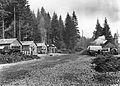
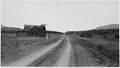 "Abandoned general store and other log buildings" - NARA - 292843.jpg 3,000 × 1,697; 2 MB
-
 119th Street looking east (3410211866).jpg 1,050 × 756; 259 KB
-

-
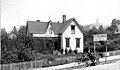
 A Summer Home, Buckeye Lake, O. (12660103565).jpg 3,242 × 2,045; 8.33 MB
-
 Alapaha River Wildlife Management Area sign.jpg 5,184 × 3,456; 10.71 MB
-
 America's Highways 1776–1976 - page 103.jpg 2,184 × 1,424; 2.39 MB
-

-
 Emigrant Train, Strawberry Valley, going east. (no. 625) (NYPL b11707292-G89F367 027F).tiff 3,072 × 1,731; 15.22 MB
-
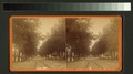 Tree-lined residential street (NYPL b11707400-G90F124 048F).tiff 3,072 × 1,714; 15.07 MB
-
 St. Johns Church, Episcopal (NYPL b11707430-G90F153 002F).tiff 3,072 × 1,719; 15.11 MB
-
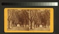 Avenue leading to Hermitage (NYPL b11707430-G90F153 021F).tiff 3,072 × 1,767; 15.53 MB
-
 Pacific Ave. cor. King St (NYPL b11707643-G90F449 023F).tiff 2,972 × 1,724; 14.66 MB
-
 Ird's eye view of Cumberland (NYPL b11707653-G90F459 008F).tiff 2,988 × 1,728; 14.77 MB
-
 Bad Lands, Unaka National Forest - NARA - 280115.jpg 3,000 × 2,230; 1.81 MB
-
 Battle Creek Aspens.jpg 4,896 × 2,752; 5.93 MB
-
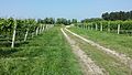 BellviewWineryVineyardBlock.jpg 4,128 × 2,322; 5.89 MB
-
 BridgeNo12.jpg 640 × 427; 292 KB
-

-
 Bunchgrass prairie SRP.jpg 1,632 × 1,224; 868 KB
-
 Butano State Park - Olmo Fire Road.jpg 1,067 × 1,600; 2.18 MB
-

-
 Conemaugh River viaduct near New Florence.jpg 6,016 × 4,000; 6.37 MB
-
 Cordova street scene, ca 1912 (THWAITES 195).jpeg 766 × 451; 51 KB
-
 Cow Creek Trip-11.22 09 (110).JPG 1,024 × 768; 347 KB
-
 Croton Gorge park trail.jpg 4,000 × 2,992; 6.32 MB
-
-
 Darius Kinsey.jpg 4,221 × 2,669; 6.38 MB
-
 Developing Washout - 105).JPG 1,024 × 768; 343 KB
-
 Dirt road on former Concord & Manchester ROW, August 2016.JPG 4,320 × 3,240; 3.99 MB
-
 Dirt road through sunglasses.jpg 5,472 × 3,648; 9.03 MB
-
 Down the Forest Road - panoramio.jpg 3,013 × 2,271; 2.92 MB
-
 Driveway at the Foot of Slate Hill (13904580640).jpg 3,298 × 2,025; 2.31 MB
-
 E.B. Forsythe NWR. (4730504447).jpg 4,000 × 3,000; 2.58 MB
-
 EARLY MORNING - NARA - 552521.jpg 3,000 × 2,044; 523 KB
-
 Either Way to Granville (13960069979).jpg 3,203 × 2,003; 1.18 MB
-
 Elk Township field along Martin Road.jpg 6,016 × 4,000; 6.47 MB
-
 Farm-gate-putnam-tn1.jpg 4,000 × 3,000; 4.41 MB
-
 FE MacKenzie Greenwood garage, ca 1920 (SEATTLE 940).jpg 768 × 612; 104 KB
-
 Fire Island Ocean Beach 11.jpg 1,536 × 1,024; 313 KB
-
 Going Down to Clarks Fork Hidden Valley Ranch.jpg 720 × 540; 400 KB
-

-
 GTV JLTV.jpg 2,464 × 1,632; 2.22 MB
-
 Road and bridge over the Mohawk (NYPL Hades-1826175-1662533).tiff 7,230 × 5,428; 112.28 MB
-
 Schooley's Springs (NYPL Hades-1826194-1662552).tiff 7,230 × 5,428; 112.28 MB
-
 Foundry on Jones Creek near Baltimore (NYPL Hades-1826197-1662555).tiff 5,428 × 7,230; 112.28 MB
-
 HAER HCRH OR-36-88.jpg 5,000 × 3,966; 1.92 MB
-
 HAER HCRH OR-36-T-9.jpg 5,000 × 3,945; 1.89 MB
-
 IL 336 - Macomb Bypass construction.jpg 4,608 × 3,456; 6.86 MB
-

-
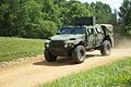 Joint Light Tactical Vehicle near Aberdeen Proving Ground.jpg 1,280 × 857; 1.04 MB
-
 Kentucky Oaks - A Thousand Mile Walk to the Gulf.jpg 2,462 × 1,817; 1.43 MB
-
 Knights Ferry Rd Flooding Lowndes County GPSing 2.JPG 3,072 × 2,304; 3.04 MB
-
 Latona Ave NE from NE 62nd St, ca 1920 (SEATTLE 536).jpg 768 × 539; 96 KB
-
 Little hotdog in the road.jpg 7,360 × 4,912; 11.59 MB
-
 Mason Farm 20140424 3.jpg 2,448 × 3,264; 8.39 MB
-
 Millcreek Road north of Strattanville.jpg 6,016 × 4,000; 6.3 MB
-
 Corduroy work on the farm station truck trail - NARA - 285711.jpg 3,000 × 1,740; 1.1 MB
-
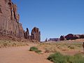 Monument Valley 2004 05.jpg 2,592 × 1,944; 2.81 MB
-
 MonumentValley.jpg 3,319 × 2,008; 3.75 MB
-
 MUTCD-TX W8-7aT.svg 458 × 458; 11 KB
-
 My way (2214448553).jpg 3,008 × 2,000; 4.55 MB
-
 Nepaug State Forest - "Tunxis Trail" Dirt Road Main Entrance Off CT-202.jpg 4,032 × 3,024; 10.94 MB
-
 Niemeyer Rd. May 2015 - panoramio.jpg 3,264 × 2,448; 7.12 MB
-
 Occidental Hotel, ca. 1865 - DPLA - b135f60c3f8ff89be8c3880f3e176968.jpg 5,819 × 3,960; 1.86 MB
-
 Occidental Hotel, Seattle, ca 1865 (SEATTLE 3658).jpg 768 × 507; 38 KB
-
-
 Old Toll House (13960050839).jpg 3,276 × 2,061; 3.21 MB
-
 P1000863 (7041643787).jpg 3,648 × 1,575; 4.93 MB
-

-
 Pacific Highway through a Washington red cedar stump, 20 feet in diameter LCCN2002706970.tif 5,600 × 4,368; 70.07 MB
-

-
 Post Intelligencer newspaper office, June 1889 (SEATTLE 661).jpg 768 × 450; 71 KB
-

-
 Private Railroad Xing off Old US 17; Jasper Co, SC-1.jpg 3,648 × 2,736; 2.03 MB
-
 Private Railroad Xing off Old US 17; Jasper Co, SC-2.jpg 3,648 × 2,736; 2.02 MB
-
 Private Railroad Xing off Old US 17; Jasper Co, SC-3.jpg 3,648 × 2,736; 2.02 MB
-
 PSM V56 D0546 Beverly road and 15th street brooklyn march 1899.png 1,635 × 969; 288 KB
-
 Raube2.JPG 1,728 × 2,304; 1.56 MB
-
 Road with wagon tracks (3409402797).jpg 1,050 × 757; 216 KB
-
 Road-to-chester-swamp.png 3,020 × 2,008; 12.08 MB
-
 Sabal palmetto 010 by Scott Zona.jpg 3,648 × 2,736; 8.98 MB
-

-
 Sam Mellor running at the 1904 Olympic Marathon.jpg 1,740 × 1,666; 679 KB
-

-
 Seamen's Home on Western Avenue, ca 1906 (MOHAI 6139).jpg 698 × 575; 43 KB
-

-

-

-
 SnowMountainFrenchRidge1.jpg 2,000 × 1,333; 635 KB
-
 Spring Mountains road 553 3.jpg 2,400 × 1,600; 734 KB
-

-
 T - panoramio - A-Reck.jpg 1,200 × 1,600; 427 KB
-

-
 Tiptonville from South Junction HWY 14 (39f41b80f80b49b49fe2f8b1f2dfc749).JPG 6,830 × 3,772; 10.64 MB
-
 Two little boys in overalls 01947v.jpg 1,024 × 842; 141 KB
-
 Unpaved street or alley between houses in Georgia LCCN99472393.jpg 4,096 × 3,297; 1.57 MB
-
 Waltmire Bridge.jpg 3,264 × 2,448; 4.23 MB
-


.jpg)
.JPG)
.jpg)


.jpeg)


.jpeg)
.JPG)

.jpeg)

.JPG)


.jpg)
.jpg)

.jpg)


.jpg)


.jpg)


.jpg)


.jpg)


.jpg)
.jpg)
.jpg)
.jpg)

.jpg)
.jpg)


.jpg)


.jpg)
.jpg)
.jpg)
.jpg)
.jpg)


.jpg)

.jpeg)
.JPG)


.jpeg)
_at_807_7th_Ave,_Seattle,_Washington,_May_20,_1911_(LEE_128).jpeg)