Category:Dinas Mawddwy
Jump to navigation
Jump to search
village in Gwynedd, Wales, UK  | |||||
| Upload media | |||||
| Instance of | |||||
|---|---|---|---|---|---|
| Location | Mawddwy, Gwynedd, Wales | ||||
 | |||||
Cymraeg: Mae Dinas Mawddwy yn bentref yn ne-ddwyrain Gwynedd fymryn oddi ar y ffordd A470, lle mae'r ffordd fechan i bentref Llanuwchllyn yn gadael yr A470 i ddringo dros Fwlch y Groes, y bwlch uchaf yng Nghymru sydd a ffordd fodur drosto. O'r pentref mae'r ffordd yma yn arwain i'r gogledd trwy Gwm Cywarch i gyfeiriad Aran Fawddwy. Mae'r pentref gerllaw Afon Dyfi. Daw'r enw oddi wrth hen gwmwd Mawddwy, oedd ar un adeg yn deyrnas annibynnol.
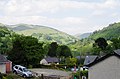
English: Dinas Mawddwy is a village in Gwynedd, north Wales, just to the side of the A470 so that most visitors pass the village by. The village marks the junction of the unclassified road to Llanuwchllyn which climbs up through the mountains to cross Bwlch y Groes at its highest point, the highest road pass in Wales. This minor road also provides the closest access to the mountain Aran Fawddwy.
Subcategories
This category has only the following subcategory.
Media in category "Dinas Mawddwy"
The following 46 files are in this category, out of 46 total.
-
 Afon Dyfi - geograph.org.uk - 212948.jpg 640 × 480; 135 KB
-
 Craig Maesglase near Dinas Mawddwy.JPG 1,600 × 1,200; 1.07 MB
-
 Dinas Mawddwy Manor House 02313.jpg 1,404 × 865; 1.04 MB
-
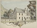 Dinas Mawddwy Manor House.jpg 1,465 × 1,111; 1.31 MB
-
 Dinas Mawddwy.jpg 4,928 × 3,264; 3.86 MB
-
 Dinas Mouddy Montgomeryshire.jpeg 900 × 691; 324 KB
-
 DV405 no.110 Dinas Mawddwy.png 1,992 × 1,195; 6.82 MB
-
 Ebeneser Newydd (2009).jpg 2,592 × 3,872; 4.19 MB
-
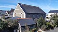
 Ebeneser Welsh Independent Chapel (5).jpg 3,872 × 2,592; 4.31 MB
-
 Ebeneser Welsh Independent Chapel (7).jpg 4,928 × 3,264; 7.03 MB
-
 Ebeneser Welsh Independent Chapel (8).jpg 3,872 × 2,592; 4.39 MB
-
 Ebeneser Welsh Independent Chapel (9).jpg 3,872 × 2,592; 4.27 MB
-
 Ebenezer Chapel (1).jpg 4,034 × 2,269; 4.87 MB
-
 Ebenezer Chapel - geograph.org.uk - 212857.jpg 640 × 480; 88 KB
-
 Ebenezer Chapel 2.jpg 3,773 × 5,673; 2.58 MB
-
 Ebenezer Chapel Keynsham.jpg 5,863 × 3,899; 3.77 MB
-
 Ebenezer chapel.jpg 4,608 × 2,592; 5.43 MB
-
 Ebenezer Welsh Independent Chapel.jpg 2,832 × 2,128; 1.96 MB
-
 Gate and track, Bwlch-Coediog Uchaf - geograph.org.uk - 449349.jpg 640 × 480; 165 KB
-
 NWalesJul09 039 (6266978541).jpg 2,896 × 1,944; 2.7 MB
-
 Plas Dinas, Mawddwy, Merionethshire 07.jpeg 621 × 458; 178 KB
-
 Plas Dinas, Mawddwy, Merionethshire 08.jpeg 508 × 381; 104 KB
-
 Slate plaque, Dinas Mawddwy - geograph.org.uk - 554042.jpg 480 × 635; 141 KB
-
 The head of Cwm Cywarch - geograph.org.uk - 547375.jpg 800 × 600; 700 KB
-
 Wesleyan Chapel - geograph.org.uk - 212872.jpg 640 × 480; 90 KB
-
 Afon Clywedog - geograph.org.uk - 601055.jpg 640 × 480; 106 KB
-
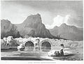
 Bridge over River Dovey - geograph.org.uk - 506296.jpg 640 × 480; 175 KB
-
 Bridleway along valley - geograph.org.uk - 601062.jpg 640 × 480; 107 KB
-
 Bwlch Siglen from the valley - geograph.org.uk - 647048.jpg 640 × 480; 97 KB
-
 Bwlch Siglen looking north - geograph.org.uk - 647036.jpg 640 × 480; 69 KB
-
 Cattle in Cwm Cywarch - geograph.org.uk - 1492870.jpg 640 × 426; 88 KB
-
 Cemetery in Dinas Mawddwy - geograph.org.uk - 1500104.jpg 426 × 640; 97 KB
-
 Curious gates - geograph.org.uk - 212943.jpg 640 × 480; 129 KB
-
 Disused chapel, Penrhyn - geograph.org.uk - 506353.jpg 640 × 480; 137 KB
-
 Entrance gates, Dinas Mawddwy - geograph.org.uk - 554038.jpg 480 × 640; 193 KB
-
 Hillside, Mynydd Copog - geograph.org.uk - 450047.jpg 640 × 480; 111 KB
-
 Meirion Mill, Dinas Mawddwy - geograph.org.uk - 554033.jpg 640 × 480; 128 KB
-
 Old barn, Cwm Cywarch valley - geograph.org.uk - 507196.jpg 640 × 491; 109 KB
-
 Old Ford over Nant Cwm Cewydd - geograph.org.uk - 449322.jpg 640 × 480; 185 KB
-

-

-
 Rhododendron in front of Foel Benddin - geograph.org.uk - 57685.jpg 640 × 480; 120 KB
-
 River Dovey at Ty-gwyn - geograph.org.uk - 506281.jpg 640 × 480; 204 KB
-

-
 Sheep in Cywarch valley - geograph.org.uk - 506684.jpg 640 × 480; 127 KB
-
 Telephone box, Aber-Cywarch - geograph.org.uk - 506680.jpg 480 × 640; 127 KB


.jpg)
.jpg)
.jpg)
.jpg)
.jpg)
.jpg)


.jpg)


