Category:Denton, Lincolnshire
Jump to navigation
Jump to search
English: Denton, Lincolnshire is an ancient Roman settlement nestling just south west of Grantham and the A1 in England. It may also be a site of the Beaker culture, based on some archeological finds made. The parish is around 2,600 acres (11 km²) in size. The name derives from the Old English dene+tun, meaning "village in a valley," but in Domesday it is written as 'Dentune'.

village and civil parish in Lincolnshire, UK  | |||||
| Upload media | |||||
| Instance of | |||||
|---|---|---|---|---|---|
| Location | South Kesteven, Lincolnshire, East Midlands, England | ||||
 | |||||
Subcategories
This category has the following 16 subcategories, out of 16 total.
A
B
D
- Denton Reservoir (18 F)
F
G
H
- Hedges in Denton, Lincolnshire (13 F)
S
- Snow in Denton, Lincolnshire (8 F)
T
- Trees in Denton, Lincolnshire (13 F)
Media in category "Denton, Lincolnshire"
The following 200 files are in this category, out of 217 total.
(previous page) (next page)-

-
 A607 towards Grantham - geograph.org.uk - 2966473.jpg 640 × 480; 119 KB
-
 A607 towards Grantham - geograph.org.uk - 2966481.jpg 640 × 480; 96 KB
-
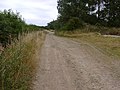
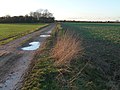 Access track to the Fire Plantation - geograph.org.uk - 3796588.jpg 1,024 × 768; 156 KB
-
 Arable farmland near Denton, Lincolnshire - geograph.org.uk - 30141.jpg 640 × 480; 127 KB
-
 Arable land north of Denton - geograph.org.uk - 3025130.jpg 3,648 × 2,736; 4.4 MB
-
 Belvoir Road - geograph.org.uk - 3025097.jpg 3,648 × 2,736; 2.97 MB
-
 Belvoir Road - geograph.org.uk - 3648900.jpg 1,280 × 960; 384 KB
-

-
 Belvoir Road near Brewer's Grave - geograph.org.uk - 5241248.jpg 800 × 606; 215 KB
-
 Belvoir Road railway bridge - geograph.org.uk - 3648898.jpg 1,280 × 960; 357 KB
-
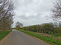
 Belvoir Road towards Denton - geograph.org.uk - 5588290.jpg 800 × 468; 157 KB
-
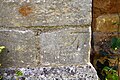 Benchmark on buttress of St Andrew's Church - geograph.org.uk - 6278748.jpg 1,024 × 683; 292 KB
-
 Benchmark on ^91 Church Street - geograph.org.uk - 6278830.jpg 1,024 × 683; 279 KB
-

-
 Bridge under Belvoir Road - geograph.org.uk - 3648886.jpg 1,280 × 960; 466 KB
-
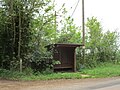 Bus shelter on Denton Lane - geograph.org.uk - 6145496.jpg 1,024 × 768; 260 KB
-
 Canal feeder channel, Denton Reservoir - geograph.org.uk - 1567414.jpg 480 × 640; 138 KB
-
 Casthorpe Road - geograph.org.uk - 6034096.jpg 640 × 480; 70 KB
-
 Casthorpe Road heading north - geograph.org.uk - 3610561.jpg 640 × 480; 62 KB
-
 Cawthra Court, Main Street - geograph.org.uk - 4801033.jpg 2,367 × 1,746; 1.14 MB
-
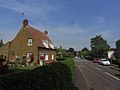
 Church Street, Denton, Lincolnshire - geograph.org.uk - 67705.jpg 640 × 480; 144 KB
-
 Cottage, Church St, Denton, Lincs (geograph 4282232).jpg 1,024 × 768; 135 KB
-
 Cottage, Church Street, Denton (geograph 7296192).jpg 1,024 × 768; 217 KB
-
 Cottage, Main Street, Denton (geograph 7296164).jpg 1,024 × 768; 170 KB
-
 Cottage, Park Lane, Denton (geograph 7296100).jpg 1,024 × 768; 184 KB
-
 Countryside near Denton - geograph.org.uk - 151983.jpg 640 × 427; 122 KB
-
 Countryside towards Round Covert - geograph.org.uk - 4270929.jpg 2,816 × 2,112; 1.61 MB
-
 Course of former mineral railway near Denton - geograph.org.uk - 6145501.jpg 1,024 × 768; 140 KB
-
 Crop field east of Casthorpe Road - geograph.org.uk - 3610558.jpg 640 × 480; 62 KB
-
 Crop field west of Denton - geograph.org.uk - 3610551.jpg 640 × 480; 97 KB
-
 Crop marks in a field in Casthorpe Hills - geograph.org.uk - 5846328.jpg 800 × 533; 103 KB
-
 Cropland near the Grantham Canal - geograph.org.uk - 2748641.jpg 3,418 × 2,485; 2.91 MB
-
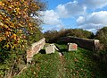
 Denton Bridge - geograph.org.uk - 3979842.jpg 1,024 × 683; 317 KB
-
 Denton Church - geograph.org.uk - 6034112.jpg 640 × 480; 65 KB
-
 Denton farmland - geograph.org.uk - 1030070.jpg 640 × 427; 106 KB
-
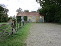
 Denton Manor Gatehouse - geograph.org.uk - 3024384.jpg 3,554 × 2,599; 3.24 MB
-
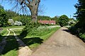
 Denton Park - geograph.org.uk - 4409453.jpg 1,024 × 683; 226 KB
-
 Denton Park Lodges - geograph.org.uk - 2265104.jpg 640 × 427; 95 KB
-
 Denton Primary School - geograph.org.uk - 3602862.jpg 1,280 × 960; 318 KB
-
 Denton Reservoir - geograph.org.uk - 30145.jpg 640 × 480; 88 KB
-
 Denton Reservoir - geograph.org.uk - 5583073.jpg 800 × 621; 77 KB
-
 Denton Village Hall.jpg 1,280 × 960; 300 KB
-
 Denton Wharf - geograph.org.uk - 3602954.jpg 1,280 × 960; 282 KB
-

-
-
 Denton Wharf, Grantham Canal - geograph.org.uk - 30112.jpg 480 × 640; 151 KB
-
-
 Dropping down to Denton - geograph.org.uk - 3602051.jpg 1,280 × 960; 345 KB
-

-
 Earth bank at Denton Reservoir - geograph.org.uk - 1128990.jpg 427 × 640; 97 KB
-
 Entering Lincolnshire on the A607 - geograph.org.uk - 2966469.jpg 640 × 480; 115 KB
-
 Family of swans on the Grantham Canal - geograph.org.uk - 5253373.jpg 774 × 800; 189 KB
-
 Farm access and footpath - geograph.org.uk - 3601996.jpg 1,280 × 960; 344 KB
-
 Farm track off Harston Road - geograph.org.uk - 3952645.jpg 3,088 × 2,056; 4.19 MB
-
 Farm Track to The Fire Plantation, near Denton - geograph.org.uk - 3106371.jpg 1,504 × 2,256; 1.81 MB
-
 Farmland and Hill Top Farm - geograph.org.uk - 5240974.jpg 800 × 602; 159 KB
-
 Farmland near Denton - geograph.org.uk - 2966488.jpg 640 × 480; 89 KB
-
 Farmland near the Grantham Canal - geograph.org.uk - 5588570.jpg 800 × 591; 171 KB
-
 Farmland near Top Ash Plantation - geograph.org.uk - 5241026.jpg 800 × 601; 157 KB
-
 Farmland next to Black Fir Plantation - geograph.org.uk - 5241136.jpg 800 × 600; 185 KB
-
 Farmland next to Socketwell Plantation - geograph.org.uk - 5241206.jpg 800 × 540; 166 KB
-

-
 Farmland west of Denton - geograph.org.uk - 3025064.jpg 3,648 × 2,736; 3.58 MB
-
 Farmland west of Hill Top Farm - geograph.org.uk - 3796574.jpg 1,024 × 768; 135 KB
-
 Farmland, Hill Top Farm - geograph.org.uk - 2966465.jpg 640 × 480; 74 KB
-
 Field margin near Hill Top Farm - geograph.org.uk - 603542.jpg 640 × 427; 131 KB
-
 Fields near Denton, Lincolnshire - Dec 2005 (2).JPG 2,560 × 1,920; 5.24 MB
-
 Footbridge along the Grantham Canal - geograph.org.uk - 5253385.jpg 800 × 653; 201 KB
-
 Footbridge over stream - geograph.org.uk - 3602129.jpg 1,280 × 960; 466 KB
-

-
 Footpath past Welby Hill Top Farm - geograph.org.uk - 3601985.jpg 1,280 × 960; 391 KB
-
 Footpath to Denton - geograph.org.uk - 6146931.jpg 1,024 × 768; 361 KB
-
 Former almshouses, Casthorpe Road, Denton (geograph 6518372).jpg 4,032 × 3,024; 5.59 MB
-
 Former railway line near Denton - geograph.org.uk - 5588560.jpg 800 × 567; 222 KB
-

-
 Former village smithy - geograph.org.uk - 3602119.jpg 1,280 × 960; 462 KB
-
 Glebe Farmhouse - geograph.org.uk - 3602184.jpg 1,280 × 960; 313 KB
-
 GNR Denton Branch below Socketwell Plantation - geograph.org.uk - 3648834.jpg 1,280 × 960; 327 KB
-
 GNR Denton Branch near Denton Manor Farm - geograph.org.uk - 3648837.jpg 1,280 × 960; 521 KB
-
 Grantham Canal - geograph.org.uk - 2748655.jpg 3,554 × 2,640; 2.57 MB
-
 Grantham Canal - geograph.org.uk - 3602960.jpg 1,280 × 960; 316 KB
-
 Grantham Canal - geograph.org.uk - 3905345.jpg 4,272 × 2,848; 5.49 MB
-
 Grantham Canal at Denton Wharf - geograph.org.uk - 4230108.jpg 4,000 × 3,000; 3.16 MB
-

-
 Grantham Canal, north-west from Denton Bridge - geograph.org.uk - 2627571.jpg 1,024 × 777; 972 KB
-

-
 Harlaxton Quarries railway trackbed - geograph.org.uk - 3602168.jpg 1,280 × 960; 518 KB
-
 Harston Road heading east - geograph.org.uk - 3610546.jpg 640 × 480; 76 KB
-
 Harston Road heading east - geograph.org.uk - 3610553.jpg 640 × 480; 79 KB
-

-
 Heading north along The Drift - geograph.org.uk - 5241197.jpg 800 × 600; 163 KB
-
 Hill Top Farm - geograph.org.uk - 2130835.jpg 1,600 × 1,200; 476 KB
-
 Hill Top Farm, from the west - geograph.org.uk - 3796581.jpg 1,024 × 768; 128 KB
-
 Hillside grazing near Denton - geograph.org.uk - 2966479.jpg 640 × 480; 84 KB
-
 House at the end of Church Street, Denton (geograph 7296092).jpg 1,024 × 768; 255 KB
-
 House, Main Street, Denton (geograph 7296184).jpg 1,024 × 734; 142 KB
-
 Ivy clad trees near Hungerton - geograph.org.uk - 4433677.jpg 1,024 × 768; 238 KB
-
 Keeper's Lodge - geograph.org.uk - 3648810.jpg 960 × 1,280; 463 KB
-
 Landscape near Denton - geograph.org.uk - 3648820.jpg 1,280 × 960; 361 KB
-
 Landscape near Denton Park - geograph.org.uk - 3648806.jpg 1,280 × 960; 448 KB
-
 Lane to Welby Hill Top Farm - geograph.org.uk - 3601988.jpg 1,280 × 960; 396 KB
-
 Lane towards Croxton Kerrial - geograph.org.uk - 3016376.jpg 640 × 480; 65 KB
-
 Lane towards Croxton Kerrial - geograph.org.uk - 3016383.jpg 640 × 480; 106 KB
-
 Lay-by on the A607 near Denton - geograph.org.uk - 2966485.jpg 640 × 480; 88 KB
-
 Leys House from the churchyard - geograph.org.uk - 3602879.jpg 1,280 × 960; 418 KB
-
 Lincolnshire spires - geograph.org.uk - 3602016.jpg 1,280 × 960; 305 KB
-
 Line of old mineral roadway, near Denton - geograph.org.uk - 30151.jpg 640 × 480; 107 KB
-
 Lone Fisherman Greets the Sun - geograph.org.uk - 2036125.jpg 5,616 × 3,744; 797 KB
-
 Looking WNW along Belvoir Road - geograph.org.uk - 6278823.jpg 1,024 × 683; 304 KB
-

-

-
 Minor road near Hungerton - geograph.org.uk - 4433682.jpg 1,024 × 768; 205 KB
-
 National Cycle Route 15 - geograph.org.uk - 5588566.jpg 800 × 601; 242 KB
-
 Netherhall Farmhouse, Denton (geograph 7296182).jpg 1,024 × 768; 292 KB
-
 New Cottages along The Drift - geograph.org.uk - 5241201.jpg 800 × 532; 148 KB
-
 Oak trees beside the A607 road at Denton - geograph.org.uk - 2573014.jpg 2,304 × 3,072; 3.17 MB
-
 Old Beck - geograph.org.uk - 1126979.jpg 640 × 427; 131 KB
-
 Old Beck, looking upstream - geograph.org.uk - 1126996.jpg 427 × 640; 118 KB
-
 Old railway track, Denton - geograph.org.uk - 1126936.jpg 427 × 640; 161 KB
-
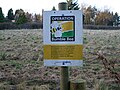 Operation Bumblebee - geograph.org.uk - 1129226.jpg 640 × 480; 108 KB
-
 Outbuilding, next to 'The Laurels', Main Street - geograph.org.uk - 6278711.jpg 1,024 × 683; 277 KB
-
 Park Cottage - geograph.org.uk - 3602889.jpg 1,280 × 960; 297 KB
-
 Parkland - geograph.org.uk - 6034115.jpg 640 × 480; 97 KB
-
 Path Leading Off The Grantham Canal - geograph.org.uk - 4246319.jpg 4,000 × 3,000; 4.13 MB
-
 Path next to Denton Reservoir - geograph.org.uk - 5583046.jpg 800 × 541; 175 KB
-
 Path to Denton Reservoir - geograph.org.uk - 5582921.jpg 800 × 591; 167 KB
-
 Pear Tree Cottage, Church Street - geograph.org.uk - 3602858.jpg 1,280 × 960; 241 KB
-
 Pear Tree Cottage, Denton (geograph 7296191).jpg 1,024 × 768; 181 KB
-
 Post Box near Home Dairy Farm Hungerton - geograph.org.uk - 4433673.jpg 1,024 × 638; 191 KB
-
 Public Footpath near Hilltop Farm - geograph.org.uk - 3954907.jpg 4,272 × 2,848; 5.05 MB
-

-
 Rape harvesting near Woolsthorpe - geograph.org.uk - 3648982.jpg 1,280 × 960; 410 KB
-
 Red Algae on the Grantham Canal - geograph.org.uk - 4285829.jpg 2,816 × 2,112; 1.49 MB
-
 Red Kites near Denton - geograph.org.uk - 4722174.jpg 1,995 × 2,117; 806 KB
-
 Road junction - geograph.org.uk - 6034107.jpg 640 × 480; 67 KB
-
 Road junction and finger post - geograph.org.uk - 6034100.jpg 640 × 480; 97 KB
-
 Road junction near Home Dairy Farm - geograph.org.uk - 3954913.jpg 3,088 × 2,056; 4.34 MB
-

-
 Sawmill at Denton - geograph.org.uk - 3602882.jpg 1,280 × 960; 428 KB
-
-
 Sewstern Lane (track) - geograph.org.uk - 3610543.jpg 640 × 480; 117 KB
-
 Sewstern Lane - 10 - geograph.org.uk - 4073949.jpg 3,776 × 2,520; 3.83 MB
-
 Sewstern Lane - 13 - geograph.org.uk - 4074021.jpg 3,776 × 2,520; 4.16 MB
-
 Sewstern Lane - 14 - geograph.org.uk - 4075461.jpg 3,776 × 2,520; 4.25 MB
-
 Sewstern Lane - 15 - geograph.org.uk - 4075472.jpg 3,776 × 2,520; 4.08 MB
-
 Sewstern Lane - 9 - geograph.org.uk - 4073935.jpg 3,776 × 2,520; 4.06 MB
-
 Sewstern Lane - geograph.org.uk - 3979708.jpg 1,024 × 683; 415 KB
-
 Sewstern Lane - geograph.org.uk - 6146907.jpg 1,024 × 768; 297 KB
-

-
 Shadows on Belvoir Road - geograph.org.uk - 3489700.jpg 1,367 × 2,116; 3.39 MB
-
 Sheep and pasture near Hungerton - geograph.org.uk - 5255533.jpg 800 × 520; 101 KB
-
 Short's Cottage, ^91 Church Street - geograph.org.uk - 6278835.jpg 1,024 × 664; 171 KB
-
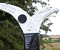
 Sign posts at Denton Bridge ^1 - geograph.org.uk - 5940985.jpg 640 × 480; 109 KB
-
 Sign posts at Denton Bridge ^2 - geograph.org.uk - 5940991.jpg 480 × 640; 132 KB
-
 Slipway at Denton Wharf - geograph.org.uk - 5582979.jpg 800 × 489; 146 KB
-
 Sparse crop near Denton - geograph.org.uk - 3602951.jpg 1,280 × 960; 302 KB
-
 Spring tine cultivator - geograph.org.uk - 603557.jpg 640 × 427; 132 KB
-
 St Andrew's Church - geograph.org.uk - 6278762.jpg 658 × 1,024; 126 KB
-
 Straight track - geograph.org.uk - 6034088.jpg 640 × 480; 135 KB
-
 Sustrans Millennium Milepost at Denton (detail) - geograph.org.uk - 3602968.jpg 1,280 × 960; 259 KB
-
 Sustrans Millennium Milepost at Denton (ID 1001) - geograph.org.uk - 3602965.jpg 960 × 1,280; 500 KB
-
 Sustrans notice - geograph.org.uk - 3648825.jpg 1,280 × 960; 332 KB
-
 Swans near Casthorpe Bridge - geograph.org.uk - 2748790.jpg 3,648 × 2,736; 2.92 MB
-
 Swans on Denton Reservoir - geograph.org.uk - 5583087.jpg 800 × 482; 94 KB
-
 The A607 road at Denton - geograph.org.uk - 2573024.jpg 3,072 × 2,304; 2.71 MB
-
 The Drift (track) - geograph.org.uk - 2966467.jpg 640 × 480; 101 KB
-
 The Drift (track) - geograph.org.uk - 3953708.jpg 3,088 × 2,056; 3.97 MB
-
 The Drift (track) and part of the Viking Way - geograph.org.uk - 4433690.jpg 1,024 × 768; 297 KB
-
 The Drift - geograph.org.uk - 3648808.jpg 1,280 × 960; 526 KB
-
 The Drift in Big Wood - geograph.org.uk - 5241166.jpg 800 × 600; 249 KB
-
 The Drift near Hill Top Farm - geograph.org.uk - 5240982.jpg 800 × 600; 226 KB
-
 The Grantham Canal - geograph.org.uk - 3653932.jpg 640 × 481; 307 KB
-
 The Grantham Canal at Denton Bridge - geograph.org.uk - 2627464.jpg 1,024 × 768; 943 KB
-
 The Grantham Canal near Denton Bridge - geograph.org.uk - 2627527.jpg 1,024 × 768; 1,004 KB
-
 The lane to Denton Wharf - geograph.org.uk - 3602948.jpg 1,280 × 960; 250 KB
-
 The Old Post Office, Main Street - geograph.org.uk - 3602901.jpg 1,280 × 960; 367 KB
-
 The road from Harston at Denton - geograph.org.uk - 3602885.jpg 1,280 × 960; 364 KB
-
 The Viking Way on Sewstern Lane - geograph.org.uk - 5078470.jpg 4,320 × 3,240; 6.16 MB
-
 The Welby Arms, Denton (geograph 7296193).jpg 1,024 × 768; 195 KB
-
 The Welby Arms, Denton - geograph.org.uk - 6145498.jpg 1,024 × 768; 219 KB
-
 Three generations of housing - geograph.org.uk - 3602101.jpg 1,280 × 960; 247 KB
-
 Tollbar Plantation - geograph.org.uk - 3601974.jpg 1,280 × 960; 660 KB
-
 Towpath along the Grantham Canal - geograph.org.uk - 5253124.jpg 800 × 569; 186 KB
-
 Towpath along the Grantham Canal - geograph.org.uk - 5253169.jpg 761 × 800; 240 KB
-
 Towpath along the Grantham Canal - geograph.org.uk - 5584873.jpg 800 × 582; 166 KB
-
 Towpath along the Grantham Canal - geograph.org.uk - 5584906.jpg 800 × 600; 132 KB
-

-
 Track near Denton Lodge Farm - geograph.org.uk - 5588575.jpg 800 × 603; 211 KB
-
 Track to Casthorpe Road - geograph.org.uk - 5582925.jpg 800 × 580; 115 KB
-
 Track to Denton Manor Farm - geograph.org.uk - 6145497.jpg 1,024 × 768; 136 KB
-
 Track towards France Plantation - geograph.org.uk - 5588581.jpg 800 × 497; 107 KB
-
 Trackbed of the Denton Branch - geograph.org.uk - 1464839.jpg 640 × 480; 181 KB
-
 Trackbed of the Denton Branch - geograph.org.uk - 3025091.jpg 3,648 × 2,736; 3.43 MB
-

-
 Tree next to The Drift - geograph.org.uk - 5241100.jpg 800 × 600; 205 KB
-
 Unauthorised access blocked by bales - geograph.org.uk - 3796556.jpg 1,024 × 768; 129 KB
-
 Under Denton Bridge - geograph.org.uk - 2627485.jpg 1,024 × 768; 845 KB
-
 Unsuitable for motors - geograph.org.uk - 3648816.jpg 1,280 × 960; 488 KB
-
 Very deeply rutted track - geograph.org.uk - 808226.jpg 640 × 558; 144 KB


.jpg)
.jpg)
.jpg)
.jpg)


.JPG)


.jpg)


.jpg)
.jpg)


.jpg)


.jpg)


_-_geograph.org.uk_-_3610543.jpg)


_-_geograph.org.uk_-_2966467.jpg)
_-_geograph.org.uk_-_3953708.jpg)
_and_part_of_the_Viking_Way_-_geograph.org.uk_-_4433690.jpg)


.jpg)


_-_geograph.org.uk_-_3602968.jpg)
_-_geograph.org.uk_-_3602965.jpg)