Category:Denham, Buckinghamshire
Jump to navigation
Jump to search
Main Wikipedia article: Denham.
Nederlands: Denham is een plaats in het bestuurlijke gebied South Bucks, in het Engelse graafschap Buckinghamshire.
Română: Denham este un sat în comitatul Buckinghamshire, regiunea South East, Anglia. Localitatea se află în districtul South Bucks a cărei reşedinţă este.
village and civil parish in Buckinghamshire, England  | |||||
| Upload media | |||||
| Instance of | |||||
|---|---|---|---|---|---|
| Location | Buckinghamshire, South East England, England | ||||
| Area |
| ||||
| Said to be the same as | Denham (Wikimedia duplicated page, civil parish) | ||||
 | |||||
Subcategories
This category has the following 14 subcategories, out of 14 total.
B
- Baker's Wood (1 F)
- Buckinghamshire Golf Club (6 F)
C
- Chalfont Viaduct (21 F)
D
- Denham Film Studios (3 F)
H
I
K
L
- Denham Lock, Buckinghamshire (4 F)
N
- Northmoor Hill Wood (20 F)
O
- Old Rectory Meadows (6 F)
V
Media in category "Denham, Buckinghamshire"
The following 200 files are in this category, out of 588 total.
(previous page) (next page)-

-
 A woodland walk near Denham Aerodrome - geograph.org.uk - 664055.jpg 640 × 480; 181 KB
-
 A40 - geograph.org.uk - 3348631.jpg 640 × 430; 58 KB
-

-
 A40 at Denham - geograph.org.uk - 232121.jpg 640 × 480; 77 KB
-
 A40 at Denham - geograph.org.uk - 232129.jpg 640 × 480; 77 KB
-
 A40 bridge, Grand Union Canal - geograph.org.uk - 5557602.jpg 640 × 426; 65 KB
-
 A40 bridge, Grand Union Canal - geograph.org.uk - 5557612.jpg 640 × 426; 62 KB
-
 A40 bridge, Grand Union Canal - geograph.org.uk - 5557764.jpg 640 × 426; 78 KB
-
 A40 bridge, M25 - geograph.org.uk - 3445471.jpg 640 × 389; 36 KB
-
 A40 Denham roundabout - geograph.org.uk - 2299866.jpg 1,600 × 1,200; 523 KB
-
 A40 eastbound at Huntwyk - geograph.org.uk - 2831419.jpg 640 × 481; 80 KB
-
 A40 near Uxbridge - geograph.org.uk - 3179034.jpg 3,036 × 2,010; 3.11 MB
-
 A40 Oxford Road, Tatling End - geograph.org.uk - 2300330.jpg 1,600 × 1,200; 566 KB
-

-
 A40 Tatling End - geograph.org.uk - 2299686.jpg 1,600 × 1,200; 564 KB
-
 A40, Denham - geograph.org.uk - 3207801.jpg 640 × 409; 38 KB
-
 A40, Denham - geograph.org.uk - 3207803.jpg 640 × 387; 35 KB
-
 A40, Denham - geograph.org.uk - 3348630.jpg 640 × 430; 49 KB
-
 A40, Denham Rd Roundabout - geograph.org.uk - 3207793.jpg 640 × 430; 41 KB
-
 A40, junction with A412, Denham - geograph.org.uk - 3207807.jpg 640 × 430; 35 KB
-
 A40, Tatling End - geograph.org.uk - 2299677.jpg 1,600 × 1,200; 572 KB
-
 A40-A412 junction at Denham - geograph.org.uk - 2862729.jpg 640 × 480; 61 KB
-
 A412 - geograph.org.uk - 3348628.jpg 640 × 430; 45 KB
-
 A412 - North Orbital Road - geograph.org.uk - 2415329.jpg 640 × 435; 47 KB
-

-
 A412, Denham - geograph.org.uk - 3348626.jpg 640 × 430; 58 KB
-
 A412, Denham - geograph.org.uk - 4721827.jpg 640 × 426; 82 KB
-
 A412, Denham Avenue - geograph.org.uk - 3211735.jpg 640 × 430; 37 KB
-
 A412, southbound - geograph.org.uk - 3348621.jpg 640 × 430; 71 KB
-
 Advance signs for M40 junction 1A - geograph.org.uk - 2862755.jpg 640 × 439; 53 KB
-
 Allotments, New Denham - geograph.org.uk - 20370.jpg 640 × 480; 144 KB
-
 Approaching junction 16 - M25 - geograph.org.uk - 2444827.jpg 640 × 438; 38 KB
-
 Approaching Uxbridge Lock - geograph.org.uk - 2665839.jpg 3,624 × 2,232; 1.26 MB
-

-

-

-

-
 Bakers Wood Private Road - geograph.org.uk - 6227878.jpg 3,648 × 2,736; 3.81 MB
-
 Bear at 81 miles - geograph.org.uk - 4321294.jpg 640 × 480; 151 KB
-
 Below Uxbridge lock - geograph.org.uk - 2169304.jpg 640 × 427; 191 KB
-
 Below Uxbridge Lock - geograph.org.uk - 4322221.jpg 640 × 480; 139 KB
-
 Blacksmith's Lane - geograph.org.uk - 6227868.jpg 3,648 × 2,736; 6.04 MB
-
 Blacksmiths Lane, Denham Mount - geograph.org.uk - 21284.jpg 640 × 480; 150 KB
-
 Blacksmiths Lane, Tatling End - geograph.org.uk - 5430571.jpg 2,048 × 1,536; 1.48 MB
-
 Blue plaque for Sir John Mills - geograph.org.uk - 3337431.jpg 640 × 480; 189 KB
-
 Blue plaque on Hills House - geograph.org.uk - 3434802.jpg 640 × 618; 263 KB
-
 Blue Plaque, Denham, Buckinghamshire - geograph.org.uk - 3511939.jpg 1,024 × 683; 911 KB
-
 Boundary Wall, Wrango (geograph 6494682).jpg 1,024 × 684; 166 KB
-
 Bridge 183 - geograph.org.uk - 4324073.jpg 2,048 × 1,536; 2.28 MB
-
 Bridge 183, Grand Union Canal - geograph.org.uk - 4321262.jpg 640 × 480; 102 KB
-
 Bridge 183a, Grand Union Canal - geograph.org.uk - 4321269.jpg 640 × 480; 113 KB
-
 Bridge 184, Grand Union Canal - geograph.org.uk - 5557484.jpg 640 × 426; 93 KB
-
 Bridge over Stream, Denham, Buckinghamshire - geograph.org.uk - 3511972.jpg 1,024 × 683; 1,012 KB
-

-
 Bridge over the River Colne - geograph.org.uk - 6230471.jpg 5,120 × 3,840; 5.75 MB
-
 Bridge ^183, Grand Union Canal - geograph.org.uk - 5557627.jpg 640 × 426; 79 KB
-
 Bridge ^183, Grand Union Canal - geograph.org.uk - 5557766.jpg 640 × 425; 80 KB
-
 Bridge ^184 by Lock ^88 - geograph.org.uk - 5557516.jpg 640 × 426; 86 KB
-
 Bridges over the canal north of Uxbridge - geograph.org.uk - 5429239.jpg 1,600 × 1,200; 982 KB
-
 Bridleway on Boundary of Field - geograph.org.uk - 6227865.jpg 3,648 × 2,736; 4.35 MB
-
 Bridleway to Southlands Road - geograph.org.uk - 1475696.jpg 640 × 480; 91 KB
-
 Broadwater Park - geograph.org.uk - 3348623.jpg 640 × 430; 87 KB
-
 Buckinghamshire Golf Club gates - geograph.org.uk - 4315671.jpg 1,974 × 1,481; 2.9 MB
-

-
 Buckinghamshire Golf Course - geograph.org.uk - 6230345.jpg 3,648 × 2,736; 3.38 MB
-
 Buckinghamshire Golf Course Club House - geograph.org.uk - 6230420.jpg 3,648 × 2,736; 2.98 MB
-
 C17 and C18 buildings, Denham - geograph.org.uk - 4071814.jpg 4,320 × 3,240; 3.3 MB
-
 Car boot sale field - geograph.org.uk - 4320663.jpg 640 × 480; 95 KB
-
 Car park, Denham Station - geograph.org.uk - 4534732.jpg 640 × 426; 57 KB
-
 Car park, Denham Station - geograph.org.uk - 5322145.jpg 640 × 426; 85 KB
-

-
 Cattle by Froggy Lane - geograph.org.uk - 4175593.jpg 640 × 480; 137 KB
-
 Chalfont House, Denham - geograph.org.uk - 5954177.jpg 1,024 × 768; 230 KB
-
 Cheapside Lane, Denham - geograph.org.uk - 3332909.jpg 640 × 480; 133 KB
-
 Chiltern Main Line - geograph.org.uk - 5328731.jpg 640 × 426; 85 KB
-
 Chiltern Main Line, Denham - geograph.org.uk - 5322150.jpg 640 × 426; 72 KB
-
 Chiltern Main Line, Denham - geograph.org.uk - 5322152.jpg 640 × 426; 80 KB
-
 Chiltern Main Line, Denham - geograph.org.uk - 5394404.jpg 640 × 426; 90 KB
-
 Chiltern Main line, Denham Station - geograph.org.uk - 5649931.jpg 640 × 426; 92 KB
-
 Chiltern Main line, Denham Station - geograph.org.uk - 5665508.jpg 640 × 426; 86 KB
-
 Chiltern Mainline - geograph.org.uk - 6053087.jpg 1,024 × 681; 234 KB
-
 Chiltern Mainline, Denham - geograph.org.uk - 5963839.jpg 1,024 × 681; 226 KB
-
 Chiltern Mainline, Denham - geograph.org.uk - 5963840.jpg 1,024 × 681; 231 KB
-
 Closely mown field - geograph.org.uk - 3560270.jpg 640 × 480; 70 KB
-
 Collsels Wood - geograph.org.uk - 89671.jpg 640 × 480; 166 KB
-
 Concrete works, New Denham - geograph.org.uk - 3500969.jpg 640 × 480; 79 KB
-
 Coriander beds - geograph.org.uk - 4319552.jpg 640 × 480; 127 KB
-
 Coriander beds - geograph.org.uk - 4319558.jpg 640 × 480; 133 KB
-
 Coriander planting details, Rush Hill - geograph.org.uk - 4319572.jpg 640 × 480; 106 KB
-
 Cottage next to Uxbridge Lock No 88 - geograph.org.uk - 4626931.jpg 800 × 519; 134 KB
-
 Crop Field - geograph.org.uk - 6227884.jpg 3,648 × 2,736; 3.27 MB
-
 Damp patch at field edge - geograph.org.uk - 4319584.jpg 640 × 480; 161 KB
-
 Damp patch at field edge - geograph.org.uk - 4319593.jpg 640 × 480; 166 KB
-

-
 Danfoss offices on Oxford Road - geograph.org.uk - 5430572.jpg 2,048 × 1,536; 1.51 MB
-
 De Remo (geograph 6494686).jpg 1,024 × 775; 166 KB
-
 Denham - geograph.org.uk - 3340446.jpg 640 × 480; 152 KB
-
 Denham - geograph.org.uk - 3340529.jpg 640 × 480; 143 KB
-
 Denham Adventure Zone, Denham Country Park - geograph.org.uk - 5143285.jpg 3,648 × 2,736; 4.01 MB
-
 Denham Aerodrome - geograph.org.uk - 3340547.jpg 640 × 480; 115 KB
-
 Denham Aerodrome - geograph.org.uk - 3562420.jpg 640 × 480; 78 KB
-
 Denham Aerodrome End of Runway - geograph.org.uk - 6227384.jpg 5,120 × 3,840; 4.7 MB
-
 Denham Avenue (A412) - geograph.org.uk - 3340543.jpg 640 × 480; 136 KB
-
 Denham Avenue - geograph.org.uk - 3211737.jpg 640 × 398; 35 KB
-
 Denham Avenue, junction with the A40 - geograph.org.uk - 3665860.jpg 4,320 × 3,240; 3.53 MB
-
 Denham Country park - geograph.org.uk - 4315684.jpg 2,048 × 1,536; 3.1 MB
-
 Denham Country Park - geograph.org.uk - 4315700.jpg 2,048 × 1,536; 3.16 MB
-
 Denham Country Park - geograph.org.uk - 4324855.jpg 2,048 × 1,536; 3.66 MB
-
 Denham Country Park - geograph.org.uk - 4325196.jpg 2,048 × 1,536; 3.36 MB
-
 Denham Court Drive - geograph.org.uk - 4315708.jpg 2,048 × 1,536; 3.17 MB
-
 Denham Court Drive - geograph.org.uk - 4320684.jpg 640 × 480; 122 KB
-
 Denham exit, Denham roundabout - geograph.org.uk - 2299910.jpg 1,600 × 1,200; 497 KB
-
 Denham Golf Club - geograph.org.uk - 6123871.jpg 800 × 539; 137 KB
-
 Denham Golf Club - geograph.org.uk - 6227879.jpg 3,648 × 2,736; 2.67 MB
-
 Denham Golf Club - geograph.org.uk - 6227895.jpg 3,648 × 2,736; 4.51 MB
-
 Denham Golf Club railway station - geograph.org.uk - 3338789.jpg 1,024 × 768; 211 KB
-
 Denham Golf Club Station - geograph.org.uk - 5665526.jpg 640 × 426; 91 KB
-
 Denham Golf Club Station - geograph.org.uk - 5665529.jpg 640 × 426; 67 KB
-
 Denham Golf Club Station - geograph.org.uk - 5665540.jpg 640 × 425; 83 KB
-
 Denham Golf Club Station - geograph.org.uk - 5665554.jpg 640 × 426; 81 KB
-
 Denham Golf Club Station - geograph.org.uk - 6053089.jpg 1,024 × 681; 269 KB
-
 Denham Golf Club Station - geograph.org.uk - 6053109.jpg 1,024 × 681; 236 KB
-
 Denham Golf Course - geograph.org.uk - 6121279.jpg 800 × 600; 134 KB
-
 Denham Green Close - geograph.org.uk - 5397802.jpg 640 × 426; 66 KB
-
 Denham Green Close - geograph.org.uk - 5963849.jpg 1,024 × 681; 169 KB
-
 Denham Green Close - geograph.org.uk - 5963852.jpg 1,024 × 681; 148 KB
-
 Denham Green Lane at the junction of Greentiles Lane - geograph.org.uk - 4139916.jpg 2,560 × 1,920; 1.98 MB
-
 Denham Green Lane at the junction of Tilehouse Lane - geograph.org.uk - 4139238.jpg 2,560 × 1,920; 1.99 MB
-
 Denham Green village sign - geograph.org.uk - 2831420.jpg 640 × 481; 87 KB
-
 Denham Lane by Denham Golf Club station - geograph.org.uk - 4139509.jpg 2,446 × 1,756; 1.57 MB
-
 Denham Marina - geograph.org.uk - 5557478.jpg 640 × 426; 98 KB
-
 Denham Marina - geograph.org.uk - 5557488.jpg 640 × 426; 62 KB
-
 Denham Marina, Grand Union Canal - geograph.org.uk - 4322241.jpg 640 × 480; 113 KB
-
 Denham Media Park - geograph.org.uk - 3348622.jpg 640 × 406; 85 KB
-
 Denham Methodist Church (2) - geograph.org.uk - 1177494.jpg 640 × 480; 108 KB
-
 Denham Methodist Church, Bucks (1) - geograph.org.uk - 1177487.jpg 640 × 480; 94 KB
-
 Denham parish church from the east - geograph.org.uk - 3834961.jpg 716 × 1,024; 291 KB
-
 Denham Post Office - geograph.org.uk - 5397795.jpg 640 × 426; 74 KB
-
 Denham railway station - geograph.org.uk - 3338796.jpg 1,024 × 768; 186 KB
-
 Denham Rd Roundabout - geograph.org.uk - 3348632.jpg 640 × 430; 45 KB
-
 Denham Road Roundabout - geograph.org.uk - 3207789.jpg 640 × 430; 53 KB
-
 Denham Road Roundabout - geograph.org.uk - 3348634.jpg 640 × 455; 52 KB
-
 Denham Roundabout - A40 - geograph.org.uk - 854328.jpg 640 × 480; 65 KB
-
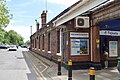
 Denham station - entrance building - geograph.org.uk - 6270386.jpg 1,024 × 768; 175 KB
-
 Denham Station - geograph.org.uk - 5322148.jpg 640 × 426; 58 KB
-
 Denham Station - geograph.org.uk - 5322154.jpg 640 × 426; 70 KB
-
 Denham Station - geograph.org.uk - 5322155.jpg 640 × 426; 83 KB
-
 Denham Station - geograph.org.uk - 5322157.jpg 640 × 426; 78 KB
-
 Denham Station - geograph.org.uk - 5322214.jpg 640 × 426; 89 KB
-
 Denham Station - geograph.org.uk - 5328723.jpg 640 × 426; 99 KB
-
 Denham Station - geograph.org.uk - 5328727.jpg 640 × 425; 80 KB
-
 Denham Station - geograph.org.uk - 5328728.jpg 640 × 426; 86 KB
-
 Denham Station - geograph.org.uk - 5328733.jpg 640 × 426; 93 KB
-
 Denham Station - geograph.org.uk - 5394401.jpg 640 × 426; 78 KB
-
 Denham Station - geograph.org.uk - 5394403.jpg 640 × 426; 83 KB
-
 Denham Station - geograph.org.uk - 5394405.jpg 640 × 426; 77 KB
-
 Denham Station - geograph.org.uk - 5397787.jpg 640 × 426; 72 KB
-
 Denham Station - geograph.org.uk - 5397821.jpg 640 × 426; 76 KB
-
 Denham Station - geograph.org.uk - 5558751.jpg 640 × 426; 70 KB
-
 Denham Station - geograph.org.uk - 5558753.jpg 640 × 426; 78 KB
-
 Denham Station - geograph.org.uk - 5558756.jpg 640 × 426; 99 KB
-
 Denham Station - geograph.org.uk - 5558759.jpg 640 × 426; 78 KB
-
 Denham Station - geograph.org.uk - 5558768.jpg 640 × 426; 81 KB
-
 Denham Station - geograph.org.uk - 5558771.jpg 640 × 426; 93 KB
-
 Denham Station - geograph.org.uk - 5558772.jpg 640 × 426; 94 KB
-
 Denham Station - geograph.org.uk - 5649944.jpg 640 × 426; 81 KB
-
 Denham Station - geograph.org.uk - 5649945.jpg 640 × 426; 92 KB
-
 Denham Station - geograph.org.uk - 5665509.jpg 640 × 426; 81 KB
-
 Denham Station - geograph.org.uk - 5665510.jpg 640 × 426; 77 KB
-
 Denham Station - geograph.org.uk - 5712527.jpg 640 × 426; 86 KB
-
 Denham Station - geograph.org.uk - 5712528.jpg 640 × 426; 88 KB
-
 Denham Station - geograph.org.uk - 5712529.jpg 640 × 426; 80 KB
-
 Denham Station - geograph.org.uk - 5712530.jpg 640 × 425; 76 KB
-
 Denham Station - geograph.org.uk - 5885799.jpg 1,024 × 681; 182 KB
-
 Denham Station - geograph.org.uk - 5885805.jpg 1,024 × 681; 184 KB
-
 Denham Station - geograph.org.uk - 5885809.jpg 1,024 × 681; 159 KB
-
 Denham Station - geograph.org.uk - 5885811.jpg 1,024 × 681; 159 KB
-
 Denham Station - geograph.org.uk - 5885814.jpg 1,024 × 681; 209 KB
-
 Denham Station - geograph.org.uk - 5885815.jpg 1,024 × 681; 196 KB
-
 Denham Station - geograph.org.uk - 5885816.jpg 1,024 × 681; 196 KB
-
 Denham Station - geograph.org.uk - 6053080.jpg 1,024 × 681; 169 KB
-
 Denham Station - geograph.org.uk - 6053084.jpg 1,024 × 681; 237 KB
-
 Denham station - geograph.org.uk - 6270383.jpg 1,024 × 768; 218 KB
-
 Denham Station car park - geograph.org.uk - 5394400.jpg 640 × 426; 77 KB
-
 Denham Station car park - geograph.org.uk - 5558743.jpg 640 × 426; 91 KB
-
 Denham Telephone Exchange, Bucks - geograph.org.uk - 1201441.jpg 640 × 480; 83 KB
-
 Denham United vs. Clapton Community (2022).jpg 4,032 × 3,024; 3.83 MB
-
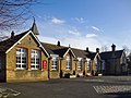 Denham Viillage Infant School (geograph 3834562).jpg 1,024 × 768; 167 KB
-
 Denham village - geograph.org.uk - 3474322.jpg 640 × 480; 69 KB
-
 Denham village green - geograph.org.uk - 3434811.jpg 640 × 427; 217 KB
-
 Denham village green - geograph.org.uk - 3434812.jpg 640 × 417; 230 KB
-
 Denham village green - geograph.org.uk - 3474354.jpg 640 × 480; 83 KB
-
 Denham Village Memorial Hall - geograph.org.uk - 3332908.jpg 640 × 480; 116 KB
-
 Denham Village Memorial Hall - geograph.org.uk - 3474311.jpg 640 × 480; 53 KB
-
 Denham Village Memorial Hall - geograph.org.uk - 3559684.jpg 640 × 428; 79 KB
-
 Denham War Memorial - geograph.org.uk - 3474329.jpg 480 × 640; 84 KB
-
 Denham Wesleyan Chapel - geograph.org.uk - 3834546.jpg 768 × 1,024; 238 KB
-
 Denham, converted mill - geograph.org.uk - 4122804.jpg 1,024 × 768; 219 KB
-

_Squadron,_Air_Training_Corps_-_geograph.org.uk_-_3560290.jpg)


.jpg)


.jpg)


_-_geograph.org.uk_-_3340543.jpg)


_-_geograph.org.uk_-_1177494.jpg)
_-_geograph.org.uk_-_1177487.jpg)


.jpg)
.jpg)


