Category:Demographic maps of the world
Jump to navigation
Jump to search
English: Demographic maps of the world.
See also:

Subcategories
This category has the following 18 subcategories, out of 18 total.
C
- Circumcision maps of the world (14 F)
D
F
- Fertility rate maps of the world (14 F)
G
H
- HDI maps of subnational entities (63 F)
- HDI maps of the world (108 F)
- Homicide rate maps of the world (14 F)
L
M
P
R
T
- Teenage pregnancy maps (9 F)
W
Media in category "Demographic maps of the world"
The following 91 files are in this category, out of 91 total.
-
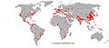
 100621-ISAF-troops-per-1million-pop.jpg 1,800 × 820; 180 KB
-
 101115-ISAF-troops-per-1million-pop.jpg 1,800 × 820; 161 KB
-
 2006megacities-1-.jpg 1,024 × 449; 42 KB
-
 2006megacities-fr.svg 1,425 × 625; 1.42 MB
-
 2006megacities.svg 1,425 × 625; 1.42 MB
-
 2006nian Renlei Fazhan Zhishu.svg 940 × 477; 1.71 MB
-
 2007 - 2012, Adolescent birth rate per 1000 women world map.svg 863 × 443; 1.55 MB
-
 2013 Female Genital Mutilation Cutting FGM World Map UNICEF.jpg 1,800 × 820; 156 KB
-
 2017 world map, median age by country-ar.svg 864 × 443; 1.62 MB
-
 2017 world map, median age by country.svg 864 × 443; 1.55 MB
-
 24 Countries with the Highest Number of Civil Airliner Accidents from 1945-2016.jpg 3,088 × 1,800; 517 KB
-
 800px-101115-ISAF-troops-per-1million-pop.jpg 800 × 364; 49 KB
-
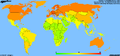 AgeMap-World.png 1,357 × 628; 48 KB
-
 Arable land percent world.png 1,357 × 628; 40 KB
-
 Area by country topten.PNG 1,442 × 633; 59 KB
-
 Area by country.PNG 1,442 × 633; 52 KB
-
 Asylum-seekers-by-country-of-origin.svg 940 × 477; 1.56 MB
-

-

-
 Letzte Volkszählung Weltkarte.png 1,357 × 628; 34 KB
-
 Civilisations actuelles.png 1,500 × 800; 223 KB
-
 Completeness of birth registration.png 3,400 × 2,400; 808 KB
-
 Countries by area.svg 6,000 × 2,647; 1.13 MB
-
 Demographics of Finland 2010.PNG 1,357 × 628; 55 KB
-
 Die 15 bevölkerungsreichsten Staaten.png 1,357 × 628; 23 KB
-
 Die 16 bevölkerungsreichsten Staaten.png 1,357 × 628; 52 KB
-
 Ethnic diversity.jpg 2,000 × 993; 206 KB
-
 European ancestry.jpg 489 × 301; 18 KB
-
 GHI Severity Map (Spanish).jpg 3,300 × 2,440; 1.35 MB
-
 Global meat consumption map.svg 2,560 × 1,314; 1.1 MB
-
 Habitat-homo-sapiens.svg 825 × 387; 1.6 MB
-
 Happy Planet.PNG 6,447 × 2,962; 3.03 MB
-
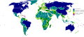
 HDImap2006.png 1,357 × 628; 47 KB
-
 Home-based worker percentage 2019.svg 2,560 × 1,314; 3.26 MB
-
 Homo Sapien range.png 1,502 × 742; 41 KB
-
 Homo sapiens range map.PNG 1,357 × 628; 42 KB
-

-
 Hábitat homo sapiens.PNG 2,628 × 1,196; 88 KB
-
 Immigratio versus Portoricum.jpg 1,818 × 913; 293 KB
-
 Irrigated land world map.png 1,357 × 628; 40 KB
-
 Jednostki administracyjne z powierzchnią ponad 1 milion km kw..PNG 1,500 × 739; 115 KB
-
 Karte Flüchtlingskrise in Europa 2015 - Herkunftsländer der Asylsuchenden.png 2,519 × 1,539; 697 KB
-
 Lastcensus.svg 1,592 × 900; 403 KB
-
-
 Literacy rate world 2007.svg 788 × 354; 1.72 MB
-
 Literacy rate world-2009UNDP.gif 840 × 426; 44 KB
-
 Literacy rate world.PNG 800 × 378; 161 KB
-
 Local Demographic Window Phases in Less Developed Countries.webp 1,416 × 666; 98 KB
-
 Map Age Dependency Ratio.PNG 1,425 × 625; 65 KB
-
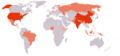
 Map of countries by percentage of immigrants.png 800 × 406; 86 KB
-
 Map of the European Migrant Crisis 2015 - Asylum applicants' countries of origin.png 2,519 × 1,539; 728 KB
-
 Median age ru.jpg 800 × 370; 148 KB
-
 Median age uk.png 1,357 × 628; 46 KB
-
 Migrants in the world 2015-en.svg 1,357 × 670; 2.56 MB
-
 Mobile phone use world.PNG 1,532 × 628; 47 KB
-
 Mobile phone use world2.PNG 1,422 × 628; 46 KB
-
 Monde analphabetisme 2000.jpg 1,357 × 628; 99 KB
-
 Nations by percentage of urban population living in slums.jpg 1,015 × 444; 63 KB
-
 Natural increase, 2017 CIA World Factbook.svg 2,754 × 1,398; 1.05 MB
-
 Naturalincrease1.png 1,481 × 628; 53 KB
-
 Net migration rate world.PNG 1,425 × 625; 41 KB
-
 Net Migration Rate.svg 1,035 × 531; 1.47 MB
-
 Net Population Growth in 2016.svg 863 × 396; 1.61 MB
-
 Planche VIII - Répartition de la population du globe - Liv4-Ch02.png 4,024 × 3,096; 3.22 MB
-
 Population growth rate world 2013.svg 940 × 415; 1.55 MB
-
 Prevalence-of-night-blindness-in-pre-school-children.png 3,400 × 2,400; 767 KB
-
 Promedio edad mundo.png 1,357 × 628; 64 KB
-
 Prostitution laws of the world recolored.PNG 1,427 × 628; 33 KB
-
 Prostitution laws of the world.svg 2,811 × 1,203; 1.67 MB
-
 Races of Mankind Cropped.png 2,887 × 1,569; 6.31 MB
-
 Railroads and Population 25.jpg 5,484 × 2,643; 1.77 MB
-
 Satisfaction with Life Index Map.png 1,341 × 615; 480 KB
-
 Sex ratio below 15 per country smooth.png 1,338 × 621; 15 KB
-
 Sex ratio over 65 per country smooth.png 1,341 × 618; 33 KB
-
 Sex ratio total population gbbr.gif 1,363 × 637; 20 KB
-
 Sex ratio total population per country smooth.png 1,357 × 628; 16 KB
-
 Share of Migrants in the world 2015-en.svg 1,370 × 688; 2.56 MB
-
 Tasa natalidad mundo.png 1,357 × 628; 62 KB
-
 The 50 largest countries by density.jpg 1,743 × 794; 135 KB
-
 The different civilizations english.png 1,500 × 800; 88 KB
-
 The different civilizations-ar.png 1,500 × 716; 81 KB
-
 Urban population living in slums.png 1,425 × 625; 56 KB
-
 Urbanisation grandes villes.jpg 509 × 289; 55 KB
-
 Vegans by country.png 4,731 × 2,454; 1.13 MB
-
 WHI 2017 Weltkarte.jpg 2,400 × 1,617; 1.51 MB
-
 World happiness 2006.png 1,350 × 652; 52 KB
-
 World literacy map UNHD 2007 2008-ar.png 800 × 370; 109 KB
-
 World map of countries by World Happiness Report score (2017).svg 940 × 415; 1.5 MB
-
 World map of countries by World Happiness Report score (2023).svg 940 × 415; 1.5 MB
-
 WorldMapLiteracy2011.png 1,350 × 625; 50 KB
-
 Естественный прирост по странам мира 2017.png 1,481 × 628; 42 KB


.jpg)


.svg)
.svg)

