Category:Deelen Air Base
Jump to navigation
Jump to search
|
This is a category about rijksmonumentcomplex number 529781
|
| Object location | | View all coordinates using: OpenStreetMap |
|---|
airport in the Netherlands  | |||||
| Upload media | |||||
| Instance of | |||||
|---|---|---|---|---|---|
| Location | Deelen, Ede, Gelderland, Netherlands | ||||
| Operator | |||||
| Date of official opening |
| ||||
| Elevation above sea level |
| ||||
| ICAO airport code |
| ||||
 | |||||
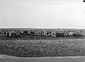
The area of the air base Deelen was previously known as Kemperheide.
Subcategories
This category has the following 4 subcategories, out of 4 total.
Media in category "Deelen Air Base"
The following 23 files are in this category, out of 23 total.
-
 5.87788E 52.05957N Deelen airbase.png 990 × 610; 605 KB
-
 A-398 (8171760924).jpg 2,983 × 1,829; 5.47 MB
-
 Alouette 3 KLu (23172817999).jpg 1,400 × 933; 484 KB
-
 Alouette 3 KLu (23245029660).jpg 1,400 × 933; 647 KB
-
 Arnhem-Deelen, museum vliegbasis Deelen IMG 1149 2021-10-18 09.53.jpg 5,326 × 3,488; 12.03 MB
-
 Autodump bij Deelen, Bestanddeelnr 901-7941.jpg 4,502 × 3,304; 2.18 MB
-

-
 Deelen, Museum Vliegbasis Deelen IMG 4642 2020-04-16 11.35.jpg 4,859 × 2,794; 10.18 MB
-
-

-

-

-

-

-

-

-

-

-

-
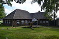 Museum Deelen.jpg 4,928 × 3,264; 8.72 MB
-
 NIMH - 2011 - 5142 - Aerial photograph of Kemperheide, The Netherlands.jpg 4,000 × 2,623; 2.15 MB
-
 Open Street Map of Deelen.png 919 × 951; 390 KB
-
 Veluwe - 2015 - panoramio (66).jpg 4,928 × 3,264; 8.38 MB
.jpg)
.jpg)
.jpg)


.jpg)