Category:De Liefde, Streefkerk
Jump to navigation
Jump to search
| Object location | | View all coordinates using: OpenStreetMap |
|---|
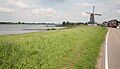
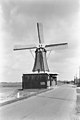
windmill in Streefkerk, Netherlands  | |||||
| Upload media | |||||
| Instance of | |||||
|---|---|---|---|---|---|
| Location | Streefkerk, Molenlanden, South Holland, Netherlands | ||||
| Street address |
| ||||
| Located on street |
| ||||
| Has use | |||||
| Heritage designation |
| ||||
| Source of energy | |||||
 | |||||
|
This is a category about rijksmonument number 34937
|
| Address |
|
Media in category "De Liefde, Streefkerk"
The following 105 files are in this category, out of 105 total.
-

-
 Around kinderdijk - Flickr - bertknot.jpg 2,400 × 1,600; 951 KB
-

-
 Detail, het restauratiebord achter de molen - Streefkerk - 20421170 - RCE.jpg 1,200 × 800; 155 KB
-
 Kaaswrongelpers.jpg 3,264 × 2,448; 1.71 MB
-
 KINDERDIJK AND ENVIRONS 2007 (176) (8189027717).jpg 1,727 × 1,959; 808 KB
-
 KINDERDIJK AND ENVIRONS 2007 (179) (8189019145).jpg 4,312 × 2,465; 3.91 MB
-
 Koekenbreker.jpg 3,264 × 2,448; 2.15 MB
-
 Korenmolen - Streefkerk - 20206499 - RCE.jpg 777 × 1,200; 120 KB
-
 Korenmolen - Streefkerk - 20206500 - RCE.jpg 1,200 × 1,175; 210 KB
-

-
 Melkbus litermaten.jpg 2,448 × 1,835; 814 KB
-
 Melkbus met teems.jpg 1,655 × 2,220; 1.1 MB
-
 Molen De Liefde, Streefkerk 29-09-2012 (1).jpg 2,448 × 3,264; 1.62 MB
-
 Molen De Liefde, Streefkerk 29-09-2012 (2).jpg 2,382 × 3,211; 1.03 MB
-
 Molen De Liefde, Streefkerk 29-09-2012 (3).jpg 2,448 × 3,264; 2 MB
-
 Molen De Liefde, Streefkerk 29-09-2012 (5).jpg 3,128 × 2,234; 1,006 KB
-
 Molen De Liefde, Streefkerk 29-09-2012.jpg 2,376 × 3,201; 1.17 MB
-
 Molen De Liefde, Streefkerk, aandrijfwerk.jpg 2,448 × 3,264; 1.62 MB
-
 Molen De Liefde, Streefkerk, houten achtkant gebint korbeel (1).jpg 2,448 × 3,264; 2.8 MB
-
 Molen De Liefde, Streefkerk, houten achtkant gebint korbeel.jpg 2,448 × 3,264; 2.29 MB
-
 Molen De Liefde, Streefkerk, houten achtkant gebint.jpg 2,448 × 3,264; 1.78 MB
-
 Molen De Liefde, Streefkerk, houten achtkant hondsoren.jpg 2,448 × 3,264; 1.73 MB
-
 Molen De Liefde, Streefkerk, houten achtkant museumzolder.jpg 2,448 × 3,264; 1.71 MB
-
 Molen De Liefde, Streefkerk, houten achtkant stellingdeur (1).jpg 2,448 × 3,264; 2.06 MB
-
 Molen De Liefde, Streefkerk, houten achtkant stellingdeur.jpg 2,373 × 3,220; 1.31 MB
-
 Molen De Liefde, Streefkerk, ingang straatkant (1).jpg 3,188 × 2,335; 1.24 MB
-
 Molen De Liefde, Streefkerk, ingang straatkant.jpg 3,174 × 2,321; 1.32 MB
-
 Molen De Liefde, Streefkerk, ingang zijkant.jpg 3,193 × 2,376; 1.37 MB
-
 Molen De Liefde, Streefkerk, kaapstander.jpg 2,301 × 3,160; 1.47 MB
-
 Molen De Liefde, Streefkerk, kap achterkeuvelens binnen.jpg 3,264 × 2,448; 1.64 MB
-
 Molen De Liefde, Streefkerk, kap achterkeuvelens.jpg 3,209 × 2,384; 1.11 MB
-
 Molen De Liefde, Streefkerk, kap askop baard.jpg 3,143 × 2,276; 915 KB
-
 Molen De Liefde, Streefkerk, kap bovenas hals steenbed.jpg 3,264 × 2,448; 2.57 MB
-
 Molen De Liefde, Streefkerk, kap bovenas hals.jpg 2,448 × 3,264; 2.14 MB
-
 Molen De Liefde, Streefkerk, kap bovenas penlager (1).jpg 3,121 × 2,248; 1.53 MB
-
 Molen De Liefde, Streefkerk, kap bovenas penlager springbeugel.jpg 3,264 × 2,448; 2.33 MB
-
 Molen De Liefde, Streefkerk, kap bovenas penlager.jpg 3,264 × 2,448; 2.02 MB
-
 Molen De Liefde, Streefkerk, kap bovenas spiegelgat.jpg 3,264 × 2,448; 2.33 MB
-
 Molen De Liefde, Streefkerk, kap bovenwiel achterkant.jpg 3,264 × 2,448; 1.91 MB
-
 Molen De Liefde, Streefkerk, kap bovenwiel bovenschijfloop busdeur (1).jpg 2,448 × 3,264; 2.62 MB
-
 Molen De Liefde, Streefkerk, kap bovenwiel bovenschijfloop busdeur.jpg 3,264 × 2,448; 2.11 MB
-
 Molen De Liefde, Streefkerk, kap bovenwiel bovenschijfloop.jpg 2,448 × 3,264; 2.74 MB
-
 Molen De Liefde, Streefkerk, kap bovenwiel ijzerbalk.jpg 1,755 × 2,619; 1.5 MB
-
 Molen De Liefde, Streefkerk, kap bovenwiel.jpg 3,264 × 2,448; 2.35 MB
-
 Molen De Liefde, Streefkerk, kap kruiwerk.jpg 3,264 × 2,448; 2.45 MB
-
 Molen De Liefde, Streefkerk, kap lange spruit (1).jpg 3,264 × 2,448; 1.87 MB
-
 Molen De Liefde, Streefkerk, kap lange spruit.jpg 2,448 × 1,832; 1.12 MB
-
 Molen De Liefde, Streefkerk, kap roosterhouten.jpg 3,264 × 2,448; 1.07 MB
-
 Molen De Liefde, Streefkerk, kap staart.jpg 2,448 × 3,264; 1.53 MB
-
 Molen De Liefde, Streefkerk, kap steunder.jpg 2,008 × 2,919; 1.43 MB
-
 Molen De Liefde, Streefkerk, kap vang haak.jpg 2,160 × 3,060; 4.06 MB
-
 Molen De Liefde, Streefkerk, kap vang hangereel kneppel (1).jpg 2,448 × 3,264; 1.75 MB
-
 Molen De Liefde, Streefkerk, kap vang hangereel kneppel (2).jpg 2,448 × 3,264; 2.65 MB
-
 Molen De Liefde, Streefkerk, kap vang hangereel kneppel.jpg 2,448 × 3,264; 2.17 MB
-
 Molen De Liefde, Streefkerk, kap vang hangereel.jpg 3,264 × 2,448; 1.56 MB
-
 Molen De Liefde, Streefkerk, kap vang koebout.jpg 3,264 × 2,448; 1.91 MB
-
 Molen De Liefde, Streefkerk, kap vang rust rijklamp.jpg 2,448 × 3,264; 1.64 MB
-
 Molen De Liefde, Streefkerk, kap vangbalk ezel (1).jpg 2,448 × 3,264; 2.76 MB
-
 Molen De Liefde, Streefkerk, kap vangbalk ezel (2).jpg 2,067 × 2,996; 1.88 MB
-
 Molen De Liefde, Streefkerk, kap vangbalk ezel.jpg 2,448 × 3,264; 2.63 MB
-
 Molen De Liefde, Streefkerk, koningsspil koppeling.jpg 3,264 × 2,448; 1.58 MB
-
 Molen De Liefde, Streefkerk, kruiketting haak.jpg 3,264 × 2,448; 3.2 MB
-
 Molen De Liefde, Streefkerk, kruiwiel (1).jpg 2,301 × 3,128; 1.1 MB
-
 Molen De Liefde, Streefkerk, kruiwiel.jpg 2,448 × 3,264; 1.05 MB
-
 Molen De Liefde, Streefkerk, luiwerk luias.jpg 2,448 × 3,264; 2.45 MB
-
 Molen De Liefde, Streefkerk, luiwerk luiluik.jpg 3,264 × 2,448; 2.64 MB
-
 Molen De Liefde, Streefkerk, luiwerk luitafel 1e luiwerk (1).jpg 3,264 × 2,448; 1.68 MB
-
 Molen De Liefde, Streefkerk, luiwerk luitafel 1e luiwerk.jpg 2,448 × 3,264; 2.27 MB
-
 Molen De Liefde, Streefkerk, luiwerk luitafel 2 luiwerken.jpg 3,114 × 2,273; 1.42 MB
-
 Molen De Liefde, Streefkerk, luiwerk luitafel 2e luiwerk.jpg 2,448 × 3,264; 1.91 MB
-
 Molen De Liefde, Streefkerk, luiwerk wiel 2e luiwerk.jpg 3,264 × 2,448; 1.92 MB
-
 Molen De Liefde, Streefkerk, luizolder balk.jpg 2,448 × 3,264; 2.63 MB
-
 Molen De Liefde, Streefkerk, maalstoel (1) bolspil.jpg 3,264 × 2,448; 2.65 MB
-
 Molen De Liefde, Streefkerk, maalstoel (1).jpg 2,310 × 3,154; 1.78 MB
-
 Molen De Liefde, Streefkerk, maalstoel a (1).jpg 2,448 × 3,264; 2.37 MB
-
 Molen De Liefde, Streefkerk, maalstoel a (2).jpg 2,448 × 3,264; 2.34 MB
-
 Molen De Liefde, Streefkerk, maalstoel a steenrondsel spoorwiel.jpg 3,264 × 2,448; 2.67 MB
-
 Molen De Liefde, Streefkerk, maalstoel a steenrondsel.jpg 3,264 × 2,448; 2.53 MB
-
 Molen De Liefde, Streefkerk, maalstoel a.jpg 3,228 × 2,371; 1.89 MB
-
 Molen De Liefde, Streefkerk, maalstoel balanceerrijn.jpg 3,264 × 2,448; 2.06 MB
-
 Molen De Liefde, Streefkerk, maalstoel bolspil (1).jpg 2,448 × 3,264; 2.26 MB
-
 Molen De Liefde, Streefkerk, maalstoel bolspil (2).jpg 2,448 × 3,264; 2.24 MB
-
 Molen De Liefde, Streefkerk, maalstoel bolspil steenbus.jpg 2,448 × 3,264; 1.48 MB
-
 Molen De Liefde, Streefkerk, maalstoel bolspil taatspot tweetaksrijn.jpg 2,448 × 3,264; 2.47 MB
-
 Molen De Liefde, Streefkerk, maalstoel regulateur.jpg 2,038 × 2,960; 2.83 MB
-
 Molen De Liefde, Streefkerk, maalstoel steenkraan.jpg 3,264 × 2,448; 2.11 MB
-
 Molen De Liefde, Streefkerk, maalstoel steenrondsel spoorwiel (1).jpg 3,264 × 2,448; 1.77 MB
-
 Molen De Liefde, Streefkerk, maalstoel steenrondsel spoorwiel (2).jpg 3,264 × 2,448; 1.64 MB
-
 Molen De Liefde, Streefkerk, maalstoel tweetaksrijn.jpg 3,264 × 2,448; 2.47 MB
-
 Molenmakersgereedschappen (1).jpg 3,264 × 2,448; 1.49 MB
-
 Molenmakersgereedschappen.jpg 3,264 × 2,448; 1.46 MB
-
 Overzicht - Streefkerk - 20369828 - RCE.jpg 1,200 × 1,200; 250 KB
-
 Overzicht van de molen - Streefkerk - 20421171 - RCE.jpg 1,200 × 800; 133 KB
-
 Overzicht van de voorkant - Streefkerk - 20421164 - RCE.jpg 1,200 × 800; 129 KB
-
 Petroleumkannen.jpg 2,448 × 3,264; 1.95 MB
-
 Schaven.jpg 3,264 × 2,448; 1.51 MB
-
 Steekkarren.jpg 2,184 × 3,067; 1.24 MB
-
 Stellingmolen, aanzicht Nieuwe Veer 42 - Streefkerk - 20206539 - RCE.jpg 802 × 1,200; 124 KB
-
 Stoel biezen zitting.jpg 2,448 × 3,264; 1.83 MB
-
 Streefkerk - molen De Liefde.jpg 1,400 × 2,100; 1.29 MB
-
 Streefkerk, molen 2007-03-15 13.53.JPG 2,272 × 1,704; 951 KB
-
 Takelblokken.jpg 2,726 × 2,017; 1.73 MB
-
 Zagen.jpg 3,108 × 2,194; 1.07 MB
-
 Zuid Holland-06-Windmuehle-2010-gje.jpg 3,083 × 4,048; 2.06 MB
_te_Streefkerk_-_Streefkerk_-_20449375_-_RCE.jpg)


_(8189027717).jpg)
_(8189019145).jpg)


.jpg)
.jpg)
.jpg)
.jpg)


.jpg)


.jpg)

.jpg)


.jpg)


.jpg)


.jpg)


.jpg)
.jpg)


.jpg)
.jpg)


.jpg)


.jpg)


_bolspil.jpg)
.jpg)
.jpg)
.jpg)


.jpg)
.jpg)


.jpg)
.jpg)

.jpg)


