Category:De Laar (Arnhem)
Jump to navigation
Jump to search
| Object location | | View all coordinates using: OpenStreetMap |
|---|
neighbourhood in Arnhem, The Netherlands   | |||||
| Upload media | |||||
| Instance of | |||||
|---|---|---|---|---|---|
| Location | Arnhem-Zuid, Arnhem, Gelderland, Netherlands | ||||
 | |||||
Subcategories
This category has the following 3 subcategories, out of 3 total.
A
- Art in De Laar (Arnhem) (25 F)
P
- Poort (Lange Akkers, Arnhem) (4 F)
Media in category "De Laar (Arnhem)"
The following 27 files are in this category, out of 27 total.
-
 Arnhem - De Laar.PNG 331 × 312; 9 KB
-
 Map - NL - Arnhem - Wijk 22 De Laar - Buurt 95 De Laar-West.svg 375 × 375; 51 KB
-
 Map - NL - Arnhem - Wijk 22 De Laar - Buurt 96 De Laar-Oost.svg 375 × 375; 51 KB
-
 Map - NL - Arnhem - Wijk 22 De Laar.svg 625 × 575; 19 KB
-
 2007-01-14 11.52 Arnhem, viadukt Kroonse Wal.JPG 2,272 × 1,704; 1.13 MB
-
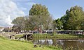
 Arnhem De Laar oost, houten brug in het Jublieumpark foto7 2015-06-30 16.14.jpg 4,352 × 3,264; 13.34 MB
-
 Arnhem De Laar oost, medisch centrum Insula Batavorum foto4 2015-06-30 12.46.jpg 3,879 × 2,909; 9.71 MB
-
 Arnhem-De Laar oost, de woonboulevard foto3 2015-06-25 15.17.jpg 4,352 × 3,264; 7.33 MB
-
 Arnhem-De Laar oost, narcissen op de Randweg foto7 2016-03-30 14.06.jpg 4,352 × 3,096; 8.34 MB
-

-
 Arnhem-De Laar west, kunstwerk bij Kroonse Wal-Brabantweg foto4 2015-06-27 19.39.jpg 4,352 × 3,264; 10.08 MB
-
 Arnhem-De Laar west, narcissen op de Brabantweg foto6 2016-03-30 15.01.jpg 4,326 × 3,245; 11.42 MB
-
 Arnhem-De Laar west, straatzicht De Kroonse Wal bij de Ginnekenstraat foto5 2015-06-25 11.43.jpg 4,335 × 3,251; 10.54 MB
-
 Arnhem-De Laar, boom aan de Randweg in de herfst IMG 2902 2019-11-30 09.12.jpg 3,394 × 5,091; 14.56 MB
-
 Arnhem-De Laar, de herfst bij elkaar geveegd in de Bredasingel foto13 2016-11-23 14.52.jpg 4,352 × 2,952; 11.82 MB
-
 Arnhem-De Laar, de OHRA-tunnel (voor fietsers) met sneeuw foto14 2017-01-15 13.17.jpg 3,951 × 2,579; 6.97 MB
-

-

-

-
-

-
 Arnhem-de Laar, rotonde Brabantweg-Batavierenweg-Randweg foto3 2015-06-25 09.17.jpg 4,313 × 3,235; 9.58 MB
-

-
 Arnhem-De Laar, straatzicht de Randweg met de sneeuw foto5 2017-01-15 13.34.jpg 4,224 × 3,177; 8.94 MB
-
 Arnhem-De Laar, viaduct de Kroonse Wal foto16 2013-03-04 11.25.jpg 4,416 × 3,312; 8.81 MB
-
 Arnhem-de Laar, viaduct Kroonse Wal foto7 2015-06-25 08.56.jpg 4,352 × 3,264; 9.61 MB
-
 Arnhem-Elderveld, de Matsertraverse foto4 2015-06-25 09.48.jpg 4,321 × 3,241; 8.2 MB


_met_sneeuw_foto14_2017-01-15_13.17.jpg)


