Category:De Hoop, Harderwijk
Jump to navigation
Jump to search
| Object location | | View all coordinates using: OpenStreetMap |
|---|
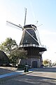
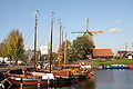
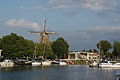
windmill in Harderwijk, Netherlands  | |||||
| Upload media | |||||
| Instance of | |||||
|---|---|---|---|---|---|
| Location | Harderwijk, Gelderland, Netherlands | ||||
| Street address |
| ||||
| Located on street |
| ||||
| Has use | |||||
| Heritage designation |
| ||||
| Source of energy | |||||
 | |||||
|
This is a category about rijksmonument number 511958
|
| Address |
|
Media in category "De Hoop, Harderwijk"
The following 121 files are in this category, out of 121 total.
-
 2007-03-11 13.42 Harderwijk, molen foto3.JPG 1,584 × 2,066; 1.98 MB
-
 Binnenstad, 3841 Harderwijk, Netherlands - panoramio (11).jpg 2,048 × 1,148; 447 KB
-
 Binnenstad, 3841 Harderwijk, Netherlands - panoramio (54).jpg 2,048 × 1,148; 563 KB
-
 Binnenstad, 3841 Harderwijk, Netherlands - panoramio (9).jpg 2,048 × 1,148; 511 KB
-
 Brandtrap - Harderwijk - 20101350 - RCE.jpg 1,196 × 1,200; 231 KB
-
 Brandtrap, achterzijde - Harderwijk - 20101348 - RCE.jpg 1,197 × 1,200; 272 KB
-
 Brandtrap, detail - Harderwijk - 20101349 - RCE.jpg 1,200 × 1,192; 282 KB
-
 Detail - Harderwijk - 20101361 - RCE.jpg 1,200 × 1,195; 219 KB
-
 Detail binnenplaats - Harderwijk - 20101356 - RCE.jpg 1,200 × 1,193; 318 KB
-
 Detail front - Harderwijk - 20101352 - RCE.jpg 1,200 × 1,193; 249 KB
-
 Detail stelling - Harderwijk - 20101354 - RCE.jpg 1,186 × 1,200; 333 KB
-
 DSC08699 - HARDERWIJK (37747241526).jpg 1,333 × 2,000; 602 KB
-
 Harderwiek molle.jpg 300 × 400; 115 KB
-
 Harderwijk - De Hoop 1.JPG 2,848 × 4,272; 3.98 MB
-
 Harderwijk - De Hoop 2.JPG 2,848 × 4,272; 5.36 MB
-
 Harderwijk - De Hoop 3.JPG 2,848 × 4,272; 4.01 MB
-
 Harderwijk - De Hoop 4.JPG 4,272 × 2,848; 4.89 MB
-
 Harderwijk - De Hoop 5.JPG 2,848 × 4,272; 4.79 MB
-
 Harderwijk - Molen "De Hoop".jpg 3,872 × 2,592; 3.36 MB
-
 Harderwijk, windkorenmolen De Hoop RM511958 IMG 4353 2018-06-27 15.16.jpg 3,494 × 4,785; 10.67 MB
-
 Ingang - Harderwijk - 20101357 - RCE.jpg 1,193 × 1,200; 248 KB
-
 Inrijdeuren - Harderwijk - 20101347 - RCE.jpg 1,200 × 1,194; 355 KB
-
 Korenmolen "De Hoop", aanzicht na brand - Harderwijk - 20101363 - RCE.jpg 1,200 × 1,176; 201 KB
-
 Korenmolen "De Hoop", aanzicht na brand - Harderwijk - 20101364 - RCE.jpg 1,200 × 1,179; 257 KB
-
 Korenmolen "De Hoop", aanzicht na brand - Harderwijk - 20101365 - RCE.jpg 1,200 × 1,176; 198 KB
-
 Korenmolen "De Hoop", met ommuring - Harderwijk - 20101362 - RCE.jpg 1,195 × 1,200; 248 KB
-
 Korenmolen "De Hoop", overzicht - Harderwijk - 20101346 - RCE.jpg 1,195 × 1,200; 247 KB
-
 Molen De Hoop, Harderwijk (1).jpg 2,243 × 3,059; 991 KB
-
 Molen De Hoop, Harderwijk, achterkeuvelens (1).jpg 3,264 × 2,448; 1.77 MB
-
 Molen De Hoop, Harderwijk, achterkeuvelens (2).jpg 3,264 × 2,448; 2.6 MB
-
 Molen De Hoop, Harderwijk, achterkeuvelens.jpg 3,264 × 2,448; 1.73 MB
-
 Molen De Hoop, Harderwijk, askop (1).jpg 2,448 × 3,264; 1.54 MB
-
 Molen De Hoop, Harderwijk, askop spin.jpg 3,264 × 2,448; 1.17 MB
-
 Molen De Hoop, Harderwijk, askop.jpg 2,448 × 3,264; 1.65 MB
-
 Molen De Hoop, Harderwijk, bovenas hals.jpg 2,448 × 3,264; 2.22 MB
-
 Molen De Hoop, Harderwijk, bovenas pen zwichtboom.jpg 3,264 × 2,448; 1.74 MB
-
 Molen De Hoop, Harderwijk, bovenas pen zwichtstang smeerpot.jpg 3,264 × 2,448; 2.63 MB
-
 Molen De Hoop, Harderwijk, bovenas pen zwichtstang.jpg 3,158 × 2,365; 2.36 MB
-
 Molen De Hoop, Harderwijk, bovenas pen.jpg 3,264 × 2,448; 2.26 MB
-
 Molen De Hoop, Harderwijk, bovenas steenbed (1).jpg 3,264 × 2,448; 2.16 MB
-
 Molen De Hoop, Harderwijk, bovenas steenbed.jpg 3,264 × 2,448; 1.97 MB
-
 Molen De Hoop, Harderwijk, bovenschijfloop (1).jpg 3,264 × 2,448; 1.66 MB
-
 Molen De Hoop, Harderwijk, bovenschijfloop.jpg 2,448 × 3,264; 1.35 MB
-
 Molen De Hoop, Harderwijk, bovenwiel (1).jpg 3,264 × 2,448; 1.75 MB
-
 Molen De Hoop, Harderwijk, bovenwiel achterzijde (1).jpg 3,264 × 2,448; 2.21 MB
-
 Molen De Hoop, Harderwijk, bovenwiel achterzijde.jpg 3,264 × 2,448; 2.08 MB
-
 Molen De Hoop, Harderwijk, bovenwiel bovenas.jpg 3,264 × 2,448; 1.65 MB
-
 Molen De Hoop, Harderwijk, bovenwiel bovenschijfloop (1).jpg 2,448 × 3,264; 1.83 MB
-
 Molen De Hoop, Harderwijk, bovenwiel bovenschijfloop.jpg 2,448 × 3,264; 1.91 MB
-
 Molen De Hoop, Harderwijk, bovenwiel H Vaags 2002.jpg 2,047 × 2,902; 1.33 MB
-
 Molen De Hoop, Harderwijk, bovenwiel lendestut.jpg 2,448 × 3,264; 1.61 MB
-
 Molen De Hoop, Harderwijk, bovenwiel oud.jpg 2,448 × 3,264; 1.72 MB
-
 Molen De Hoop, Harderwijk, bovenwiel pal.jpg 2,448 × 3,264; 1.6 MB
-
 Molen De Hoop, Harderwijk, bovenwiel.jpg 3,178 × 2,334; 1.38 MB
-
 Molen De Hoop, Harderwijk, buil.jpg 3,264 × 2,448; 1.55 MB
-
 Molen De Hoop, Harderwijk, handmolen (1).jpg 2,178 × 2,977; 1.51 MB
-
 Molen De Hoop, Harderwijk, handmolen (2).jpg 3,264 × 2,448; 3.36 MB
-
 Molen De Hoop, Harderwijk, handmolen.jpg 3,264 × 2,448; 2.07 MB
-
 Molen De Hoop, Harderwijk, Harderwijk haven.jpg 3,264 × 2,448; 1.68 MB
-
 Molen De Hoop, Harderwijk, houten achtkant achtkantstijl met lagergat ophijsen steenspil.jpg 2,448 × 3,264; 1.82 MB
-
 Molen De Hoop, Harderwijk, houten achtkant boventafelement engels kruiwerk.jpg 3,080 × 2,296; 1.64 MB
-
 Molen De Hoop, Harderwijk, houten achtkant boventafelement.jpg 2,448 × 3,264; 2.17 MB
-
 Molen De Hoop, Harderwijk, houten achtkant korbeel (1).jpg 2,448 × 3,264; 1.91 MB
-
 Molen De Hoop, Harderwijk, houten achtkant korbeel.jpg 2,448 × 3,264; 1.56 MB
-
 Molen De Hoop, Harderwijk, houten achtkant ondertafelement.jpg 3,264 × 2,448; 1.35 MB
-
 Molen De Hoop, Harderwijk, houten achtkant veldkruis.jpg 2,448 × 3,264; 2.15 MB
-
 Molen De Hoop, Harderwijk, houten achtkant weeg.jpg 3,264 × 2,448; 2.15 MB
-
 Molen De Hoop, Harderwijk, invaart.jpg 2,287 × 3,068; 1.6 MB
-
 Molen De Hoop, Harderwijk, koningsspil taats.jpg 3,264 × 2,448; 1.86 MB
-
 Molen De Hoop, Harderwijk, koningsspil tap.jpg 3,174 × 2,319; 1.45 MB
-
 Molen De Hoop, Harderwijk, kruiwiel (1).jpg 2,160 × 3,068; 963 KB
-
 Molen De Hoop, Harderwijk, kruiwiel (2).jpg 2,448 × 3,264; 1.66 MB
-
 Molen De Hoop, Harderwijk, kruiwiel (3).jpg 2,448 × 3,264; 1.64 MB
-
 Molen De Hoop, Harderwijk, kruiwiel.jpg 2,295 × 3,130; 1.28 MB
-
 Molen De Hoop, Harderwijk, lange spruit.jpg 3,264 × 2,448; 2.1 MB
-
 Molen De Hoop, Harderwijk, luiwerk aandrijving.jpg 2,448 × 3,264; 1.61 MB
-
 Molen De Hoop, Harderwijk, luiwerk gaffelwiel.jpg 2,448 × 3,264; 2.09 MB
-
 Molen De Hoop, Harderwijk, luiwerk luitafel (1).jpg 2,382 × 3,201; 1.56 MB
-
 Molen De Hoop, Harderwijk, luiwerk luitafel.jpg 2,448 × 3,264; 1.54 MB
-
 Molen De Hoop, Harderwijk, luiwerk pasbrug.jpg 2,330 × 3,180; 1.73 MB
-
 Molen De Hoop, Harderwijk, luiwerk.jpg 3,179 × 2,320; 1.45 MB
-
 Molen De Hoop, Harderwijk, maalkoppel (1).jpg 2,448 × 3,264; 1.56 MB
-
 Molen De Hoop, Harderwijk, maalkoppel licht regulateur (1).jpg 2,448 × 3,264; 1.82 MB
-
 Molen De Hoop, Harderwijk, maalkoppel licht regulateur.jpg 3,059 × 2,214; 1.31 MB
-
 Molen De Hoop, Harderwijk, maalkoppel open (1).jpg 2,448 × 3,264; 1.9 MB
-
 Molen De Hoop, Harderwijk, maalkoppel open balanceerrijn.jpg 3,264 × 2,448; 2.14 MB
-
 Molen De Hoop, Harderwijk, maalkoppel open bolspil taatspot.jpg 2,373 × 3,209; 1.5 MB
-
 Molen De Hoop, Harderwijk, maalkoppel open licht pasbalk.jpg 3,264 × 2,448; 1.75 MB
-
 Molen De Hoop, Harderwijk, maalkoppel open licht.jpg 3,264 × 2,448; 1.67 MB
-
 Molen De Hoop, Harderwijk, maalkoppel open steenbus.jpg 2,448 × 3,264; 1.96 MB
-
 Molen De Hoop, Harderwijk, maalkoppel open steenspil.jpg 2,448 × 3,264; 1.94 MB
-
 Molen De Hoop, Harderwijk, maalkoppel open.jpg 3,226 × 2,403; 1.53 MB
-
 Molen De Hoop, Harderwijk, maalstoel.jpg 2,196 × 3,064; 1.37 MB
-
 Molen De Hoop, Harderwijk, mengmaschine.jpg 2,448 × 3,264; 1.36 MB
-
 Molen De Hoop, Harderwijk, spoorwiel.jpg 3,264 × 2,448; 2.09 MB
-
 Molen De Hoop, Harderwijk, steenkraan.jpg 2,310 × 3,147; 1.3 MB
-
 Molen De Hoop, Harderwijk, steenrondsel.jpg 3,264 × 2,448; 2.19 MB
-
 Molen De Hoop, Harderwijk, tekening molen.jpg 1,826 × 2,484; 429 KB
-
 Molen De Hoop, Harderwijk, vang koebout.jpg 2,448 × 3,264; 1.52 MB
-
 Molen De Hoop, Harderwijk, vangbalk ezel schuif (1).jpg 2,448 × 3,264; 1.6 MB
-
 Molen De Hoop, Harderwijk, vangbalk ezel schuif.jpg 3,264 × 2,448; 1.81 MB
-
 Molen De Hoop, Harderwijk, vangbalk hangereel.jpg 2,448 × 3,264; 1.86 MB
-
 Molen De Hoop, Harderwijk, vangbalk.jpg 3,264 × 2,448; 1.97 MB
-
 Molen De Hoop, Harderwijk, wanmolen.jpg 3,264 × 2,448; 1.55 MB
-
 Molen De Hoop, Harderwijk, wiek fokwiek (1).jpg 2,448 × 3,264; 1.66 MB
-
 Molen De Hoop, Harderwijk, wiek fokwiek.jpg 2,448 × 3,264; 1.54 MB
-
 Molen De Hoop, Harderwijk, wiek roeplaatje.jpg 3,264 × 2,448; 1.55 MB
-
 Molen De Hoop, Harderwijk, wiek zeeg.jpg 3,264 × 2,448; 1.09 MB
-
 Molen De Hoop, Harderwijk, windpeluw zwanenhals.jpg 3,264 × 2,448; 1.75 MB
-
 Molen De Hoop, Harderwijk, wolfsdak.jpg 3,264 × 2,448; 2.13 MB
-
 Molen De Hoop, Harderwijk, zeef.jpg 3,264 × 2,448; 2.31 MB
-
 Molen De Hoop, Harderwijk.jpg 1,736 × 2,408; 832 KB
-
 Muurgedeelte - Harderwijk - 20101359 - RCE.jpg 1,200 × 1,192; 287 KB
-

-
 Poortje - Harderwijk - 20101358 - RCE.jpg 1,193 × 1,200; 348 KB
-
 Stelling - Harderwijk - 20101355 - RCE.jpg 1,199 × 1,200; 287 KB
-
 The harbour of harderwijk with a traditional Dutch flour windmill - panoramio.jpg 3,648 × 2,432; 2.11 MB
-

-
 Vooraanzicht - Harderwijk - 20101353 - RCE.jpg 1,200 × 1,199; 276 KB
-
 Wieken - Harderwijk - 20101351 - RCE.jpg 1,197 × 1,200; 222 KB
-
 Zijkant en muur - Harderwijk - 20101360 - RCE.jpg 1,195 × 1,200; 218 KB

.jpg)
.jpg)
.jpg)


.jpg)


.jpg)
.jpg)
.jpg)

.jpg)


.jpg)

.jpg)

.jpg)
.jpg)


.jpg)


.jpg)
.jpg)


.jpg)


.jpg)
.jpg)
.jpg)


.jpg)


.jpg)
.jpg)

.jpg)


.jpg)


.jpg)


