Category:De Hoop, Arnhem
Jump to navigation
Jump to search
| Object location | | View all coordinates using: OpenStreetMap |
|---|
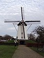
windmill in Arnhem, Netherlands  | |||||
| Upload media | |||||
| Instance of | |||||
|---|---|---|---|---|---|
| Location | Elden, Arnhem, Gelderland, Netherlands | ||||
| Street address |
| ||||
| Located on street |
| ||||
| Has use | |||||
| Heritage designation |
| ||||
| Source of energy | |||||
 | |||||
|
This is a category about rijksmonument number 8387
|
| Address |
|
Media in category "De Hoop, Arnhem"
The following 12 files are in this category, out of 12 total.
-
 2006-05-02 17.59 Arnhem-Elden, molen.JPG 1,704 × 2,272; 1.95 MB
-
 Arnhem-Elden, molen de Hoop RM8387 foto2 2014-03-10 18.04.jpg 3,227 × 4,303; 6.3 MB
-
 Beltkorenmolen "De Hoop", aanzicht - Elden - 20069357 - RCE.jpg 813 × 1,200; 212 KB
-
 De Hoop (Elden) 1.JPG 3,456 × 4,608; 3.25 MB
-
 De Hoop (Elden) 2.JPG 3,456 × 4,608; 3.08 MB
-
 Elden, molen de Hoop RM8387 foto5 2015-04-20 20.11.jpg 3,244 × 4,325; 8.96 MB
-
 Elden, molen de Hoop RM8387 foto8 2014-05-20 17.43.jpg 3,120 × 4,159; 7.55 MB
-
 Gezicht op de molen - Elden - 20262186 - RCE.jpg 779 × 1,200; 198 KB
-
 Korenmolen "De Hoop", proefdraaien - Elden - 20069358 - RCE.jpg 1,200 × 1,170; 258 KB
-

-
 Molen - Elden - 20069355 - RCE.jpg 939 × 1,200; 241 KB
-
 Molen, overzicht - Elden - 20069359 - RCE.jpg 801 × 1,200; 197 KB


_1.JPG)
_2.JPG)


