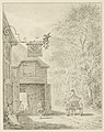
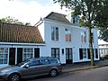
Category:De Dorstige Kuil
Jump to navigation
Jump to search
| Object location | | View all coordinates using: OpenStreetMap |
|---|
building in Heemstede, Netherlands  | |||||
| Upload media | |||||
| Instance of | |||||
|---|---|---|---|---|---|
| Location | Heemstede, North Holland, Netherlands | ||||
| Street address |
| ||||
| Located on street |
| ||||
| Heritage designation |
| ||||
 | |||||
|
This is a category about rijksmonument number 21116
|
| Address |
|
Media in category "De Dorstige Kuil"
The following 7 files are in this category, out of 7 total.
-
 Aanzicht - Heemstede - 20104881 - RCE.jpg 1,195 × 1,200; 289 KB
-
 Aanzicht - Heemstede - 20104882 - RCE.jpg 1,200 × 1,200; 348 KB
-
-
 Dorstige Kuil - achterkant.jpg 3,072 × 2,048; 3.2 MB
-

-
 Herberg 'De Dorstige Kuil'.JPG 2,148 × 1,547; 602 KB
-
 RM21116 Heemstede - Koediefslaan 69.jpg 3,264 × 2,448; 1.83 MB


