Category:De Blauwe Hand, Harlingen
Jump to navigation
Jump to search
| Object location | | View all coordinates using: OpenStreetMap |
|---|
 | |||||
| Upload media | |||||
| Instance of | |||||
|---|---|---|---|---|---|
| Location | Harlingen, Friesland, Netherlands | ||||
| Located on street | |||||
| Heritage designation |
| ||||
 | |||||
|
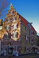
This is a category about rijksmonument number 20364
|
| Address |
|
Media in category "De Blauwe Hand, Harlingen"
The following 15 files are in this category, out of 15 total.
-
 2010-04-17 10.46 Harlingen, monumentaal bedrijfspand1.JPG 3,456 × 2,592; 1.44 MB
-
 20180721 187 harlingen.jpg 4,000 × 6,000; 13.07 MB
-
 20190920 De blauwe hand1 Harlingen.jpg 3,024 × 4,032; 2.57 MB
-
 20190920 De blauwe hand2 Harlingen.jpg 4,032 × 3,024; 2.88 MB
-
 Achtergevel - Harlingen - 20101945 - RCE.jpg 957 × 1,200; 301 KB
-
 De blauwe hand Harlingen.jpg 2,736 × 3,648; 941 KB
-
 De blauwe Hand.jpg 1,000 × 667; 948 KB
-
 DSC01586- HARLINGEN (NL) (30623480483).jpg 1,333 × 2,000; 978 KB
-
 DSC01587- HARLINGEN (NL) (31394772356).jpg 2,000 × 1,351; 957 KB
-
 Harlingen (NL) - panoramio (2).jpg 2,664 × 4,000; 926 KB
-
 Harlingen 259.jpg 400 × 300; 132 KB
-
 Harlingen, 2019 (31).jpg 2,848 × 4,272; 5.36 MB
-
 Nordholland Harlingen 2004 082.jpg 2,304 × 1,728; 1.15 MB
-
 RM20364 Harlingen - Grote Bredeplaats 35.jpg 1,944 × 2,592; 1.19 MB
-
 Trapgevel Harlingen.jpg 2,848 × 4,288; 9.1 MB


_(30623480483).jpg)
_(31394772356).jpg)
_-_panoramio_(2).jpg)

.jpg)


