Category:Daviot, Aberdeenshire
Jump to navigation
Jump to search
village in Aberdeenshire, Scotland, UK  | |||||
| Upload media | |||||
| Instance of | |||||
|---|---|---|---|---|---|
| Location |
| ||||
 | |||||
English: Daviot ( Gaelic: Deimhidh) is a village in Aberdeenshire. Theologian William Robinson Clark was born here.
Subcategories
This category has the following 2 subcategories, out of 2 total.
H
- Harlaw Monument (7 F)
L
- Loanhead Stone Circle (52 F)
Media in category "Daviot, Aberdeenshire"
The following 61 files are in this category, out of 61 total.
-
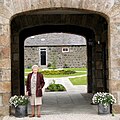 A bonny courtyard, Daviot, Aberdeenshire.jpg 2,448 × 2,448; 2.66 MB
-
 Beinn Dubh and Meall na Fuar-ghlaic - geograph.org.uk - 371800.jpg 640 × 377; 81 KB
-
 Bogbain - geograph.org.uk - 448857.jpg 639 × 419; 58 KB
-
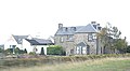 Bogbain BandB - geograph.org.uk - 1545536.jpg 640 × 353; 40 KB
-
 Bogbain Farm kiddies play area - geograph.org.uk - 484034.jpg 640 × 480; 51 KB
-
 Boggy land, Daviot - geograph.org.uk - 449063.jpg 640 × 480; 90 KB
-
 Carn Loch na Leitir 415mts - geograph.org.uk - 191748.jpg 640 × 424; 79 KB
-
 Cleared forest at Fallie - geograph.org.uk - 219617.jpg 640 × 480; 41 KB
-
 Daviot Fundamental Bench Mark - geograph.org.uk - 352928.jpg 639 × 479; 84 KB
-
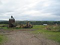 Farm equipment at Cottartown - geograph.org.uk - 219678.jpg 640 × 480; 39 KB
-
 Fishing Pond at Dalveallan - geograph.org.uk - 219610.jpg 640 × 480; 45 KB
-
 Forest Track in Strathnairn - geograph.org.uk - 219668.jpg 640 × 480; 79 KB
-
 Forestry Road - geograph.org.uk - 324480.jpg 640 × 480; 131 KB
-
 Forestry Road - geograph.org.uk - 342126.jpg 640 × 480; 121 KB
-

-
 Logpiles at Craggiemore - geograph.org.uk - 219661.jpg 640 × 480; 88 KB
-
 Meall Mor - geograph.org.uk - 219674.jpg 640 × 480; 65 KB
-
 Meall Mor - geograph.org.uk - 25828.jpg 640 × 406; 64 KB
-
 On the B851 - geograph.org.uk - 266522.jpg 640 × 480; 59 KB
-
 Road bridge over the Craggie Burn - geograph.org.uk - 219657.jpg 640 × 480; 86 KB
-
 Turn off for Gunhill Farm. - geograph.org.uk - 329620.jpg 640 × 426; 123 KB
-
 Wester Lairgs - geograph.org.uk - 324534.jpg 640 × 480; 115 KB
-

-

-
 B9001 heading north - geograph.org.uk - 591266.jpg 640 × 480; 75 KB
-
 Balnafroig - geograph.org.uk - 219663.jpg 640 × 480; 62 KB
-
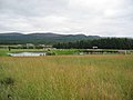
 Bennachie Mount - geograph.org.uk - 844643.jpg 640 × 427; 32 KB
-
 Bennachie Mount - geograph.org.uk - 844647.jpg 640 × 427; 27 KB
-
 Burn near Scatraig - geograph.org.uk - 750598.jpg 480 × 640; 147 KB
-
 Climb towards Lumphart Farm - geograph.org.uk - 591277.jpg 640 × 480; 99 KB
-
 Daviot Wood - geograph.org.uk - 514600.jpg 426 × 640; 165 KB
-
 Daviot Wood forestry track. - geograph.org.uk - 743224.jpg 640 × 427; 225 KB
-
 Daviot Wood young conifer plantation. - geograph.org.uk - 743720.jpg 640 × 427; 220 KB
-
 Daviot Woods. End of forestry track. - geograph.org.uk - 743500.jpg 427 × 640; 261 KB
-
 Daviot Woods. Forestry track. - geograph.org.uk - 743515.jpg 640 × 427; 216 KB
-
 Daviot Woods. Forestry track. - geograph.org.uk - 743662.jpg 640 × 427; 305 KB
-
 Dry Stane Dyke and Culvert - geograph.org.uk - 756456.jpg 640 × 427; 288 KB
-
 Dry Stane Dyke-Culvert - geograph.org.uk - 756442.jpg 640 × 427; 249 KB
-
 Entrance to sand and gravel quarry - geograph.org.uk - 658026.jpg 640 × 426; 73 KB
-
 Forest Cottage - geograph.org.uk - 117544.jpg 640 × 480; 124 KB
-
 Forest track near Daviot - geograph.org.uk - 658113.jpg 640 × 426; 88 KB
-
 General Wade's Military Road. - geograph.org.uk - 743479.jpg 640 × 427; 312 KB
-
 General Wade's Military Road. - geograph.org.uk - 743696.jpg 427 × 640; 212 KB
-
 General Wade's Military Road. - geograph.org.uk - 743709.jpg 427 × 640; 255 KB
-
-
 Harvest time at Hillhead of Daviot - geograph.org.uk - 592111.jpg 640 × 480; 101 KB
-
 Junction of forest track and the A9 - geograph.org.uk - 658114.jpg 640 × 426; 129 KB
-
 Lethenty Mill - geograph.org.uk - 739794.jpg 640 × 480; 72 KB
-
 Looking across to Broadward Farm. - geograph.org.uk - 329617.jpg 640 × 426; 88 KB
-
 Looking up the fence line - geograph.org.uk - 618716.jpg 640 × 480; 75 KB
-
 Mains of Inveramsay Farm. - geograph.org.uk - 329598.jpg 640 × 426; 72 KB
-
 Newton of Mounie - geograph.org.uk - 592109.jpg 640 × 480; 92 KB
-
 Pitcaple-Oldmeldrum Road - geograph.org.uk - 591259.jpg 640 × 480; 81 KB
-

-

-
 Recumbent Stone Loanhead of Daviot - geograph.org.uk - 507733.jpg 640 × 479; 72 KB
-

-
 Roadside advertising - geograph.org.uk - 448852.jpg 640 × 480; 93 KB
-
 Telecommunication mast, Bogbain - geograph.org.uk - 448859.jpg 640 × 480; 42 KB
-
 The Balhalgardy Farm. - geograph.org.uk - 329522.jpg 640 × 426; 79 KB
-
 The Lodge - geograph.org.uk - 117537.jpg 640 × 480; 102 KB


