Category:Data graphs relating to the Fukushima I Nuclear Power Plant
Jump to navigation
Jump to search
| Upload media | |||||
 | |||||
Subcategories
This category has only the following subcategory.
R
Media in category "Data graphs relating to the Fukushima I Nuclear Power Plant"
The following 21 files are in this category, out of 21 total.
-
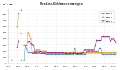
 Fukushima I accidents containment pressures.svg 940 × 600; 197 KB
-
 Fukushima I reactor cooling water 2011-07-02.svg 920 × 570; 141 KB
-
 Fukushima I reactor cooling water.png 792 × 540; 18 KB
-
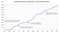
 Fukushima I reactor cooling water.svg 936 × 546; 136 KB
-
 Fukushima I spent fuel pool 4 cooling water March-May 2011 en.svg 940 × 515; 29 KB
-
 Fukushima I spent fuel pool 4 cooling water March-May 2011.svg 512 × 281; 28 KB
-
 Fukushima I Unit 1 accident reactor data (en).svg 512 × 327; 268 KB
-
 Fukushima I Unit 1 accident reactor data.svg 512 × 327; 269 KB
-
 Fukushima I Unit 1 Containment Radiation.png 1,376 × 724; 76 KB
-
 Fukushima I Unit 1 earthquake log.png 590 × 513; 496 KB
-
 Fukushima I Unit 1 Reactor Pressure March-May 2011.png 1,316 × 614; 46 KB
-
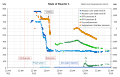
 Fukushima I Unit 2 accident reactor data.svg 512 × 358; 280 KB
-
 Fukushima I Unit 2 Containment Radiation.png 1,376 × 724; 79 KB
-
 Fukushima I Unit 2 diesel generator failure.png 2,223 × 672; 134 KB
-
 Fukushima I Unit 3 Containment Radiation.png 1,376 × 724; 78 KB
-
 Fukushima I Unit 3 RCICS graph.png 491 × 1,242; 670 KB
-
 Fukushima I Unit 3 RPV Temperature March-May 2011.png 1,995 × 767; 85 KB
-
 Fukushima I Unit 3 RPV Temperature March-May 2011.svg 790 × 485; 485 KB
-
 Fukushima modélisation circulation particules radioactives rejetées en mer 2021.jpg 1,500 × 1,148; 307 KB
-
 Fukushima panaches pollution rejets radionucleides.jpg 1,472 × 810; 142 KB
-
 Wind Rain Prediction Fukushima Japan 20110314 12UTC.PNG 490 × 414; 27 KB
.svg)