Category:Dar al-Fadilah Orphanage
Jump to navigation
Jump to search
| Object location | | View all coordinates using: OpenStreetMap |
|---|
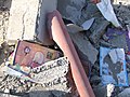
English: Dar al-Fadilah orphanage and school, southeast of Rafah. Opened in 2005 and destroyed in 2009 during the Gaza War.
Media in category "Dar al-Fadilah Orphanage"
The following 7 files are in this category, out of 7 total.
-
 32 - Destroyed orphans school.jpg 1,944 × 2,592; 1.14 MB
-
 33 - Destroyed orphans school (3193919539).jpg 2,592 × 1,944; 1.25 MB
-
 34 - Destroyed orphans school (3193916943).jpg 1,944 × 2,592; 1.16 MB
-
 35 - Destroyed orphans school (3194761606).jpg 2,592 × 1,944; 1.28 MB
-
 36 - Destroyed orphans school (3193918419).jpg 2,592 × 1,944; 1.25 MB
-
 37 - Destroyed orphans school (3194762590).jpg 2,592 × 1,944; 1.26 MB
-
 Orphanschoolmosque.jpg 2,048 × 1,536; 755 KB

.jpg)
.jpg)
.jpg)
.jpg)
.jpg)
