Category:Damaged road transport infrastructure in Japan
Jump to navigation
Jump to search
Countries of Asia: East Timor · Japan · Philippines · Russia‡
Limited recognition: Taiwan
‡: partly located in Asia
Limited recognition: Taiwan
‡: partly located in Asia
Media in category "Damaged road transport infrastructure in Japan"
The following 52 files are in this category, out of 52 total.
-
 2004 Chuetsu earthquake Cracks on the road, Nagaoka 01.jpg 1,024 × 768; 230 KB
-
 2004 Chuetsu earthquake Cracks on the road, Nagaoka 02.jpg 1,024 × 768; 325 KB
-
 2004 Chuetsu earthquake Cracks on the road, Nagaoka 03.jpg 1,024 × 768; 400 KB
-
 2004 Chuetsu earthquake Cracks on the road, Nagaoka 04.jpg 1,024 × 768; 373 KB
-
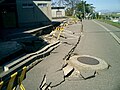
 20051126 Niigata Prefectural Road Route 71.jpg 1,280 × 960; 214 KB
-
 20110314 舞浜駅付近 (5531887395).jpg 1,936 × 2,592; 2.2 MB
-
 20110415 - panoramio.jpg 800 × 599; 207 KB
-
 2016 Kumamoto earthquake Kyushu Expressway Kashima JCT-Mashiki Kumamoto Airport 01.JPG 2,448 × 3,264; 1.53 MB
-
 2016 Kumamoto earthquake Kyushu Expressway Kashima JCT-Mashiki Kumamoto Airport 02.JPG 3,264 × 2,448; 1.74 MB
-
 2016 Kumamoto earthquake Kyushu Expressway Kashima JCT-Mashiki Kumamoto Airport 03.JPG 3,264 × 2,448; 1.58 MB
-
 2016 Kumamoto earthquake Kyushu Expressway Kashima JCT-Mashiki Kumamoto Airport 04.JPG 3,264 × 2,448; 1.55 MB
-
 2016 Kumamoto earthquake Kyushu Expressway Kashima JCT-Mashiki Kumamoto Airport 06.JPG 3,264 × 2,448; 1.59 MB
-
 2016 Kumamoto earthquake Mashiki-cho 04.JPG 3,264 × 2,448; 1.86 MB
-
 2016 Kumamoto earthquake Route 443 Shin Kiyama Bridge.JPG 3,264 × 2,448; 1.87 MB
-
 2018 Western Japan flood damage Hiroshima prefecture (43914434395).jpg 640 × 640; 130 KB
-
 Benten(Urayasu City).JPG 4,752 × 3,168; 5.18 MB
-
 Blind cross (15317726265).jpg 3,648 × 2,736; 860 KB
-
 Broken Signal 20171103.jpg 3,648 × 5,472; 7.06 MB
-
 Central Park Urayasu City.JPG 4,752 × 3,168; 5.43 MB
-
 Chuetsu earthquake-earthquake liquefaction1.jpg 1,857 × 1,393; 518 KB
-
 Chuetsu earthquake-earthquake liquefaction2.jpg 1,000 × 600; 80 KB
-
 Chuetsu earthquake-Yamabe Bridge.jpg 1,766 × 1,325; 425 KB
-
 Collapsed road.jpg 3,872 × 2,592; 2.64 MB
-
 Crack along the road at Uranohama Port.jpg 1,856 × 2,726; 3.61 MB
-
 Crack in the ground caused by the earthquake,Kogaishima,Katori-city,Japan.jpg 1,000 × 669; 225 KB
-
 Damage of Tsunami in Sendai.JPG 2,352 × 1,568; 2.8 MB
-
 Damaged National Route 210 in Hita, Oita, Japan.jpg 464 × 348; 90 KB
-
 Damaged National Route 41 in Gero, Gifu, Japan.jpg 464 × 260; 55 KB
-
 Ibaraki Earthquake.jpg 4,032 × 3,024; 3.15 MB
-
 JR Kashima-Line Kyucyu-Bridge slipped off,Kshima-city,Japan.jpg 1,000 × 671; 220 KB
-
 Kamishiro fault earthquake 5.jpg 3,456 × 4,608; 3.62 MB
-
 Kamishiro fault earthquake 7.JPG 4,608 × 3,456; 6.81 MB
-
 Liquefaction 5,Suigo-cho,Katori-city,Japan.jpg 1,000 × 669; 199 KB
-
 Liquefaction,Hinode,Itako-city,Japan.jpg 1,000 × 671; 183 KB
-
 Liquefaction2,Nishishiro,Inashiki-city,Japan.jpg 1,000 × 671; 194 KB
-
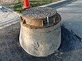 Manhole shows subsidence occurred by 2011 Sendai earthquake.jpg 2,560 × 1,920; 1.64 MB
-
 Nagaoka CT Chuetsu earthquake.jpg 640 × 480; 129 KB
-
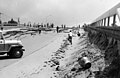 NIED Niigata Earthquake 1964 055.jpg 5,133 × 3,340; 1.44 MB
-
 NIED Niigata Earthquake 1964 067.jpg 5,121 × 3,345; 1.48 MB
-
 O0640048011105406054.jpg 640 × 480; 143 KB
-
 Soil liquefaction 1,Katori-city,Japan.jpg 1,000 × 1,333; 205 KB
-
 Soil liquefaction 2,Katori-city,Japan.jpg 1,000 × 633; 191 KB
-
 Soil liquefaction 3,katori-city,Japan.jpg 1,000 × 669; 212 KB
-
 Soil-liquefaction at Shinkiba after 2011 Tohoku Pacific Ocean offshore earthquake.jpg 4,592 × 3,056; 6.03 MB
-
 The Damage of Bessyodake.jpg 1,600 × 1,200; 496 KB
-
 Torinoumi area after Tsunami waves 1st April 2011 1.JPG 3,072 × 2,304; 1.63 MB
-
 Torinoumi area after Tsunami waves 1st April 2011 2.JPG 3,072 × 2,304; 1.5 MB
-
 台上道路.JPG 3,456 × 2,592; 2.94 MB
-
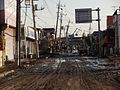
 東北地方太平洋沖地震 コストコ多摩境倉庫店.jpg 4,000 × 2,248; 4.19 MB
-
 東日本大震災で被災した白棚線バス専用道路.jpg 1,936 × 2,592; 2.1 MB
-
 東日本大震災で被災した白棚線バス専用道路2.jpg 1,936 × 2,592; 1.09 MB
-
 長野県神城断層地震翌朝の白馬・天神坂旧道.jpg 5,472 × 3,648; 3.62 MB


.jpg)


.JPG)
.jpg)


.jpg)