Category:Dairycoates
Jump to navigation
Jump to search
English: Dairycoates is a region of Kingston upon Hull, the site of a large railway engine shed, the area now includes "Brighton Street Industrial Estate" and a Tarmac plant (as of 2011). It is east of Priory Park business park (formerly Priory Sidings)
area of Kingston upon Hull, East Riding of Yorkshire, England, UK | |||||
| Upload media | |||||
| Instance of |
| ||||
|---|---|---|---|---|---|
| Location | Kingston upon Hull, City of Kingston upon Hull, East Riding of Yorkshire, Yorkshire and the Humber, England | ||||
 | |||||
Subcategories
This category has the following 5 subcategories, out of 5 total.
B
D
Media in category "Dairycoates"
The following 155 files are in this category, out of 155 total.
-
 A falling tide on the River Humber - geograph.org.uk - 5614360.jpg 1,024 × 768; 122 KB
-

-
 A Moth For Amy - geograph.org.uk - 5013615.jpg 1,600 × 1,065; 445 KB
-
 A Moth For Amy - geograph.org.uk - 5013624.jpg 1,600 × 1,497; 723 KB
-
 A Moth For Amy - geograph.org.uk - 5013635.jpg 1,188 × 1,600; 340 KB
-
 A Moth For Amy - geograph.org.uk - 5013721.jpg 1,600 × 1,065; 504 KB
-
 A Moth For Amy - geograph.org.uk - 5013748.jpg 1,517 × 1,600; 754 KB
-
 A Moth For Amy - geograph.org.uk - 5013752.jpg 1,130 × 1,600; 262 KB
-
 A Moth For Amy - geograph.org.uk - 5013774.jpg 1,600 × 1,065; 356 KB
-
 A Moth For Amy - geograph.org.uk - 5013776.jpg 1,598 × 1,600; 414 KB
-
 A Moth For Amy - geograph.org.uk - 5013780.jpg 1,265 × 1,600; 400 KB
-
 A moth for Amy, Strata House, Hull - geograph.org.uk - 5685847.jpg 640 × 567; 70 KB
-
 A63 Clive Sullivan Way - geograph.org.uk - 5254449.jpg 640 × 480; 33 KB
-
 Along Hessle Road - geograph.org.uk - 5549738.jpg 640 × 427; 239 KB
-
 Along the railing by the Humber - geograph.org.uk - 5211498.jpg 640 × 480; 95 KB
-
 Alternative Heritage Blue Plaque - geograph.org.uk - 6104605.jpg 1,417 × 1,310; 460 KB
-
 Alternative Heritage Blue Plaque - geograph.org.uk - 6104641.jpg 1,600 × 1,064; 624 KB
-

-
 Asda supermarket, Hull - geograph.org.uk - 5684246.jpg 2,848 × 2,136; 1.29 MB
-
 Big Brother unplugged, Hull - geograph.org.uk - 5713218.jpg 539 × 640; 185 KB
-
 Breadcakes Galore, Hull - geograph.org.uk - 5143277.jpg 464 × 640; 414 KB
-
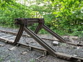 Buffer, Kingston upon Hull.jpg 1,024 × 768; 710 KB
-
 Buildings at the former St Andrews Fish Dock - geograph.org.uk - 5256225.jpg 1,200 × 799; 239 KB
-
 Buildings at the former St Andrews Fish Dock - geograph.org.uk - 5256237.jpg 1,200 × 569; 282 KB
-
 Burnt out car at St Andrews Quay, Hull - geograph.org.uk - 5255241.jpg 1,200 × 799; 338 KB
-
 Bus stop and shelter on Hessle Road, Hull - geograph.org.uk - 5685015.jpg 2,848 × 2,136; 1.41 MB
-
 Clive Sullivan Way, Kingston upon Hull - geograph.org.uk - 5195117.jpg 3,228 × 2,398; 2.86 MB
-
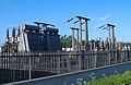 Dairycoates electricity sub-station - geograph.org.uk - 438734.jpg 640 × 415; 174 KB
-
 Dairycoates, Kingston upon Hull 2.JPG 1,024 × 768; 345 KB
-
 Dairycoates, Kingston upon Hull 3.JPG 1,024 × 768; 298 KB
-
 Dairycoates, Kingston upon Hull.JPG 1,024 × 768; 415 KB
-
 Derelict Building at St Andrew's Dock - geograph.org.uk - 5460160.jpg 640 × 481; 493 KB
-
 Derelict building at St Andrews Quay - geograph.org.uk - 5477209.jpg 800 × 561; 112 KB
-
 Derelict St Andrew's Dock - geograph.org.uk - 5460146.jpg 640 × 480; 412 KB
-
 Elizabeth II postbox, Asda superstore, Hull - geograph.org.uk - 5685425.jpg 927 × 1,993; 320 KB
-
 Entrance to St Andrew's Quay Retail Park - geograph.org.uk - 5290375.jpg 5,376 × 3,024; 1.85 MB
-
 Eureka Picture Palace - geograph.org.uk - 23873.jpg 640 × 480; 149 KB
-
 For Those in Peril on the Sea - geograph.org.uk - 5460193.jpg 640 × 481; 302 KB
-
 Frankie ^ Jenny's, St Andrews Quay, Hull - geograph.org.uk - 5255294.jpg 1,200 × 799; 239 KB
-
 Freightliner Road, Dairycoates - geograph.org.uk - 1129561.jpg 640 × 479; 82 KB
-
 George V postbox on St George's Road, Hull - geograph.org.uk - 5684612.jpg 1,185 × 2,319; 560 KB
-
 George V postbox on West Dock Street, Hull - geograph.org.uk - 5685032.jpg 1,421 × 2,783; 784 KB
-
 Haddon Street, Hull - geograph.org.uk - 1173200.jpg 640 × 468; 74 KB
-
 Hessle Road and Wiltshire Road - geograph.org.uk - 5549740.jpg 640 × 427; 207 KB
-
 Hessle Road, Hull - geograph.org.uk - 5685016.jpg 2,848 × 2,136; 1.22 MB
-
 Hull Military Supplies, Hessle Road - geograph.org.uk - 5143275.jpg 640 × 501; 509 KB
-

-
 Humber Estuary, New Holland - geograph.org.uk - 5460103.jpg 640 × 427; 381 KB
-
 Humber sunrise, Hull - geograph.org.uk - 5668019.jpg 640 × 468; 119 KB
-
 Humber twilight - geograph.org.uk - 5211495.jpg 640 × 458; 88 KB
-

-
 Industrial building on West Dock Street, Hull - geograph.org.uk - 5685034.jpg 2,848 × 2,136; 1.5 MB
-

-

-
 K6 telephone box on Goulton Street, Hull - geograph.org.uk - 5684236.jpg 591 × 640; 100 KB
-

-

-

-
 K8 telephone box on St George's Road, Hull - geograph.org.uk - 5685446.jpg 2,848 × 2,136; 1.49 MB
-
 K8 telephone box on St George's Road, Hull - geograph.org.uk - 5685447.jpg 2,848 × 2,136; 1.41 MB
-

-
 Left fishing, trawlermen no more - geograph.org.uk - 5290385.jpg 5,310 × 2,900; 2.12 MB
-
 Level crossing Hawthorn Avenue, Hull - geograph.org.uk - 5685854.jpg 640 × 502; 62 KB
-
 Level crossing Hawthorn Avenue, Hull - geograph.org.uk - 5685859.jpg 640 × 480; 40 KB
-
 Lock gate to St Andrew's Dock - geograph.org.uk - 5290389.jpg 5,376 × 3,024; 2.28 MB
-
 Lord Line Building - geograph.org.uk - 5256234.jpg 1,200 × 717; 376 KB
-
 Lord Line Building, St Andrew's Dock - geograph.org.uk - 5460154.jpg 640 × 481; 407 KB
-

-

-
 Lost Trawlermen - geograph.org.uk - 5460200.jpg 640 × 481; 366 KB
-

-
 Lost trawlermens memorial St Andrews Quay - geograph.org.uk - 5302095.jpg 2,242 × 1,642; 1.25 MB
-
 Makro Hull at St Andrews Quay - geograph.org.uk - 5477128.jpg 800 × 497; 71 KB
-
 Makro wholesale warehouse - geograph.org.uk - 5290372.jpg 5,376 × 3,024; 1.76 MB
-
 Modern housing on Eastbourne Street, Hull - geograph.org.uk - 5685701.jpg 2,542 × 1,741; 816 KB
-

-
 National Cycle Route 65, Hull - geograph.org.uk - 5685468.jpg 640 × 480; 52 KB
-
 National Cycle Route 65, Hull - geograph.org.uk - 5685472.jpg 640 × 486; 73 KB
-
 Newington Primary School - geograph.org.uk - 1190701.jpg 640 × 475; 98 KB
-
 Part of the Lost Trawlermen Memorial - geograph.org.uk - 5402606.jpg 800 × 611; 137 KB
-
 Pizza Hut, St Andrew's Quay Retail Park - geograph.org.uk - 5460165.jpg 640 × 480; 337 KB
-

-

-
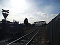
 Rail track, Dairycoates, Hull.jpg 1,024 × 768; 388 KB
-
 Railway towards Doncaster - geograph.org.uk - 5685694.jpg 640 × 480; 64 KB
-
 Railway towards Doncaster - geograph.org.uk - 5685855.jpg 640 × 480; 60 KB
-
 Railway towards Hull Paragon Station - geograph.org.uk - 5685858.jpg 640 × 480; 67 KB
-
 Red (Port) Buoy in the Humber Estuary - geograph.org.uk - 5460106.jpg 640 × 480; 409 KB
-
 Rotting timbers at St Andrews Quay - geograph.org.uk - 5403204.jpg 800 × 600; 136 KB
-
 Runners on Gillett Street - geograph.org.uk - 5549726.jpg 640 × 427; 203 KB
-
 Runners on Hessle Road - geograph.org.uk - 5549729.jpg 640 × 427; 191 KB
-
 Save at Lidl - geograph.org.uk - 260234.jpg 487 × 640; 261 KB
-
 Shore Path near St Andrew's Quay - geograph.org.uk - 5460134.jpg 640 × 480; 378 KB
-

-
 St Andrew's Dock, Kingston upon Hull - geograph.org.uk - 5195352.jpg 3,246 × 2,424; 2.34 MB
-
 St Andrew's Dock, Kingston upon Hull - geograph.org.uk - 5195528.jpg 3,246 × 2,424; 2.62 MB
-
 St Andrew's Dock, Kingston upon Hull - geograph.org.uk - 5195530.jpg 3,264 × 2,448; 3.45 MB
-
 St Andrew's Dock, Kingston upon Hull - geograph.org.uk - 5195533.jpg 3,264 × 2,448; 2.65 MB
-
 St Andrew's Dock, Kingston upon Hull - geograph.org.uk - 5195534.jpg 3,264 × 2,448; 2.49 MB
-
 St Andrew's Dock, Kingston upon Hull - geograph.org.uk - 5195537.jpg 3,246 × 2,424; 3.13 MB
-
 St Andrew's Dock, Kingston upon Hull - geograph.org.uk - 5195539.jpg 3,264 × 2,448; 2.73 MB
-
 St Andrew's Dock, Kingston upon Hull - geograph.org.uk - 5195551.jpg 3,240 × 2,416; 3.71 MB
-
 St Andrew's Dock, Kingston upon Hull - geograph.org.uk - 5195553.jpg 3,264 × 2,446; 3.43 MB
-
 St Andrew's Quay Retail Park - geograph.org.uk - 5290377.jpg 4,848 × 2,711; 1.62 MB
-
 St Andrew's Quay Retail Park - geograph.org.uk - 5402588.jpg 800 × 417; 71 KB
-
 St Andrew's Quay Retail Park - geograph.org.uk - 5460167.jpg 640 × 427; 246 KB
-
 St Andrew's Quay retail park - geograph.org.uk - 5665253.jpg 640 × 480; 43 KB
-
 St Andrew's Quay, Hull after sunset - geograph.org.uk - 5211497.jpg 640 × 428; 92 KB
-
 St Andrew's Quay, Kingston upon Hull - geograph.org.uk - 5195301.jpg 3,236 × 2,410; 3.27 MB
-
 St Andrew's Quay, Kingston upon Hull - geograph.org.uk - 5195321.jpg 3,264 × 2,448; 3.19 MB
-
 St Andrew's Quay, Kingston upon Hull - geograph.org.uk - 5195327.jpg 3,214 × 2,380; 2.48 MB
-
 St Andrew's Quay, Kingston upon Hull - geograph.org.uk - 5195333.jpg 3,264 × 2,448; 2.96 MB
-
 St Andrew's Quay, Kingston upon Hull - geograph.org.uk - 5195336.jpg 3,264 × 2,448; 2.81 MB
-
 St Andrew's Quay, Kingston upon Hull - geograph.org.uk - 5195341.jpg 3,260 × 2,442; 2.89 MB
-
 St Andrew's Quay, Kingston upon Hull - geograph.org.uk - 5195541.jpg 3,264 × 2,448; 2.94 MB
-
 St Andrew's Retail Park, B^Q Extra - geograph.org.uk - 5460176.jpg 640 × 427; 327 KB
-
 St Andrews Quay at Kingston upon Hull - geograph.org.uk - 5477195.jpg 800 × 771; 148 KB
-
 St Andrews Quay Retail Park - geograph.org.uk - 5477166.jpg 800 × 404; 69 KB
-

-
 St George's Road, Hull - geograph.org.uk - 5684613.jpg 640 × 480; 63 KB
-
 St George's Road, Hull - geograph.org.uk - 5684615.jpg 2,848 × 2,136; 1.45 MB
-
 St George's Road, Hull - geograph.org.uk - 5684619.jpg 2,848 × 2,136; 1.25 MB
-
 St George's Road, Hull - geograph.org.uk - 5685465.jpg 640 × 480; 83 KB
-
 Supermarket service station, Hull - geograph.org.uk - 5684238.jpg 640 × 447; 44 KB
-

-

-
 The derelict Lord Line building - geograph.org.uk - 5477199.jpg 800 × 505; 116 KB
-
 The Former St Andrew's Dock, Hull - geograph.org.uk - 5460139.jpg 640 × 480; 377 KB
-
 The Half Way public house - geograph.org.uk - 5684241.jpg 640 × 480; 74 KB
-
 The lock gates into St.Andrew's Dock - geograph.org.uk - 5665248.jpg 640 × 480; 54 KB
-

-

-
 The Lost Trawlermen Memorial, St Andrew's Quay, Hull - geograph.org.uk - 6117831.jpg 4,592 × 3,448; 2.7 MB
-
 The River Humber near St Andrews Quay - geograph.org.uk - 5613662.jpg 1,024 × 768; 118 KB
-

-
 The Sail Makers at St Andrews Quay - geograph.org.uk - 5477187.jpg 800 × 462; 101 KB
-

-

-
 Trans Pennine Trail at St Andrews Quay, Hull - geograph.org.uk - 5255245.jpg 1,200 × 799; 276 KB
-
 Trans Pennine Trail at St Andrews Quay, Hull - geograph.org.uk - 5255249.jpg 1,200 × 799; 210 KB
-
 Trans Pennine Trail at St Andrews Quay, Hull - geograph.org.uk - 5255253.jpg 1,200 × 799; 270 KB
-
 Trans Pennine Trail at St Andrews Quay, Hull - geograph.org.uk - 5255255.jpg 1,200 × 799; 256 KB
-

-
 Trawlerman's mural on Hessle Road, Hull - geograph.org.uk - 5397485.jpg 1,200 × 799; 334 KB
-
 Trawlerman's mural on Hessle Road, Hull - geograph.org.uk - 5397489.jpg 1,200 × 799; 418 KB
-
 Trawlerman's mural on Hessle Road, Hull - geograph.org.uk - 5397495.jpg 1,200 × 799; 344 KB
-
 Trawlerman's Mural, Hessle Road, Hull - geograph.org.uk - 6236519.jpg 1,600 × 1,064; 731 KB
-
 Trawlermen's memorial, Hull - geograph.org.uk - 5668020.jpg 640 × 596; 81 KB
-
 Victorian postbox on Hessle Road, Hull - geograph.org.uk - 5685011.jpg 1,208 × 2,586; 732 KB
-
 West Dock Street - geograph.org.uk - 5549728.jpg 640 × 427; 188 KB
-
 West Dock Street, Hull - geograph.org.uk - 5685035.jpg 2,848 × 2,136; 1.22 MB
-
 Woodcock Street, Hull - geograph.org.uk - 5685467.jpg 640 × 480; 42 KB
-
 Woodcock Street, Hull - geograph.org.uk - 5685831.jpg 640 × 480; 58 KB
-
 Woodcock Street, Hull - geograph.org.uk - 5685849.jpg 640 × 480; 54 KB
-
 Dairycoates West level crossing - geograph.org.uk - 438719.jpg 629 × 480; 182 KB


_Buoy_in_the_Humber_Estuary_-_geograph.org.uk_-_5460106.jpg)


