Category:Cwmyoy
Jump to navigation
Jump to search
village in Wales  | |||||
| Upload media | |||||
| Instance of | |||||
|---|---|---|---|---|---|
| Location | Crucorney, Monmouthshire, Wales | ||||
 | |||||
Subcategories
This category has only the following subcategory.
M
- St Martin's Church, Cwmyoy (22 F)
Media in category "Cwmyoy"
The following 46 files are in this category, out of 46 total.
-
 20140818 10 Offa's Dyke Path - Cwmyoy (15120838325).jpg 3,648 × 2,736; 4.84 MB
-
 20140818 I14 Offa's Dyke Path - Cwmyoy (14934310347).jpg 5,184 × 3,888; 7.07 MB
-
 20140818 I20 Offa's Dyke Path - Cwmyoy (15117860561).jpg 5,184 × 3,888; 8.15 MB
-
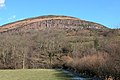
 Above Blaenyoy - geograph.org.uk - 73947.jpg 640 × 480; 77 KB
-
 Ancient field boundary - geograph.org.uk - 660653.jpg 480 × 640; 88 KB
-
 Below Bal-Mawr - geograph.org.uk - 704159.jpg 639 × 479; 195 KB
-
 Campsite by Pont Rhys Powell - geograph.org.uk - 817727.jpg 640 × 480; 108 KB
-
 Church of St Martin, Cwmyoy, Monmouthshire - churchyard cross.jpg 1,936 × 2,592; 1.65 MB
-
 Country road near Pont Rhys Powell - geograph.org.uk - 127356.jpg 640 × 480; 116 KB
-
 Cwmyoy valley - geograph.org.uk - 127353.jpg 640 × 480; 64 KB
-
 Cwmyoy.jpg 640 × 480; 87 KB
-
 Darren, Black Mountains - geograph.org.uk - 133077.jpg 640 × 426; 116 KB
-
 Fallen hawthorn tree on Bryn Arw - geograph.org.uk - 348519.jpg 640 × 426; 129 KB
-
 Farms at Upper and Lower Henllan - geograph.org.uk - 133967.jpg 640 × 426; 110 KB
-
 Footbridge and ford, Vale of Ewyas - geograph.org.uk - 133078.jpg 640 × 426; 159 KB
-

-
 Forest road near Pont Rhys Powell - geograph.org.uk - 127351.jpg 640 × 480; 103 KB
-
 Rainbow over Gaer - geograph.org.uk - 348502.jpg 640 × 426; 89 KB
-
 Rainbow over Gaer - geograph.org.uk - 348512.jpg 640 × 426; 106 KB
-
 The Hunt on the Black Mountains - geograph.org.uk - 132750.jpg 640 × 426; 81 KB
-
 The north-western slopes of Bryn Arw - geograph.org.uk - 348472.jpg 640 × 426; 124 KB
-
 Track to Bryn Arw - geograph.org.uk - 348486.jpg 426 × 640; 163 KB
-
 Tree near Pen-y-ffordd, Black Mountains - geograph.org.uk - 131888.jpg 426 × 640; 105 KB
-
 Twyn y Gaer - geograph.org.uk - 347396.jpg 640 × 426; 131 KB
-
 Ty-mawr Farm, Cymyoy, Monmouthshire.jpg 640 × 480; 88 KB
-
 Bal-Mawr - geograph.org.uk - 704180.jpg 638 × 458; 210 KB
-
 Coed-dias - geograph.org.uk - 705514.jpg 639 × 479; 202 KB
-
 Descent from Bal-Mawr - geograph.org.uk - 704170.jpg 639 × 479; 204 KB
-
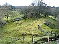
 End of the farm - geograph.org.uk - 660648.jpg 640 × 480; 118 KB
-
 Farm building in the Grwyne Fawr - geograph.org.uk - 705523.jpg 639 × 479; 205 KB
-
 Farmland meets forest - geograph.org.uk - 660030.jpg 640 × 480; 98 KB
-
 Farmland meets forest - geograph.org.uk - 660042.jpg 640 × 480; 70 KB
-
 Footpath to Stanton - geograph.org.uk - 348493.jpg 640 × 426; 187 KB
-
 Land near Ffawydden - geograph.org.uk - 705500.jpg 639 × 479; 217 KB
-
 Landslip country - geograph.org.uk - 751366.jpg 640 × 480; 122 KB
-
 Looking down Grwyne Fawr - geograph.org.uk - 705509.jpg 639 × 479; 229 KB
-
 Pasture in the valley - geograph.org.uk - 705502.jpg 639 × 479; 206 KB
-
 Path around Bal-Mawr - geograph.org.uk - 704153.jpg 639 × 479; 196 KB
-

-
 South from the flank of Bal-Mawr - geograph.org.uk - 703798.jpg 639 × 479; 219 KB
-
 Sugar Loaf - geograph.org.uk - 447506.jpg 640 × 480; 115 KB
-
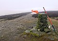
 Summit of Sugar Loaf - geograph.org.uk - 655678.jpg 640 × 480; 44 KB
-
 The north-western slopes of Bryn Arw - geograph.org.uk - 349728.jpg 640 × 426; 113 KB
-
 Ty-mawr - geograph.org.uk - 705529.jpg 639 × 479; 184 KB
-
 Valley floor - geograph.org.uk - 705505.jpg 639 × 479; 207 KB
-
 Waterfall - geograph.org.uk - 413665.jpg 480 × 640; 139 KB
.jpg)
.jpg)
.jpg)


