Category:Cummertrees
Jump to navigation
Jump to search
village in Dumfries and Galloway, Scotland, UK  | |||||
| Upload media | |||||
| Instance of | |||||
|---|---|---|---|---|---|
| Location |
| ||||
 | |||||
English: Cummertrees is a coastal village and parish of Annandale in Dumfries and Galloway. It is a rural, primarily residential village with a name of doubtful etymology.
Subcategories
This category has the following 5 subcategories, out of 5 total.
Media in category "Cummertrees"
The following 44 files are in this category, out of 44 total.
-
 A conversion - geograph.org.uk - 572126.jpg 640 × 480; 87 KB
-

-
 Agnes Hill, Cummertrees, Dumfries, Scotland.JPG 2,288 × 1,712; 1.21 MB
-

-
 Cattle Near Hitchill - geograph.org.uk - 565045.jpg 640 × 480; 192 KB
-
 Cattle Near Maulscastle - geograph.org.uk - 565092.jpg 640 × 480; 180 KB
-
 Comar na Drise - Allmhurach 01.jpg 3,104 × 1,746; 2.18 MB
-
 Covered gateway, Cummertrees church - geograph.org.uk - 154746.jpg 480 × 640; 58 KB
-

-
 Cummertrees Church Lych Gate, Dumfries and Galloway.jpg 4,608 × 3,456; 3.55 MB
-
 Cummertrees Church March 2006 - geograph.org.uk - 513325.jpg 640 × 426; 117 KB
-
 Cummertrees Church. - geograph.org.uk - 663462.jpg 640 × 454; 60 KB
-
 Cummertrees Mill - geograph.org.uk - 541844.jpg 640 × 480; 184 KB
-
 Cummertrees Mill - geograph.org.uk - 541852.jpg 640 × 426; 165 KB
-
 Cummertrees Parish Church & Lych gate.JPG 2,288 × 1,712; 1.16 MB
-
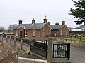 Cummertrees railway station.JPG 2,288 × 1,712; 1.17 MB
-
 Cummertrees ROC Post - geograph.org.uk - 1410565.jpg 640 × 480; 101 KB
-
 Cummertrees Village - geograph.org.uk - 1410576.jpg 640 × 480; 76 KB
-
 Erratic on Priestside Bank - geograph.org.uk - 1393897.jpg 640 × 414; 206 KB
-
 Field and Trees - geograph.org.uk - 564759.jpg 640 × 480; 161 KB
-
 Field at South Bowhill - geograph.org.uk - 564819.jpg 640 × 480; 193 KB
-
 Fields Near Hitchill - geograph.org.uk - 565048.jpg 640 × 480; 193 KB
-
 Foodstore Near Maulscastle - geograph.org.uk - 565089.jpg 640 × 480; 200 KB
-
 Footpath to Powfoot - geograph.org.uk - 565051.jpg 640 × 480; 256 KB
-
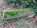 Grave of 8th Marquess of Queensberry.jpg 4,032 × 3,024; 5.75 MB
-
 Hedge Near Upper Mains - geograph.org.uk - 565072.jpg 640 × 480; 200 KB
-
 Landscape to North of Cummertrees - geograph.org.uk - 541872.jpg 640 × 343; 72 KB
-
 Lay-by - geograph.org.uk - 87289.jpg 640 × 426; 107 KB
-
 Logpile Near Maulscastle Cottage - geograph.org.uk - 565096.jpg 640 × 480; 185 KB
-
 Lone walker on the merse - geograph.org.uk - 1082432.jpg 640 × 466; 102 KB
-

-

-
 Mapa dg comar na drise.jpg 2,004 × 1,363; 599 KB
-
 Millside Plantation - geograph.org.uk - 572146.jpg 640 × 480; 128 KB
-
 Minor Road Near Maulscastle - geograph.org.uk - 565098.jpg 640 × 480; 213 KB
-

-
 Queensberry Terrace, Agnes Hill, Cummertrees, Dumfries & Galloway.jpg 4,608 × 3,456; 3.61 MB
-
 Queensberry Terrace, Agnes Hill, Cummertrees, Dumfriesshire.jpg 4,605 × 2,405; 2.33 MB
-
 Queensberry Terrace, Agnes Hill, Cummertrees, Scotland.jpg 4,608 × 3,456; 3.64 MB
-
 Roadside Pines Near Backburn - geograph.org.uk - 564751.jpg 480 × 640; 202 KB
-
 Row of houses, Cummertrees.jpg 640 × 480; 69 KB
-
 Saltmarsh near east Howcreek - geograph.org.uk - 526632.jpg 640 × 436; 84 KB
-
 The church, Cummertrees - geograph.org.uk - 154742.jpg 640 × 435; 51 KB
-
 Trees Near Hannah - geograph.org.uk - 565054.jpg 480 × 640; 164 KB


