Category:Csóványos
Jump to navigation
Jump to search
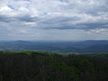
A peak of Börzsöny mountain. Passed by National Blue Trail. Csóványos also located at boundary of Pest and Nógrád County in Hungary.
| Object location | | View all coordinates using: OpenStreetMap |
|---|
mountain  | |||||
| Upload media | |||||
| Instance of | |||||
|---|---|---|---|---|---|
| Location | Pest County, Hungary | ||||
| Mountain range | |||||
| Elevation above sea level |
| ||||
 | |||||
Subcategories
This category has only the following subcategory.
C
- Csóványos observation tower (6 F)
Media in category "Csóványos"
The following 3 files are in this category, out of 3 total.
-
 Csóványos - Szabó-kövek - panoramio.jpg 4,000 × 3,000; 3.37 MB
-
 Csóványos.JPG 3,296 × 2,472; 1.85 MB
-
 Nő, 1958. Fortepan 1840.jpg 3,276 × 2,747; 4.68 MB

