Category:Crosby, Cumbria
Jump to navigation
Jump to search
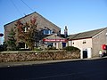
English: Crosby is a small village in Cumbria, England, three miles north-east of Maryport on the A596 road. It has a population of approximately 1000. The only remaining public house in the village is The Stag Inn.
village in Allerdale, Cumbria, United Kingdom  | |||||
| Upload media | |||||
| Instance of | |||||
|---|---|---|---|---|---|
| Location | Crosscanonby, Allerdale, Cumbria, North West England, England | ||||
 | |||||
Media in category "Crosby, Cumbria"
The following 42 files are in this category, out of 42 total.
-
 "Chapel Bank" - geograph.org.uk - 527614.jpg 640 × 480; 221 KB
-
 Along the line of Stanegate - geograph.org.uk - 406233.jpg 640 × 480; 150 KB
-
 Cycle path alongside the A689 - geograph.org.uk - 207721.jpg 640 × 480; 71 KB
-
 Dearham Bridge - geograph.org.uk - 526843.jpg 640 × 480; 139 KB
-
 Oughterside Post Office in Prospect - geograph.org.uk - 599195.jpg 640 × 480; 223 KB
-
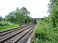
 The Carlisle to Barrow Railway - geograph.org.uk - 526863.jpg 640 × 480; 193 KB
-
 The Stag Inn, Crosby - geograph.org.uk - 527619.jpg 640 × 480; 223 KB
-
 Wallfoot Hotel and Restaurant - geograph.org.uk - 207722.jpg 640 × 480; 86 KB
-
 Approaching Holme Gate - geograph.org.uk - 342966.jpg 640 × 480; 90 KB
-
 Barn at Holme Gate - geograph.org.uk - 342969.jpg 640 × 480; 94 KB
-
 Bridleway to Bankend - geograph.org.uk - 527607.jpg 640 × 480; 180 KB
-
 Bridleway to Gilcrux - geograph.org.uk - 578566.jpg 640 × 480; 130 KB
-
 Cattle grid - geograph.org.uk - 249398.jpg 480 × 640; 123 KB
-
 Crosshow Farm - geograph.org.uk - 526866.jpg 640 × 480; 221 KB
-
 Derelict site on Glasson Business Park - geograph.org.uk - 526916.jpg 640 × 480; 221 KB
-
 Eden Golf Club, near Crosby-on-Eden - geograph.org.uk - 207725.jpg 640 × 480; 60 KB
-
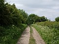
 Footpath to Oughterside - geograph.org.uk - 463769.jpg 640 × 480; 135 KB
-
 Footpath to Tallentire - geograph.org.uk - 578571.jpg 640 × 480; 225 KB
-
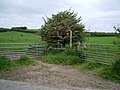
 Gate - geograph.org.uk - 463775.jpg 640 × 480; 153 KB
-
 Gate - geograph.org.uk - 578568.jpg 640 × 480; 161 KB
-
 Glasson Rugby League Football Club - geograph.org.uk - 759314.jpg 640 × 480; 59 KB
-

-
 Hatching Well - geograph.org.uk - 578549.jpg 640 × 480; 126 KB
-
 Hill Farm - geograph.org.uk - 578603.jpg 640 × 480; 227 KB
-
 Holme Gate Cottage - geograph.org.uk - 342970.jpg 640 × 480; 65 KB
-
 Lane to Holmegate - geograph.org.uk - 342964.jpg 640 × 480; 69 KB
-
 Level crossing - geograph.org.uk - 526910.jpg 640 × 480; 237 KB
-
 No5 Main Street, Maryport - geograph.org.uk - 526913.jpg 640 × 480; 162 KB
-
 No5 Main Street, Maryport - geograph.org.uk - 526914.jpg 640 × 480; 224 KB
-
 River Eden - geograph.org.uk - 488822.jpg 640 × 480; 65 KB
-
 River Ellen - geograph.org.uk - 526841.jpg 640 × 480; 123 KB
-
 Short track to field - geograph.org.uk - 460120.jpg 640 × 480; 178 KB
-
 Sun on ridge - geograph.org.uk - 462272.jpg 640 × 480; 154 KB
-
 Tall barn at Holme Gate - geograph.org.uk - 342971.jpg 640 × 480; 97 KB
-
 The A596(T) at Crosby - geograph.org.uk - 45382.jpg 640 × 480; 112 KB
-
 The Carlisle to Barrow Railway - geograph.org.uk - 526854.jpg 640 × 480; 208 KB
-
 The Carlisle to Maryport Railway - geograph.org.uk - 463759.jpg 640 × 480; 158 KB
-

-
 The road from Gilcrux to Tallentire Hill - geograph.org.uk - 578563.jpg 640 × 433; 173 KB
-
 Track to Oughterside - geograph.org.uk - 463742.jpg 640 × 480; 101 KB
-
 Track to Strickland - geograph.org.uk - 342963.jpg 640 × 480; 61 KB
-
 View south of the A689 - geograph.org.uk - 406216.jpg 640 × 480; 63 KB


_at_Crosby_-_geograph.org.uk_-_45382.jpg)


