Category:Crookham, Northumberland
Jump to navigation
Jump to search
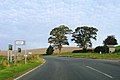
English: Crookham is a village on the River Till in Northumberland, in England. It is situated approximately 8 km (5 miles) to the east of Coldstream and 14 km (9 miles) northwest of Wooler. It has two farms, which are both west of the village. They are called Crookham Eastfield and Crookham Westfield. Recorded as "Crucum" in 1244, the village name derived from the Old English for "Settlement at the Bend" (of the River Till).
village in Northumberland, England, UK  | |||||
| Upload media | |||||
| Instance of | |||||
|---|---|---|---|---|---|
| Location | Ford, Northumberland, North East England, England | ||||
 | |||||
Subcategories
This category has only the following subcategory.
Media in category "Crookham, Northumberland"
The following 59 files are in this category, out of 59 total.
-
 'The Postman Always Rings Twice', Crookham - geograph.org.uk - 1939273.jpg 1,024 × 768; 233 KB
-
 A 'scarycrow' at Crookham - geograph.org.uk - 2678620.jpg 427 × 640; 265 KB
-
 A 'scarycrow' at Crookham - geograph.org.uk - 2678673.jpg 640 × 427; 195 KB
-
 A697 northbound - geograph.org.uk - 3188091.jpg 640 × 429; 53 KB
-
 A697 northbound - geograph.org.uk - 3394795.jpg 640 × 452; 40 KB
-
 A697, Crookham - geograph.org.uk - 4778229.jpg 1,024 × 683; 311 KB
-
 A697, Crookham - geograph.org.uk - 4778342.jpg 1,024 × 683; 333 KB
-
 Autumn hedgerow in stubble field - geograph.org.uk - 1038103.jpg 640 × 480; 143 KB
-
 Cottage garden, Crookham - geograph.org.uk - 1939247.jpg 1,024 × 769; 298 KB
-
 Cottages, Crookham - geograph.org.uk - 1932404.jpg 1,024 × 768; 247 KB
-

-
 Crookham - geograph.org.uk - 4158408.jpg 640 × 428; 83 KB
-
 Crookham Eastfield, Northumberland - geograph.org.uk - 3999468.jpg 3,648 × 2,736; 4.71 MB
-
 Exchanging tokens - geograph.org.uk - 225406.jpg 640 × 558; 59 KB
-
 Farmland near Crookham - geograph.org.uk - 4158403.jpg 640 × 428; 79 KB
-
 Field margin, Crookham - geograph.org.uk - 4778339.jpg 1,024 × 683; 358 KB
-
 Flowering hedgerow near Heaton Covert, Crookham - geograph.org.uk - 3999623.jpg 3,648 × 2,736; 4.72 MB
-
 Footbridge over Pallin's Burn, south of Crookham - geograph.org.uk - 1933318.jpg 1,024 × 768; 353 KB
-
 Footpath south of Crookham - geograph.org.uk - 1933293.jpg 1,024 × 768; 313 KB
-
 Fruits of the hedgerow - geograph.org.uk - 1038096.jpg 640 × 480; 131 KB
-
 Heatherslaw Light Railway - geograph.org.uk - 142371.jpg 640 × 426; 66 KB
-
 Houses in Crookham - geograph.org.uk - 4158410.jpg 640 × 428; 82 KB
-
 Main A697 near Crookham - geograph.org.uk - 1939172.jpg 1,024 × 768; 223 KB
-
 Main street through Crookham - geograph.org.uk - 3648199.jpg 3,718 × 2,783; 1.87 MB
-
 Main Street, Crookham - geograph.org.uk - 3648145.jpg 4,608 × 3,456; 2.72 MB
-
 Old Post Office, Crookham - geograph.org.uk - 3648150.jpg 4,500 × 3,308; 1.82 MB
-
 Overgrown footpath south of Crookham - geograph.org.uk - 1933309.jpg 1,024 × 768; 262 KB
-

-
 Pasture, Crookham - geograph.org.uk - 4778337.jpg 1,024 × 683; 373 KB
-
 Quiet country lane - geograph.org.uk - 1038084.jpg 640 × 480; 136 KB
-
 Rainbow over the A697 - geograph.org.uk - 288114.jpg 640 × 480; 45 KB
-
 Road junction, Crookham - geograph.org.uk - 4778331.jpg 1,024 × 683; 350 KB
-
 Rounded hills near Crookham - geograph.org.uk - 5049863.jpg 1,600 × 1,111; 210 KB
-
 Sheep grazing near Crookham - geograph.org.uk - 3653228.jpg 2,510 × 1,596; 934 KB
-

-
 The A697 approaches Crookham - geograph.org.uk - 5049865.jpg 1,600 × 1,160; 213 KB
-
 The Old Church, Crookham - geograph.org.uk - 1939233.jpg 1,024 × 768; 262 KB
-
 The Old Post Office in Crookham - geograph.org.uk - 5049870.jpg 1,600 × 1,143; 237 KB
-
 Village Hall, Crookham - geograph.org.uk - 1932392.jpg 1,024 × 768; 265 KB
-
 Village street, Crookham - geograph.org.uk - 1939252.jpg 1,024 × 768; 188 KB
-
 Wheat field near Crookham - geograph.org.uk - 4778359.jpg 1,024 × 683; 356 KB
-

-
 Disused saw mill - geograph.org.uk - 288942.jpg 640 × 467; 77 KB
-
 Encampment Farm - geograph.org.uk - 288127.jpg 640 × 421; 56 KB
-
 Farmland near Ford - geograph.org.uk - 288118.jpg 640 × 480; 99 KB
-
 Farmland near Heaton - geograph.org.uk - 350026.jpg 640 × 480; 118 KB
-
 Footpath to Crookham Eastfield - geograph.org.uk - 350000.jpg 640 × 480; 104 KB
-
 House at Fishers Steads by the A697 - geograph.org.uk - 288126.jpg 640 × 480; 80 KB
-
 Minor road to Crookham Eastfield - geograph.org.uk - 349949.jpg 640 × 480; 117 KB
-
 Overgrown lake at Pallinsburn House - geograph.org.uk - 349940.jpg 640 × 480; 119 KB
-
 Plantation on Flodden Hill - geograph.org.uk - 349978.jpg 640 × 480; 114 KB
-
 Rough grazing - geograph.org.uk - 288122.jpg 640 × 480; 83 KB
-
 Stubble field - geograph.org.uk - 288120.jpg 640 × 480; 82 KB
-
 Stubble field - geograph.org.uk - 288943.jpg 640 × 467; 59 KB
-
 The access road to Callerburn Farm - geograph.org.uk - 288135.jpg 640 × 426; 48 KB
-
 The B6354 near Flodden Lodge - geograph.org.uk - 288117.jpg 640 × 480; 91 KB
-
 The trig point on Whitton Hill - geograph.org.uk - 288098.jpg 640 × 480; 129 KB
-
 Thrieprig Farm - geograph.org.uk - 350011.jpg 640 × 480; 104 KB
-
 Track leading to Marldown - geograph.org.uk - 349930.jpg 640 × 480; 107 KB


