Category:Croft, Cheshire
Jump to navigation
Jump to search
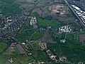
English: Croft is a village and civil parish in Warrington, Cheshire, England, about five miles north of Warrington town centre. According to the 2001 Census it had a population of 2,920. It is a rural, residential district.
village and civil parish in Cheshire, England, UK  | |||||
| Upload media | |||||
| Instance of | |||||
|---|---|---|---|---|---|
| Location | Warrington, Cheshire, North West England, England | ||||
 | |||||
Subcategories
This category has the following 2 subcategories, out of 2 total.
C
- Christ Church, Croft (11 F)
K
- Kenyon, Cheshire (4 F)
Media in category "Croft, Cheshire"
The following 200 files are in this category, out of 213 total.
(previous page) (next page)-
 A bend in the road to New Lane End - geograph.org.uk - 2782054.jpg 4,255 × 2,444; 7.59 MB
-
 A footpath opposite Wilton Grange - geograph.org.uk - 2782064.jpg 640 × 426; 105 KB
-
 A planted field by Glaziers Lane - geograph.org.uk - 5179876.jpg 6,000 × 4,000; 3.47 MB
-
 A surfeit of signs - geograph.org.uk - 2777445.jpg 4,589 × 2,547; 7.45 MB
-
 A579 heading north - geograph.org.uk - 3355098.jpg 1,200 × 900; 249 KB
-
 A579 Winwick Lane - geograph.org.uk - 2254182.jpg 640 × 480; 56 KB
-
 Abandoned trailers off Lady Lane - geograph.org.uk - 5181348.jpg 6,000 × 4,000; 4.05 MB
-
-
 Approaching the Plough Inn on Kenyon Lane - geograph.org.uk - 2662691.jpg 4,000 × 3,000; 3.18 MB
-
 Barn conversion, Little Town - geograph.org.uk - 3354955.jpg 640 × 480; 88 KB
-
 Bates Farm - geograph.org.uk - 5178523.jpg 6,000 × 4,000; 3.33 MB
-
 Bellcote - geograph.org.uk - 2864735.jpg 480 × 640; 401 KB
-
 Bellcote Inscription - geograph.org.uk - 2864738.jpg 640 × 640; 637 KB
-
 Bridge over M62 at Risley - geograph.org.uk - 2496731.jpg 3,743 × 2,484; 3.68 MB
-
 Bridges over the M6 at Junction 22 - geograph.org.uk - 6302408.jpg 1,024 × 576; 72 KB
-
 Broad bean crop - geograph.org.uk - 5463913.jpg 2,000 × 1,333; 2.01 MB
-
 Church of St Lewis, Mustard Lane - geograph.org.uk - 6059138.jpg 1,600 × 1,200; 650 KB
-
 Churchyard of St Lewis' Catholic Church - geograph.org.uk - 5179917.jpg 6,000 × 4,000; 4.66 MB
-
 Corner of Field, Off Culcheth Linear Park - geograph.org.uk - 5430947.jpg 1,440 × 1,080; 828 KB
-
 Croft - Heath Lane - geograph.org.uk - 2662697.jpg 4,000 × 3,000; 4.3 MB
-

-
 Croft Primary School - geograph.org.uk - 4360182.jpg 3,264 × 2,448; 3.12 MB
-
 Croft Village Memorial Hall - geograph.org.uk - 2864746.jpg 640 × 480; 446 KB
-
 Croft Village Memorial Hall - geograph.org.uk - 3354962.jpg 1,024 × 768; 182 KB
-
 Cross Lane - geograph.org.uk - 2782817.jpg 4,592 × 3,056; 6.8 MB
-
 Cross Lane Bridge - geograph.org.uk - 2330950.jpg 640 × 480; 183 KB
-
 Cross Lane Bridge - geograph.org.uk - 2330957.jpg 640 × 480; 212 KB
-
 Cross Lane, Croft - geograph.org.uk - 2330932.jpg 800 × 600; 347 KB
-

-

-
 Dam Lane - geograph.org.uk - 2782263.jpg 4,592 × 3,056; 6.95 MB
-
 Dam Lane near Croft - geograph.org.uk - 3354939.jpg 640 × 480; 120 KB
-
 Derelict building near Brook House Farm - geograph.org.uk - 5181357.jpg 6,000 × 4,000; 4.71 MB
-
 Drainage Ditch South of New Lane, Croft - geograph.org.uk - 6059362.jpg 1,600 × 1,200; 423 KB
-
 Elliot's General Store, Heath Lane, Croft - geograph.org.uk - 6059345.jpg 1,600 × 1,281; 460 KB
-
 Entering Wigan at Dolly's Bridge - geograph.org.uk - 2690058.jpg 3,889 × 2,259; 3.32 MB
-
 Entrance Lodge, Taylor Business Park - geograph.org.uk - 2866107.jpg 640 × 480; 592 KB
-
 Entrance to Southworth Hall Farm - geograph.org.uk - 4360176.jpg 3,264 × 2,448; 3.51 MB
-
 Entrance to The Old Rectory - geograph.org.uk - 5181410.jpg 6,000 × 4,000; 6.09 MB
-
 Farm buildings, Rowe Farm - geograph.org.uk - 3355927.jpg 1,024 × 569; 93 KB
-
 Farmland and woodland near Moss Pits - geograph.org.uk - 3355093.jpg 640 × 480; 47 KB
-
 Farmland at Kenyon - geograph.org.uk - 5706811.jpg 3,266 × 2,444; 5.23 MB
-
 Farmland near Bates Farm - geograph.org.uk - 5178512.jpg 6,000 × 4,000; 5.07 MB
-
 Farmland near Brewery Farm - geograph.org.uk - 3354976.jpg 640 × 480; 88 KB
-
 Farmland near Croft - geograph.org.uk - 3354942.jpg 640 × 480; 103 KB
-
 Farmland near Croft - geograph.org.uk - 5181406.jpg 6,000 × 4,000; 4.52 MB
-
 Farmland near Culcheth - geograph.org.uk - 5178096.jpg 6,000 × 4,000; 3.84 MB
-
 Farmland near Kenyon Hall - geograph.org.uk - 3355080.jpg 640 × 480; 111 KB
-
 Farmland near Little Town - geograph.org.uk - 5179922.jpg 6,000 × 4,000; 3.58 MB
-
 Farmland near Wigshaw - geograph.org.uk - 5179911.jpg 5,294 × 3,529; 6.63 MB
-
 Farmland off Stone Pit Lane - geograph.org.uk - 3355071.jpg 640 × 480; 77 KB
-
 Farmland, Laneside - geograph.org.uk - 3354949.jpg 640 × 480; 79 KB
-
 Farmland, Morris's Farm - geograph.org.uk - 3355103.jpg 640 × 480; 42 KB
-
 Farmland, New Lane End - geograph.org.uk - 3354982.jpg 640 × 480; 105 KB
-
 Field by Oven Back Cottage - geograph.org.uk - 2440173.jpg 3,824 × 2,173; 3.04 MB
-
 Field pond at Kenyon - geograph.org.uk - 2931808.jpg 1,600 × 1,200; 902 KB
-
 Fields by Croft Riding Centre - geograph.org.uk - 5183284.jpg 6,000 × 4,000; 4.94 MB
-
 Flickr - ronsaunders47 - GREEN BOAT AND A MURKY POND..jpg 2,464 × 1,792; 894 KB
-
 Flickr - ronsaunders47 - It's a hard life. Croft ,Warrington Cheshire. UK..jpg 3,008 × 2,000; 1.74 MB
-
 Flickr - ronsaunders47 - ROOM TO MOVE..jpg 2,804 × 1,864; 1.02 MB
-
 Flickr - ronsaunders47 - THE WORKING DAY IS OVER...jpg 1,764 × 1,171; 637 KB
-
 Flickr - ronsaunders47 - VILLAGE POND IN CROFT. WARRINGTON CHESHIRE UK..jpg 3,008 × 2,000; 2.02 MB
-
 Footpath between Lady Lane and Lord Street, Croft - geograph.org.uk - 6059102.jpg 1,600 × 1,200; 582 KB
-
 Footpath by a wood - geograph.org.uk - 3024952.jpg 4,000 × 3,000; 7.22 MB
-
 Former school house, Croft - geograph.org.uk - 3354970.jpg 768 × 1,024; 166 KB
-
 Former Schoolhouse(^) at Croft - geograph.org.uk - 2864734.jpg 640 × 480; 431 KB
-
 From Croft Parish churchyard - geograph.org.uk - 3839657.jpg 1,024 × 753; 524 KB
-
 General store, Croft - geograph.org.uk - 3354968.jpg 800 × 600; 86 KB
-
 Glaziers Lane - geograph.org.uk - 2662816.jpg 4,000 × 3,000; 4.82 MB
-
 Graveyard at the South End of Lady Lane, Croft - geograph.org.uk - 6059370.jpg 1,600 × 1,202; 632 KB
-
 Grazing near Culcheth - geograph.org.uk - 3355925.jpg 640 × 480; 73 KB
-
 Grazing, Rowe Farm - geograph.org.uk - 3355929.jpg 1,024 × 646; 95 KB
-
 Greenhouses, Kenyon Hall Farm - geograph.org.uk - 2864702.jpg 640 × 480; 484 KB
-
 Heath Lane at New Lane End - geograph.org.uk - 2782078.jpg 4,386 × 2,919; 6.86 MB
-
 Heath Lane heading north - geograph.org.uk - 3354977.jpg 640 × 480; 59 KB
-
 Heath Lane, South View - geograph.org.uk - 2864752.jpg 640 × 480; 419 KB
-
 Herons by the lakeside - geograph.org.uk - 5178479.jpg 6,000 × 4,000; 4.94 MB
-
 Hey Farm, Cross Lane - geograph.org.uk - 2330936.jpg 800 × 600; 410 KB
-
 High Peak Care Home, Kenyon - geograph.org.uk - 2892124.jpg 1,024 × 768; 216 KB
-
 HM Prison Risley from the air - geograph.org.uk - 3948247.jpg 640 × 480; 160 KB
-
 Holcroft Moss Bridge over M62 - geograph.org.uk - 2496741.jpg 3,974 × 2,389; 3.02 MB
-
 House at Wigshaw - geograph.org.uk - 2662820.jpg 3,533 × 2,801; 3.49 MB
-
 House on Kenyon Lane - geograph.org.uk - 2662678.jpg 4,000 × 3,000; 4.06 MB
-
 Junction 11 on M62 Eastbound - geograph.org.uk - 2496736.jpg 3,984 × 2,138; 2.4 MB
-
 Junction 22, M6 - geograph.org.uk - 3985839.jpg 640 × 480; 56 KB
-
-
 Junction of Sandy Brow Lane with Winwick Lane - geograph.org.uk - 6345073.jpg 2,784 × 1,568; 2.12 MB
-
 Junction of Warrington Road and Cross Lane - geograph.org.uk - 6260160.jpg 3,264 × 2,448; 2.35 MB
-
 Kenyon Hall Farm - geograph.org.uk - 2864691.jpg 640 × 480; 556 KB
-
 Kenyon Hall Farm - geograph.org.uk - 2864694.jpg 640 × 427; 442 KB
-
 Kenyon Hall Farm - geograph.org.uk - 3488694.jpg 3,968 × 2,232; 4.94 MB
-
 Kenyon Hall Farm - geograph.org.uk - 3488711.jpg 3,968 × 2,232; 4.86 MB
-
 Kenyon Lane - geograph.org.uk - 3354986.jpg 640 × 480; 85 KB
-
 Kenyon Lane near Wilton Grange - geograph.org.uk - 6143455.jpg 1,024 × 767; 247 KB
-
 Kenyon Lane, Kenyon - geograph.org.uk - 2662681.jpg 4,000 × 3,000; 3.51 MB
-
 Kenyon, Kenyon Lane - geograph.org.uk - 2864823.jpg 640 × 480; 466 KB
-
 Lady Lane - geograph.org.uk - 2782210.jpg 4,439 × 2,878; 5.8 MB
-
 Lady Lane, Croft - geograph.org.uk - 3354951.jpg 640 × 480; 61 KB
-
 Lady Lane, Little Town - geograph.org.uk - 3354953.jpg 640 × 480; 89 KB
-
 Lakeside view - geograph.org.uk - 5128625.jpg 4,608 × 3,456; 4.41 MB
-
 Croft - Saint Lewis' Catholic Church.jpg 640 × 480; 199 KB
-

-

-
 M6 Junction 21a - geograph.org.uk - 2777336.jpg 4,179 × 2,522; 6.61 MB
-

-
 M6 Motorway - junction 22 bridges - geograph.org.uk - 2363340.jpg 640 × 480; 60 KB
-
 M6 motorway - junction 22 bridges - geograph.org.uk - 2886817.jpg 639 × 450; 106 KB
-
 M6 motorway - Southworth Lane bridge - geograph.org.uk - 2886823.jpg 639 × 450; 118 KB
-
 M6 near Winwick - geograph.org.uk - 28904.jpg 640 × 426; 92 KB
-
 M6 Southbound - geograph.org.uk - 117668.jpg 640 × 480; 77 KB
-
 M6 southbound nearing Croft Interchange - geograph.org.uk - 2886824.jpg 638 × 452; 101 KB
-
 M6, Warrington - geograph.org.uk - 26684.jpg 640 × 426; 98 KB
-
 M62 approaching Junction 11 - geograph.org.uk - 2645130.jpg 640 × 480; 44 KB
-
 M62 eastbound - geograph.org.uk - 2645137.jpg 640 × 480; 38 KB
-
 M62 eastbound at Junction 21a - geograph.org.uk - 3023572.jpg 640 × 480; 45 KB
-
 M62 eastbound near Birchwood - geograph.org.uk - 2645127.jpg 640 × 480; 46 KB
-
 M62 Flyover, Warrington. - geograph.org.uk - 29200.jpg 640 × 426; 97 KB
-
 M62 Junction 11 (Birchwood) - geograph.org.uk - 2062718.jpg 640 × 480; 136 KB
-
 M62 Motorway - A574 overbridge - geograph.org.uk - 1917648.jpg 640 × 480; 148 KB
-
 M62 Motorway - geograph.org.uk - 2330944.jpg 640 × 480; 167 KB
-
 M62 motorway at Holcroft Moss overbridge - geograph.org.uk - 1917608.jpg 640 × 480; 152 KB
-
 M62 motorway, west of junction 11 - geograph.org.uk - 1917624.jpg 640 × 480; 145 KB
-
 M62, Birchwood Way Bridge At Junction 11 - geograph.org.uk - 2062723.jpg 640 × 480; 133 KB
-
 Manure heap near Bates Farm - geograph.org.uk - 5178516.jpg 6,000 × 4,000; 5.1 MB
-
 Millhouse Lane - geograph.org.uk - 1817347.jpg 1,024 × 683; 207 KB
-
 Millhouse Lane and slip road - geograph.org.uk - 1817341.jpg 1,024 × 683; 227 KB
-
 Morris's Farm - geograph.org.uk - 2864696.jpg 640 × 427; 541 KB
-
 Morris's Farm - geograph.org.uk - 3355099.jpg 1,200 × 900; 239 KB
-
 Mustard Lane - geograph.org.uk - 2663472.jpg 640 × 480; 61 KB
-
 Mustard Lane, Little Town - geograph.org.uk - 4360179.jpg 3,264 × 2,448; 3.44 MB
-
 Mustard Lane, Little Town - geograph.org.uk - 5179916.jpg 6,000 × 4,000; 4.94 MB
-
 Mustard Lane, Little Town - geograph.org.uk - 6059149.jpg 1,600 × 1,200; 604 KB
-
 New crop on the moss - geograph.org.uk - 5177238.jpg 6,000 × 4,000; 3.76 MB
-
 New Lane - Eaves Brow, Croft - geograph.org.uk - 2662756.jpg 4,000 × 3,000; 4.08 MB
-
 New Lane, Croft - geograph.org.uk - 3354944.jpg 1,024 × 768; 141 KB
-
 New Lane, Croft - geograph.org.uk - 5463905.jpg 2,000 × 1,333; 2 MB
-
 New plantation near Moss Side Farm tip - geograph.org.uk - 5178458.jpg 6,000 × 4,000; 4.76 MB
-
 North End of Culcheth Linear Park - geograph.org.uk - 5430925.jpg 1,440 × 1,080; 615 KB
-
 Old School House, Mustard Lane, Croft - geograph.org.uk - 6059352.jpg 1,600 × 1,597; 567 KB
-
 Out buildings at Rowe Farm - geograph.org.uk - 2632926.jpg 4,473 × 2,324; 5.6 MB
-
 Overbridge near Southworth Hall - geograph.org.uk - 4441356.jpg 640 × 177; 30 KB
-
 Partridge Lakes Fishery, Croft - geograph.org.uk - 29496.jpg 640 × 426; 103 KB
-
 Path and drainage channel - geograph.org.uk - 5177234.jpg 6,000 × 4,000; 4.99 MB
-
 Path through a woodland tunnel - geograph.org.uk - 5178447.jpg 6,000 × 4,000; 5.53 MB
-
 Path towards Bates Farm - geograph.org.uk - 5178505.jpg 6,000 × 4,000; 5.2 MB
-
 Pond in woodland - geograph.org.uk - 5178496.jpg 6,000 × 4,000; 5.44 MB
-
 Power lines cross the M6 - geograph.org.uk - 2886819.jpg 638 × 451; 109 KB
-
 Reservoir near Moss Side Farm tip - geograph.org.uk - 5178091.jpg 6,000 × 4,000; 5.64 MB
-
 Road junction - geograph.org.uk - 910899.jpg 640 × 480; 197 KB
-
 Rough Farm - geograph.org.uk - 2864582.jpg 640 × 480; 479 KB
-
 Rough Farm - geograph.org.uk - 2864594.jpg 640 × 480; 477 KB
-
 Sandy Brow Lane - geograph.org.uk - 2690063.jpg 3,763 × 2,815; 4.45 MB
-
 Sandy Brow Lane - geograph.org.uk - 2782031.jpg 640 × 436; 130 KB
-
 Sandy Brow Lane - geograph.org.uk - 2864712.jpg 640 × 480; 537 KB
-

-
 Sandy Brow Lane, near Kenyon - geograph.org.uk - 2892122.jpg 1,024 × 768; 179 KB
-
 Sign and bridges for J21A of the M6 southbound lane - geograph.org.uk - 5226221.jpg 1,600 × 1,200; 726 KB
-
 Sign on The Horse Shoe - geograph.org.uk - 1817295.jpg 683 × 1,024; 145 KB
-
 Slip road bridges, Croft Interchange - geograph.org.uk - 2886839.jpg 639 × 450; 134 KB
-
 Slurry silos at Brook House Farm - geograph.org.uk - 5181376.jpg 6,000 × 4,000; 4.02 MB
-
 Smithy Brow looking east - geograph.org.uk - 2663419.jpg 640 × 480; 76 KB
-
 Southworth Lane at Croft boundary - geograph.org.uk - 2663390.jpg 640 × 480; 70 KB
-
 Southworth Lane crosses the M6 - geograph.org.uk - 5079826.jpg 1,500 × 999; 124 KB
-
 Spot the Ball - geograph.org.uk - 58329.jpg 640 × 480; 82 KB
-
 Spring Lane - geograph.org.uk - 5183290.jpg 6,000 × 4,000; 4.45 MB
-

-
-
 St Lewis' Catholic Primary School, Croft - geograph.org.uk - 4360181.jpg 3,264 × 2,448; 3.18 MB
-
 Stone Pit Lane heading west - geograph.org.uk - 3355076.jpg 640 × 480; 107 KB
-
 The A574 - geograph.org.uk - 5463920.jpg 2,000 × 1,333; 1.82 MB
-
 The bridges over the M6 at J22 - geograph.org.uk - 5226216.jpg 1,600 × 1,200; 630 KB
-
 The Croft Interchange from Outside Hop Pole Farm - geograph.org.uk - 2662749.jpg 4,000 × 3,000; 3.46 MB
-
 The General Elliot - geograph.org.uk - 6059336.jpg 1,600 × 1,283; 362 KB
-
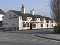
 The General Elliot pub, Croft - geograph.org.uk - 3354965.jpg 640 × 480; 55 KB
-
 The General Elliot Public House - Croft - geograph.org.uk - 2662705.jpg 4,000 × 3,000; 4.85 MB
-
 The General Elliot, Croft - geograph.org.uk - 2864748.jpg 640 × 480; 385 KB
-
 The Horse Shoe - geograph.org.uk - 1817188.jpg 1,024 × 683; 164 KB
-
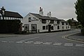
 The Horse Shoe, Croft - geograph.org.uk - 2864718.jpg 640 × 480; 398 KB
-
 The Horse Shoe, Croft - geograph.org.uk - 29476.jpg 640 × 426; 102 KB
-
 The junction of Dam Lane and Smithy Lane - geograph.org.uk - 2782838.jpg 3,533 × 2,909; 6.73 MB
-
 The M6 runs under the Winwick Interchange - geograph.org.uk - 5079819.jpg 1,500 × 999; 110 KB
-
 The M62 East of Junction 11 - geograph.org.uk - 2860589.jpg 4,412 × 2,219; 4.74 MB
-
 The M62 junction on the M6 heading southbound - geograph.org.uk - 5079832.jpg 1,500 × 999; 122 KB
-
 The morning queue - geograph.org.uk - 2291068.jpg 640 × 379; 50 KB
-
 The Old Stocks - geograph.org.uk - 6059099.jpg 1,600 × 1,202; 711 KB
-
 The Plough - geograph.org.uk - 2864757.jpg 640 × 480; 402 KB
-
 The Plough pub, New Lane End - geograph.org.uk - 3354981.jpg 640 × 480; 52 KB
-
 The Plough, at Junction of Stone Pit Lane & Kenyon Lane - geograph.org.uk - 6345069.jpg 2,784 × 1,568; 2.04 MB
-
 The Spur to Southworth Hall Farm - geograph.org.uk - 2662708.jpg 3,613 × 2,814; 4.1 MB
-
 Track to Bates Farm - geograph.org.uk - 5178520.jpg 6,000 × 4,000; 4.84 MB
-
 Track to Highfield Farm - geograph.org.uk - 3355095.jpg 640 × 480; 61 KB
-
 Unitarian Chapel graveyard - geograph.org.uk - 5181412.jpg 6,000 × 4,000; 5.99 MB
-
-
 Warrington Road (A574), heading south - geograph.org.uk - 3355930.jpg 1,200 × 900; 270 KB
-
-
 Western Aspect of Christ Church, Lady Lane, Croft - geograph.org.uk - 6059101.jpg 1,278 × 1,600; 470 KB
-
 Wetland near Partridge Lakes - geograph.org.uk - 5179896.jpg 6,000 × 4,000; 3.34 MB
-
 Wheel rake at rest, Kenyon - geograph.org.uk - 2945255.jpg 1,600 × 1,200; 545 KB
-
 Wigshaw across the fields - geograph.org.uk - 5179885.jpg 6,000 × 4,000; 3.91 MB
-
 Wigshaw Lane - geograph.org.uk - 2663495.jpg 640 × 480; 48 KB


_at_Croft_-_geograph.org.uk_-_2864734.jpg)


_-_geograph.org.uk_-_2062718.jpg)


,_heading_south_-_geograph.org.uk_-_3355926.jpg)
,_heading_south_-_geograph.org.uk_-_3355930.jpg)


