Category:Croatian-language SVG maps showing history
Jump to navigation
Jump to search
Media in category "Croatian-language SVG maps showing history"
The following 18 files are in this category, out of 18 total.
-
 1914 albania hr.svg 624 × 1,170; 125 KB
-
 1941-1943 Axis occupation of Yugoslavia map - hr.svg 1,613 × 1,471; 2.89 MB
-
 2001 Macedonia insurgency hr.svg 1,493 × 1,205; 152 KB
-
 AncientGreekDialects (Woodard) hr.svg 660 × 555; 1 MB
-
 Austria-Hungary map hr.svg 783 × 605; 334 KB
-
 Egypt 1450 BC hr.svg 1,300 × 1,500; 252 KB
-
 France map Lambert-93 with regions and departments-occupation-hr.svg 1,996 × 1,894; 697 KB
-
 Grandes invasions Empire romain-sh.svg 1,800 × 1,300; 236 KB
-
 Kingdom of Croatia-Slavonia counties hr.svg 733 × 398; 472 KB
-
 LithuanianHistory-hr.svg 1,525 × 1,750; 110 KB
-
 Map Europe 1923-hr.svg 726 × 493; 1.14 MB
-
 Map Europe alliances 1914-hr.svg 998 × 593; 90 KB
-
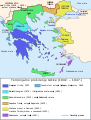 Map Greece expansion 1832-1947-hr.svg 730 × 959; 100 KB
-
 Map of Ancient Rome 271 AD hr.svg 2,050 × 1,213; 385 KB
-
 Operacija Burin.svg 480 × 650; 140 KB
-
 SonderbundWarMap-Croatian.svg 1,349 × 865; 338 KB
-
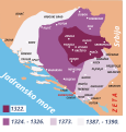 Srednjovjekovno Bosansko Kraljevstvo.svg 2,747 × 2,874; 52 KB
-
 Yom Kippur War map hr.svg 400 × 602; 45 KB


_hr.svg)


