Category:Cregneash
Jump to navigation
Jump to search
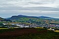
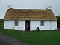
English: Cregneash or Cregneish is a remote village situated on Mull Hill in the south of the Isle of Man

village on the Isle of Man  | |||||
| Upload media | |||||
| Instance of | |||||
|---|---|---|---|---|---|
| Location | Isle of Man, Irish Sea | ||||
 | |||||
Subcategories
This category has only the following subcategory.
S
Media in category "Cregneash"
The following 187 files are in this category, out of 187 total.
-
 Bay Stacka - geograph.org.uk - 2557725.jpg 1,280 × 897; 811 KB
-
 Black Head, Isle of Man - geograph.org.uk - 210110.jpg 640 × 480; 100 KB
-
 Burroo Ned, Isle of Man - geograph.org.uk - 210096.jpg 640 × 480; 91 KB
-

-
 Bwaane-Ned-Beg-Hom-Ruy.jpg 3,264 × 2,448; 1.73 MB
-
 Calf of Man - geograph.org.uk - 2963573.jpg 2,592 × 1,728; 2.09 MB
-
 Calf of Man from Cregneash - geograph.org.uk - 784705.jpg 640 × 426; 45 KB
-
 Calf of Man over Calf Sound - geograph.org.uk - 2963580.jpg 2,592 × 1,728; 2.19 MB
-
 Calf of Man, from near Cregneash - geograph.org.uk - 789332.jpg 640 × 480; 53 KB
-
 Calf Sound - geograph.org.uk - 2385245.jpg 1,280 × 960; 616 KB
-
 Calf Sound from Spanish Head - geograph.org.uk - 2641989.jpg 640 × 427; 375 KB
-
 Church Display - geograph.org.uk - 784709.jpg 640 × 426; 89 KB
-
 Cottages at Cregneash - geograph.org.uk - 784694.jpg 640 × 426; 57 KB
-
 Cottages in Cregneash - geograph.org.uk - 1463738.jpg 597 × 640; 102 KB
-
 Cregneash - Field, village lane, Harry Kelly's Cottage - geograph.org.uk - 1717159.jpg 3,517 × 1,180; 3.88 MB
-
 Cregneash - Harry Kelly's Cottage panoramic - geograph.org.uk - 1717133.jpg 3,479 × 1,183; 2.88 MB
-
 Cregneash - House and garage near Cregneash Rd - geograph.org.uk - 1716950.jpg 3,545 × 1,187; 2.94 MB
-
 Cregneash - Ruins along village lane south of village - geograph.org.uk - 1717186.jpg 3,503 × 1,169; 3.82 MB
-
 Cregneash - The Smithy building and village lane - geograph.org.uk - 1717054.jpg 3,475 × 1,183; 3.09 MB
-
 Cregneash - View from Church Farm to the southwest - geograph.org.uk - 1717035.jpg 3,513 × 1,189; 4.68 MB
-
 Cregneash - View of hillside and The Calf of Man - geograph.org.uk - 1717193.jpg 3,520 × 1,201; 2.65 MB
-
 Cregneash - Village lane near Cregneash Road (A31) - geograph.org.uk - 1716967.jpg 3,580 × 1,201; 3.67 MB
-
 Cregneash - Village lane near Cregneash Road (A31) - geograph.org.uk - 1716994.jpg 3,524 × 1,201; 4.22 MB
-
 Cregneash - Village lane past The Weaver's House - geograph.org.uk - 1717103.jpg 3,531 × 1,189; 3.09 MB
-
 Cregneash Church - geograph.org.uk - 784710.jpg 640 × 426; 62 KB
-
 Cregneash church.jpg 1,024 × 768; 188 KB
-
 Cregneash Cottage - geograph.org.uk - 784698.jpg 640 × 426; 56 KB
-
 Cregneash Cottages 01.jpg 4,554 × 2,268; 3.9 MB
-
 Cregneash Cottages 02.jpg 4,509 × 2,225; 4.42 MB
-
 Cregneash Cottages 03.jpg 4,428 × 3,099; 5.53 MB
-
 Cregneash Cottages 04.jpg 4,583 × 2,551; 4.85 MB
-
 Cregneash Cottages 05.jpg 4,564 × 2,447; 4.15 MB
-
 Cregneash Cottages 06.jpg 4,569 × 2,949; 5.24 MB
-
 Cregneash Cottages 07.jpg 4,523 × 2,797; 6.09 MB
-
 Cregneash Cottages 08.jpg 4,583 × 2,660; 4.25 MB
-
 Cregneash Cottages 09.jpg 4,586 × 2,294; 4.75 MB
-
 Cregneash Cottages 10.jpg 4,586 × 3,070; 6.44 MB
-
 Cregneash Cottages 11.jpg 4,534 × 2,262; 4.47 MB
-
 Cregneash Cottages 12.jpg 4,564 × 2,390; 3.77 MB
-
 Cregneash Cottages 13.jpg 4,542 × 3,069; 5.51 MB
-
 Cregneash Cottages 14.jpg 4,583 × 2,835; 7.23 MB
-
 Cregneash Cottages 15.jpg 4,559 × 2,890; 7.29 MB
-
 Cregneash Cottages 16.jpg 4,582 × 3,201; 9.24 MB
-
 Cregneash Cottages 17.jpg 4,563 × 3,226; 8 MB
-
 Cregneash Cottages 18.jpg 4,574 × 3,061; 5.21 MB
-
 Cregneash Cottages 19.jpg 4,529 × 3,155; 6.96 MB
-
 Cregneash Cottages 20.jpg 4,550 × 2,893; 5.13 MB
-
 Cregneash Cottages 21.jpg 4,509 × 3,028; 4.97 MB
-
 Cregneash Cottages Loaghtan 1.jpg 4,571 × 2,546; 6.36 MB
-
 Cregneash Cottages Loaghtan 2.jpg 4,589 × 3,444; 3.12 MB
-
 Cregneash Cottages Loaghtan 3.jpg 4,465 × 3,194; 7.45 MB
-
 Cregneash Cottages Loaghtan 4.jpg 4,534 × 3,368; 5.8 MB
-
 Cregneash Cottages Loaghtan 5.jpg 4,442 × 3,238; 6.4 MB
-
 Cregneash Cottages Loaghtan 6.jpg 4,436 × 3,228; 6.54 MB
-
 Cregneash Cottages Loaghtan 7.jpg 4,442 × 3,238; 6.41 MB
-
 Cregneash Cottages Loaghtan 8.jpg 4,579 × 3,152; 7.51 MB
-
 Cregneash Cottages Loaghtan 9.jpg 4,579 × 3,022; 6.24 MB
-
 Cregneash cowshed.jpg 5,184 × 3,456; 6.62 MB
-
 Cregneash Cross, Isle of Man.jpg 2,304 × 3,072; 5.06 MB
-
 Cregneash Folk Museum 1988.jpg 1,500 × 940; 1.05 MB
-
 Cregneash HarryKellysCottage.jpg 640 × 397; 85 KB
-
 Cregneash Meayll Circle View to Port Erin 1.jpg 4,559 × 2,669; 5.83 MB
-
 Cregneash Meayll Circle View to Port Erin 2.jpg 4,499 × 2,605; 4.53 MB
-
 Cregneash Meayll Circle View to Port Erin 3.jpg 4,533 × 2,733; 3.64 MB
-
 Cregneash Meayll Circle View to Port Erin 4.jpg 4,572 × 2,826; 3.87 MB
-
 Cregneash Meayll Circle View to Port Erin 5.jpg 4,536 × 2,848; 3.96 MB
-
 Cregneash Meayll Circle View to Port Erin 6.jpg 4,542 × 3,277; 1.88 MB
-
 Cregneash Meayll Circle View to Port Erin 7.jpg 4,573 × 3,148; 6.15 MB
-
 Cregneash Meayll Circle View to Port Erin 8.jpg 4,559 × 3,335; 5.52 MB
-
 Cregneash Meayll Circle View to Port Erin 9.jpg 4,586 × 3,055; 3.95 MB
-
 Cregneash Spanish Head View to the Calf of Man 1.jpg 4,592 × 2,814; 4.73 MB
-
 Cregneash Spanish Head View to the Calf of Man 2.jpg 4,559 × 2,997; 4.91 MB
-
 Cregneash Spanish Head View to the Calf of Man 3.jpg 4,471 × 2,926; 3.97 MB
-
 Cregneash Spanish Head View to the Calf of Man 4.jpg 4,554 × 3,094; 5.1 MB
-
 Cregneash Spanish Head View to the Southeast Coast 1.jpg 4,563 × 2,506; 4.85 MB
-
 Cregneash Spanish Head View to the Southeast Coast 2.jpg 4,544 × 2,926; 4.66 MB
-
 Cregneash Spanish Head View to the Southeast Coast 3.jpg 4,564 × 3,217; 1.33 MB
-
 Cregneash Spanish Head View to the Southeast Coast 4.jpg 4,569 × 3,186; 1.36 MB
-
 Cregneash Spanish Head View to the Southeast Coast 5.jpg 4,564 × 3,410; 1.36 MB
-
 Cregneash Spanish Head View to the Southeast Coast 6.jpg 4,592 × 3,239; 1.73 MB
-
 Cregneash Spanish Head View to the Southeast Coast 7.jpg 4,544 × 2,599; 3.35 MB
-
 Cregneash The Parade Cross.jpg 4,554 × 3,040; 1.03 MB
-
 Cregneash The Parade View to the Calf of Man 1.jpg 4,572 × 2,425; 4.24 MB
-
 Cregneash The Parade View to the Calf of Man 2.jpg 4,588 × 2,409; 4.69 MB
-
 Cregneash The Parade View to the Calf of Man 3.jpg 4,559 × 2,403; 4.29 MB
-
 Cregneash The Parade View to the Calf of Man 4.jpg 4,533 × 2,886; 4.26 MB
-
 Cregneash The Parade View to the Calf of Man 5.jpg 4,589 × 3,196; 1.36 MB
-
 Cregneash The Parade View to the Calf of Man 6.jpg 4,514 × 3,184; 1.23 MB
-
 Cregneash The Parade View to the Calf of Man 7.jpg 4,523 × 3,301; 1.11 MB
-
 Cregneash The Parade View to the Calf of Man 8.jpg 4,571 × 2,881; 3.79 MB
-
 Cregneash View to Port St Mary 1.jpg 4,553 × 2,308; 5.07 MB
-
 Cregneash View to Port St Mary 2.jpg 4,582 × 2,663; 4.68 MB
-
 Cregneash View to the Calf of Man.jpg 4,529 × 2,746; 4.14 MB
-
 Cregneash Village - Building southeast of The Smithy - geograph.org.uk - 1692072.jpg 2,862 × 1,908; 4.31 MB
-
 Cregneash Village - Church Farm field - geograph.org.uk - 1690711.jpg 1,536 × 1,024; 1.88 MB
-
 Cregneash Village - Church Farm haystacks - geograph.org.uk - 1690710.jpg 1,720 × 1,147; 2.35 MB
-
 Cregneash Village - Church Farm House - geograph.org.uk - 1690706.jpg 1,732 × 1,155; 1.02 MB
-
 Cregneash Village - Church Farm House interior - geograph.org.uk - 1690707.jpg 1,721 × 1,147; 1.61 MB
-

-
 Cregneash Village - Church Farm thatched building - geograph.org.uk - 1690709.jpg 1,754 × 1,169; 1.96 MB
-
 Cregneash Village - Cregneash Museum garden - geograph.org.uk - 1692206.jpg 1,661 × 1,107; 2.18 MB
-
 Cregneash Village - Field and lane - geograph.org.uk - 1692185.jpg 1,630 × 1,087; 1.92 MB
-

-
 Cregneash Village - Gate, field, thatched cottage - geograph.org.uk - 1692171.jpg 1,608 × 1,072; 1.68 MB
-
 Cregneash village - geograph.org.uk - 784419.jpg 640 × 480; 140 KB
-
 Cregneash village - geograph.org.uk - 789320.jpg 640 × 438; 99 KB
-
 Cregneash Village - Green telephone booth - geograph.org.uk - 1691991.jpg 2,196 × 3,294; 3.13 MB
-
 Cregneash Village - Lane and thatched building - geograph.org.uk - 1692150.jpg 3,189 × 2,126; 5.79 MB
-
 Cregneash Village - Lane, thatched cottage, Museum - geograph.org.uk - 1692101.jpg 1,589 × 1,059; 1.43 MB
-
 Cregneash Village - Private residence off A31 - geograph.org.uk - 1690688.jpg 3,405 × 2,270; 4.32 MB
-
 Cregneash Village - Private residence off A31 - geograph.org.uk - 1690689.jpg 1,587 × 1,058; 1.42 MB
-

-
 Cregneash Village - Thatched cottage residence - geograph.org.uk - 1692118.jpg 1,528 × 1,019; 1.09 MB
-
 Cregneash Village - Thatched cottage residence - geograph.org.uk - 1692129.jpg 1,447 × 965; 1.1 MB
-
 Cregneash Village - The Museum (Cummel Beg) - geograph.org.uk - 1692201.jpg 1,587 × 1,058; 1.48 MB
-
 Cregneash Village - The Smithy (Blacksmith) building - geograph.org.uk - 1692018.jpg 1,744 × 955; 1.77 MB
-
-
 Cregneash Village - The Smithy taking a break - geograph.org.uk - 1692050.jpg 1,077 × 1,616; 1.45 MB
-
 Cregneash Village - Village lane and building off A31 - geograph.org.uk - 1690696.jpg 3,482 × 2,321; 7.21 MB
-

-
 Cregneash Village - Village lane and buildings off A31 - geograph.org.uk - 1690700.jpg 3,460 × 2,306; 5.8 MB
-
 Cregneash Village - Village lane and buildings off A31 - geograph.org.uk - 1690702.jpg 1,738 × 1,158; 2.02 MB
-
 Cregneash Village - Village lane and buildings off A31 - geograph.org.uk - 1690703.jpg 1,746 × 1,164; 2.22 MB
-
 Cregneash Village - Village lane off A31 - geograph.org.uk - 1690690.jpg 3,485 × 2,323; 5.46 MB
-
 Cregneash Village - Village lane off A31 - geograph.org.uk - 1690693.jpg 3,498 × 2,331; 6.25 MB
-
 Cregneash Village - Village lane, wall, and Fuscia - geograph.org.uk - 1690705.jpg 1,650 × 1,100; 1.71 MB
-
 Cregneash Village - Village Sign - geograph.org.uk - 1690687.jpg 2,145 × 1,958; 1.35 MB
-

-
 Cregneash, Isle of man.JPG 3,888 × 2,592; 2.98 MB
-
 End of the ploughing session - geograph.org.uk - 1030088.jpg 640 × 429; 62 KB
-

-
 Hut circle at The Chasms - geograph.org.uk - 786819.jpg 640 × 480; 164 KB
-
 Isle of Man - panoramio (70).jpg 4,176 × 2,784; 4.72 MB
-
 Isle of man, Cregneash.JPG 3,888 × 2,592; 2.3 MB
-
 Joiners workshop at Cregneash - geograph.org.uk - 1424971.jpg 640 × 480; 76 KB
-
 Kione ny Garee - geograph.org.uk - 2385599.jpg 1,280 × 960; 581 KB
-
 Kione ny Garee - geograph.org.uk - 2385604.jpg 1,280 × 960; 598 KB
-
 Loaghtan sheep, Cregneash .jpg 2,180 × 3,854; 8.32 MB
-
 Manx loghtan lamb, Cregneash Isle of Man - geograph.org.uk - 442070.jpg 640 × 480; 119 KB
-
 Mushrooms of Spanish Head - geograph.org.uk - 1071503.jpg 640 × 393; 161 KB
-
 Old Breakwater, Port Erin Bay - geograph.org.uk - 2385572.jpg 1,280 × 960; 661 KB
-

-
 Port Erin Bradda Head Milner's Tower View to the Southwestern Coast 1.jpg 4,503 × 2,417; 3.98 MB
-
 Port Erin Bradda Head Milner's Tower View to the Southwestern Coast 2.jpg 4,583 × 3,306; 5.5 MB
-
 Port Erin Bradda Head Milner's Tower View to the Southwestern Coast 3.jpg 4,592 × 3,157; 5.31 MB
-
 Post Box at Cregneash - geograph.org.uk - 991992.jpg 426 × 640; 87 KB
-
 Rust Red and Fuchsia Red - geograph.org.uk - 1463678.jpg 640 × 329; 123 KB
-
 Rustic roof in Cregneash - geograph.org.uk - 1463804.jpg 640 × 427; 122 KB
-
 Several buildings at Cregneash - geograph.org.uk - 784696.jpg 640 × 426; 58 KB
-
 Shark^ - geograph.org.uk - 1308.jpg 640 × 469; 121 KB
-
 Site of building at former radar station, Mull Hill.jpg 4,128 × 2,322; 4.64 MB
-
 Straw Rope - geograph.org.uk - 1401309.jpg 640 × 480; 69 KB
-

-
 Thatched Cottage at Craigneash - geograph.org.uk - 747251.jpg 640 × 426; 58 KB
-
 The Chasms - geograph.org.uk - 786832.jpg 640 × 480; 147 KB
-
-

-

-
 The Joiners Workshop at Cregneash - geograph.org.uk - 1421311.jpg 640 × 480; 81 KB
-
 The Restaurant at The Sound - geograph.org.uk - 1422156.jpg 640 × 480; 64 KB
-
 The Sugarloaf and Bay Stacka - geograph.org.uk - 796488.jpg 480 × 640; 84 KB
-

-

-

-
 View to the South from Cregneash - geograph.org.uk - 784701.jpg 640 × 426; 52 KB
-

-
 Village of Cregneash - geograph.org.uk - 784703.jpg 640 × 426; 62 KB
-
 Wild plants at Cregneash - geograph.org.uk - 784707.jpg 426 × 640; 112 KB
-
 WWII gun post, Mull Hill.jpg 3,868 × 2,053; 7.56 MB
-
 WWII Pillbox on Mull Hill - geograph.org.uk - 1317333.jpg 640 × 480; 61 KB
-
 Young and Old - geograph.org.uk - 1463201.jpg 575 × 640; 166 KB
-
 A31 beyond Cregneash - geograph.org.uk - 763942.jpg 640 × 480; 77 KB
-
 A31, Sound Road - geograph.org.uk - 789313.jpg 640 × 480; 69 KB
-
 Aldrick - geograph.org.uk - 23998.jpg 640 × 427; 122 KB
-
 Aldrick, looking towards Bradda Head - geograph.org.uk - 796464.jpg 480 × 640; 76 KB
-
 Baie ny Briechyn, Isle of Man - geograph.org.uk - 210099.jpg 640 × 480; 72 KB
-
 Beacon above Cregneash - geograph.org.uk - 1426669.jpg 640 × 480; 34 KB
-

-
 Cregneash Thatched Cottage - geograph.org.uk - 458840.jpg 640 × 480; 72 KB
-
 Harry Kelly's Cottage - geograph.org.uk - 1401320.jpg 640 × 480; 67 KB
-
 Harvest Time - geograph.org.uk - 4857.jpg 450 × 640; 114 KB
-
 Kitterland - geograph.org.uk - 96223.jpg 640 × 480; 68 KB
-

-

-

-
 The cliffs of Spanish Head - geograph.org.uk - 1306.jpg 480 × 640; 127 KB
-
 The Sound, Isle of Man - geograph.org.uk - 386358.jpg 640 × 480; 84 KB


_2009_Volvo_B9TL_Wright_Eclipse_Gemini_2,_Cregneash,_route_1,_25_February_2010.jpg)


_-_geograph.org.uk_-_1692201.jpg)
_building_-_geograph.org.uk_-_1692018.jpg)
_building_-_geograph.org.uk_-_1692040.jpg)


.jpg)


_-_geograph.org.uk_-_1716967.jpg)
_-_geograph.org.uk_-_1716994.jpg)