Category:Crawleyside
Jump to navigation
Jump to search
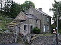
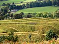
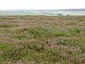
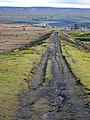
English: Crawleyside is a village in County Durham, in England. It is situated to the north of Stanhope, in Weardale.
village in United Kingdom  | |||||
| Upload media | |||||
| Instance of | |||||
|---|---|---|---|---|---|
| Location | Stanhope, County Durham, North East England, England | ||||
 | |||||
Media in category "Crawleyside"
The following 70 files are in this category, out of 70 total.
-

-
 Conifers at Crawleyside - geograph.org.uk - 3827464.jpg 1,500 × 888; 1.1 MB
-
 Crawley Side - geograph.org.uk - 2837728.jpg 640 × 480; 96 KB
-
 Crawleyside - geograph.org.uk - 3075068.jpg 640 × 480; 108 KB
-
 Crawleyside - geograph.org.uk - 3851353.jpg 4,320 × 3,240; 3.71 MB
-
 Crawleyside - geograph.org.uk - 549784.jpg 640 × 480; 105 KB
-
 Crawleyside Bank - geograph.org.uk - 3181394.jpg 640 × 480; 105 KB
-
 Crawleyside Bank - geograph.org.uk - 3181403.jpg 640 × 480; 78 KB
-
 Crawleyside, B6278 - geograph.org.uk - 2959459.jpg 1,024 × 768; 134 KB
-
 Crawleyside, County Durham.jpg 640 × 480; 80 KB
-
 Crawleyside, railway carriage - geograph.org.uk - 2959591.jpg 1,024 × 768; 198 KB
-
 Disused quarry at Crawleyside - geograph.org.uk - 1520069.jpg 640 × 480; 125 KB
-

-
 Disused railway approaching Park Head - geograph.org.uk - 297613.jpg 640 × 480; 88 KB
-

-
 Grouse butts on Black Hill - geograph.org.uk - 524884.jpg 640 × 480; 116 KB
-
 Grouse butts on Horseshoe Plain - geograph.org.uk - 513765.jpg 640 × 480; 79 KB
-
 Horseshoe Plain - geograph.org.uk - 525769.jpg 640 × 480; 99 KB
-
 Moorland north of Black Hill - geograph.org.uk - 524688.jpg 640 × 480; 117 KB
-
 Moorland northwest of Black Hill - geograph.org.uk - 524714.jpg 640 × 480; 85 KB
-
 Mystery Item - geograph.org.uk - 549866.jpg 640 × 480; 139 KB
-
 Noble rams at Crawleyside - geograph.org.uk - 1520096.jpg 640 × 414; 102 KB
-
 Old limestone quarry at Crawleyside - geograph.org.uk - 348696.jpg 640 × 480; 75 KB
-
 Old limestone quarry at Crawleyside - geograph.org.uk - 348697.jpg 640 × 480; 76 KB
-
 Railway track - geograph.org.uk - 665713.jpg 640 × 388; 290 KB
-
 Ruined buildings, Crawleyside - geograph.org.uk - 3181421.jpg 640 × 480; 121 KB
-
 Sign at Parkhead Station - geograph.org.uk - 297621.jpg 640 × 480; 75 KB
-
 The Weardale Railway - geograph.org.uk - 665726.jpg 640 × 427; 435 KB
-
 Weatherhill Engine House - geograph.org.uk - 297596.jpg 640 × 480; 92 KB
-
 Weatherhill Incline - geograph.org.uk - 348791.jpg 640 × 480; 68 KB
-
 Weatherhill Incline - geograph.org.uk - 348800.jpg 480 × 640; 74 KB
-

-
 Black grouse butt on Feldon Plain - geograph.org.uk - 524597.jpg 640 × 480; 101 KB
-
 Black Hill - geograph.org.uk - 524671.jpg 640 × 480; 95 KB
-
 Communication Mast - geograph.org.uk - 536756.jpg 480 × 640; 21 KB
-
 Crawleyside - geograph.org.uk - 501413.jpg 480 × 640; 119 KB
-
 Dead Friars - geograph.org.uk - 536762.jpg 640 × 382; 49 KB
-
 Edmondbyers Common (2) - geograph.org.uk - 520936.jpg 640 × 480; 86 KB
-
 Edmondbyers Common (2) - geograph.org.uk - 520942.jpg 640 × 480; 103 KB
-
 Edmondbyers Common (3) - geograph.org.uk - 520945.jpg 640 × 480; 103 KB
-
 Edmondbyers Common (4) - geograph.org.uk - 520947.jpg 640 × 480; 110 KB
-
 Edmondbyers Common - geograph.org.uk - 513745.jpg 640 × 480; 113 KB
-
 Edmondbyers Common - geograph.org.uk - 536733.jpg 640 × 480; 77 KB
-
 Edmondbyers Common - geograph.org.uk - 536788.jpg 640 × 385; 45 KB
-
 Edmondbyers Common - geograph.org.uk - 536792.jpg 640 × 480; 78 KB
-
 Footpath to Sikehead - geograph.org.uk - 520952.jpg 640 × 480; 84 KB
-
 Grouse butts below Horseshoe Hill - geograph.org.uk - 525825.jpg 640 × 480; 92 KB
-
 Grouse butts on Feldon Plain - geograph.org.uk - 513760.jpg 640 × 480; 90 KB
-
 Haygarth's Flat - geograph.org.uk - 524867.jpg 640 × 480; 110 KB
-
 Haygarth's Flat - geograph.org.uk - 524870.jpg 640 × 480; 114 KB
-
 Heatherburning - geograph.org.uk - 494867.jpg 640 × 413; 77 KB
-
 Horseshoe Hill - geograph.org.uk - 536748.jpg 640 × 480; 59 KB
-
 Horseshoe Plain - geograph.org.uk - 536778.jpg 640 × 458; 83 KB
-
 Lanehead Quarry - geograph.org.uk - 494855.jpg 480 × 640; 166 KB
-
 Lough near Black Hill - geograph.org.uk - 524644.jpg 640 × 480; 102 KB
-
 Millstone Quarry, Crawleyside - geograph.org.uk - 297601.jpg 640 × 480; 82 KB
-
 Millstone Quarry, Crawleyside - geograph.org.uk - 297603.jpg 640 × 480; 93 KB
-
 Moorland above the Eudon Burn - geograph.org.uk - 524877.jpg 640 × 480; 109 KB
-
 Moorland east of Black Hill - geograph.org.uk - 524702.jpg 640 × 480; 113 KB
-
 Moorland track above Crawleyside - geograph.org.uk - 348701.jpg 640 × 480; 57 KB
-
 More moorland above the Eudon Burn - geograph.org.uk - 524880.jpg 640 × 480; 114 KB
-

-
 Parkhead - geograph.org.uk - 550282.jpg 640 × 480; 91 KB
-
 Rookhope Railway - geograph.org.uk - 537281.jpg 480 × 640; 71 KB
-
 Spongy ground west of Black Hill - geograph.org.uk - 524882.jpg 640 × 480; 139 KB
-
 Stanhope Burn - geograph.org.uk - 520533.jpg 640 × 480; 126 KB
-
 Stanhope Burn - geograph.org.uk - 587840.jpg 640 × 480; 115 KB
-
 Stanhope Common - geograph.org.uk - 536785.jpg 640 × 480; 116 KB
-
 Stanhopeburn Mine (disused) - geograph.org.uk - 494861.jpg 640 × 426; 101 KB
-
 The B6278 - geograph.org.uk - 550287.jpg 640 × 281; 51 KB


_-_geograph.org.uk_-_520936.jpg)
_-_geograph.org.uk_-_520942.jpg)
_-_geograph.org.uk_-_520945.jpg)
_-_geograph.org.uk_-_520947.jpg)


_-_geograph.org.uk_-_494861.jpg)
