Category:Coychurch
Jump to navigation
Jump to search
village in Bridgend, Wales, UK  | |||||
| Upload media | |||||
| Instance of | |||||
|---|---|---|---|---|---|
| Location | Bridgend County Borough, Wales | ||||
 | |||||
Cymraeg: Pentref bach rhwng Pencoed a Phen-y-Bont ym mwrdeistref sirol Pen-y-bont ar Ogwr yw Llangrallo (Saesneg: Coychurch).
English: Coychurch is a small village that sits between Pencoed and Bridgend in Wales, bordering with Bridgend Industrial Estate.
Subcategories
This category has only the following subcategory.
S
- St Crallo's Church, Coychurch (11 F)
Media in category "Coychurch"
The following 19 files are in this category, out of 19 total.
-

-
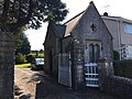 Brynffryd, Gatehouse, Coychurch.jpg 4,032 × 3,024; 3.25 MB
-
 Coed-y-Mwstwr Clubhouse - geograph.org.uk - 5111931.jpg 3,264 × 2,448; 1.33 MB
-
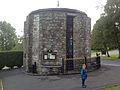 Coychurch Crematorium, Chapel of Remembrance.JPG 2,592 × 1,936; 1.8 MB
-
 Coychurch-Llangrallo Primary School - geograph.org.uk - 1089485.jpg 640 × 538; 63 KB
-
 Mid Glamorgan Crematorium - geograph.org.uk - 371572.jpg 640 × 480; 75 KB
-
 Mid Glamorgan Crematorium - geograph.org.uk - 371580.jpg 640 × 480; 109 KB
-
 St. Mary's View, Coychurch - geograph.org.uk - 1144276.jpg 640 × 480; 170 KB
-
 The Prince of Wales, Coychurch - geograph.org.uk - 1144306.jpg 640 × 480; 168 KB
-
 The White Horse, Coychurch - geograph.org.uk - 1144302.jpg 640 × 480; 170 KB
-
 Waterton Industrial Estate - geograph.org.uk - 342146.jpg 640 × 367; 87 KB
-
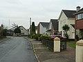
 Waterton Village - geograph.org.uk - 339668.jpg 640 × 443; 165 KB
-
 A473 Towards Coychurch - geograph.org.uk - 339654.jpg 640 × 350; 99 KB
-
 Brackla Roundabout - geograph.org.uk - 339049.jpg 640 × 412; 125 KB
-
 Bridgend Industrial Estate - geograph.org.uk - 339094.jpg 640 × 391; 101 KB
-
 Coedymwstwr - geograph.org.uk - 15860.jpg 640 × 425; 166 KB
-
 Coychurch Common - geograph.org.uk - 339080.jpg 640 × 434; 167 KB
-
 Main Road Coychurch - geograph.org.uk - 339658.jpg 640 × 420; 130 KB
-
 Towards Coed-y-Mwstwr - geograph.org.uk - 339066.jpg 640 × 375; 107 KB


