Category:Covington, South Lanarkshire (civil parish)
Jump to navigation
Jump to search
Scottish parish in South Lanarkshire, Scotland, UK | |||||
| Upload media | |||||
| Instance of | |||||
|---|---|---|---|---|---|
| Part of |
| ||||
| Named after |
| ||||
| Location |
| ||||
| Population |
| ||||
| Area |
| ||||
 | |||||
Media in category "Covington, South Lanarkshire (civil parish)"
The following 200 files are in this category, out of 271 total.
(previous page) (next page)-
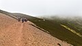
 A damp section of path - geograph.org.uk - 5551216.jpg 1,469 × 1,102; 549 KB
-
 A tributary of the Spittle Burn - geograph.org.uk - 5878086.jpg 1,024 × 768; 179 KB
-
 A72 heading in a northerly direction - geograph.org.uk - 3680044.jpg 640 × 480; 59 KB
-
 Above the Kirk Burn - geograph.org.uk - 3144992.jpg 640 × 480; 100 KB
-
 An Ordnance Survey Fundamental Bench Mark - geograph.org.uk - 4261398.jpg 4,000 × 3,000; 5.1 MB
-
 Arable fields near Thankerton - geograph.org.uk - 1869968.jpg 640 × 480; 113 KB
-

-
 Barley field at Covington - geograph.org.uk - 3615289.jpg 1,024 × 768; 153 KB
-
 Barley fields near Thankerton - geograph.org.uk - 4517465.jpg 4,608 × 3,456; 4.56 MB
-
 Bath in a field - geograph.org.uk - 1207512.jpg 640 × 411; 74 KB
-
 Black Mount - geograph.org.uk - 2735637.jpg 640 × 360; 197 KB
-
 Boat Farm at Thankerton - geograph.org.uk - 4191587.jpg 4,000 × 3,000; 2.77 MB
-
 Boat Road, Thankerton - geograph.org.uk - 4713419.jpg 1,024 × 640; 95 KB
-
 Boat Road, Thankerton - geograph.org.uk - 6212282.jpg 1,600 × 1,060; 291 KB
-
 By Maurice's Cleuch - geograph.org.uk - 5742065.jpg 1,163 × 1,600; 664 KB
-
 Cairn - geograph.org.uk - 5758656.jpg 640 × 360; 75 KB
-
 Cairn on Totherin Hill - geograph.org.uk - 3779762.jpg 4,384 × 3,288; 4.64 MB
-
 Cairn on Totherin Hill, Tinto - geograph.org.uk - 4022414.jpg 1,024 × 678; 177 KB
-
 Cairn, Totherin Hill - geograph.org.uk - 2734374.jpg 640 × 360; 243 KB
-
 Carmichael Visitor Centre - geograph.org.uk - 2906782.jpg 640 × 360; 227 KB
-
 Cattle below Totherin Hill - geograph.org.uk - 3143241.jpg 640 × 480; 98 KB
-
 Cattle grazing on heather, Thankerton Moor - geograph.org.uk - 5603691.jpg 4,606 × 3,071; 2.47 MB
-
 Cattle near Wellbrae - geograph.org.uk - 6212679.jpg 1,600 × 1,060; 420 KB
-
 Chester Hill from the air - geograph.org.uk - 5669633.jpg 640 × 480; 156 KB
-
 Chester Hill from the air - geograph.org.uk - 5669638.jpg 640 × 480; 150 KB
-
 Cleuch Burn - geograph.org.uk - 4393086.jpg 800 × 533; 222 KB
-
 Climbing Tinto - geograph.org.uk - 4022404.jpg 887 × 1,024; 306 KB
-
 Clyde in flood from Boat Bridge - geograph.org.uk - 2292859.jpg 2,048 × 1,536; 1.35 MB
-
 Clyde, Quothquan - geograph.org.uk - 1181260.jpg 640 × 480; 88 KB
-
 Coming off Totherin Hill - geograph.org.uk - 3144886.jpg 640 × 480; 99 KB
-
 Covington - geograph.org.uk - 1207500.jpg 640 × 480; 112 KB
-
 Covington - geograph.org.uk - 3956625.jpg 640 × 376; 99 KB
-
 Covington - geograph.org.uk - 3956628.jpg 640 × 339; 84 KB
-
 Covington Doocot and Tower - geograph.org.uk - 6212485.jpg 1,600 × 1,060; 712 KB
-
 Covington from the air - geograph.org.uk - 4588682.jpg 640 × 480; 117 KB
-
 Covington from the air - geograph.org.uk - 4588683.jpg 640 × 480; 114 KB
-
 Covington Kirk - geograph.org.uk - 3684526.jpg 640 × 480; 81 KB
-
 Covington Mains and Tinto - geograph.org.uk - 6212497.jpg 1,600 × 1,060; 432 KB
-
 Covington Smiddy - geograph.org.uk - 6212367.jpg 1,600 × 1,060; 398 KB
-
 Covington Tower - geograph.org.uk - 1207504.jpg 640 × 480; 118 KB
-
 Covington Tower - geograph.org.uk - 3684509.jpg 640 × 480; 62 KB
-
 Covington Tower - geograph.org.uk - 3956631.jpg 640 × 359; 65 KB
-
 Covington Tower - geograph.org.uk - 3956634.jpg 640 × 351; 78 KB
-
 Covington Tower - geograph.org.uk - 3956635.jpg 640 × 382; 93 KB
-
 Covington Tower - geograph.org.uk - 4904208.jpg 640 × 396; 104 KB
-
 Covington Tower - geograph.org.uk - 5967443.jpg 1,024 × 768; 220 KB
-
 Covington Tower - geograph.org.uk - 5967447.jpg 1,024 × 768; 194 KB
-
 Covington Tower - geograph.org.uk - 6212475.jpg 1,600 × 1,060; 436 KB
-
 Covington Tower and doocot - geograph.org.uk - 1207497.jpg 640 × 480; 139 KB
-
 Covington Tower and Quothquan Law - geograph.org.uk - 6212675.jpg 1,600 × 1,112; 242 KB
-
 Decorative burn on Scaut Hill - geograph.org.uk - 2385680.jpg 640 × 480; 59 KB
-

-
 Descending Tinto - geograph.org.uk - 4435932.jpg 1,024 × 682; 199 KB
-
 Dovecote at Covington - geograph.org.uk - 5967451.jpg 1,024 × 768; 213 KB
-
 Early morning mist on the River Clyde - geograph.org.uk - 5303228.jpg 1,600 × 1,200; 209 KB
-
 Electricity Transmission Lines - geograph.org.uk - 5758684.jpg 640 × 427; 90 KB
-
 Entrance to Meadow Mains, Covington - geograph.org.uk - 4070062.jpg 640 × 464; 96 KB
-
 Equipment - geograph.org.uk - 5758644.jpg 640 × 427; 102 KB
-
 Fallburn - geograph.org.uk - 1731411.jpg 2,848 × 2,136; 1.62 MB
-
 Farm buildings and shop, Warrenhill - geograph.org.uk - 4435942.jpg 1,024 × 682; 141 KB
-
 Farm buildings at Heatheryhall - geograph.org.uk - 5968226.jpg 1,024 × 768; 157 KB
-
 Farm road, Hillhead - geograph.org.uk - 1181238.jpg 640 × 480; 95 KB
-
 Farm track at Covington - geograph.org.uk - 5967455.jpg 1,024 × 768; 187 KB
-
 Farmland at Covington - geograph.org.uk - 5967444.jpg 1,024 × 768; 234 KB
-
 Farmlands at Muirhouse - geograph.org.uk - 3676376.jpg 640 × 480; 81 KB
-
 Fence on Tinto - geograph.org.uk - 3359846.jpg 640 × 360; 54 KB
-
 Fence-lined minor road between Fallburn and Woodend - geograph.org.uk - 6204606.jpg 4,000 × 3,000; 2.94 MB
-

-
 Field entrance below Chester Hill - geograph.org.uk - 5878166.jpg 1,024 × 768; 313 KB
-
 Field of barley - geograph.org.uk - 5968219.jpg 1,024 × 768; 233 KB
-
 Field track, Hillhead - geograph.org.uk - 6212503.jpg 1,600 × 1,060; 419 KB
-
 Fields near Heatheryhall - geograph.org.uk - 5968288.jpg 1,024 × 768; 199 KB
-
 Fields near Thankerton - geograph.org.uk - 4846998.jpg 1,024 × 682; 176 KB
-
 Fields near Thankerton - geograph.org.uk - 6245805.jpg 1,600 × 1,065; 375 KB
-
 Flooded field by Thankerton - geograph.org.uk - 2734510.jpg 640 × 360; 172 KB
-
 Footpath to the carpark - geograph.org.uk - 5877973.jpg 1,024 × 768; 168 KB
-
 Former creamery, Thankerton - geograph.org.uk - 6213226.jpg 1,600 × 1,060; 322 KB
-
 Former Moat at Covington Tower - geograph.org.uk - 4904216.jpg 640 × 403; 104 KB
-
 Former pond at Heatheryhall - geograph.org.uk - 5877893.jpg 1,024 × 768; 237 KB
-
 Former schools, Newtown of Covington - geograph.org.uk - 6212373.jpg 1,600 × 1,060; 390 KB
-
 From St John's - geograph.org.uk - 858404.jpg 640 × 480; 110 KB
-
 Gap in the dyke - geograph.org.uk - 3779779.jpg 4,608 × 3,456; 5.75 MB
-
 Gate and fence just below the hillfort - geograph.org.uk - 5550222.jpg 1,469 × 1,102; 597 KB
-
 Gate on the Tinto path - geograph.org.uk - 4136080.jpg 640 × 480; 90 KB
-
 Glade Burn, Thankerton - geograph.org.uk - 1207518.jpg 640 × 480; 78 KB
-
 Glasshouses at Bonnet Knowe Nursery - geograph.org.uk - 3684530.jpg 640 × 350; 30 KB
-
 Going Round The Bend - geograph.org.uk - 1536862.jpg 640 × 480; 75 KB
-
 Grass field and houses on Perryflats Road - geograph.org.uk - 5876303.jpg 1,024 × 768; 182 KB
-
 Grassland, Hillhead - geograph.org.uk - 1181241.jpg 640 × 359; 63 KB
-
 Grassland, Muirhouse - geograph.org.uk - 1209323.jpg 640 × 480; 77 KB
-
 Grazing cattle at Sherifflatts - geograph.org.uk - 1305818.jpg 640 × 379; 144 KB
-
 Harvest time^ - geograph.org.uk - 5927007.jpg 1,024 × 576; 190 KB
-
 Heading up the Tinto Hill path - geograph.org.uk - 4136098.jpg 640 × 480; 102 KB
-
 Heather cutting on Scaut Hill - geograph.org.uk - 3779794.jpg 640 × 348; 29 KB
-
 Heather moorland on the NW side of Tinto - geograph.org.uk - 5551212.jpg 1,469 × 1,102; 685 KB
-
 Heather uplands on the NE flank of Tinto - geograph.org.uk - 5551218.jpg 1,469 × 1,102; 577 KB
-
 Hill fort, Tinto - geograph.org.uk - 4022343.jpg 1,024 × 678; 233 KB
-
 Hillhead - geograph.org.uk - 2067461.jpg 640 × 480; 51 KB
-
 Hillside and path a little way below the summit of Tinto - geograph.org.uk - 5551217.jpg 1,559 × 1,169; 731 KB
-
 Hilltop trees, Hillhead - geograph.org.uk - 1188516.jpg 640 × 480; 76 KB
-
 House at St John's Kirk - geograph.org.uk - 3143252.jpg 640 × 480; 78 KB
-
 In the mists of South Lanarkshire - geograph.org.uk - 3684523.jpg 640 × 480; 20 KB
-
 Information board, Tinto hill path - geograph.org.uk - 4022337.jpg 1,024 × 678; 217 KB
-
 Iron age fort on Tinto Hill - geograph.org.uk - 3060951.jpg 640 × 481; 87 KB
-
 Iron age fort on Tinto Hill - geograph.org.uk - 3061003.jpg 640 × 481; 86 KB
-

-
 Leaving Thankerton behind. - geograph.org.uk - 805335.jpg 640 × 480; 76 KB
-
 Lodge at Eastend - geograph.org.uk - 1059089.jpg 640 × 480; 75 KB
-
 Lodge house - geograph.org.uk - 5878097.jpg 1,024 × 768; 186 KB
-
 Looking back on the Tinto path - geograph.org.uk - 4136096.jpg 640 × 480; 98 KB
-

-

-
 Looking towards Swaites Farm - geograph.org.uk - 924990.jpg 640 × 425; 153 KB
-
 Looking west from Quothquan law - geograph.org.uk - 1481515.jpg 640 × 480; 95 KB
-
 Main line and Tinto - geograph.org.uk - 6212669.jpg 1,600 × 1,060; 490 KB
-
 Maurice's Cleuch - geograph.org.uk - 1845128.jpg 1,024 × 768; 194 KB
-
 Maurice's Cleuch - geograph.org.uk - 4136111.jpg 640 × 480; 93 KB
-
 Maurice's Cleuch - geograph.org.uk - 5758652.jpg 640 × 427; 102 KB
-
 Maurice's Cleuch, Tinto - geograph.org.uk - 4022787.jpg 1,024 × 678; 200 KB
-
 Minor road heading towards Wood End - geograph.org.uk - 6204604.jpg 4,000 × 3,000; 2.79 MB
-

-
 Monument to Donald Cargill, Covenanter - geograph.org.uk - 6212355.jpg 1,600 × 1,060; 343 KB
-
 Moor and rough pasture near Fallburn - geograph.org.uk - 1059048.jpg 640 × 480; 118 KB
-
 Moorland beneath Tinto - geograph.org.uk - 4396862.jpg 800 × 533; 197 KB
-
 Moorland beneath Tinto - geograph.org.uk - 4396867.jpg 800 × 600; 184 KB
-
 Moorland, Tinto - geograph.org.uk - 2735631.jpg 640 × 360; 270 KB
-
 Muddy track at Covington - geograph.org.uk - 5967434.jpg 1,024 × 768; 256 KB
-
 Muirhouse Farm - geograph.org.uk - 858390.jpg 640 × 480; 78 KB
-
 Nearly at Covington - geograph.org.uk - 3684497.jpg 640 × 446; 37 KB
-
 New car park for Tinto Hill - geograph.org.uk - 2385694.jpg 640 × 480; 96 KB
-
 Newtown of Covington - geograph.org.uk - 2067459.jpg 640 × 480; 70 KB
-
 Newtown of Covington - geograph.org.uk - 4395408.jpg 4,608 × 3,456; 5.65 MB
-
 Northern ramparts of Fallburn Fort - geograph.org.uk - 5878078.jpg 1,024 × 768; 265 KB
-
 Northern slopes of Tinto - geograph.org.uk - 2735642.jpg 640 × 360; 227 KB
-
 Northwards from the Tinto path - geograph.org.uk - 4022401.jpg 1,024 × 678; 255 KB
-
 NW ramparts of the Tinto hillfort - geograph.org.uk - 5550223.jpg 1,469 × 1,102; 700 KB
-
 On the path bound for Tinto - geograph.org.uk - 5742041.jpg 1,230 × 1,600; 581 KB
-
 Once There Were Glasshouses Here - geograph.org.uk - 858383.jpg 640 × 480; 95 KB
-
 Ordnance Survey Flush Bracket G461 - geograph.org.uk - 4261402.jpg 4,000 × 3,000; 5.08 MB
-
 Ordnance Survey Flush Bracket G465 - geograph.org.uk - 4261394.jpg 4,000 × 3,000; 3.83 MB
-
 Ordnance Survey Flush Bracket G554 - geograph.org.uk - 4261587.jpg 4,000 × 3,000; 2.61 MB
-
 Ordnance Survey Flush Bracket G555 - geograph.org.uk - 4261608.jpg 4,000 × 3,000; 4.04 MB
-
 Parhelion ('sun dog') in the sky above Covington - geograph.org.uk - 4410652.jpg 4,608 × 3,456; 5.48 MB
-
 Park Knowe from the southern ramparts of the hill fort - geograph.org.uk - 5550225.jpg 1,469 × 1,102; 622 KB
-
 Parking for Tinto - geograph.org.uk - 5550217.jpg 1,469 × 1,102; 599 KB
-
 Pasture beside the Spittal Burn - geograph.org.uk - 894386.jpg 640 × 480; 83 KB
-
 Pasture near St John's Kirk farm - geograph.org.uk - 3143245.jpg 640 × 480; 77 KB
-
 Pasture, Thankerton - geograph.org.uk - 1207531.jpg 640 × 480; 62 KB
-
 Path above Maurice's Cleuch - geograph.org.uk - 3779804.jpg 4,606 × 2,764; 4.89 MB
-
 Path contouring above Maurice's Cleuch - geograph.org.uk - 4022778.jpg 1,024 × 678; 275 KB
-
 Path on Tinto - geograph.org.uk - 4783923.jpg 1,500 × 844; 1.13 MB
-
 Path to Tinto Hill - geograph.org.uk - 5758687.jpg 640 × 427; 110 KB
-
 Path to Tinto Hill - geograph.org.uk - 5758698.jpg 640 × 360; 84 KB
-
 Path up Tinto - geograph.org.uk - 2734368.jpg 640 × 360; 248 KB
-
 Path up Tinto - geograph.org.uk - 2734369.jpg 640 × 360; 224 KB
-
 Path up Tinto - geograph.org.uk - 2734373.jpg 640 × 360; 223 KB
-
 Path up Tinto - geograph.org.uk - 2734375.jpg 640 × 360; 236 KB
-
 Path up Tinto - geograph.org.uk - 2735629.jpg 640 × 360; 249 KB
-
 Path up Tinto - geograph.org.uk - 3361073.jpg 640 × 360; 81 KB
-
 Path up Tinto - geograph.org.uk - 4022388.jpg 1,024 × 678; 197 KB
-
 Path up Tinto from Fallburn - geograph.org.uk - 4022350.jpg 1,024 × 678; 192 KB
-
 Pattern of heather cutting, Scaut Hill - geograph.org.uk - 3756292.jpg 4,604 × 2,762; 4.6 MB
-
 Pentland Hills above a layer of low cloud - geograph.org.uk - 3755323.jpg 4,429 × 2,132; 3.16 MB
-
 Perryflats farm and Quothquan Law - geograph.org.uk - 6213218.jpg 1,600 × 1,060; 405 KB
-
 Perryflats farm and road - geograph.org.uk - 6212698.jpg 1,600 × 1,060; 430 KB
-
 Perryflats Road - geograph.org.uk - 6213223.jpg 1,600 × 1,060; 370 KB
-
 Perryflats Road entering Thankerton - geograph.org.uk - 6204616.jpg 4,000 × 3,000; 2.62 MB
-

-
 Plaque to Robert Burns, Covington - geograph.org.uk - 6212491.jpg 1,600 × 1,060; 488 KB
-
 Pond near Park Knowe - geograph.org.uk - 4023398.jpg 1,024 × 678; 179 KB
-
 Power lines pass Tinto - geograph.org.uk - 2734367.jpg 640 × 360; 217 KB
-
 Quothquan Law - geograph.org.uk - 3684546.jpg 640 × 480; 39 KB
-
 Quothquan Law - geograph.org.uk - 3956610.jpg 640 × 317; 73 KB
-
 Railway Near Covington - geograph.org.uk - 4904218.jpg 640 × 424; 101 KB
-
 Remains of Hill Fort - geograph.org.uk - 5758680.jpg 640 × 427; 104 KB
-
 River Clyde - geograph.org.uk - 2067450.jpg 640 × 480; 80 KB
-
 River Clyde - geograph.org.uk - 3359825.jpg 640 × 360; 89 KB
-
 River Clyde at Thankerton - geograph.org.uk - 4395377.jpg 4,608 × 3,456; 5.27 MB
-
 River Clyde from Thankerton Bridge - geograph.org.uk - 4191593.jpg 4,000 × 3,000; 3.4 MB
-
 River Clyde View - geograph.org.uk - 4904189.jpg 640 × 402; 63 KB
-
 Road (A73) at St John's Kirk - geograph.org.uk - 4191549.jpg 4,000 × 3,000; 3.94 MB
-
 Road below Tinto - geograph.org.uk - 894370.jpg 640 × 480; 62 KB
-
 Road beneath Tinto - geograph.org.uk - 4396871.jpg 800 × 600; 152 KB
-
 Road down to the railway bridge - geograph.org.uk - 6212547.jpg 1,600 × 1,060; 453 KB
-
 Road east of Boat Bridge,Thankerton - geograph.org.uk - 4395353.jpg 4,608 × 3,456; 4.74 MB
-
 Road heading over Thankerton Bridge - geograph.org.uk - 3676383.jpg 640 × 480; 69 KB
-
 Road junction at Boat - geograph.org.uk - 6212284.jpg 1,600 × 1,060; 284 KB
-
 Road junction near Perryflats - geograph.org.uk - 6212703.jpg 1,600 × 1,060; 433 KB
-
 Road to Covington - geograph.org.uk - 6212375.jpg 1,600 × 1,060; 306 KB
-
 Rough grazing by the A73 - geograph.org.uk - 3145008.jpg 640 × 480; 97 KB
-
 Seat under Tinto - geograph.org.uk - 2734362.jpg 640 × 360; 236 KB
-
 Seat with a view - geograph.org.uk - 5758689.jpg 640 × 360; 78 KB
-
 September heather on the hillside - geograph.org.uk - 5550221.jpg 1,469 × 1,102; 655 KB
-
 Shadows on the snow - geograph.org.uk - 5742108.jpg 1,165 × 1,600; 296 KB
-
 Shallow rainbow near Woodend - geograph.org.uk - 5878103.jpg 1,024 × 768; 179 KB
-
 Sherifflats Road, Thankerton - geograph.org.uk - 6212275.jpg 1,600 × 1,060; 247 KB
-
 Sherrifflatts Road, Thankerton - geograph.org.uk - 4847003.jpg 1,024 × 682; 153 KB
-
 Snow on Tinto - geograph.org.uk - 5742069.jpg 1,600 × 1,176; 393 KB
-
 Snow pattern, Tinto - geograph.org.uk - 4804238.jpg 4,894 × 2,936; 4.79 MB
-
 Snow remnants on Tinto - geograph.org.uk - 5618651.jpg 4,608 × 3,456; 5.22 MB


_in_the_sky_above_Covington_-_geograph.org.uk_-_4410652.jpg)


_at_St_John%27s_Kirk_-_geograph.org.uk_-_4191549.jpg)


&filefrom=Snowy+Pines+-+geograph.org.uk+-+1632112.jpg#mw-category-media)