Category:Countryside around Amesbury
Jump to navigation
Jump to search
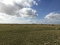
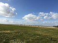
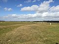
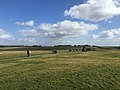
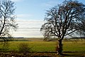
Images showing the wide open terrain of the countryside around Amesbury, including Salisbury Plain and the upper reaches of the Hampshire Avon Valley.
Media in category "Countryside around Amesbury"
The following 50 files are in this category, out of 50 total.
-
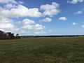
 Across the Field at West Amesbury - geograph.org.uk - 1626761.jpg 640 × 428; 69 KB
-
 Amesbury Down - geograph.org.uk - 491461.jpg 640 × 480; 144 KB
-
 Amesbury SP4, UK - panoramio (1).jpg 3,264 × 2,448; 2.45 MB
-
 Amesbury SP4, UK - panoramio (10).jpg 3,264 × 2,448; 2.46 MB
-
 Amesbury SP4, UK - panoramio (11).jpg 3,264 × 2,448; 2.73 MB
-
 Amesbury SP4, UK - panoramio (12).jpg 3,264 × 2,448; 2.64 MB
-
 Amesbury SP4, UK - panoramio (13).jpg 3,264 × 2,448; 2.21 MB
-
 Amesbury SP4, UK - panoramio (15).jpg 3,264 × 2,448; 2.66 MB
-
 Amesbury SP4, UK - panoramio (16).jpg 3,264 × 2,448; 2.51 MB
-
 Amesbury SP4, UK - panoramio (17).jpg 3,264 × 2,448; 2.43 MB
-
 Amesbury SP4, UK - panoramio (18).jpg 3,264 × 2,448; 2.37 MB
-
 Amesbury SP4, UK - panoramio (19).jpg 3,264 × 2,448; 1.88 MB
-
 Amesbury SP4, UK - panoramio (2).jpg 3,264 × 2,448; 1.75 MB
-
 Amesbury SP4, UK - panoramio (20).jpg 3,264 × 2,448; 1.19 MB
-
 Amesbury SP4, UK - panoramio (21).jpg 3,264 × 2,448; 1.96 MB
-
 Amesbury SP4, UK - panoramio (22).jpg 3,264 × 2,448; 2.2 MB
-
 Amesbury SP4, UK - panoramio (23).jpg 3,264 × 2,448; 1.2 MB
-
 Amesbury SP4, UK - panoramio (24).jpg 3,264 × 2,448; 1.94 MB
-
 Amesbury SP4, UK - panoramio (25).jpg 3,264 × 2,448; 1.66 MB
-
 Amesbury SP4, UK - panoramio (26).jpg 3,264 × 2,448; 2.02 MB
-
 Amesbury SP4, UK - panoramio (3).jpg 3,264 × 2,448; 1.59 MB
-
 Amesbury SP4, UK - panoramio (4).jpg 3,264 × 2,448; 1.89 MB
-
 Amesbury SP4, UK - panoramio (5).jpg 3,264 × 2,448; 2.11 MB
-
 Amesbury SP4, UK - panoramio (6).jpg 3,264 × 2,448; 2.11 MB
-
 Amesbury SP4, UK - panoramio (7).jpg 3,264 × 2,448; 1.51 MB
-
 Amesbury SP4, UK - panoramio (8).jpg 3,264 × 2,448; 2.16 MB
-
 Amesbury SP4, UK - panoramio (9).jpg 3,264 × 2,448; 2.19 MB
-
 Amesbury SP4, UK - panoramio.jpg 3,264 × 2,448; 1.84 MB
-
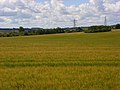 Barley near Amesbury - geograph.org.uk - 489542.jpg 640 × 480; 119 KB
-
 Barn in the fog, Normanton Down - geograph.org.uk - 1622294.jpg 640 × 480; 61 KB
-
 Bela paisagem - panoramio.jpg 800 × 534; 196 KB
-

-
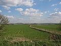
 Bridleway to West Gomeldon - geograph.org.uk - 337983.jpg 640 × 480; 164 KB
-
 Bridleway, Amesbury Down - geograph.org.uk - 491457.jpg 640 × 480; 159 KB
-
 Byway and barn, Normanton Down - geograph.org.uk - 491273.jpg 640 × 480; 161 KB
-
 Byway on Normanton Down - geograph.org.uk - 1622230.jpg 640 × 480; 65 KB
-

-
 Farmland on Salisbury Plain - geograph.org.uk - 147580.jpg 640 × 480; 83 KB
-
 Farmland, Amesbury - geograph.org.uk - 489545.jpg 640 × 480; 178 KB
-
 Farmland, Amesbury - geograph.org.uk - 489546.jpg 640 × 480; 146 KB
-
 Farmland, Amesbury - geograph.org.uk - 491450.jpg 640 × 480; 162 KB
-
 Farmland, Amesbury - geograph.org.uk - 813732.jpg 640 × 480; 132 KB
-
 Green lane near Springbottom Farm - Mowed just for us - panoramio.jpg 2,930 × 2,021; 700 KB
-
 King Barrow Ridge, Near Stonehenge - geograph.org.uk - 1626621.jpg 3,872 × 2,592; 3.05 MB
-
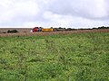 Looking toward the A303 - geograph.org.uk - 952609.jpg 640 × 480; 92 KB
-
 New King Barrows - geograph.org.uk - 135158.jpg 640 × 480; 114 KB
-
 Poppies, Amesbury - geograph.org.uk - 478983.jpg 640 × 480; 168 KB
-
 Round Barrow - geograph.org.uk - 789305.jpg 640 × 480; 47 KB
-
 View at West Amesbury - geograph.org.uk - 1626687.jpg 640 × 428; 70 KB
-
 View From King Barrow Ridge, Wiltshire - geograph.org.uk - 1626645.jpg 3,872 × 2,592; 6.02 MB


.jpg)
.jpg)
.jpg)
.jpg)
.jpg)
.jpg)
.jpg)
.jpg)
.jpg)
.jpg)
.jpg)
.jpg)
.jpg)
.jpg)
.jpg)
.jpg)
.jpg)
.jpg)
.jpg)
.jpg)
.jpg)
.jpg)
.jpg)
.jpg)
.jpg)


