Category:Country lanes in Norfolk, England
Jump to navigation
Jump to search
Media in category "Country lanes in Norfolk, England"
The following 86 files are in this category, out of 86 total.
-
 -2018-08-15 Quiet country lane in the parish of Gimingham (1).JPG 3,864 × 5,152; 5.46 MB
-
 -2018-08-15 Quiet country lane in the parish of Gimingham (2).JPG 3,864 × 5,152; 7.69 MB
-
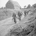 8th Royal Lincolnshire Regiment Norfolk July 1941.jpg 800 × 793; 113 KB
-
 90 degree turn on Hogg Lane - geograph.org.uk - 442242.jpg 640 × 480; 77 KB
-
 A bend in Lodge Road - geograph.org.uk - 1572624.jpg 640 × 480; 171 KB
-
 A bend in Station Road - geograph.org.uk - 1528189.jpg 640 × 480; 80 KB
-
 A blustery day in mid-October - geograph.org.uk - 1539728.jpg 640 × 538; 98 KB
-

-

-
 A dip in Ferry Road - geograph.org.uk - 1568321.jpg 640 × 480; 134 KB
-
 A dip in School Road - geograph.org.uk - 917301.jpg 480 × 640; 137 KB
-
 A dip in the road - geograph.org.uk - 919425.jpg 480 × 640; 167 KB
-
 A double bend - geograph.org.uk - 1558958.jpg 640 × 480; 81 KB
-
 A long drawn-out bend - geograph.org.uk - 930316.jpg 480 × 640; 176 KB
-
 A serpentine road - geograph.org.uk - 1267692.jpg 480 × 640; 88 KB
-
 A small lane up to Bridge 1197 - geograph.org.uk - 1525538.jpg 640 × 480; 134 KB
-
 Access road to Glen Farm - geograph.org.uk - 714989.jpg 480 × 640; 197 KB
-
 Anson's Lane - geograph.org.uk - 223639.jpg 640 × 480; 132 KB
-

-
 Ash Lane, Hargate - geograph.org.uk - 223654.jpg 640 × 480; 92 KB
-

-
 Back Lane - geograph.org.uk - 457609.jpg 640 × 480; 131 KB
-
 Barham's Lane, Bunwell - geograph.org.uk - 223706.jpg 640 × 480; 161 KB
-
 Birds Lane - geograph.org.uk - 640456.jpg 640 × 480; 66 KB
-
 Bradman Lane - geograph.org.uk - 277556.jpg 640 × 480; 99 KB
-
 Broome Church - geograph.org.uk - 729774.jpg 480 × 640; 55 KB
-
 Bud burst on Beechamwell Road - geograph.org.uk - 396033.jpg 640 × 480; 127 KB
-
 Church Lane - geograph.org.uk - 715123.jpg 480 × 640; 139 KB
-
 Church Road - geograph.org.uk - 1312807.jpg 640 × 480; 118 KB
-
 Closed Country Lane, Harford - geograph.org.uk - 709785.jpg 640 × 429; 54 KB
-
 Cobblers Lane - geograph.org.uk - 182233.jpg 640 × 480; 103 KB
-
 Country lane - geograph.org.uk - 1566500.jpg 640 × 435; 54 KB
-
 Country Lane - geograph.org.uk - 522019.jpg 640 × 480; 114 KB
-
 Country lane - geograph.org.uk - 709534.jpg 480 × 640; 105 KB
-
 Country lane by the church - geograph.org.uk - 1564981.jpg 640 × 427; 92 KB
-

-
 Country lane in North Norfolk. - geograph.org.uk - 215604.jpg 640 × 480; 83 KB
-
 Country Lane Junction - geograph.org.uk - 358077.jpg 640 × 480; 102 KB
-

-
 Country lane near Kipton Ash Farm - geograph.org.uk - 530625.jpg 640 × 480; 120 KB
-
 Country lane north of Sustead - geograph.org.uk - 714978.jpg 480 × 640; 172 KB
-

-
 Country Lane to Buxton - geograph.org.uk - 728246.jpg 640 × 463; 110 KB
-
 Country lane to Northacre - geograph.org.uk - 702031.jpg 640 × 480; 79 KB
-
 Country Road And Bridge - geograph.org.uk - 380312.jpg 640 × 480; 110 KB
-
 Crinoline Lane - geograph.org.uk - 605181.jpg 480 × 640; 89 KB
-
-
 Goose Lane - geograph.org.uk - 90866.jpg 426 × 640; 103 KB
-
 Green Lane, Pudding Norton - geograph.org.uk - 377918.jpg 640 × 480; 65 KB
-
 Hawkes Lane, Bracon Ash - geograph.org.uk - 349659.jpg 640 × 480; 97 KB
-
 Hedge-lined country lane - geograph.org.uk - 728200.jpg 640 × 480; 128 KB
-
 Here comes the rain - geograph.org.uk - 1127130.jpg 512 × 640; 130 KB
-

-
 Lane - geograph.org.uk - 347083.jpg 640 × 480; 127 KB
-
 Lane to All Saints - geograph.org.uk - 396243.jpg 640 × 480; 83 KB
-
 Leaning Post Box, Suton - geograph.org.uk - 345409.jpg 640 × 480; 124 KB
-
 Leys Lane - geograph.org.uk - 380043.jpg 640 × 480; 125 KB
-
 Looking west on Tunstead Road - geograph.org.uk - 615759.jpg 480 × 640; 55 KB
-
 Narrow country lane - geograph.org.uk - 710062.jpg 480 × 640; 157 KB
-
 Neatly trimmed hedgerows - geograph.org.uk - 615043.jpg 640 × 480; 93 KB
-
 North towards Metton - geograph.org.uk - 715244.jpg 640 × 480; 175 KB
-
 On a Fen road at Walnut Farm, Three Holes. - geograph.org.uk - 70830.jpg 557 × 640; 170 KB
-
 Peddars Way North - geograph.org.uk - 837431.jpg 480 × 640; 166 KB
-

-
 Railway bridge No 1300 - geograph.org.uk - 1278989.jpg 640 × 480; 143 KB
-
 Road and runway running parallel - geograph.org.uk - 702167.jpg 640 × 480; 141 KB
-
 This way to Metton - geograph.org.uk - 714965.jpg 480 × 640; 129 KB
-

-
 Tractor on the move - geograph.org.uk - 853235.jpg 640 × 480; 113 KB
-
 Tree-lined country lane to West End - geograph.org.uk - 710073.jpg 480 × 640; 155 KB
-
 View south along a quiet country lane - geograph.org.uk - 717028.jpg 640 × 480; 151 KB
-
 View south along the Peddars Way North - geograph.org.uk - 837421.jpg 640 × 462; 145 KB
-
 Walking the ponies to pasture - geograph.org.uk - 1254942.jpg 568 × 640; 153 KB
-
 A narrow country lane - geograph.org.uk - 1117006.jpg 640 × 480; 119 KB
-
 A narrow country lane - geograph.org.uk - 1117169.jpg 480 × 640; 130 KB
-

-
 Closed Country Lane, Harford - geograph.org.uk - 709799.jpg 640 × 480; 98 KB
-
 Country Lane - geograph.org.uk - 335805.jpg 480 × 640; 141 KB
-
 Country lane - geograph.org.uk - 686155.jpg 480 × 640; 84 KB
-

-
 Country lane from Metton to Hanworth - geograph.org.uk - 715238.jpg 480 × 640; 160 KB
-
 Country Lane in Norfolk - geograph.org.uk - 374244.jpg 640 × 480; 68 KB
-
-
 Footpath Crossing Country Lane - geograph.org.uk - 358087.jpg 640 × 480; 95 KB
-
 Milking time, Hickling - geograph.org.uk - 197405.jpg 479 × 640; 291 KB
-
 Private country lane. - geograph.org.uk - 200234.jpg 640 × 480; 104 KB
.JPG)
.JPG)


