Category:Cornbrook Metrolink station
Jump to navigation
Jump to search
Cymraeg: Mae gorsaf Metrolink Cornbrook yn orsaf Metrolink sydd wedi'i lleoli i'r gogledd o Cornbrook Road ym Manceinion.
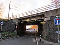
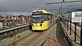
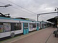
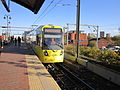
English: Cornbrook Metrolink station is located on the north side of Cornbrook Road between the A56 Chester Road dual carriageway and Pomona Docks on the Manchester Ship Canal. It is built on the former Cheshire Lines Committee approach to Manchester Central.
Manchester Metrolink tram stop  | |||||
| Upload media | |||||
| Instance of |
| ||||
|---|---|---|---|---|---|
| Location | Manchester, Greater Manchester, North West England, England | ||||
| Transport network | |||||
| Date of official opening |
| ||||
| Adjacent station |
| ||||
 | |||||
Media in category "Cornbrook Metrolink station"
The following 81 files are in this category, out of 81 total.
-
 A view from Cornbrook tram stop - geograph.org.uk - 5928505.jpg 854 × 516; 373 KB
-
 Airport Tram at Cornbrook - geograph.org.uk - 4231720.jpg 640 × 480; 257 KB
-
 Airport Tram Leaves Cornbrook - geograph.org.uk - 4231722.jpg 640 × 480; 274 KB
-
 Altrincham tram at Cornbrook - geograph.org.uk - 4995784.jpg 1,000 × 750; 647 KB
-
 Approaching Cornbrook - geograph.org.uk - 3633176.jpg 640 × 481; 355 KB
-
 Bridge at Cornbrook Metrolink station.jpg 4,320 × 3,240; 3.12 MB
-
 Cornbrook - geograph.org.uk - 1801031.jpg 2,734 × 2,051; 654 KB
-
 Cornbrook - geograph.org.uk - 1801039.jpg 2,816 × 2,112; 996 KB
-
 Cornbrook entrance.jpg 5,312 × 2,988; 4.57 MB
-
 Cornbrook Metrolink station (1).JPG 4,320 × 3,240; 2.84 MB
-
 Cornbrook Metrolink station (10).JPG 4,320 × 3,240; 2.7 MB
-
 Cornbrook Metrolink station (11).JPG 4,320 × 3,240; 2.97 MB
-
 Cornbrook Metrolink station (12).JPG 4,320 × 3,240; 2.94 MB
-
 Cornbrook Metrolink station (13).JPG 4,320 × 3,240; 3.44 MB
-
 Cornbrook Metrolink station (14).JPG 4,320 × 3,240; 3.32 MB
-
 Cornbrook Metrolink station (15).JPG 4,320 × 3,240; 3.21 MB
-
 Cornbrook Metrolink station (16).JPG 4,320 × 3,240; 3.12 MB
-
 Cornbrook Metrolink station (17).JPG 4,320 × 3,240; 2.82 MB
-
 Cornbrook Metrolink station (18).JPG 4,320 × 3,240; 2.5 MB
-
 Cornbrook Metrolink station (2).JPG 4,320 × 3,240; 2.77 MB
-
 Cornbrook Metrolink station (3).JPG 4,320 × 3,240; 2.83 MB
-
 Cornbrook Metrolink station (4).JPG 4,320 × 3,240; 3.03 MB
-
 Cornbrook Metrolink station (5).JPG 4,320 × 3,240; 3.48 MB
-
 Cornbrook Metrolink station (6).JPG 4,320 × 3,240; 2.73 MB
-
 Cornbrook Metrolink station (7).JPG 4,320 × 3,240; 2.87 MB
-
 Cornbrook Metrolink station (8).JPG 4,320 × 3,240; 3.15 MB
-
 Cornbrook Metrolink station (9).JPG 4,320 × 3,240; 2.63 MB
-
 Cornbrook Metrolink Station - geograph.org.uk - 3528350.jpg 800 × 600; 104 KB
-
 Cornbrook Metrolink station - geograph.org.uk - 3856952.jpg 3,984 × 2,218; 4.93 MB
-
 Cornbrook Metrolink Station - geograph.org.uk - 3879758.jpg 640 × 480; 265 KB
-
 Cornbrook platforms.jpg 5,312 × 2,988; 4.93 MB
-
 Cornbrook Station - geograph.org.uk - 1801017.jpg 2,816 × 2,112; 1,000 KB
-
 Cornbrook Station - geograph.org.uk - 2636975.jpg 640 × 557; 130 KB
-
 Cornbrook Station - geograph.org.uk - 2636982.jpg 640 × 480; 132 KB
-
 Cornbrook Station - geograph.org.uk - 2762793.jpg 640 × 480; 435 KB
-
 Cornbrook Station - geograph.org.uk - 3879730.jpg 640 × 480; 250 KB
-
 Cornbrook station on Manchester Metrolink system - geograph.org.uk - 3856992.jpg 4,000 × 2,248; 4.3 MB
-
 Cornbrook station.jpg 1,600 × 1,200; 149 KB
-
 Cornbrook Tram Station - geograph.org.uk - 1469068.jpg 640 × 456; 130 KB
-
 Cornbrook Tram Station - geograph.org.uk - 1469070.jpg 640 × 411; 99 KB
-
 Cornbrook Tram Station - geograph.org.uk - 1469073.jpg 640 × 435; 111 KB
-
 Cornbrook Tram Station - geograph.org.uk - 2681342.jpg 800 × 600; 99 KB
-
 Cornbrook Tram Station - geograph.org.uk - 3880773.jpg 640 × 480; 286 KB
-
 Cornbrook tram stop - geograph.org.uk - 4995723.jpg 1,000 × 748; 624 KB
-
 Cornbrook Tram Stop - geograph.org.uk - 4995797.jpg 1,000 × 742; 552 KB
-
 Cornbrook Tram Stop - geograph.org.uk - 5873932.jpg 800 × 450; 404 KB
-
 Cornbrook tram stop, Greater Manchester - geograph.org.uk - 5426346.jpg 1,600 × 1,200; 295 KB
-
 Cornbrook tram stop.jpg 5,312 × 2,988; 4.35 MB
-
 Cornbrook, Manchester, May 2020 (01).jpg 2,560 × 1,920; 3.02 MB
-
 Entrance to Cornbrook Metrolink station (1).jpg 4,320 × 3,240; 3.2 MB
-
 Entrance to Cornbrook Metrolink station (2).jpg 4,320 × 3,240; 2.8 MB
-
 Evening Tram at Cornbrook - geograph.org.uk - 2762795.jpg 640 × 480; 444 KB
-
 Lines out of Cornbrook - geograph.org.uk - 4995780.jpg 1,000 × 750; 584 KB
-
 Manchester, Cornbrook Metrolink station - geograph.org.uk - 4234617.jpg 3,456 × 2,304; 4.44 MB
-
 Manchester, from Cornbrook Metrolink station - geograph.org.uk - 3100842.jpg 4,000 × 2,248; 1.29 MB
-
 Manchester, View from Cornbrook Metrolink station - geograph.org.uk - 4234647.jpg 3,456 × 2,304; 4.64 MB
-
 Metrolink tram at Cornbrook - geograph.org.uk - 4580136.jpg 640 × 360; 68 KB
-
-
 New Buildings near Cornbrook Station - geograph.org.uk - 6245571.jpg 800 × 600; 750 KB
-
 Ordsall from Cornbrook - geograph.org.uk - 4995717.jpg 1,000 × 693; 478 KB
-
 Outside Cornbrook Metrolink station (1).jpg 4,320 × 3,240; 3.11 MB
-
 Outside Cornbrook Metrolink station (2).jpg 4,320 × 3,240; 3.07 MB
-
 Railway Arches below Cornbrook Metrolink Station - geograph.org.uk - 1943316.jpg 4,224 × 3,168; 5.83 MB
-
 Road and Rail at Cornbrook - geograph.org.uk - 3961089.jpg 1,000 × 750; 390 KB
-
 Terminating tram at Cornbrook - geograph.org.uk - 4719969.jpg 1,280 × 853; 343 KB
-
 Tram 1026 at Cornbrook (1).JPG 4,320 × 3,240; 2.62 MB
-
 Tram 1026 at Cornbrook (2).JPG 4,320 × 3,240; 2.94 MB
-
 Tram 3003 at Cornbrook.JPG 4,320 × 3,240; 2.97 MB
-
 Tram 3019 at Cornbrook.JPG 4,320 × 3,240; 2.82 MB
-
 Tram 3074 at Cornbrook.jpg 4,320 × 3,240; 3.33 MB
-
 Tram Approaching Cornbrook - geograph.org.uk - 3880772.jpg 640 × 480; 308 KB
-
 Tram at Cornbrook - geograph.org.uk - 3633165.jpg 640 × 480; 295 KB
-
 Tram at Cornbrook - geograph.org.uk - 3879736.jpg 640 × 480; 270 KB
-
 Tram on Test, Cornbrook - geograph.org.uk - 4231717.jpg 640 × 480; 276 KB
-
 Tram replacement bus at Cornbrook - geograph.org.uk - 4712012.jpg 1,000 × 750; 580 KB
-
 Tram view from near Cornbrook Station - geograph.org.uk - 3813127.jpg 1,024 × 424; 100 KB
-
 Tramlines at Cornbrook - geograph.org.uk - 4995715.jpg 1,000 × 790; 593 KB
-
 Viaduct near Cornbrook Metrolink station.jpg 4,320 × 3,240; 2.45 MB
-
 View from Cornbrook Metrolink station (1).JPG 4,320 × 3,240; 2.77 MB
-
 View from Cornbrook Metrolink station (2).JPG 4,320 × 3,240; 2.82 MB
-
 Waiting for a tram at Cornbrook - geograph.org.uk - 4995808.jpg 1,000 × 750; 614 KB


.JPG)
.JPG)
.JPG)
.JPG)
.JPG)
.JPG)
.JPG)
.JPG)
.JPG)
.JPG)
.JPG)
.JPG)
.JPG)
.JPG)
.JPG)
.JPG)
.JPG)
.JPG)


.jpg)
.jpg)
.jpg)


.jpg)
.jpg)


.JPG)
.JPG)


.JPG)
.JPG)
