Category:Cordillera Central (Luzon)
Jump to navigation
Jump to search
mountain range situated in the northern central part of the island of Luzon, Philippines  | |||||
| Upload media | |||||
| Instance of |
| ||||
|---|---|---|---|---|---|
| Location |
| ||||
| Highest point | |||||
| Elevation above sea level |
| ||||
 | |||||
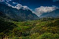
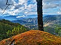
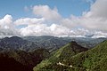
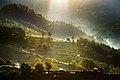
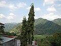
English: The Cordillera Central is a massive mountain range situated in the northern central part of the island of Luzon, in the Philippines.
Subcategories
This category has the following 10 subcategories, out of 10 total.
B
- Binubulauan (21 F)
- Bokod River Valley (1 F)
L
- Luzon tropical pine forests (6 F)
M
- Magat River (13 F)
- Mount Santo Tomas (12 F)
P
- Mount Pulag (35 F)
S
T
- Mount Tuwato (6 F)
Media in category "Cordillera Central (Luzon)"
The following 86 files are in this category, out of 86 total.
-
 1592Cuenca, Pugo, La Union 01.jpg 4,608 × 3,456; 6.18 MB
-
 1592Cuenca, Pugo, La Union 02.jpg 4,608 × 3,456; 6.79 MB
-
 1592Cuenca, Pugo, La Union 03.jpg 4,608 × 3,456; 6.85 MB
-
 1592Cuenca, Pugo, La Union 05.jpg 4,608 × 3,456; 6.88 MB
-
 1592Cuenca, Pugo, La Union 06.jpg 4,608 × 3,456; 6.74 MB
-
 1592Cuenca, Pugo, La Union 07.jpg 4,608 × 3,456; 6.8 MB
-
 6505Kennon Road Tuba, Benguet section 12.jpg 4,608 × 3,456; 6.26 MB
-
 6505Kennon Road Tuba, Benguet section 13.jpg 4,608 × 3,456; 7.1 MB
-
 6505Kennon Road Tuba, Benguet section 14.jpg 4,608 × 3,456; 6.78 MB
-
 6505Kennon Road Tuba, Benguet section 15.jpg 4,608 × 3,456; 7.06 MB
-
 6505Kennon Road Tuba, Benguet section 16.jpg 4,608 × 3,456; 6.56 MB
-
 Baguio Cordillera scenery - Flickr.jpg 2,048 × 1,536; 773 KB
-
 Bakun Town.jpg 3,872 × 2,581; 7.22 MB
-
 Batad, Cordilleras, Philippines (181773558).jpg 1,544 × 1,024; 542 KB
-
 Batad, Cordilleras, Philippines (181773564).jpg 1,024 × 1,544; 349 KB
-
 BatongBuhay1861.JPG 2,304 × 1,728; 457 KB
-
 BatongBuhay1869.jpg 2,304 × 1,728; 849 KB
-
 BatongBuhay1872.jpg 1,728 × 2,304; 814 KB
-
 Bauko Peaks in Benguet - 6.jpg 4,484 × 3,363; 4.79 MB
-
 Bokong Waterfall, Sagada, Cordilleras, Philippines (181762726).jpg 995 × 1,501; 405 KB
-
 Bokong Waterfall, Sagada, Cordilleras, Philippines (181762727).jpg 1,501 × 995; 428 KB
-
 Bontoc0610-b.jpg 2,156 × 1,078; 536 KB
-
 Bontoc0610.jpg 2,304 × 1,728; 512 KB
-
 Bulubunduking Cordillera.JPG 2,048 × 1,536; 659 KB
-
 Cordillera Central.jpg 500 × 332; 129 KB
-
 Cordillera Central2.jpg 500 × 332; 122 KB
-
 Cordillera Mountain Ranges.jpg 3,000 × 2,000; 7.31 MB
-
 Djumag1898.jpg 2,304 × 1,728; 798 KB
-
 Endless Road in Besao.jpg 3,264 × 4,928; 15.08 MB
-
 FvfSablanBenguet0262 02.JPG 4,608 × 3,456; 6.63 MB
-
 FvfSablanBenguet0262 07.JPG 4,608 × 3,456; 6.55 MB
-
 FvfSablanBenguet0262 08.JPG 4,608 × 3,456; 6.34 MB
-
 FvfSablanBenguet0300 04.JPG 4,608 × 3,456; 6.96 MB
-
 FvfSablanBenguet0300 06.JPG 4,608 × 3,456; 6.35 MB
-
 FvfSablanBenguet0362 01.JPG 4,608 × 3,456; 6.94 MB
-
 FvfSablanBenguet0362 04.JPG 3,456 × 4,608; 7.02 MB
-
 FvfSablanBenguet0362 05.JPG 4,608 × 3,456; 6.47 MB
-
 FvfSablanBenguet0362 38.JPG 3,456 × 4,608; 6.32 MB
-
 FvfSablanBenguet0362 39.JPG 4,608 × 3,456; 6.9 MB
-
 Kibuñgan Cross country (KXC) -10.jpg 4,608 × 3,456; 10.79 MB
-
 Kibuñgan Cross country (KXC) -11.jpg 4,608 × 3,456; 8.57 MB
-
 Kibuñgan Cross country (KXC) -12.jpg 4,608 × 3,456; 9 MB
-
 Kibuñgan Cross country (KXC) -13.jpg 4,608 × 3,456; 7.6 MB
-
 Kibuñgan Cross country (KXC) -15.jpg 4,608 × 3,456; 10.18 MB
-
 Kibuñgan Cross country (KXC) -16.jpg 4,608 × 3,456; 6.99 MB
-
 Kibuñgan Cross country (KXC) -2.jpg 4,608 × 3,456; 7.7 MB
-
 Kibuñgan Cross country (KXC) -4.jpg 4,608 × 3,456; 7.24 MB
-
 Kibuñgan Cross country (KXC) -5.jpg 4,632 × 3,480; 7.46 MB
-
 Kibuñgan Cross country (KXC) -6.jpg 4,608 × 3,456; 6.06 MB
-
 Kibuñgan Cross country (KXC) -7.jpg 4,608 × 3,456; 6.24 MB
-
 Kibuñgan Cross country (KXC) -8.jpg 4,608 × 3,456; 10.08 MB
-
 Kibuñgan Cross country (KXC) -9.jpg 4,608 × 3,456; 6.7 MB
-
 LamutRiverBridgeCordilleraIfugaojf0529 01.JPG 6,400 × 560; 887 KB
-
 LamutRiverBridgeCordilleraIfugaojf0529 02.JPG 3,200 × 560; 422 KB
-
 LamutRiverBridgeCordilleraIfugaojf0529 03.JPG 3,200 × 560; 433 KB
-
 LamutRiverBridgeCordilleraIfugaojf0529 04.JPG 3,200 × 560; 421 KB
-
 LamutRiverBridgeCordilleraIfugaojf0529 05.JPG 3,200 × 560; 423 KB
-
 LamutRiverBridgeCordilleraIfugaojf0529 06.JPG 3,200 × 560; 399 KB
-
 LamutRiverBridgeCordilleraIfugaojf0529 07.JPG 3,200 × 560; 445 KB
-
 LamutRiverBridgeCordilleraIfugaojf0529 08.JPG 3,200 × 560; 447 KB
-
 LamutRiverBridgeCordilleraIfugaojf0529 09.JPG 3,200 × 560; 443 KB
-
 LamutRiverBridgeCordilleraIfugaojf0529 10.JPG 3,200 × 560; 447 KB
-
 LamutRiverBridgeCordilleraIfugaojf0529 11.JPG 3,200 × 560; 459 KB
-
 LamutRiverBridgeCordilleraIfugaojf0529 12.JPG 6,400 × 560; 851 KB
-
 LamutRiverBridgeCordilleraIfugaojf0529 13.JPG 6,400 × 560; 751 KB
-
 Lubuagan0552 (cropped).jpg 2,304 × 329; 476 KB
-
 Lubuagan0552.jpg 2,304 × 1,728; 1.45 MB
-
 Mountains between Laoag and Batac - panoramio.jpg 1,600 × 1,200; 336 KB
-
 Mountains near Paracelis (EAGLE OF KOLBE) - Flickr.jpg 1,920 × 1,440; 1.23 MB
-
 Mt. Tenglawan Mountain Ranges.jpg 3,000 × 4,500; 7.56 MB
-
 PasalengBay01.jpg 2,304 × 1,728; 278 KB
-
 PasilValley2198.JPG 2,304 × 1,728; 417 KB
-
 PatapatViaduct01.jpg 2,304 × 1,728; 765 KB
-
 PatapatViaduct02.jpg 2,304 × 1,728; 762 KB
-
 Sagada Sunrise.jpg 1,000 × 667; 619 KB
-
 Sagada, Cordilleras, Philippines (181762729).jpg 1,024 × 1,544; 378 KB
-
 San Fabian Pangasinan 2.JPG 2,592 × 1,728; 1.41 MB
-
 SisonPangasinanjf847.JPG 4,608 × 3,456; 5.68 MB
-
 Stirred (201757081).jpeg 2,048 × 1,155; 327 KB
-
 Sunset atok.JPG 1,280 × 960; 300 KB
-
 Tinglayan80427cg.jpg 2,304 × 1,728; 1.01 MB
-
 Traditional stilt houses in Bangaan of the Ifugao people.jpg 3,648 × 2,736; 3.7 MB
-
 Tuba Benguet 1.JPG 2,592 × 1,728; 1.76 MB
-
 Tuba Benguet 2.JPG 2,400 × 1,900; 1.76 MB
-
 UpperUma2206.jpg 2,304 × 1,728; 789 KB
-
 UpperUma2541.jpg 1,728 × 2,304; 805 KB


.jpg)
.jpg)


.jpg)
.jpg)


_-10.jpg)
_-11.jpg)
_-12.jpg)
_-13.jpg)
_-15.jpg)
_-16.jpg)
_-2.jpg)
_-4.jpg)
_-5.jpg)
_-6.jpg)
_-7.jpg)
_-8.jpg)
_-9.jpg)


_-_Flickr.jpg)


.jpg)

.jpeg)


.jpg)