Category:Connecticut River in Massachusetts
Jump to navigation
Jump to search
Subcategories
This category has the following 9 subcategories, out of 9 total.
Media in category "Connecticut River in Massachusetts"
The following 81 files are in this category, out of 81 total.
-
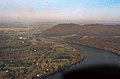
 Aerial view of Holyoke and Connecticut River.JPG 1,950 × 1,272; 1.04 MB
-
 Agawamferry toSpringfieldMa.png 793 × 540; 844 KB
-

-
 American shad being measured for survey at Holyoke Dam.jpg 4,129 × 4,257; 2.26 MB
-
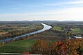
 Autumn Massachusetts 1.jpg 2,816 × 2,112; 1.29 MB
-
 Beach on the Connecticut River.JPG 4,000 × 2,248; 2.53 MB
-
 Boats on the Connecticut River in Springfield, Massachusetts.png 776 × 610; 466 KB
-
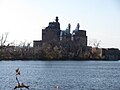
 Captain Elizur Holyoke, centennial pontoon.jpg 3,896 × 2,581; 4.09 MB
-
 Conn. River and Springfield Yacht Club, Springfield, Mass (78026).jpg 3,303 × 2,109; 3.01 MB
-
 Connecticut River (8118152838).jpg 5,184 × 3,456; 4.27 MB
-
 Connecticut River and Springfield Mass 1905.jpg 5,072 × 4,027; 8.54 MB
-

-

-

-

-
-
 Connecticut River during the Flood of 1936, view of Springdale, looking west, March 1936.jpg 2,000 × 1,498; 1.97 MB
-
 Connecticut River from Mt. Sugarloaf, South Deerfield, MA.jpg 727 × 452; 79 KB
-
-
 Connecticut River Overflowing Holyoke Dam during the Flood of 1936.jpg 3,150 × 2,000; 973 KB
-
 Connecticut River Oxbow.jpg 720 × 480; 483 KB
-
 Connecticut River Springfield Mass 1905 (2).jpg 5,072 × 4,010; 9.52 MB
-
 Connecticut River Springfield Mass 1905 (3).jpg 5,034 × 4,002; 9.84 MB
-
 Connecticut River Springfield Mass 1905.jpg 4,991 × 3,959; 9.68 MB
-
 Connecticut River Valley (8575464880).jpg 1,200 × 900; 289 KB
-
 Connecticut River Walk Park, Springfield MA.jpg 2,816 × 2,112; 2.37 MB
-
 Connecticut River, Sunderland, MA (4751531667).jpg 902 × 697; 81 KB
-
 Connecticut river1.jpg 300 × 450; 14 KB
-
 CT River at Turners Falls.jpg 600 × 450; 89 KB
-
 Ctvalley.jpg 216 × 158; 19 KB
-
 Detroit Photographic Company (0398).jpg 1,536 × 1,159; 316 KB
-
 Dry Knoll and Mount Nonotuck, Mount Tom Range.JPG 2,194 × 1,108; 481 KB
-
 Dscn3099 connecticut river french king bridge.jpg 600 × 256; 18 KB
-
 East South East View, Mt Sugarloaf, South Deerfield MA.jpg 6,010 × 2,435; 1.87 MB
-

-

-
 Forest Park Springfield Mass 1900-1910 01.jpg 4,708 × 3,792; 10.17 MB
-

-
 HadleyMA SkinnerStatePark RiverView.jpg 1,024 × 680; 206 KB
-
-
 Holyoke Dam during thaw, 2018.jpg 4,304 × 2,862; 5.85 MB
-
-
 Holyoke, Chicopee, and Westover Air Force Base from International Space Station (2011).jpeg 4,288 × 2,845; 2.12 MB
-

-

-
 HolyokeMA ConnecticutRiverAccessCenter.jpg 1,024 × 680; 226 KB
-
 HolyokeMA JonesRiverRoadLaunch.jpg 1,024 × 680; 261 KB
-
 IMG 3758 view north from French King Bridge.jpg 800 × 600; 27 KB
-
 Maury Geography 014A Connecticut river.jpg 973 × 560; 62 KB
-
 Mount Tom Massachusetts.jpg 300 × 444; 17 KB
-
 Mount Tom Power Plant from air, looking toward Connecticut River.jpg 8,213 × 5,418; 9.35 MB
-
 MtSugarloafNorthSouth.JPG 2,288 × 1,712; 1.26 MB
-
 Connecticut River and Holyoke from Mountain Park, Connecticut (NYPL b12647398-67768).tiff 2,440 × 1,652; 11.54 MB
-
 Springfield and Connecticut River, Springfield, Mass (NYPL b12647398-67886).tiff 2,424 × 1,705; 11.83 MB
-
 River Front, Springfield, Mass (NYPL b12647398-69669).tiff 2,384 × 1,599; 10.91 MB
-
 Old Toll Bridge Springfield Mass 1908.jpg 5,110 × 4,057; 10.12 MB
-
 Oxbow Marina.jpg 500 × 375; 45 KB
-
 Oxbow Northampton 1911.jpg 3,222 × 2,038; 2.25 MB
-
 Oxbow Northampton c 1870.jpg 1,706 × 1,729; 668 KB
-
 Oxbow View from Mount Holyoke 1826.jpg 2,950 × 2,010; 2.45 MB
-
 Oxbow W H Bartlett 1835.jpg 4,465 × 3,418; 5.04 MB
-
 Picturesque America55.jpg 1,100 × 773; 458 KB
-
 Pioneer Valley South From Mt. Sugarloaf.jpg 2,272 × 1,704; 808 KB
-

-
 Pulaski Park and river, Holyoke, Mass (71675).jpg 3,336 × 2,104; 3.05 MB
-

-
 RB-Pkg8010 (49720005786).jpg 8,213 × 5,418; 3.6 MB
-
 RB-Pkg8011 (49719469043).jpg 8,213 × 5,418; 3.39 MB
-
 Skyline of Holyoke, from Buckley Blvd., at night, Holyoke, Mass (71671).jpg 3,332 × 2,096; 3.04 MB
-
 Springfield Skyline, MA.jpg 3,711 × 894; 2.98 MB
-
 Springfield-MA.jpg 1,134 × 674; 125 KB
-
 Sunderland, MA 1975 (6323211601).jpg 1,139 × 1,162; 415 KB
-
 The Oxbow, Connecticut River c 1910.jpg 3,265 × 2,042; 2.18 MB
-
 Train by the Connecticut looking from Springfield North, with Mount Tom in background.png 2,664 × 1,819; 6.65 MB
-
 Victor DeGrailly-Traveler by Oxbow.jpg 605 × 442; 238 KB
-
 View along Conn. River, showing Mt. Holyoke Range, Holyoke, Mass (71674).jpg 3,335 × 2,144; 3.02 MB
-
 View from French King Bridge.jpg 1,944 × 2,592; 1.87 MB
-
 View of Downtown Holyoke, with Canal System highlighted.jpg 3,916 × 1,749; 2 MB
-
 View south from Sugarloaf Mountain, Deerfield MA.jpg 3,212 × 2,140; 1.14 MB
-
 Wastewater Treatment Plant, Amherst, Massachusetts.jpg 4,608 × 3,456; 5.67 MB
-
 West Springfield Power Plant, West Springfield MA.jpg 2,816 × 2,112; 1.43 MB


.jpg)
.jpg)

.jpg)


.jpg)
.jpg)

.jpg)

.jpg)


.jpg)


.jpg)

,_RP-F-2001-7-1059-12.jpg)

,_as_seen_in_Gleason%27s_Pictorial_Drawing-Room_Companion,_October_4,_1851.jpg)


.jpeg)

.jpg)


.jpg)
_from_Log_Pond_Cove,_Holyoke,_Massachusetts_(2017).jpg)
.jpg)
.jpg)
.jpg)

.jpg)


.jpg)


