Category:Congressional district maps of Minnesota
Jump to navigation
Jump to search
States of the United States: Alabama · Alaska · Arizona · Arkansas · California · Colorado · Connecticut · Delaware · Florida · Georgia · Hawaii · Idaho · Illinois · Indiana · Iowa · Kansas · Kentucky · Louisiana · Maine · Maryland · Massachusetts · Michigan · Minnesota · Mississippi · Missouri · Montana · Nebraska · Nevada · New Hampshire · New Jersey · New Mexico · New York · North Carolina · North Dakota · Ohio · Oklahoma · Oregon · Pennsylvania · Rhode Island · South Carolina · South Dakota · Tennessee · Texas · Utah · Vermont · Virginia · Washington · West Virginia · Wisconsin · Wyoming – Washington, D.C.
Guam · Puerto Rico · United States Virgin Islands
Guam · Puerto Rico · United States Virgin Islands
Media in category "Congressional district maps of Minnesota"
The following 48 files are in this category, out of 48 total.
-
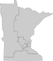 113th U.S. House districts in Minnesota.svg 358 × 407; 144 KB
-
 Minnesota Congressional Districts, 113th Congress.tif 1,292 × 1,399; 519 KB
-
 CD113 MN02.png 3,067 × 1,778; 2.34 MB
-
 Minnesota US Congressional District 1 (since 2013).tif 2,152 × 1,008; 3.53 MB
-
 Minnesota US Congressional District 2 (since 2013).tif 2,152 × 1,008; 3.07 MB
-
 Minnesota US Congressional District 3 (since 2013).tif 2,152 × 1,008; 3.27 MB
-
 Minnesota US Congressional District 4 (since 2013).tif 2,152 × 1,008; 3.71 MB
-
 Minnesota US Congressional District 5 (since 2013).tif 2,152 × 1,008; 3.74 MB
-
 Minnesota US Congressional District 6 (since 2013).tif 2,152 × 1,008; 2.93 MB
-
 Minnesota US Congressional District 7 (since 2013).tif 829 × 806; 1.08 MB
-
 Minnesota US Congressional District 8 (since 2013).tif 2,152 × 1,008; 3.27 MB
-
 Minnesota's 1st congressional district (since 2023).svg 800 × 903; 3.9 MB
-
 Minnesota's 2nd congressional district (since 2023).svg 800 × 903; 3.9 MB
-
 Minnesota's 2nd congressional district in the Twin Cities (since 2023).svg 800 × 735; 11.17 MB
-
 Minnesota's 3rd congressional district in the Twin Cities (since 2023).svg 800 × 735; 11.17 MB
-
 Minnesota's 4th congressional district in the Twin Cities (since 2023).svg 800 × 735; 11.17 MB
-
 Minnesota's 5th congressional district in the Twin Cities (since 2023).svg 800 × 735; 11.17 MB
-
 Minnesota's 6th congressional district (since 2023).svg 800 × 903; 3.9 MB
-
 Minnesota's 7th congressional district (since 2023).svg 800 × 903; 3.9 MB
-
 Minnesota's 8th congressional district (since 2023).svg 800 × 903; 3.9 MB
-
 MN 1912 House.svg 289 × 324; 1.79 MB
-
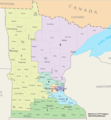
 MN 2022 congressional districts.jpg 1,237 × 1,398; 326 KB
-
 MN Congressional District 1.gif 636 × 379; 32 KB
-
 MN congressional districts.pdf 1,650 × 1,275; 456 KB
-
 MN-districts-natat.JPG 590 × 458; 45 KB
-
 MN02 109.png 635 × 380; 21 KB
-
 MN03.gif 635 × 380; 29 KB
-
 MN04.gif 635 × 380; 27 KB
-
 MN06 109.png 635 × 379; 99 KB
-
 Mn07 108.jpg 635 × 378; 64 KB
-
 MN1872House.svg 289 × 324; 326 KB
-
 MN1882House.svg 289 × 324; 1.01 MB
-
 MN1892House.svg 289 × 324; 1.49 MB
-

-
-
-

-
-
 United States Congressional Districts in Minnesota (metro highlight), since 2013.tif 1,224 × 806; 1.33 MB
-

-
 United States Congressional Districts in Minnesota, 1973 – 1982.tif 1,224 × 806; 1.21 MB
-
 United States Congressional Districts in Minnesota, 1983 – 1992.tif 1,224 × 806; 1.21 MB
-
 United States Congressional Districts in Minnesota, 1993 – 1994.tif 1,224 × 806; 1.21 MB
-
 United States Congressional Districts in Minnesota, 1995 – 2002.tif 1,224 × 806; 1.21 MB
-
 United States Congressional Districts in Minnesota, 2003 – 2013.tif 1,224 × 806; 1.21 MB
-
 United States Congressional Districts in Minnesota, since 2013.tif 1,224 × 806; 1.21 MB
-
 United States House of Representatives, Minnesota District 5 map.png 635 × 380; 19 KB
-
 United States House of Representatives, Minnesota District 8 map.gif 615 × 363; 34 KB


.svg)
.svg)
.svg)
.svg)
.svg)
.svg)
.svg)
.svg)
.svg)


,_since_2023.svg)

