Category:Colton, Staffordshire
Jump to navigation
Jump to search
English: Colton is a village and civil parish in Lichfield District, Staffordshire, England. It is situated just outside the town of Rugeley.
village and civil parish in Lichfield District, Staffordshire, England  | |||||
| Upload media | |||||
| Instance of | |||||
|---|---|---|---|---|---|
| Location | Lichfield, Staffordshire, West Midlands, England | ||||
| Said to be the same as | Colton (Wikimedia duplicated page, civil parish) | ||||
 | |||||
Subcategories
This category has the following 9 subcategories, out of 9 total.
B
C
- Colton Mill Bridge (5 F)
H
- Colton House, Staffordshire (2 F)
M
- Moreton Brook Bridge (6 F)
N
- Newlands, Staffordshire (3 F)
Media in category "Colton, Staffordshire"
The following 200 files are in this category, out of 316 total.
(previous page) (next page)-

-

-
 8 Oldwood Farm, Blithbury Road - geograph.org.uk - 2494024.jpg 640 × 428; 66 KB
-
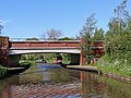
 A51 bridge over Trent ^ Mersey Canal - geograph.org.uk - 5700196.jpg 640 × 374; 28 KB
-
 A51 running parallel to the railway - geograph.org.uk - 3013909.jpg 640 × 386; 47 KB
-
 A51, Rugeley by-pass - geograph.org.uk - 2220262.jpg 640 × 275; 61 KB
-
 Approach to Rugeley Trent Valley Station - geograph.org.uk - 5868943.jpg 1,024 × 683; 191 KB
-
 Approaching the outskirts of Rugeley - geograph.org.uk - 5142634.jpg 3,454 × 2,291; 2.47 MB
-
 Aqueduct north of Rugeley in Staffordshire - geograph.org.uk - 6164288.jpg 1,440 × 960; 1.36 MB
-
 Arable field near Rugeley - geograph.org.uk - 4199796.jpg 1,024 × 768; 139 KB
-
 B ^ B Sign for Lea Hall Farm - geograph.org.uk - 2458782.jpg 428 × 640; 77 KB
-
 B5013 heading north - geograph.org.uk - 3554093.jpg 640 × 480; 99 KB
-
 B5013, Rugeley - geograph.org.uk - 2220304.jpg 640 × 430; 115 KB
-
 Bank Top Farm entrance along Hollow Lane - geograph.org.uk - 4555514.jpg 1,024 × 760; 225 KB
-
 Barn on Blithbury Road - geograph.org.uk - 5330472.jpg 640 × 480; 64 KB
-
 Bellamour Lane - geograph.org.uk - 3554091.jpg 640 × 480; 89 KB
-
 Bend in Blithbury Road - geograph.org.uk - 3554078.jpg 640 × 480; 72 KB
-
 Blithbury Road - geograph.org.uk - 3554082.jpg 640 × 480; 94 KB
-
 Blithbury Road - geograph.org.uk - 3554083.jpg 640 × 480; 68 KB
-
 Blithbury Road - geograph.org.uk - 434376.jpg 640 × 480; 82 KB
-
 Blithbury Road - geograph.org.uk - 5330467.jpg 640 × 480; 69 KB
-
 Blithbury Road - geograph.org.uk - 5330473.jpg 640 × 480; 76 KB
-
 Blithbury Road - geograph.org.uk - 5331402.jpg 640 × 480; 97 KB
-
 Blithbury Road towards Rugeley - geograph.org.uk - 4555538.jpg 1,024 × 705; 195 KB
-
 Blithbury Road, Rugeley - geograph.org.uk - 2493988.jpg 640 × 428; 75 KB
-
 Boathouse Spinney - geograph.org.uk - 4199786.jpg 1,024 × 768; 93 KB
-
 Boundary between fields and woodland - geograph.org.uk - 1768616.jpg 518 × 389; 170 KB
-
 Bridge across the West Coast Main Line - geograph.org.uk - 4555347.jpg 1,024 × 768; 262 KB
-
 Brindley Bank Aqueduct - geograph.org.uk - 4555154.jpg 1,024 × 721; 185 KB
-
-

-
 By the West Coast Main Line - geograph.org.uk - 4844097.jpg 640 × 426; 63 KB
-
 By-pass bridge north of Rugeley in Staffordshire - geograph.org.uk - 6233189.jpg 1,280 × 960; 1.75 MB
-
-
 Canal at Brindley Bank near Rugeley in Staffordshire - geograph.org.uk - 6012101.jpg 1,440 × 1,080; 1.5 MB
-
-
 Canal bridge north of Rugeley in Staffordshire - geograph.org.uk - 6233188.jpg 1,440 × 960; 1.8 MB
-
-
 Canalside pasture north of Rugeley in Staffordshire - geograph.org.uk - 5650910.jpg 1,440 × 901; 1.07 MB
-
 Canalside pasture north of Rugeley in Staffordshire - geograph.org.uk - 5650913.jpg 1,280 × 960; 1.23 MB
-
 Canalside pasture north of Rugeley in Staffordshire - geograph.org.uk - 6013510.jpg 1,600 × 800; 1.36 MB
-
 Canalside pasture north of Rugeley in Staffordshire - geograph.org.uk - 6233195.jpg 1,600 × 900; 1.29 MB
-
 Car on Bellamour Lane - geograph.org.uk - 4756773.jpg 640 × 426; 49 KB
-
 Cattle Holding Area, Newlands Lane - geograph.org.uk - 2546570.jpg 640 × 428; 76 KB
-
 Cattle on the side of Ash Hill - geograph.org.uk - 2546592.jpg 640 × 428; 87 KB
-
 Cereals beside the road - geograph.org.uk - 1441807.jpg 640 × 426; 374 KB
-
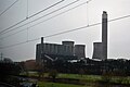
 Chimney, Rugeley Power Station - geograph.org.uk - 5700200.jpg 640 × 426; 25 KB
-
 Church of England Primary School - geograph.org.uk - 489737.jpg 640 × 480; 60 KB
-
 Colton Road (B5013) - geograph.org.uk - 3554089.jpg 640 × 480; 104 KB
-
 Colton Road in Colton - geograph.org.uk - 4558663.jpg 1,024 × 700; 205 KB
-
 Cottages, Colton Rd - geograph.org.uk - 2458552.jpg 640 × 428; 71 KB
-
 Countryside near Rugeley - geograph.org.uk - 4888186.jpg 640 × 426; 38 KB
-
 Crop field off Blithbury Road - geograph.org.uk - 3554081.jpg 640 × 480; 52 KB
-
 Crop field off Colton Road - geograph.org.uk - 3554086.jpg 640 × 480; 63 KB
-
 Crop field off Newlands Lane - geograph.org.uk - 3554101.jpg 640 × 480; 44 KB
-
 Crop field off Newlands Lane - geograph.org.uk - 3554103.jpg 640 × 480; 47 KB
-
 Crop field west off Stockwell Heath - geograph.org.uk - 3554096.jpg 640 × 480; 83 KB
-
 Dead End - geograph.org.uk - 1439854.jpg 640 × 426; 280 KB
-

-
 Embankment to the A51 - geograph.org.uk - 4751177.jpg 608 × 640; 47 KB
-
 Embankment to the A51 - geograph.org.uk - 4844062.jpg 640 × 322; 34 KB
-

-
 Farm buildings on Blithbury Road - geograph.org.uk - 5330470.jpg 640 × 480; 60 KB
-
-
 Farm track off Colton Road - geograph.org.uk - 3554087.jpg 640 × 480; 81 KB
-
 Farm track off Newlands Lane - geograph.org.uk - 3554099.jpg 640 × 480; 77 KB
-
 Farm track off Newlands Lane - geograph.org.uk - 3554107.jpg 640 × 480; 85 KB
-
 Farm Track off Newlands Lane, Colton - geograph.org.uk - 2546554.jpg 640 × 428; 99 KB
-
 Farm Track ^ Gate, Newlands Lane - geograph.org.uk - 2546565.jpg 640 × 367; 65 KB
-
 Farm track, off Newlands Lane - geograph.org.uk - 1768629.jpg 518 × 389; 149 KB
-
 Farmhouse on Blithbury Road - geograph.org.uk - 5330469.jpg 640 × 480; 64 KB
-
-
 Farmland near Rugeley - geograph.org.uk - 2829937.jpg 640 × 430; 23 KB
-
 Farmland near Rugeley Junction - geograph.org.uk - 3845213.jpg 640 × 430; 40 KB
-
 Farmland off Newlands Lane - geograph.org.uk - 3554098.jpg 640 × 480; 65 KB
-
 Farmland, Bellamour - geograph.org.uk - 3554092.jpg 640 × 480; 62 KB
-
 Farmland, Lount Farm - geograph.org.uk - 3554094.jpg 640 × 480; 92 KB
-
 Farmland, Newlands Grange - geograph.org.uk - 3554106.jpg 640 × 480; 82 KB
-
 Field boundary - geograph.org.uk - 3845215.jpg 640 × 430; 39 KB
-
 Field entrance off Blithbury Road - geograph.org.uk - 5330465.jpg 640 × 480; 122 KB
-
 Field entrance off Colton Road - geograph.org.uk - 3554085.jpg 640 × 480; 69 KB
-
 Field entrance off Stonyford Lane - geograph.org.uk - 5331408.jpg 640 × 480; 77 KB
-
 Field Near Colton - geograph.org.uk - 434409.jpg 640 × 480; 99 KB
-
 Fisherman on the Trent ^ Mersey Canal - geograph.org.uk - 4555257.jpg 1,024 × 721; 219 KB
-
 Fishing Pool - geograph.org.uk - 905978.jpg 640 × 429; 71 KB
-
-
 Footpath climbing restored landfill site - geograph.org.uk - 5135216.jpg 3,776 × 2,520; 3.84 MB
-
 Footpath Near Colton - geograph.org.uk - 530078.jpg 640 × 480; 110 KB
-
 Footpath off Blithbury Road - geograph.org.uk - 3554084.jpg 640 × 480; 132 KB
-
 Footpath off Hollow Lane - geograph.org.uk - 1768702.jpg 518 × 389; 155 KB
-
 Footpath Off Hollow Lane - geograph.org.uk - 434368.jpg 640 × 480; 104 KB
-
 Footpath through Sweetcorn - geograph.org.uk - 2546582.jpg 640 × 428; 107 KB
-
 Gate at the junction of Colton Road and Bellamour Way - geograph.org.uk - 4030076.jpg 4,341 × 2,503; 4.34 MB
-
 Gated Driveways - Bellamour - geograph.org.uk - 4030097.jpg 2,330 × 2,471; 2.49 MB
-
 Grazing off Newlands Lane - geograph.org.uk - 3554111.jpg 640 × 445; 81 KB
-
 Grazing, Lea Hall Farm - geograph.org.uk - 3421538.jpg 640 × 480; 63 KB
-
 Hadley Gate off Blithbury Road - geograph.org.uk - 2494155.jpg 640 × 428; 95 KB
-
 Hamley Heath House - geograph.org.uk - 2460099.jpg 640 × 428; 98 KB
-
 Hay bales near Rugeley - geograph.org.uk - 3662288.jpg 640 × 324; 39 KB
-
 Heading into Colton from the Church - geograph.org.uk - 489757.jpg 640 × 480; 88 KB
-
 Heading into Colton from the Church - geograph.org.uk - 489762.jpg 640 × 480; 138 KB
-
 Hollow Lane at Bank Top - geograph.org.uk - 5053475.jpg 4,000 × 3,000; 4.61 MB
-
 Hollow Lane near Hurst Wood Farm - geograph.org.uk - 4555528.jpg 1,024 × 825; 373 KB
-
 Hollow Lane, Closed towards Colton - geograph.org.uk - 2494064.jpg 640 × 428; 95 KB
-

-
 Hollow Lane, looking towards Colton - geograph.org.uk - 1768706.jpg 518 × 389; 135 KB
-
 Horse Pasture ^ Barn, Blithford Farm - geograph.org.uk - 2546602.jpg 640 × 428; 95 KB
-
 House on Blithbury Road - geograph.org.uk - 5330477.jpg 640 × 480; 77 KB
-
 Houses on Colton Rd - geograph.org.uk - 2220278.jpg 640 × 430; 128 KB
-
 Hurst Wood Meadow, Hollow Lane - geograph.org.uk - 1768703.jpg 518 × 389; 167 KB
-

-
 Jonghams Gateway - geograph.org.uk - 2498616.jpg 640 × 428; 109 KB
-
 Junction of bridleway and Newlands Lane - geograph.org.uk - 1768695.jpg 518 × 389; 155 KB
-
-
 Lane to Rugeley - geograph.org.uk - 1439879.jpg 640 × 426; 303 KB
-
 Lea Hall Farm - geograph.org.uk - 2458773.jpg 640 × 428; 91 KB
-
 Lea Hall Farm - geograph.org.uk - 927496.jpg 640 × 426; 49 KB
-
 Lea Hall Farm - geograph.org.uk - 927499.jpg 640 × 426; 63 KB
-
 Lea Hall Farm - geograph.org.uk - 927501.jpg 640 × 426; 51 KB
-
 Lea Hall Farm - geograph.org.uk - 927503.jpg 640 × 426; 65 KB
-
 Lea Lane near Admaston - geograph.org.uk - 2439125.jpg 800 × 600; 292 KB
-
 Localised flooding - geograph.org.uk - 3662313.jpg 640 × 386; 43 KB
-
 Lon Mets Lane - geograph.org.uk - 3554104.jpg 640 × 480; 77 KB
-

-
 Lorry, A51 - geograph.org.uk - 4372690.jpg 640 × 370; 34 KB
-
 Minor road heading east - geograph.org.uk - 3421536.jpg 640 × 480; 47 KB
-
 Moor Lane - geograph.org.uk - 3554097.jpg 640 × 480; 79 KB
-
 Moored working boat near Colton in Staffordshire - geograph.org.uk - 6232362.jpg 1,280 × 1,280; 2.2 MB
-
 Moreton Brook - geograph.org.uk - 1443132.jpg 625 × 640; 385 KB
-
 Mowing and baling near Rugeley in Staffordshire - geograph.org.uk - 5356593.jpg 1,280 × 828; 1.18 MB
-

-
 Narrowboat on the Trent ^ Mersey Canal - geograph.org.uk - 4558673.jpg 1,024 × 695; 212 KB
-
 Near Admaston - geograph.org.uk - 448906.jpg 640 × 480; 118 KB
-
 Near Miss on the Rugeley bypass - geograph.org.uk - 2726069.jpg 640 × 480; 56 KB
-
 Near Rugeley Station - geograph.org.uk - 4331995.jpg 640 × 430; 58 KB
-
 Newlands Grange - geograph.org.uk - 439399.jpg 640 × 480; 103 KB
-
 Newlands Lane (4) - geograph.org.uk - 1768638.jpg 518 × 389; 151 KB
-
 Newlands Lane (5) - geograph.org.uk - 1768665.jpg 518 × 389; 155 KB
-
 Newlands Lane (6) - geograph.org.uk - 1768677.jpg 518 × 389; 145 KB
-
 Newlands Lane - geograph.org.uk - 3554100.jpg 640 × 480; 87 KB
-
 Newlands Lane - geograph.org.uk - 3554102.jpg 640 × 480; 117 KB
-
 Newlands Lane - geograph.org.uk - 3554105.jpg 640 × 480; 100 KB
-
 Newlands Lane - geograph.org.uk - 3554108.jpg 640 × 480; 85 KB
-
 Newlands Lane - geograph.org.uk - 3554112.jpg 640 × 480; 85 KB
-
 No access to this little wood - geograph.org.uk - 1768683.jpg 389 × 518; 169 KB
-
 North along the Trent ^ Mersey Canal - geograph.org.uk - 4555165.jpg 1,024 × 744; 253 KB
-
 Oilseed rape crop, Newlands - geograph.org.uk - 3554110.jpg 640 × 480; 61 KB
-
 Old Wood Farm, Blithbury Road - geograph.org.uk - 2494030.jpg 640 × 428; 51 KB
-
 On the brow of a hill - geograph.org.uk - 1440248.jpg 640 × 426; 381 KB
-

-
 Passing through Rugeley Station - geograph.org.uk - 3662290.jpg 640 × 430; 63 KB
-
 Pasture and railway north of Rugeley - geograph.org.uk - 6233198.jpg 1,600 × 900; 1.4 MB
-
-
 Pasture and railway north of Rugeley, Staffordshire - geograph.org.uk - 6013518.jpg 1,440 × 960; 1.48 MB
-
 Pasture north of Rugeley in Staffordshire - geograph.org.uk - 5650473.jpg 1,280 × 922; 1.26 MB
-
 Pasture north of Rugeley in Staffordshire - geograph.org.uk - 6233211.jpg 1,440 × 960; 1.36 MB
-

-
 Pond at Stockwell Heath - geograph.org.uk - 3244724.jpg 3,072 × 2,304; 3.17 MB
-
 Post box and cottages at Colton - geograph.org.uk - 1439888.jpg 640 × 426; 273 KB
-
-
 Potato field north-west of Rugeley in Staffordshire - geograph.org.uk - 6233408.jpg 1,600 × 900; 1.92 MB
-
 Pumping station - geograph.org.uk - 4888154.jpg 640 × 354; 42 KB
-
 Pylon crossing the landscape - geograph.org.uk - 3845208.jpg 640 × 430; 33 KB
-
 Pylon in a field - geograph.org.uk - 4888151.jpg 640 × 426; 43 KB
-
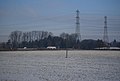
 Pylon in a snowy landscape 2 - geograph.org.uk - 2218979.jpg 640 × 430; 120 KB
-
 Pylon in a snowy landscape 3 - geograph.org.uk - 2218989.jpg 640 × 430; 122 KB
-
 Pylon in Farmland - geograph.org.uk - 3715205.jpg 640 × 430; 32 KB
-
 Pylons by Colton Rd - geograph.org.uk - 3662311.jpg 640 × 430; 38 KB
-
 Pylons by the B5013 - geograph.org.uk - 2829927.jpg 640 × 430; 36 KB
-
 Pylons crossing the landscape - geograph.org.uk - 2218994.jpg 640 × 430; 119 KB
-
 Pylons near Boathouse Spinney - geograph.org.uk - 2829926.jpg 640 × 423; 43 KB
-
 Pylons near Rugeley Junction - geograph.org.uk - 2829930.jpg 640 × 399; 38 KB
-
 Pylons on a hill - geograph.org.uk - 3662289.jpg 640 × 294; 27 KB
-
 Pylons on the hill - geograph.org.uk - 3715267.jpg 640 × 430; 30 KB
-
-
 Railway bridge over Colton Road - geograph.org.uk - 3554070.jpg 640 × 480; 57 KB
-
 Railway bridge over Colton Road - geograph.org.uk - 5142699.jpg 3,776 × 2,520; 3.42 MB
-
 Reclaimed building stone - geograph.org.uk - 5135206.jpg 3,776 × 2,520; 4.23 MB
-
 River Trent - geograph.org.uk - 4756782.jpg 640 × 426; 56 KB
-
 River Trent - geograph.org.uk - 4984734.jpg 640 × 347; 49 KB
-
 River Trent - geograph.org.uk - 5355426.jpg 640 × 426; 53 KB
-

-
 Road and Rail from Bellamour Lane - geograph.org.uk - 2460107.jpg 640 × 428; 78 KB
-
 Road junction on Blithbury Road - geograph.org.uk - 5330476.jpg 640 × 480; 84 KB
-
 Road Junction ^ Pool, Stockwell Heath - geograph.org.uk - 2458716.jpg 640 × 428; 104 KB
-
 Rock outcrop, Rugeley Junction - geograph.org.uk - 5700198.jpg 640 × 426; 94 KB
-
 Row of Cottages, Colton - geograph.org.uk - 2458661.jpg 640 × 428; 97 KB
-
 Row of houses near Rugeley Station - geograph.org.uk - 3662291.jpg 640 × 298; 38 KB
-
 Rugeley By-Pass Bridge (detail) in Staffordshire - geograph.org.uk - 6012183.jpg 1,024 × 1,024; 1.01 MB
-
 Rugeley By-Pass Bridge in Staffordshire - geograph.org.uk - 6233192.jpg 1,280 × 960; 1.42 MB
-

-
 Rugeley Power Station - geograph.org.uk - 5700199.jpg 640 × 426; 37 KB
-
 Rugeley Power Station - geograph.org.uk - 5700201.jpg 640 × 425; 57 KB
-
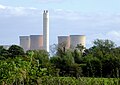 Rugeley Power Station in Staffordshire - geograph.org.uk - 5650693.jpg 1,280 × 906; 1 MB
-
 Rugeley Trading Estate - geograph.org.uk - 5700197.jpg 640 × 426; 50 KB
-
 Rycot, Colton Rd - geograph.org.uk - 2220256.jpg 640 × 430; 121 KB
-
 Rydal Industrial Estate, Colton Rd - geograph.org.uk - 2220273.jpg 640 × 430; 137 KB
-
-
 Shallow valley - geograph.org.uk - 4888192.jpg 640 × 309; 62 KB
-
 Sherracop Lane - geograph.org.uk - 2458740.jpg 640 × 428; 103 KB
)%27_(11243230865).jpg)
)%27_(11244434694).jpg)


_-_geograph.org.uk_-_3554089.jpg)


_-_geograph.org.uk_-_1768638.jpg)
_-_geograph.org.uk_-_1768665.jpg)
_-_geograph.org.uk_-_1768677.jpg)


_in_Staffordshire_-_geograph.org.uk_-_6012183.jpg)


