Category:Colorado State Highway 67
Jump to navigation
Jump to search
 | number: | (sixty-seven) |
|---|---|---|
| State highways in Colorado: | 47 · 52 · 53 · 55 · 56 · 57 · 58 · 59 · 60 · 61 · 62 · 63 · 64 · 65 · 66 · 67 · 69 · 71 · 72 · 74 · 75 · 78 · 79 · 82 · 83 · 86 |
highway in Colorado  | |||||
| Upload media | |||||
| Instance of | |||||
|---|---|---|---|---|---|
| Location | Colorado | ||||
| Transport network | |||||
| Owned by | |||||
| Maintained by | |||||
| Length |
| ||||
| |||||
Main Wikipedia article: Colorado State Highway 67.
Subcategories
This category has the following 2 subcategories, out of 2 total.
T
- Tenderfoot Pass (2 F)
Media in category "Colorado State Highway 67"
The following 11 files are in this category, out of 11 total.
-
 Colorado 67.svg 601 × 601; 6 KB
-
 Colorado State Highway 67 Map.svg 1,028 × 609; 1.32 MB
-
 Cripple Creek (Colorado).JPG 5,893 × 3,783; 17.08 MB
-
 Deckers, Colorado.JPG 4,726 × 3,695; 13.94 MB
-
 Junction of Colorado state highways 96 and 67.JPG 5,812 × 3,211; 18.65 MB
-
 Little Ike Tunnel, south portal, roadbed view 2022-04-14.jpg 2,932 × 3,909; 3.1 MB
-
 Main Street Bridge (Florence, Colorado).JPG 4,715 × 3,027; 12.91 MB
-
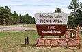 Manitou Lake Picnic Area sign.JPG 4,564 × 2,892; 8.89 MB
-
 Mueller State Park sign.JPG 3,433 × 2,302; 5.34 MB
-
 Signage indicating a terminus of Colorado State Highway 67.jpg 432 × 576; 242 KB
-
 WoodlandPark.jpg 720 × 540; 61 KB
.JPG)


.JPG)


