Category:Colorado State Highway 325
Jump to navigation
Jump to search
 | number: | (three hundred twenty-five) |
|---|---|---|
| State highways in Colorado: | 318 · 325 · 330 · 340 |
state highway in Garfield County, Colorado, United States  | |||||
| Upload media | |||||
| Instance of | |||||
|---|---|---|---|---|---|
| Location | Garfield County, Colorado | ||||
| Transport network | |||||
| Owned by | |||||
| Maintained by | |||||
| Length |
| ||||
| Terminus | |||||
| |||||
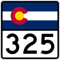
English: Media related to Colorado State Highway 325, an 11.395-mile (18.338 km) state highway in Garfield County, Colorado, United States, that conencts Colorado State Highway 13 (north of Rifle) with Rifle Mountain Park.
Subcategories
This category has only the following subcategory.
Media in category "Colorado State Highway 325"
The following 4 files are in this category, out of 4 total.
-
 Colorado 325.svg 601 × 601; 9 KB
-
 Colorado 325 wide.svg 751 × 601; 4 KB
-
 Colorado State Highway 325 Map.svg 1,028 × 609; 1.35 MB
-
 Rifle Gap Dam.JPG 5,574 × 3,557; 12.65 MB

