Category:Coledale, Cumbria
Jump to navigation
Jump to search
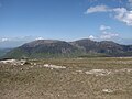
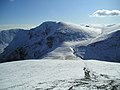
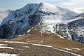
English: Coledale is a valley in the northwestern region of the Lake District in Cumbria, England. (→Coledale (Cumbria))

valley in the Lake District, England | |||||
| Upload media | |||||
| Instance of | |||||
|---|---|---|---|---|---|
| Location |
| ||||
 | |||||
Subcategories
This category has the following 2 subcategories, out of 2 total.
C
- Coledale Beck (10 F)
F
- Force Crag Mine (15 F)
Media in category "Coledale, Cumbria"
The following 39 files are in this category, out of 39 total.
-
 Above Coledale - geograph.org.uk - 935671.jpg 640 × 480; 100 KB
-
 Above Coledale Hause - geograph.org.uk - 654704.jpg 640 × 480; 62 KB
-
 At Coledale Hause - geograph.org.uk - 962703.jpg 640 × 480; 231 KB
-
 Coledale - geograph.org.uk - 1244486.jpg 426 × 640; 68 KB
-
 Coledale and Outerside from Force Crag - geograph.org.uk - 1750741.jpg 1,024 × 679; 257 KB
-
 Coledale Fells from Robinson.jpg 3,648 × 2,736; 2.69 MB
-
 Coledale from Coledale Hause - geograph.org.uk - 1762397.jpg 2,272 × 1,712; 925 KB
-
 Coledale from Coledale Hause 1.jpg 3,648 × 2,736; 2.07 MB
-
 Coledale Hause - geograph.org.uk - 1244539.jpg 640 × 426; 94 KB
-
 Coledale Hause - geograph.org.uk - 1511405.jpg 640 × 480; 106 KB
-
 Coledale Hause - geograph.org.uk - 1762406.jpg 2,272 × 1,712; 914 KB
-
 Coledale Hause - geograph.org.uk - 785684.jpg 640 × 480; 53 KB
-
 Coledale Hause from Sand Hill - geograph.org.uk - 1722782.jpg 640 × 480; 72 KB
-
 Coledale viewed from Eel Crag - geograph.org.uk - 1244475.jpg 640 × 426; 66 KB
-
 Covered Reservoir, High Coledale - geograph.org.uk - 962798.jpg 640 × 427; 255 KB
-
 Descent to Coledale Hause - geograph.org.uk - 1750637.jpg 1,024 × 679; 360 KB
-
 From Outerside - geograph.org.uk - 935676.jpg 480 × 640; 97 KB
-
 Green fields - geograph.org.uk - 1275879.jpg 640 × 447; 67 KB
-
 High Coledale - geograph.org.uk - 1490982.jpg 640 × 480; 127 KB
-
 Kinn from High Coledale - geograph.org.uk - 962796.jpg 640 × 426; 246 KB
-

-
 Looking down Coledale - geograph.org.uk - 935779.jpg 480 × 640; 68 KB
-
 Looking down Coledale from Eel Crag - geograph.org.uk - 1490613.jpg 640 × 480; 75 KB
-
 Looking over Coledale - geograph.org.uk - 1381114.jpg 640 × 480; 52 KB
-
 Looking up Coledale Hause - geograph.org.uk - 1490573.jpg 640 × 480; 72 KB
-
 On the Climb to Stile End - geograph.org.uk - 962794.jpg 640 × 426; 241 KB
-
 Path descending Coledale Hause - geograph.org.uk - 1244534.jpg 640 × 426; 97 KB
-
 Spoil heaps, Force Crag mine - geograph.org.uk - 1750725.jpg 800 × 530; 209 KB
-
 The head of Coledale - geograph.org.uk - 2720075.jpg 1,500 × 843; 1.45 MB
-
 The track into Coledale - geograph.org.uk - 3001100.jpg 2,592 × 1,944; 1.67 MB
-
 The valley of Coledale Beck - geograph.org.uk - 1749533.jpg 800 × 530; 208 KB
-
 Upper Coledale - geograph.org.uk - 3001137.jpg 2,592 × 1,944; 1.91 MB
-
 Disused Mine in Coledale - geograph.org.uk - 81177.jpg 640 × 480; 118 KB
-
 Force Crag mine track to Braithwaite. - geograph.org.uk - 109257.jpg 640 × 452; 44 KB
-
 High Coledale. - geograph.org.uk - 109139.jpg 640 × 480; 57 KB
-
 High Coledale. - geograph.org.uk - 109143.jpg 640 × 480; 102 KB
-
 Zig-zag path towards Force Crag - geograph.org.uk - 1750647.jpg 1,024 × 679; 347 KB
-
-
 The track from High Coledale. - geograph.org.uk - 109085.jpg 640 × 410; 40 KB


