Category:Coasts of South Ayrshire
Jump to navigation
Jump to search

Subcategories
This category has the following 8 subcategories, out of 8 total.
A
- Ayrshire Coastal Path (42 F)
B
- Barwhin Point (16 F)
- Bennane Head (10 F)
H
- Heads of Ayr (29 F)
L
- Low tide in South Ayrshire (28 F)
P
Media in category "Coasts of South Ayrshire"
The following 82 files are in this category, out of 82 total.
-
 Ailsa Craig From Culzean Shore - geograph.org.uk - 703238.jpg 640 × 480; 40 KB
-
 Ailsa Craig from the PS Waverley - geograph.org.uk - 1436832.jpg 640 × 454; 79 KB
-
 Ayrshire coast from Culzean castle - geograph.org.uk - 753944.jpg 640 × 428; 34 KB
-
 Balkenna Isle - geograph.org.uk - 380076.jpg 640 × 480; 54 KB
-
 Clyde View - geograph.org.uk - 808101.jpg 450 × 600; 59 KB
-
 Coastal view Dunure - geograph.org.uk - 689511.jpg 640 × 480; 101 KB
-
 Craigangal - geograph.org.uk - 770210.jpg 640 × 468; 97 KB
-
 Crane Dyke View - geograph.org.uk - 3291562.jpg 640 × 416; 108 KB
-
 Dowhill Port and Lewis Isle - geograph.org.uk - 3945769.jpg 640 × 404; 79 KB
-
 Foreshore at Dunure - geograph.org.uk - 1437420.jpg 640 × 386; 47 KB
-
 Looking towards Bennane Head and Ailsa Craig - geograph.org.uk - 3583375.jpg 3,968 × 2,956; 2.01 MB
-
 Maidens Bay View - geograph.org.uk - 4096989.jpg 640 × 379; 56 KB
-
 Maidens View - geograph.org.uk - 1101127.jpg 640 × 405; 103 KB
-
 Man's Mark on the Stinking Rocks - geograph.org.uk - 711893.jpg 640 × 480; 104 KB
-
 North Shore, Ballantrae - geograph.org.uk - 3589184.jpg 2,272 × 1,704; 702 KB
-
 Not the Mill Rock - geograph.org.uk - 710099.jpg 640 × 480; 56 KB
-
 Offshore rocks at Ballantrae - geograph.org.uk - 262998.jpg 640 × 480; 97 KB
-
 On The Coastal Path - geograph.org.uk - 1021031.jpg 640 × 397; 69 KB
-
 Port Shuchan - geograph.org.uk - 1312853.jpg 640 × 480; 92 KB
-
 Rocks at Prestwick Beach - geograph.org.uk - 303137.jpg 640 × 480; 71 KB
-
 Rocks off Prestwick Beach - geograph.org.uk - 303127.jpg 640 × 480; 101 KB
-
 Rocks with a View - geograph.org.uk - 5512746.jpg 2,592 × 1,728; 2.82 MB
-
 Rocky shore at Ballantrae - geograph.org.uk - 263031.jpg 640 × 480; 89 KB
-
 Sea shore near Lendalfoot - geograph.org.uk - 775307.jpg 640 × 480; 60 KB
-

-
 Stormy seas at Culzean - geograph.org.uk - 752557.jpg 640 × 460; 111 KB
-
 Sunset at Crane Dyke - geograph.org.uk - 4198298.jpg 640 × 413; 65 KB
-
 The Ayr coast south of Drumshang - geograph.org.uk - 52201.jpg 640 × 428; 57 KB
-

-
 The End Of Chapelton Burn - geograph.org.uk - 912259.jpg 640 × 426; 90 KB
-
 The harbour wall - geograph.org.uk - 745642.jpg 640 × 480; 72 KB
-
 The Interconnector Goes Under The Sea - geograph.org.uk - 471035.jpg 640 × 480; 83 KB
-
 The Shore at Ardwell Bay - geograph.org.uk - 5584463.jpg 2,592 × 1,728; 1.65 MB
-
 The track-road to Bennane Cave - geograph.org.uk - 875768.jpg 640 × 480; 68 KB
-
 View north from the Culzean cliff path - geograph.org.uk - 752538.jpg 640 × 480; 101 KB
-
 Windmills and Ailsa Craig aka Paddy's Milestone rotated.jpg 1,009 × 660; 170 KB
-
 Ailsa Craig - geograph.org.uk - 692711.jpg 640 × 479; 72 KB
-
 Ballantrae Bay - geograph.org.uk - 704389.jpg 640 × 479; 68 KB
-
 Ballantrae seafront - geograph.org.uk - 1441626.jpg 640 × 457; 256 KB
-
 Ballantrae seafront - geograph.org.uk - 1441630.jpg 640 × 457; 327 KB
-
 Beach near Broad Craig - geograph.org.uk - 689616.jpg 640 × 480; 98 KB
-
 Carleton Bay, Lendalfoot - geograph.org.uk - 263167.jpg 640 × 480; 81 KB
-

-
 Croy Bay - geograph.org.uk - 305877.jpg 640 × 470; 126 KB
-
 Croy House - geograph.org.uk - 305866.jpg 640 × 480; 114 KB
-
 Culzean Country Park shoreline - geograph.org.uk - 452613.jpg 640 × 408; 40 KB
-
 Deil's Dyke - geograph.org.uk - 379264.jpg 640 × 480; 98 KB
-
 Dipple Shore - geograph.org.uk - 521271.jpg 640 × 468; 99 KB
-
 Dipple Shore - geograph.org.uk - 521274.jpg 453 × 600; 71 KB
-
 Down To Balcreuchan Port - geograph.org.uk - 418252.jpg 475 × 640; 125 KB
-
 Drowned Trees - geograph.org.uk - 533964.jpg 640 × 480; 92 KB
-

-
 From Hogston Burn - geograph.org.uk - 676104.jpg 640 × 480; 67 KB
-
 Gamesloup taken from above - geograph.org.uk - 350733.jpg 640 × 390; 81 KB
-
 Girvan beach at sunset - geograph.org.uk - 1438008.jpg 640 × 381; 25 KB
-
 Heads of Ayr - geograph.org.uk - 1437430.jpg 640 × 480; 63 KB
-
 Horse Rock, south of Girvan - geograph.org.uk - 262891.jpg 640 × 480; 79 KB
-
 If You Can See Ailsa Craig.... - geograph.org.uk - 682628.jpg 640 × 473; 41 KB
-
 Loch Bradan Shoreline - geograph.org.uk - 533965.jpg 640 × 480; 99 KB
-
 Loch Bradan Shoreline - geograph.org.uk - 533967.jpg 640 × 480; 80 KB
-
 Looking down the ballast bank - geograph.org.uk - 576013.jpg 640 × 480; 85 KB
-
 Looking North - geograph.org.uk - 682597.jpg 640 × 464; 69 KB
-
 Maidens, Ayrshire - geograph.org.uk - 207247.jpg 640 × 424; 50 KB
-
 Maybole Shore - geograph.org.uk - 305863.jpg 640 × 491; 144 KB
-
 Mist in the hollow - geograph.org.uk - 702815.jpg 640 × 480; 53 KB
-
 North Culzean Bay - geograph.org.uk - 305870.jpg 640 × 464; 97 KB
-
 Old pipe line supports - geograph.org.uk - 576018.jpg 640 × 480; 134 KB
-
 Ploughed field and headland - geograph.org.uk - 463758.jpg 640 × 480; 45 KB
-
 Rocky coastline - geograph.org.uk - 462443.jpg 640 × 480; 156 KB
-
 Rocky shore near Fisherton - geograph.org.uk - 689259.jpg 640 × 462; 127 KB
-

-
 Sea coast south of Kennedy's Pass - geograph.org.uk - 462461.jpg 640 × 480; 93 KB
-
 Seafield Front - geograph.org.uk - 588262.jpg 434 × 600; 45 KB
-
 Shore at Drumbain - geograph.org.uk - 688135.jpg 640 × 444; 78 KB
-
 Shore near Fisherton - geograph.org.uk - 689218.jpg 640 × 480; 123 KB
-
 Shore near Fisherton - geograph.org.uk - 689249.jpg 640 × 482; 126 KB
-
 The Cauld Shore - geograph.org.uk - 682595.jpg 640 × 478; 58 KB
-
 Troon Shore - geograph.org.uk - 662305.jpg 640 × 461; 114 KB
-
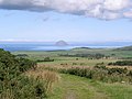
 View from the summit of Grey Hill - geograph.org.uk - 325218.jpg 640 × 480; 259 KB
-

-
 Whilk Isle - geograph.org.uk - 462521.jpg 640 × 480; 58 KB
-
 Woodland Bay, south of Girvan - geograph.org.uk - 262890.jpg 640 × 480; 60 KB


_-_geograph.org.uk_-_347395.jpg)

