Category:Coasts of County Waterford
Jump to navigation
Jump to search
Subcategories
This category has only the following subcategory.
L
- Low tide in County Waterford (2 F)
Media in category "Coasts of County Waterford"
The following 56 files are in this category, out of 56 total.
-
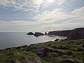
 "The 40 Steps" - geograph.org.uk - 5469490.jpg 3,648 × 2,736; 5.63 MB
-
 'Samson' shipwreck - geograph.org.uk - 2716517.jpg 1,200 × 1,600; 389 KB
-
 Annestown beach - geograph.org.uk - 493124.jpg 640 × 480; 55 KB
-
 Annestown Strand - geograph.org.uk - 1422914.jpg 640 × 480; 226 KB
-
 Annestown Strand - geograph.org.uk - 1621369.jpg 640 × 457; 75 KB
-
 Annestown Strand - geograph.org.uk - 491343.jpg 640 × 480; 62 KB
-
 Annestown Strand - geograph.org.uk - 491348.jpg 640 × 480; 58 KB
-
 Ardmore Bay - geograph.org.uk - 4949867.jpg 2,592 × 1,944; 880 KB
-
 Ballydowane Bay, Co Waterford - geograph.org.uk - 2718431.jpg 1,600 × 1,200; 290 KB
-
 Ballyvooney Cove - geograph.org.uk - 1365637.jpg 640 × 480; 91 KB
-
 Beach and headland near Ballyvoyle Bridge - geograph.org.uk - 5474786.jpg 1,024 × 751; 183 KB
-
 Boat Slip - geograph.org.uk - 3953639.jpg 640 × 480; 106 KB
-
 Brownstown head - geograph.org.uk - 824403.jpg 640 × 427; 54 KB
-
 Cliff erosion at Whiting Bay - geograph.org.uk - 5540700.jpg 640 × 480; 262 KB
-
 Cliffs at Ballymacart Cove - looking east - geograph.org.uk - 2712434.jpg 1,600 × 1,200; 463 KB
-
 Cliffs near Dysert, Ardmore - geograph.org.uk - 2717339.jpg 1,600 × 1,200; 279 KB
-
 Coast below Tankardstown Mine - geograph.org.uk - 484082.jpg 640 × 426; 125 KB
-
 Coast to the west of Dunabrattin Head - geograph.org.uk - 484929.jpg 640 × 426; 108 KB
-
 Creadan Head, Co. Waterford. - geograph.org.uk - 5469485.jpg 3,648 × 2,736; 5.23 MB
-
 Driftwood on the beach at Whiting Bay - geograph.org.uk - 5540697.jpg 640 × 480; 275 KB
-
 Dunabrattin (Boatstrand) Harbour - Co Waterford - geograph.org.uk - 5615040.jpg 5,184 × 2,920; 5.78 MB
-
 Dunabrattin (Boatstrand) Harbour - Co Waterford - geograph.org.uk - 5615042.jpg 5,184 × 2,920; 4.84 MB
-
 Eastern end of the beach at Whiting Bay - geograph.org.uk - 5540720.jpg 640 × 480; 258 KB
-
 Gallop at sunrise - geograph.org.uk - 823909.jpg 640 × 426; 34 KB
-
 Headlands at sunrise - geograph.org.uk - 5535847.jpg 640 × 480; 165 KB
-
 Helvick New Pier - geograph.org.uk - 2922890.jpg 1,024 × 680; 197 KB
-
 Kilfarassey at dusk - geograph.org.uk - 892670.jpg 640 × 335; 42 KB
-
 Kilfarassey at dusk 2 - geograph.org.uk - 892676.jpg 640 × 350; 36 KB
-

-
-
 Kilfarrasy Cove, Waterford - geograph.org.uk - 490629.jpg 640 × 480; 65 KB
-
 Kilmurran Cove - geograph.org.uk - 1422960.jpg 640 × 480; 252 KB
-
 Panorama of the bay at Dunmore East, County Waterford, Ireland - 2017.jpg 9,270 × 3,705; 22.24 MB
-
 Rathmoylan Cove with plank footbridge - geograph.org.uk - 1476404.jpg 640 × 480; 133 KB
-

-

-
 Rocky Inlet - geograph.org.uk - 3953481.jpg 480 × 640; 109 KB
-
 Rocky shore at Ballynacourty - geograph.org.uk - 5539250.jpg 640 × 480; 323 KB
-
 Rocky shore at Ballyvooney Cove - geograph.org.uk - 1422988.jpg 640 × 480; 261 KB
-
 Sea Arch - geograph.org.uk - 3953630.jpg 480 × 640; 125 KB
-
 Stream across the beach at Whiting Bay - geograph.org.uk - 5540713.jpg 640 × 480; 217 KB
-
 Sunset over Gold Coast Road - geograph.org.uk - 2927617.jpg 1,024 × 768; 100 KB
-
 Tramore - geograph.org.uk - 487021.jpg 640 × 480; 40 KB
-
 Tramore from Guillamene Cove. - geograph.org.uk - 491305.jpg 640 × 480; 79 KB
-
 Tramore Harbour - geograph.org.uk - 3361346.jpg 1,024 × 768; 196 KB
-

-
 Waterford Coastline Feature - geograph.org.uk - 5357980.jpg 640 × 480; 55 KB
-
 Waterford Harbour - geograph.org.uk - 5249236.jpg 2,240 × 1,488; 1.55 MB
-
 Way down to the beach at Whiting Bay - geograph.org.uk - 5540717.jpg 640 × 480; 259 KB
-
 Western end of Whiting Bay - geograph.org.uk - 5540694.jpg 640 × 480; 294 KB
-
 Wet and windy promenade. - geograph.org.uk - 491303.jpg 640 × 480; 40 KB
-
 Whiting Bay - geograph.org.uk - 5540702.jpg 640 × 480; 305 KB
-
 Whiting Bay - geograph.org.uk - 5540704.jpg 640 × 480; 216 KB
-
 Woodstown at dawn - geograph.org.uk - 823912.jpg 640 × 378; 44 KB
-
 Woodstown beach at sunrise - geograph.org.uk - 827749.jpg 640 × 427; 67 KB
-
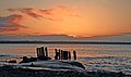
 Wreck of the Samson on Ram Head - geograph.org.uk - 5536088.jpg 480 × 640; 358 KB


_Harbour_-_Co_Waterford_-_geograph.org.uk_-_5615040.jpg)
_Harbour_-_Co_Waterford_-_geograph.org.uk_-_5615042.jpg)


_-_geograph.org.uk_-_490630.jpg)
_-_geograph.org.uk_-_490631.jpg)


